
Tuolumne River (Cherry Creek)
| Stretch: | Cherry Creek to Meral's Pool |
| Difficulty: | Class V- to V |
| Distance: | 7.75 miles |
| Flows: | 600 - 2000? cfs. Current Dreamflows (est) gauge |
| Gradient: | 108 fpm average, section up to 200 fpm |
| Put-in: | Cherry Creek |
| Take-out: | Meral's Pool |
| Shuttle: | 30 miles, 5 on a primitive-dirt road (over an hour) |
| Season: | Spring into early autumn, from dam release |
| Written: | © 2007 and 2013 |
| Featured in the Sam and Anna's FilmsCherry Summers and John Moore's rapid-by-rapid video | |
Since I began my boating career on the Trinity river, I had always heard that Burnt Ranch Gorge was the second hardest commercially rafted run in California, second only to Cherry Creek.
So with that entrance, I will say that I am not that great of a boater, I was gripped the entire run. If it weren't for spot on lines from my friends, I would have been screwed. As it were, the rapids were all straight forward enough, just very big and very intimidating. With all that said, I don't feel that I am credible enough to tell you lines (plus there are so many rapids that I cant remember them all). But I will give my impression of the river, and my impressions of some of the rapids. I don't think I was told of all the bad spots on the river, so just because a rapid seemed like class IV to me doesn't mean that it actually was, for all I know I narrowly missed a whale sized sieve or something.
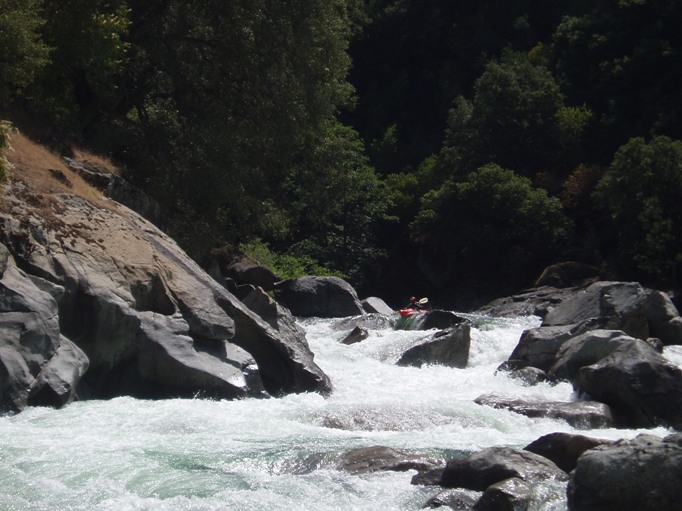
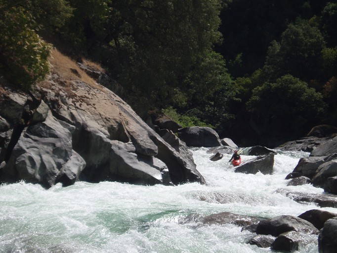
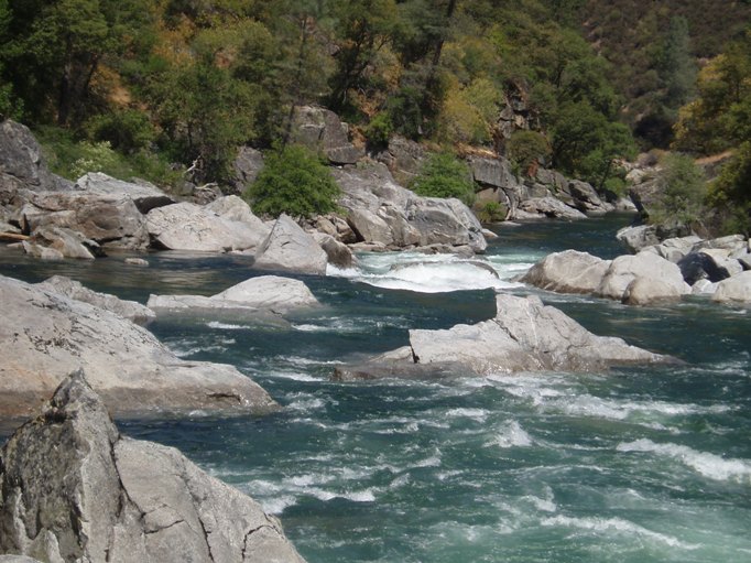
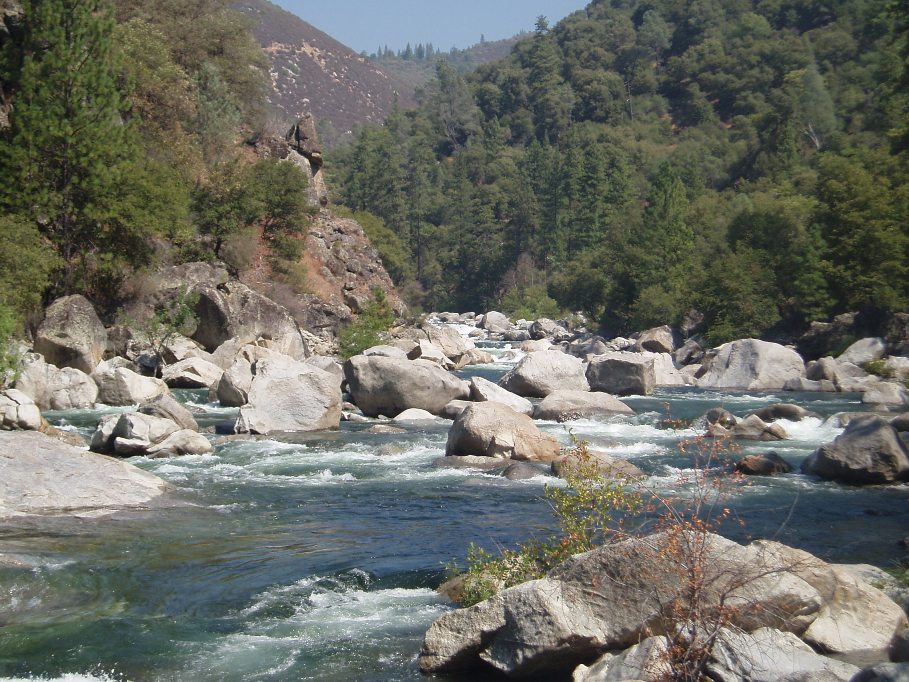
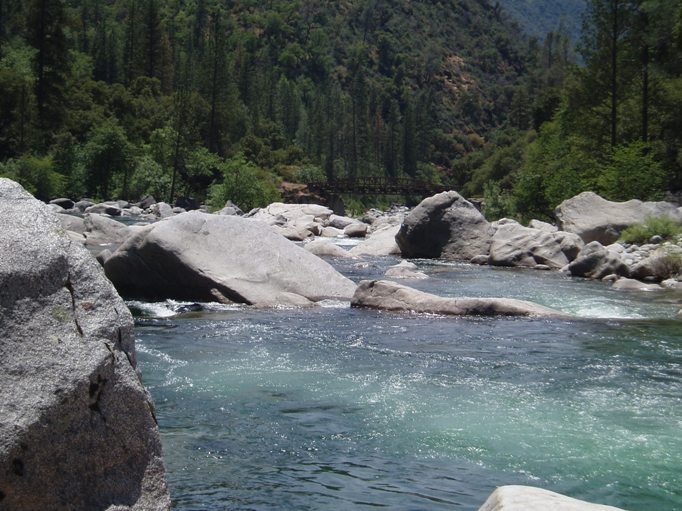
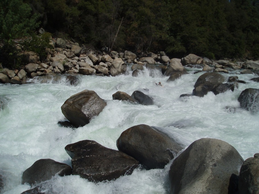
As far as the run itself goes, it was much more beautiful than I thought it would be. My only other experience in the Tuolumne drainage was on the Lower T a few years ago, as I remembered it was ok, but nothing spectacular as far as scenery goes. Cherry creek is much more green and forested which was very nice, plus looking back up river seeing a very large canyon and very large rapids make it all the more beautiful.
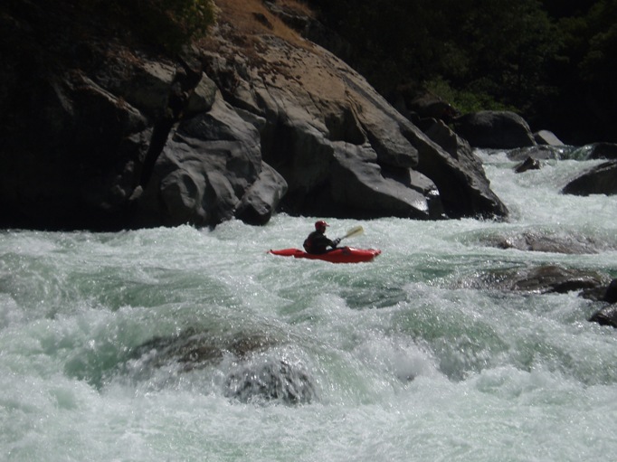
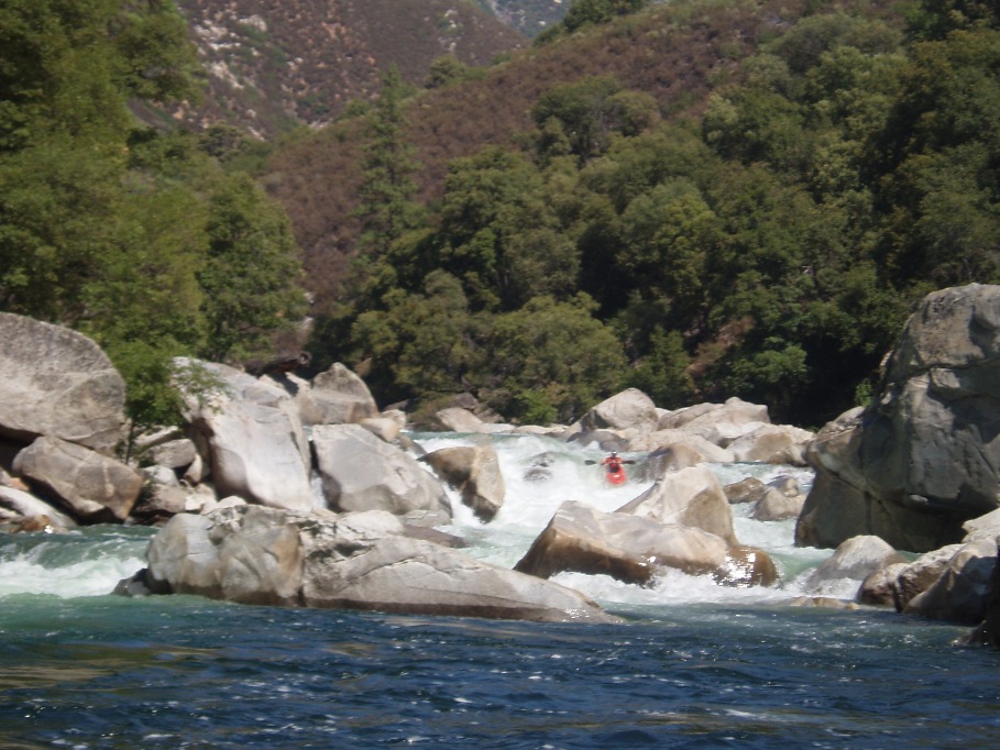
The rapids on this stretch are stout. If you have done Giant Gap or Burnt Ranch one time at low flows, this will not be enough. Once on the river, all of the biggest drops are walkable, especially Mushroom, Lewis' Leap, Flat Rock, and of course Lumsden. Although the walks aren't hard, all at river level, the boulder size can make them a bit tedious.
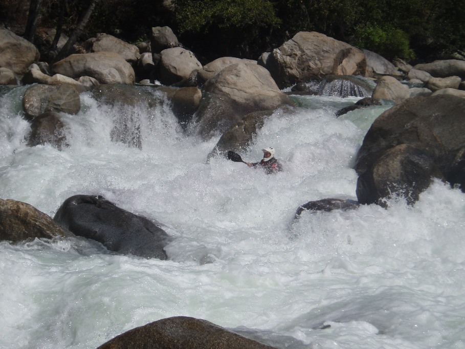
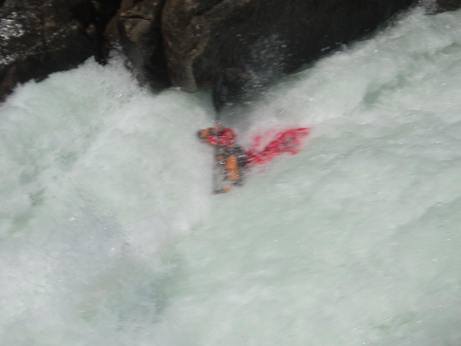
One final note, be careful on this river. One in our group who is very experienced on this run took a very bad swim in Sky King, and ended up swimming for a good ¼ mile. His boat did about 1 mile and 2 class IV+ to V- rapids. If it weren't for it eddying itself out at the lunch spot, the boat would probably have been lost. The paddler was alright, but very shaken up. At the beginning of the swim he narrowly missed going into a caldron of sieves on the river left, but the other (better) option was class III-IV for the entirety of the swim. So, small mistakes can have consequences, so just be careful and don't go in unless you are really ready.
No exact mile by mile will be given, just approximates, there is just too much going on in there. And no ratings given as I don't have the frame of reference to accurately convey this, you can look at cacreeks or the Cassady/Calhoun book for their impressions. Also, these are only the biggest and most define rapids. Also, there are numerous class IV rapids that are not making the write up because they are just manky boulder dodging affairs.
For a nice rapid by rapid video check here: youtube
For more pics check dreamflows
For more pics check raftsiberia
Here too, click "enter" then "other photo adventures" then "Cherry Creek" lynnmyersphotos
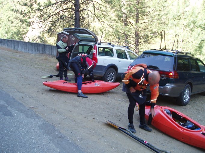
2013 Update: So, in the spirit of updating some of the write-ups to sound less scared (but where is the fun in remiscing in that?) I will say that 7 years ago when I first ran this run, it was scary. Big, pushy rapids come one after the other throughout the run. But, at the time, the next hardest thing I had done was a low water 49 to B. These days, I find this river to be a classic, one of my favorites... the rapids are still full of technical moves and boofs over big holes, but now that I have a better understanding of what it means to boof, and that paddling harder doesnt always make the rapid any easier... I love this run. The type of get deep in the water and come out with a smile on your face. Also... one of these days I will finally get out of my boat for some pictures... maybe.
Also, this Spring I had the pleasure of boating it at ~1,900 cfs. Surpsingly, though slightly pushier... the river only felt a quarter step harder. Mushroom had a bigger hole at the bottom. We snuck around Blind Faith. But all the rest went just fine. Sky King actually flushed out. You could run center at Flat Rock as the water just ramped out over the sieve. Crazy, I was expecting to be gripped but it was just fun fluffy fun. The best part though was getting to start on the T itself. Immediately you drop into fun class IV and IV+ rapids. there are at least 4 or 5 really fun rapids in this section, all harder than what are on the Cherry Creek mile. A great way to start the day and get a warm up in before things got bigger.
Mi 0:
- The first half a mile is actually on Cherry Creek. (Unless you get lucky at get flow on the Tuolumne... but then you are going to have high water down below)
There are a few good warm up drops on this. The first drop is not a big deal but has a pin rock on the far far right.
Initiation. The last rapid on the Creek itself, this rapid has an easy enough line down the right side, or a boof line on the left over a pour over. My friends make anyone they are taking down for their first time boof the left to make sure they are bringing their "A" game. 2013 Update: These days I don't take folks into initiation... though I also don't take folks I haven't boated with before down the run...
After a half mile, you meet the Tuolumne.
Cascade. The first rapid on the T, big waves and big holes, avoid the later on the left.
- Guillotine. This is a fun low stress rock slide right of center. .
Corkscrew. Just below Guillotine, this rapid has a slide into a boof on the center/right side of the the left channel.
- Jawbone. This is the first big rapid on the run. Half way down there is a large
wall of water on the right half of the channel, don't go over it. Go to the left or
it and ride out the holes.
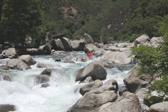
Mushroom. This is the biggest rapid on the run (besides Lumsden). Kayaks usually run over two boofs on the right. Both second channels from the shore. 2013 Update: Then either eddy out right and ferry to the left, run the race line down the middle, or just drive straight to the left. With respect to the mushroom rock itself... you can go race line to the right, straight over, just left, or far left... really the only place not to go is far far right at the bottom. Once past the mushroom rock, drive to the right side of the hole at the bottom. Easy to portage on the left.
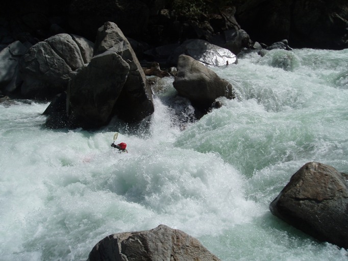
Toadstool. Immediately below Mushroom is this tricky drop, if you do everything correctly then it is not that hard. The idea is cut right across the entrance and get to the right of the mid river rock, from there boof the exit. The left side of the mid-river rock is ugly.... though also called Freight Train and is the raceline as well as the rafter line. It is a big hole along with a sticky eddy.
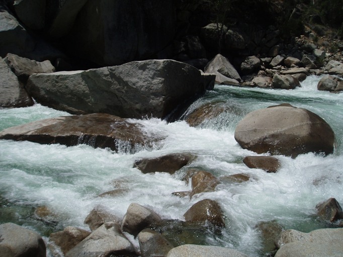
- Halfway though this mile starts the "Miracle Mile." This stretch is absolutely
continuous whitewater with only a few calm class II moments. It drops over 200 fpm
and has a few class V moments mixed in with almost continuous class III-IV drops.
Below are the moves which have been named within the section.
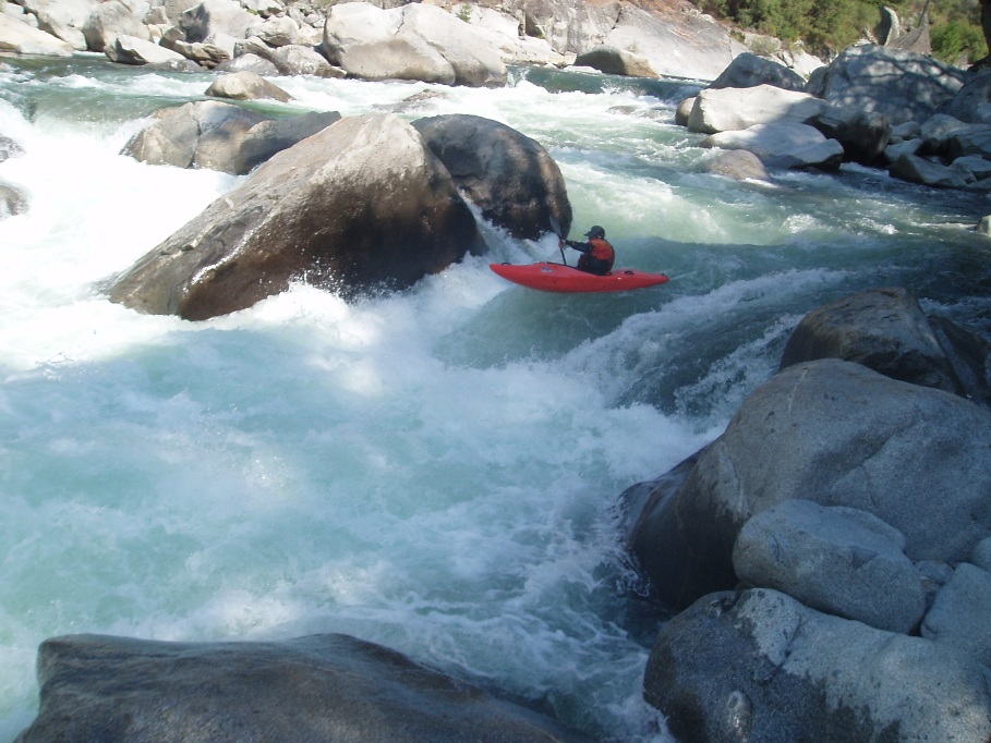
Unknown Soldier. Bolder constrict the river. Shoot through the left channel aiming at the rock on the far side of the river, boof that rock over the large hole below. Then run out through some holes.
 © Ian Buckley (Race line, normal line is the left edge of the rock to the boater's left)
Innocuous. This is an easier looking rapid that is blocked at the top by boulders. The idea is to get left and stay left with the idea that you can never be far enough left. Several large holes back each other up on the center and right.
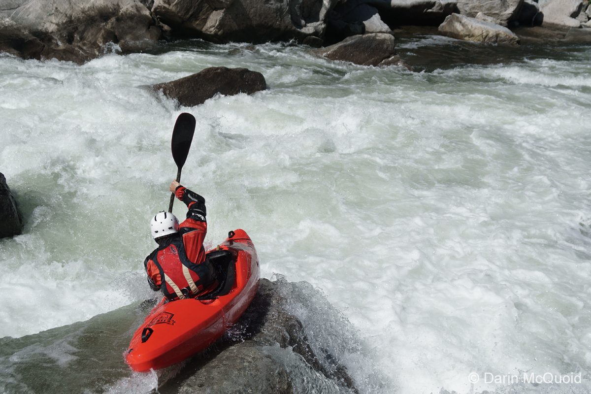
Blind Faith. A large pour over hole can be avoided by driving onto the right flake in the middle of the river and boof over it. 2013 Update: This is the one rapid that we ran differently at high flows... some ran the normal line but it was a blinder move and a bigger hole. Most of us ran a small boof on the far right that avoid the main hole.
Sky King. Although not the biggest rapid, it is one of the scarier as the run out is sieved out and long. From the eddy on the left just at the lip, peal out and boof the curler on the right side. Cross fingers and hope you don't get pounded in the hole. Easy to scout/portage on the left. 2013 Update: This one scared me for a long time, Chris had a horrible swim here my first time and I walked it for 2 years before I finally rolled in the entry 2 or 3 times and rolled up at the lip, totally committed. Since then I began to run it. And I think the hole changed, I have seen some bad lines in there including surfs... but everyone seems to work out just fine. Most don't even get stuck. Basically, you can fall into the curl on the right and keep your head dry, or boof the right side of the hole while pointing your nose a little right and it all goes well.
- Eulogy. I actually don't remember this one at all as I was trying desperately to
catch up to my friends who went off to get our swimmers boat. 2013 Update: I normally enter far far right and move back to the right side of center to drop through several large holes. There is also a fun line just right of center the whole way but there is a rock flake or two to avoid there.
Coffin Rock. I certainly remember this one as I bombed into it blind with no info on it. Apparently there is an easy line down the left side the whole way. I entered right and cut across a hole left to then avoid a mid-river rock. All I remember from there is dropping down amongst many rocks. 2013 Update There are two normal lines, one is down the far left and stay left, the top is a good size hole but easy to get your nose over. The other line is to enter far right and move all the way across to the left. At high water you can also run middle or even far right.
- Christmas Hole. This is a large hole that can be avoided on left or right. Either
way though required boofing the edge. The normal line is to drive up onto the rock on the left and slide into the eddy behind it and around the hole.
Richard's Hole. A huge hole lies in the middle of the river after a steep drop. We ran to the right of it. There was also a sneak which some did way left amongst the shallow rocks. 2013 Update: The normal line is to the left of the hole... drive hard right to left across the top and avoid the main hole. There is also a class III sneak in the left channel around the entire rapid.

- Lewis' Leap. This steep drop consists of two boofs. Both on the left side. The run
out is fine. There is one ledge 40 feet below the rest of the rapid.
 © Chris Shackleton
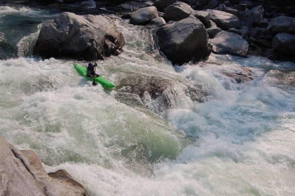
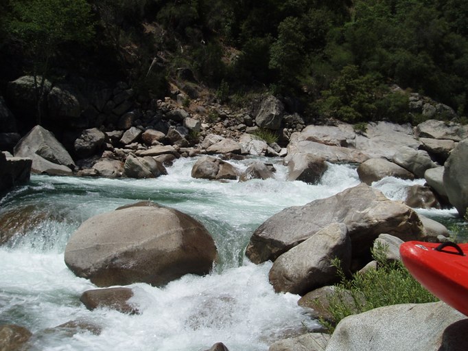
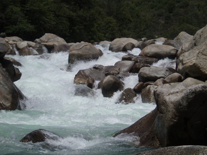
Flat Rock. A junky entrance leads to some chutes which leads to the Flat rock itself. The drop is not steep but lands in front of a rock which water dives under, very dangerous and usually portaged. The pictures are at low water... 2013 Update: These days I always run it, but I run a sneak. I also now know that it is not "usually" portaged... at least not by the A-gamers who main line it all the time. The sneak can also be used to shorten the portage. Run down the far far left, just before it gets hairy, there is a small channel that shoots off to the left and lands in an eddy. You can portage from here, or join back out with the main channel and run the next ledge middle/right but going back left. This lands you just above Flat Rock proper... which can be snuck around on the far left with a nice 5 foot boof onto a shallow ledge. Sounds bad, but at least you stay in your boat!
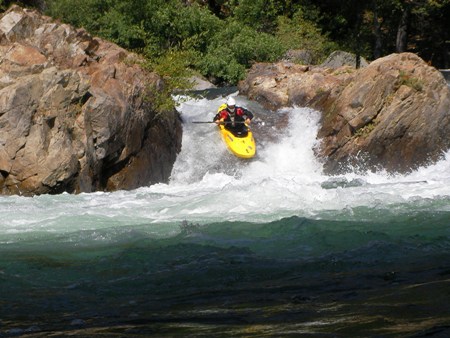
- Lumsden Falls. Huge is the only way to describe it. Portage left. 2013 Update: Or scout right. If you choose to run it... drop down the ramp, head immediately left and keep moving left... avoid the decapitor rock on the right and drop into the fluffy and flushy hole below.
Horseshoe Falls. A eight foot vertical drop on the extreme right was fun our flow.
Hole on left. This rapids does not look like much, and is not much unless you go left in which case you end up in one of the biggest holes on the river.
Take out: Drive East on Highway 120 out of Groveland. Before you get to the ranger station, turn left onto Ferretti Road ( you will also see a parking lot probably full of cars and a café both on the left). After about one-mile and the second cattle guard, take the immediate right onto Lumsden Road. This road is dirt and very rough at times, high clearance is recommended but not necessarily required.
It is best to meet someone who is doing the Lower T, and arrange a car swap. They drive down to their put in and leave their keys somewhere. Then when you paddle down to the same point, you bring there car out. Everyone wins. It saves over an hour of shuttle time for both as the dirt road is about 30 minutes each way.
Put in: From the take out, drive east on 120. Stop at the ranger station to pick up a permit (as of 2012 you can get a permit yourself at put-in). Continue up 120 until you South Fork of the Tuolumne via a high bridge. Turn left just past this on Cherry Lake Rd. Continue for 4 miles and turn left at the Y to stay on Cherry Lake Road. Follow for 5.7 miles, you will cross the T (high water put-in). Continue on. After the 5.7 miles from the last turn, turn left on the road dropping down to the river.
HTML Comment Box is loading comments...