
South Fork of the Feather (Little Grass Valley)
| Stretch: | Little Grass Valley Dam to South Fork Diversion |
| Difficulty: | Class IV-V |
| Distance: | 9.6 miles, one long day |
| Flows: | 180 - 500 cfs (300 is great). Current Dreamflows gauge |
| Gradient: | 150 fpm average (sections above 200 fpm) |
| Put-in: | Little Grass Valley Reservoir spill way |
| Take-out: | South Fork Diversion Dam |
| Shuttle: | 30? Miles (about 45 minutes one-way if done right) |
| Season: | Summer and Fall, scheduled release. |
| Written: | © 2006 & 2010 |
| Featured in Video Thirty-Two | |
So I just got of this river yesterday (as I am writing this) and man did I have a good time. I was first exposed to this rapid one year ago to the date, yesterday (ironic as you will see). So last year I went out to run it with a friend and some new acquaintances . The plan was to drive to the take out, set shuttle and camp at the put-in, putting on nice and early. Instead it took us 6.5 hours to find the take-out as we didn't come prepared with maps and proper directions... instead we had a GPS and too much confidence in its ability. So the next morning we awake and begin a drive to the put-in... repeat the prior sentence... 3.5 hours later we arrive at the put-in. So we began to put-in at about 12:30 and the day began. We ran the first drop, ran the second, took a long scout and portage on the third, ran the exit of it, portaged the falls, then scouted the following drop. As Jim and I set safety Stephan and Steve went to run the Slot and 10 Footer. Stephan cleaned it, but Steve flipped and recirculated behind the falls, where he swam, and climbed on a rock behind the falls. About thirty minutes later we finally extracted him. It had just taken us over 2 hours to run the first 200 yards of river, Josh and I fearing the unknown below, and dark, and the incoming rain, hiked off. The rest of our group continued. We promised that we would wait at Put-in for a few hours in case they decided to hike back up to us as well.
As we hiked out we see more boaters arrive, ready to put in just as we again reach the put-in (at 3:30). Darin and Jon head our warning and decide not to put on, but Thomas and Ben give it ago. One hour later after an iffy losing of a paddle just above the 30 footer, Thomas and Ben rejoin us and help us wait for the rest of our group. After a few hours we drive down to take out, it is getting dark and to our "surprise" our other three group members have not arrived at take out. A few hours pass and a four wheel drive pulls up and out hopes our group, at 10:30, they too hiked out.
Yesterday started off better, we knew the way to the take out to meet up with Darin and we knew the way to the put in, so we were putting on by 10:30. Off to a good start. Then shit hits the fan, a member flips and is swept into the third rapid, Mad Dog. He does the hole thing upside down on the right side of the river, swims, and he the boat and paddle swept downriver. The boat hangs up just above the falls and the paddle catches an eddy. After getting the boat off he decided to hike out, it is still earlier than my last trip, all is not lost. We begin making good time, running everything according to Darin's lines, scouting nothing. The half way down I begin to take on water... because of a 9 inch crack, we have to wait for the boat to dry in order to duck tape it up. From this point I was boating with a boat full of water, then my arms began to cramp. All in all, this run which can take as little as 3 hours, took us 7 hours, and that was without a single scout. Lesson, give yourself plenty of time, either bring a probe or a person experienced with the lines, and always bring a space-blanket and matches in case you can't hike out.
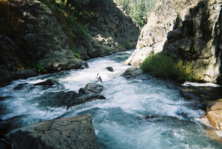
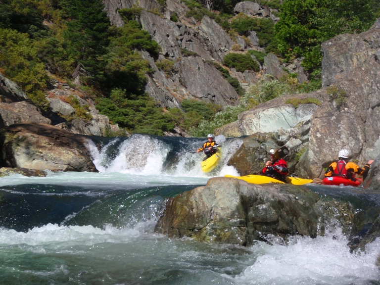
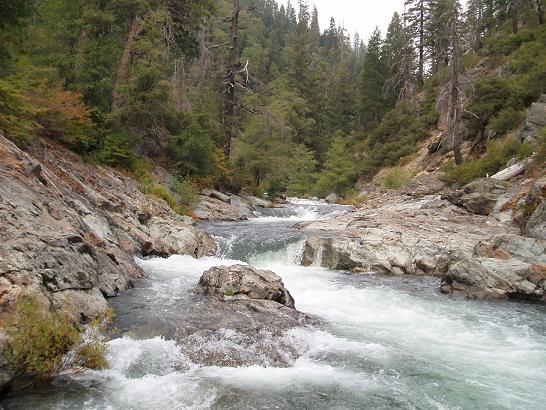
So to begin with, I would say there that at 300 cfs, there are two gorges which are Class V in nature, and one rapid further down which is Class V by itself. In the middle parts are many class III and IV gorges. The "easy" sections are not as easy as the ratings would have it. The easy sections are continuous, so although no move will be harder than class III or IV, in ten feet you will have another move, followed by another and another... for hundreds of yards at a time before an eddy can be caught. This leads to my next point, there are entirely too many drops to describe them all. In total there are six or so junky rapids, along with no less than forty clean drops. With this in mind, with the fact I have only run it once, there is no way for me to recount the whole run, or even necessarily the order of the fourth gorge's rapids, so use this more as warning or scouting hints than as an absolute guide. This run is great fun, but I would recommend being familiar with class V before entering it as you will be in for a very long and draining day otherwise.
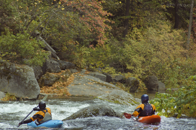
2010 Update: In the past 4 years I hadn't gotten out on the South Feather. This year I have gotten 2 runs on it. The first, two weeks ago we only were able to get on the Upper half due to 3 out of 4 cars getting lost going to take out (we found it, waited for 2 hours, drove to put-in and found our crew ready with a Post Creek shuttle set). The second was a full run. Both runs had a flow of 400 cfs. I think this flow is great. It does add some spice to a few holes, though it covers a lot of the mank near the end and I think makes for a more enjoyable experience. Even with the padding though, I still broke another boat in the runout... that means 50% of my runs have resulted in a cracked boat. The first boat was old, the second was on a previous cracks weld. In summary, at 400 cfs the river was very much a class IV+ run throughout its entirety. The first gorge was still class V.
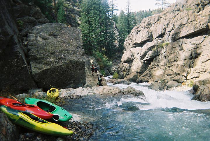
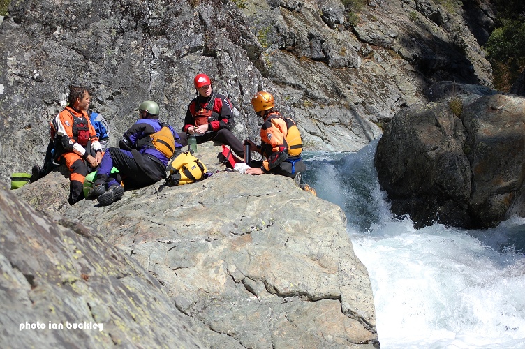
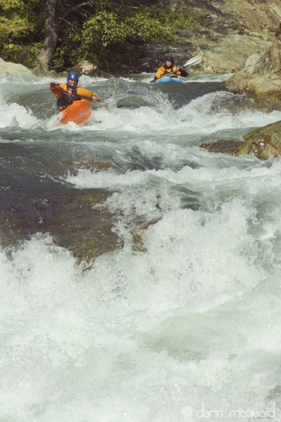
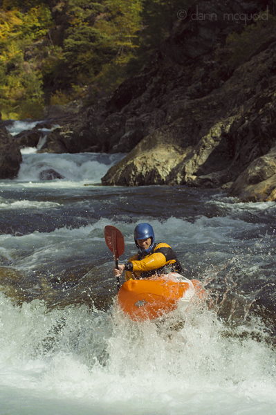
Thanks to Darin McQuoid and Ian Buckley for contributing photos to this write-up.
Also, Ben Stookesberry has some great follow-cam of the South Feather in the second half of this video.
Mi 0:
- The first gorge is class V in nature at 300 cfs and 400 cfs as the rapids are all stacked on each
other and are not forgiving, you can portage the entire gorge high on the left side
of the river or the right, but neither look easy.
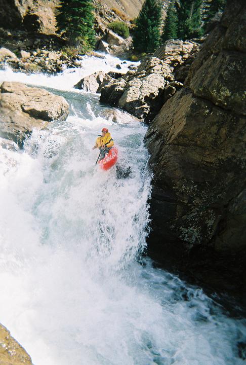
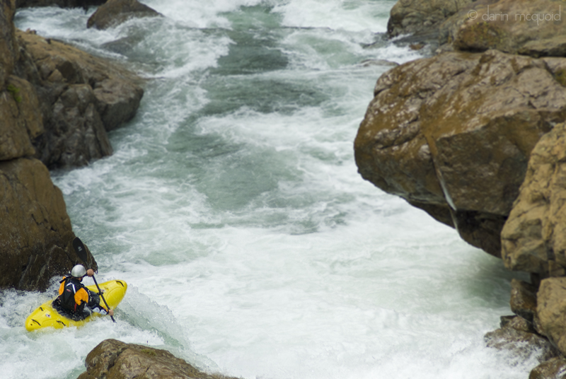
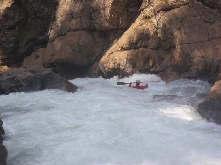
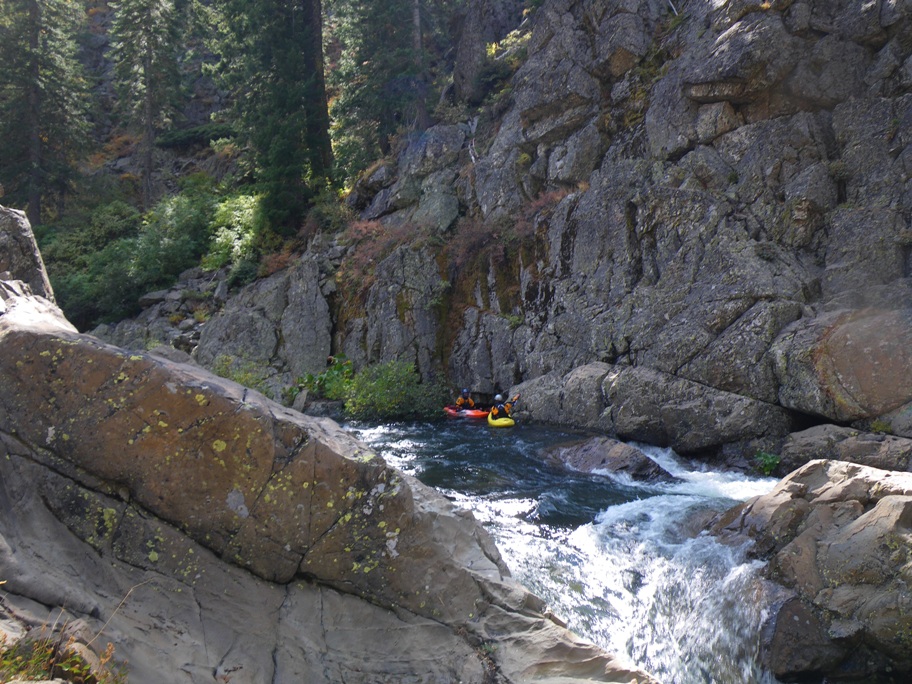
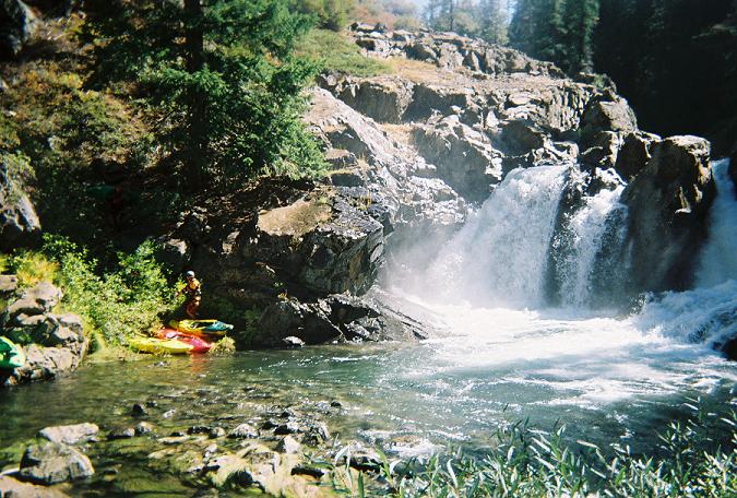
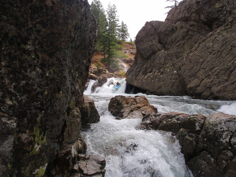
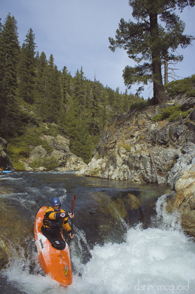
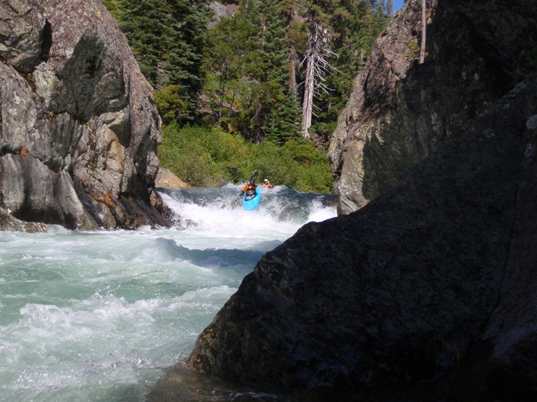
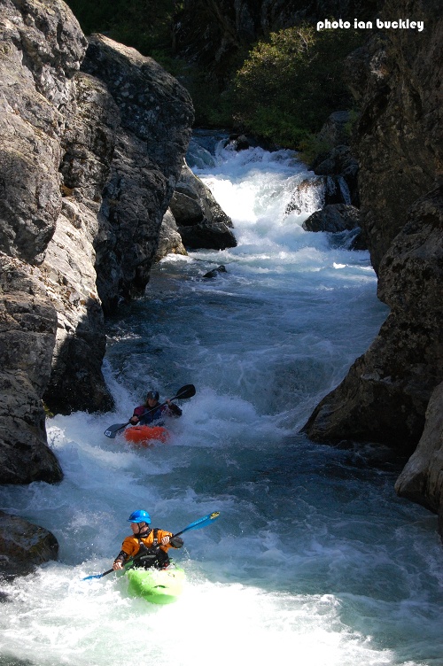
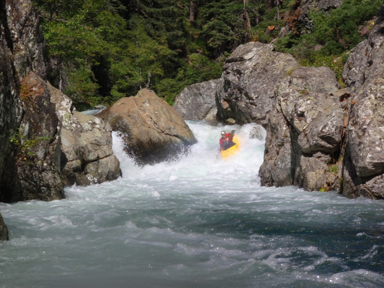
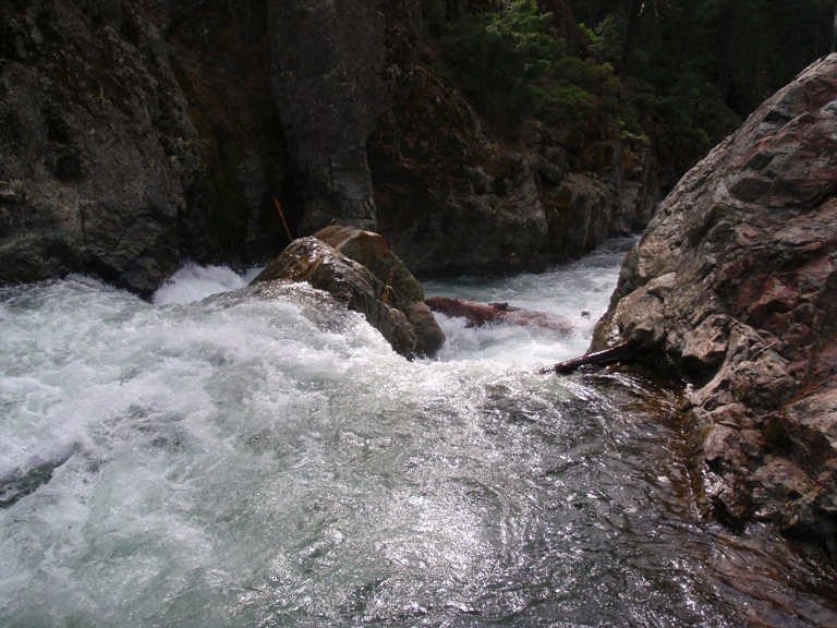
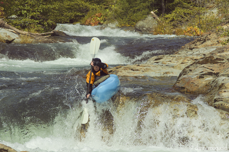
Put-in (IV). Ferry across the river from the put-in eddy, aim far left and boof off the 10-foot falls. I have seen people probe and it has worked out fine for them. Just below it there is an exit rapid which is easiest to run on the right, no more than Class III but if you go left, be prepared to get beat in the hole.
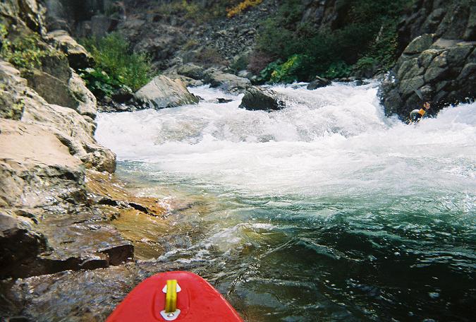
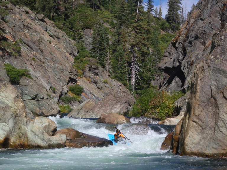
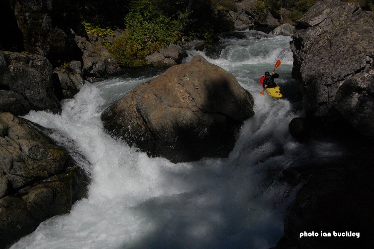
Second Rapid (IV). On the first corner the river drops over a junky rock pile and slams into the wall, turns right then drops into a few holes. It is best to run the pile on the left. Make sure to eddy out immediately after the rapid on the left and scout or portage the next drop. You can also run it far far right and avoid the few f'd up rocks.
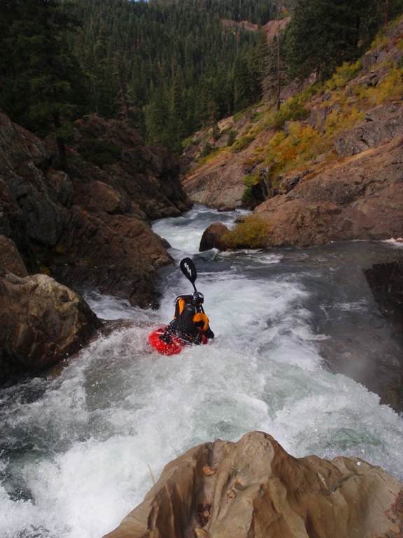
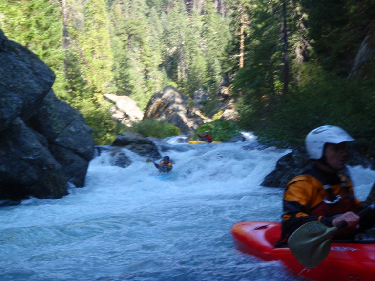
Mad Dog (V). A very junky rapid directly above a class IV run out, directly above a 30 foot waterfall portage. The rapid drops perhaps 15 feet most of it at the beginning. You can enter center left, and go over the first pillow and hit one of the launch rocks. Boof hard or you will find the rock shelf below, land and move right. Exit the rapid on the slot on the right. A few portage options exist, portage high on the left to get around the entire rapid, portage low on the left (feet in the water, there is a small shelf to walk along next to the wall) down the entry drop, put in at the base, and run the exit, or portage from the lip on the right and put in just below the exit. I think I like the right side the most.
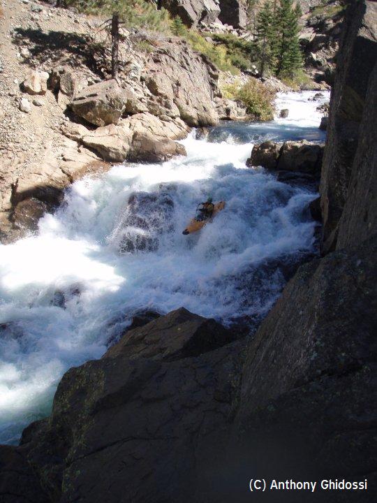
Run out (IV-). A boulder garden is all that stands between you and a thirty foot waterfall portage. The boulder garden is best to run down the right as the left side goes into a macking hole which has caused many problems.
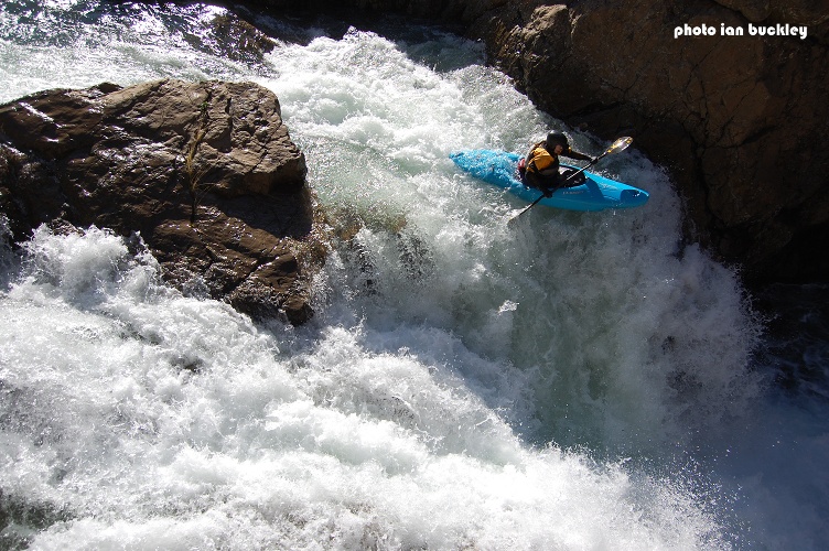
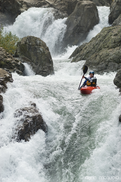
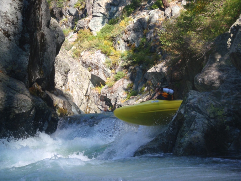
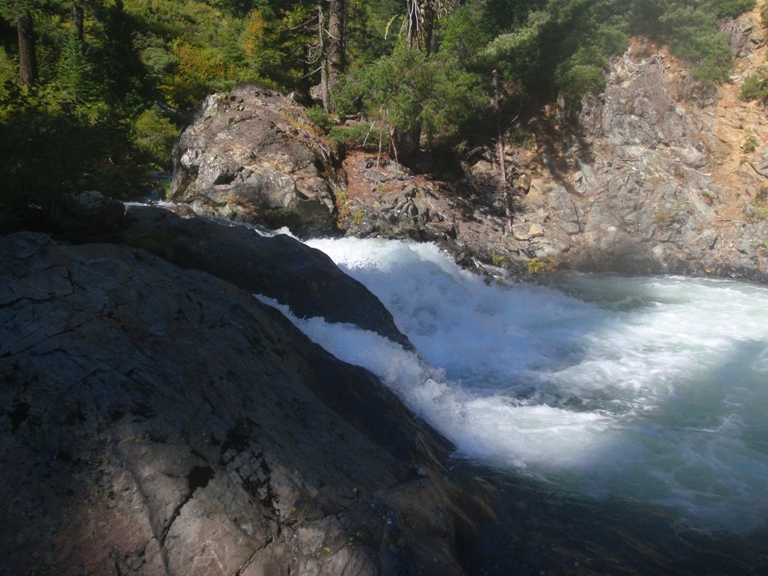
PORTAGE 30-Footer (V+). This drop has been run once, by Rusty Sage, however he broke his boat in the shallow landing and had to hike out. Ok, actually now it has been run many many times. It only took like 4 years for the second person to try. Now people run it and get a very delayed boof. Sometimes people plug and are ok, I know that others have hit something that is less than 3 feet underwater on their runs. So buyer beware. The eddy is about 1 boat big and on the right. It is just at the end of the rock wall, in front of a big bush. There is also an eddy large enough to fit several boats right across the river on the left from it but portaging from it is not possible so you must ferry across from it to the portage eddy, both eddies are mere feet from the lip of the falls. Update 2015: OK, so I am not even living in Ca anymore, but all the facebook posts brought my attention to this. In the past several years this rapid has become a non-portage with over 90% of folks running it. Just make sure you start far right and boof far left moving left to land in the deep water. It is crazy how time changes things... and in this case it didn't change the rapid, just that now that the line has been dialed, the perspective has changed.
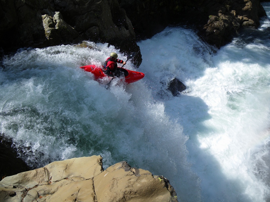
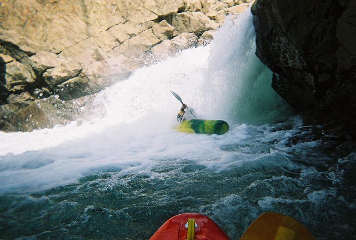
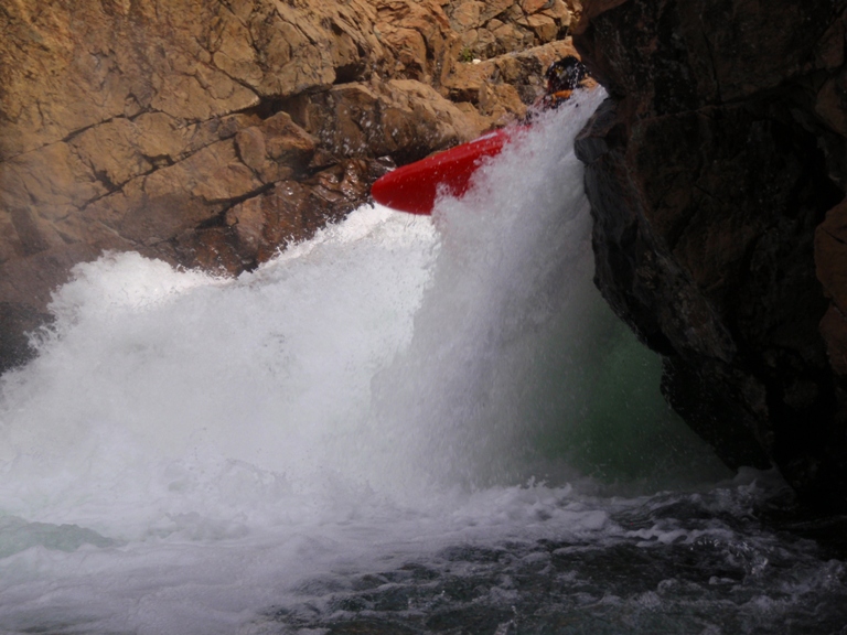
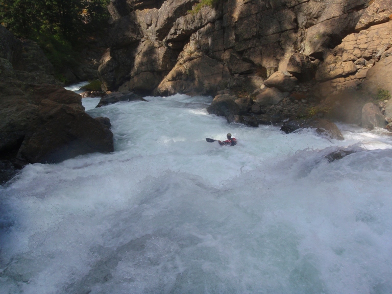
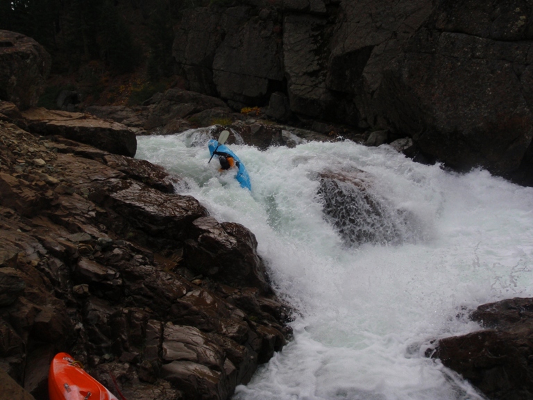
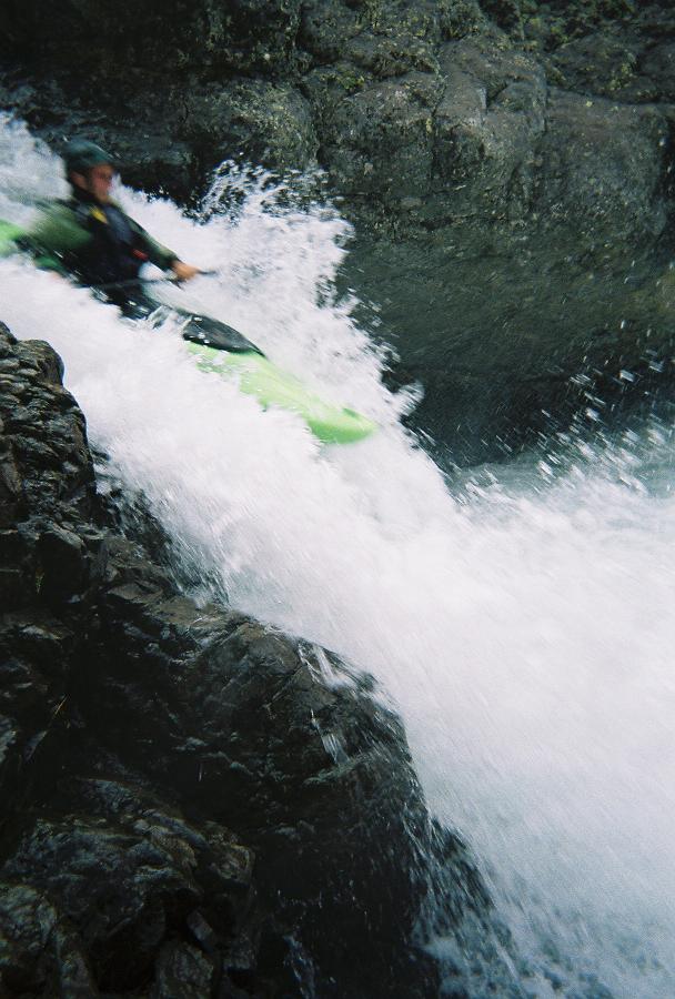
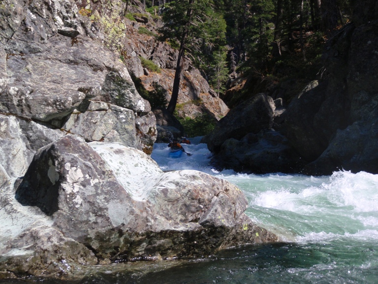
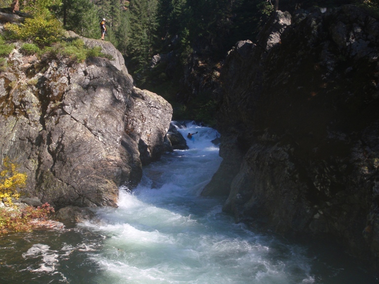
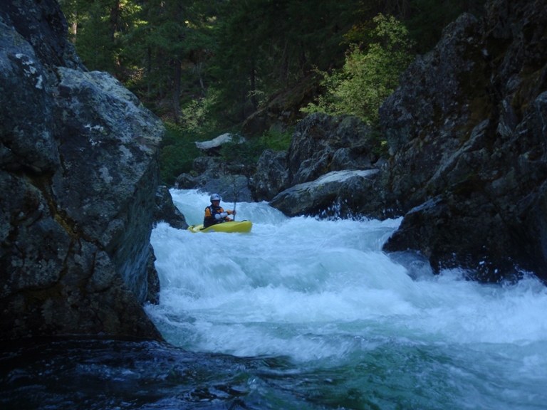
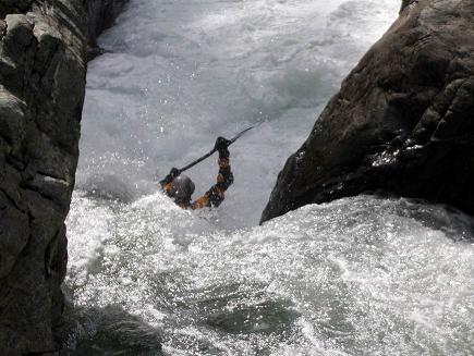
Chute and Falls (V-). Immediately below the portage is a chute which is run down the gut. The hole is a little sticky and initiated tail stands on two of our group of three. Recollect, and run left to right down the 10-foot pour over drop. This drop comes with a very sticky hole at the bottom, and tends to recirculated to the left, under an overhang and behind the falls. Just boof it and land in control. Either way, this rapid would be bright to set safety on as just downstream is another hard rapid.
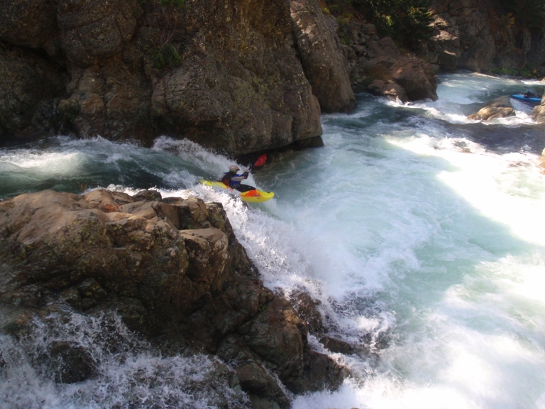
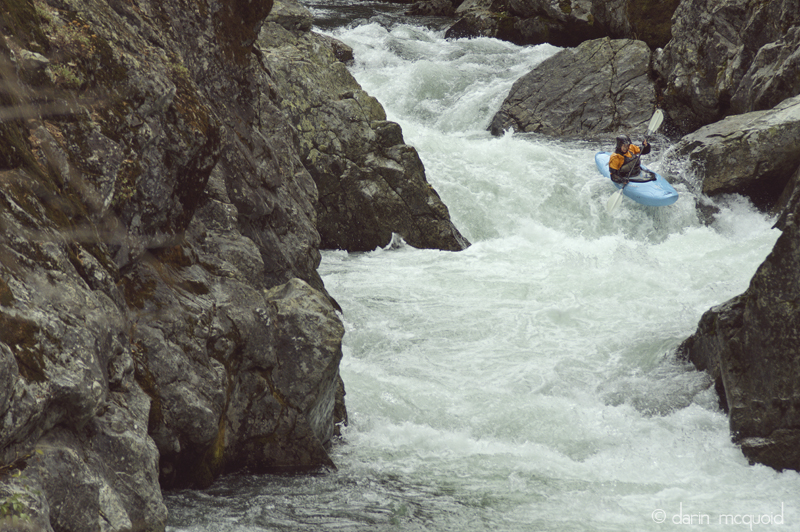
Watermelon Seed (V-). A riffle leads to another eddy on the right just above this drop. Enter left of center with a little left angle, boof down about 4 feet onto the rock in the middle. From this rock, launch center or left. Launching right will result in a bad piton or pin. Going to far left at the beginning and not making it to the rock will result in landing in a crack. Now go with the water into many holes, the exit of the rapid has ledges on either side of a mid-river rock, either side goes, the right can get sticky, and there is a fun boof on the left. -2010- This rapid was different this year, maybe it was the 400 cfs. We entered right of center and followed a tongue down to a boof, from there we ran it out down the right. It seemed a lot easier this time.
Piton (IV) One last rapid is left, run it down the left side of the main channel. The right side has a major piton hazard. In 2010, the rapid below this had a bad log blocking the right channel, go into the channels in the bushes on the left to find a clean way out.
-Mile 0.36 and this is the end of the first gorge. The next section is about a mile of class II/III water for about a half mile or so.-
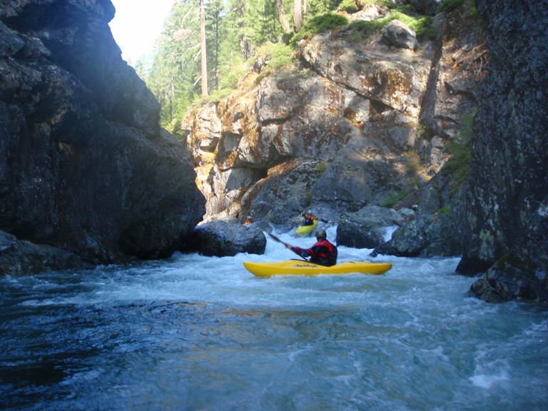
- Second Gorge (IV to IV+). A great fun gorge, mostly class IV with a few IV+.
Ledge (III+). A super fun ledge with a sweet boof on the far left.
Pocket Eddy 1 (IV). Just below the boof there is an easy curler that you want to make sure you drive across, as people can get stuck in the pocket eddy, so make sure to drive and boof left off the wall.
Trees (V). In 2010 there was a log jam in a gorged out section of the river. There was a thin line between (over) two of them that was blocked by a hole. Luckily is goes, this is probably the most dangerous move on the river, and a raft couldn't make it. And 300 cfs I don't know if a kayak could either. (As of 2012 the main hazard is gone but there is still wood to avoid on the left and right. Rafts would be ok.
Pockert Eddy 2 (IV). Another eddy where the water wants to slam you to the right wall into a pocket, use your cross current boof to avoid it.
Boof Status (IV to IV+). Not a hard rapid, but there is a big bad ledge hole at the top on the left that you want to carry through.
Another Ledge (III). This one looks like it is going to be mean, but it ends up being a 5-6 foot steep ramp into a friendly small hole.
A Fun One (IV). Enter on the right and work your way down to the fun runout.
- An easier section gives you a nice reprise.
Swimmers Hole (IV+). Be aware than on a large left bend, the river suddenly bends harder left and drops over a large hole. You can sneak it on the right, or scout from the island. Some epic beatings have been given here. Or if run properly you don't even get your head went.
- Third Gorge (IV to IV+).
A junky rapid with a hip check rock leads you to the lip of one of the best.
Postage Due (IV to IV+). When run well, this rapid is very easy, however there are plenty of places to make life harder. Enter it center driving and boofing left into the pillow, which will move you back to the center dropping you over another ledge. Now just avoid the wall on the left and the pocket on the right at the bottom. Scout on the right.
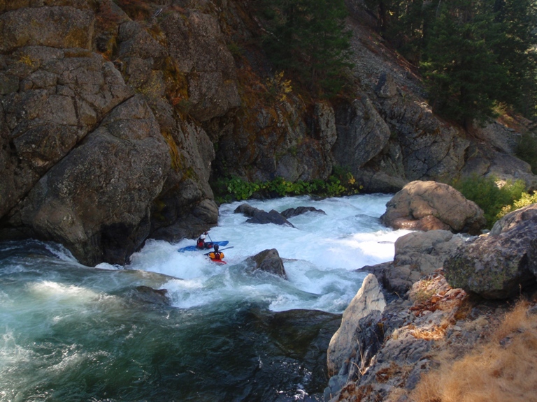
Read and Run (III-IV). There are several class III-IV read and run rapids. In 2010 there was some wood in here, so just be careful, all of it was avoidable.
Live and Left Live (IV to IV+). A class III lead-in drops you off a large ledge with a large hole. You want to be on the left side of the hole. The runout also boasts a good size hole.
Left Over Postage (IV+). Best run far right driving to the left across the middle, you don't want to end up on the right at the bottom of this drop. Just below the entry hole there is 10 feet of moving water to a rock that splits the river, the right side fades off into sieves while the left slides down to a nice boof.
Another Sieve (III+). At the end of the corridor below "Left Over Postage" is a small rapid with a sieve very much in play on the right wall. It is best to run the far left channel which drops you in just below the sieve and thus takes it out of play, however you can also run the middle with a cross current boof to avoid the flush into the sieve.
- Post Creek: Just below the last rapid the river bends right in a class II/III rapid. Just after the turn you will see a small creek on your right, you can hike up this creek, up the slope/bushes to your left to find the trail that means one of the forest service roads on the ridge above.
Post-Post Creek (IV-). Just below Post Creek is a log that you have to portage eon the right, from there, ferry out and hit the boof, don't error to the left or you will develop an abusive relationship with the wall over there.
Below here my memory begins to get foggy in the attempt to remember so many rapids.
Read and Run (III-IV). Several large and semi blind read and run rapids fill the next half mile.
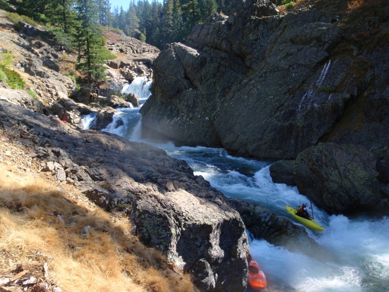
- Stump the Chumps (U then IV+). Portage the top due to wood blocking the channels and a very bad nearly unavoidable sieve on the right. In 2010 wood was across the right making the sieve 100% unavoidable. There is an eddy 20 feet above the lead-in. The lead in is class II and has a last minute eddy on the right at the lip of the drop. Portage from either. The second part of the rapid involves a right to left move behind the car size rock to avoid some pitons. The river then splits around/over another large rock and either side of it is good to go. In 2012 the wood in the main rapid was gone and a rock seems to have moved because it didn't look nearly as sievy. I bet everyone would run it in its current state if not for its history.
The Cave Sieve (V- to V). Although this rapid is not overly difficult, it is dangerous and manky. Enter down the right, 3/4ers of the way down the straightway go left off the curler, to the right is a bad sieve. This will drop you through a crack, now move back right away from another rock pile. Now move back left into the eddy behind the first rock pile. The exit is even more manky. Enter in the left channel moving right. Sometimes we finish in the bushes on the right which is reasonably clean, sometimes we finish on the far far left which was also relatively clean. Stay upright through this section to remain happy.
I know I am forgetting some class IV to IV+ stuff that is in this section... or maybe it is below Cavin Falls, I don't quite remember.
Slides (IV to IV+). Several slides with small boofs are run. The second of which has a nice boof on the left followed by a fun class III-IV drop. Below here the river slows for 50 feet. The next double slide makes an S-turn. On the right there is a large eddy below the S, catch this eddy. In 2010 the next rapid had a log on the right that Darin pinned under. To avoid, ferry out of the eddy to the left around the rock in the middle of the river, and boof the ledge below on the left wall. The log was not visible to Darin until he was over the horizon line and committed to the rapid. The next set of slides is class III but leads to a large hole, be on the far left of the river when the river straightens out to avoid getting worked above the portage. One more small ledge best run on the left leads to Cavin Falls.
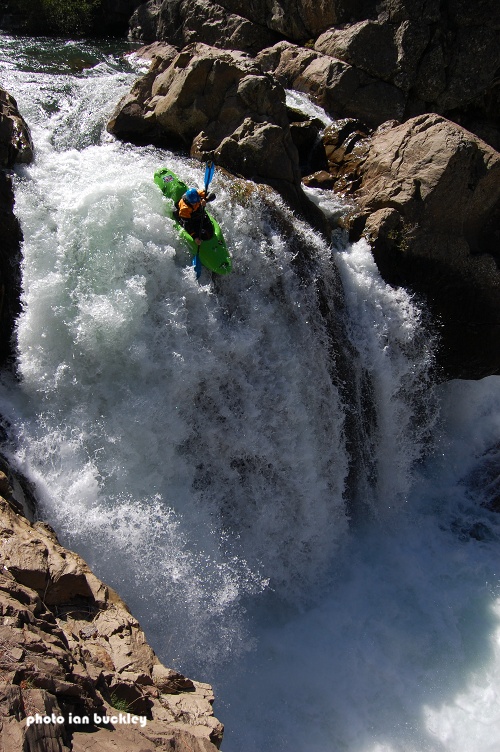
- Cavin Falls (V+). Although Taylor did not get the First Descent, that was taken from his as he scouted by someone falling out of the portage eddy and dropping the falls backwards. Taylor did then proceed to run it three times in a row. To date, I do not know of any other descents of the falls.
Several More (IV to IV+). There are 3 or 4 more bigger rapids, of which all are read and runnable. the last rapid is totally blind and has a pinch exit with two off angle holes. It is known for swimming folks just above a fairly junky exit that is best run far left. It is obvious when the river gets easier, however it now gets mankier. And I now have a hole in another kayak to remember it by. Oh well. The paddle out from here takes about an hour and gets easier and easier. For the past 5 years there has also been a log to jump over right before the end. But it is very visible from above and only has slack water leading to it.
There is then a 3 miles or so of rapids that start off as class IV- and quickly fade down to class II+.
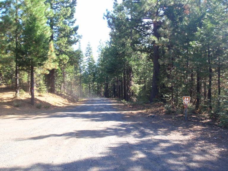
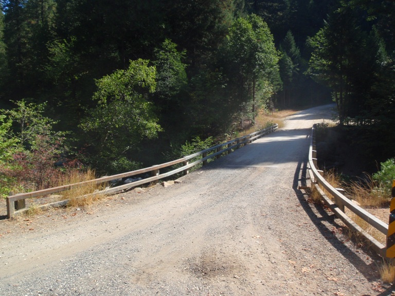
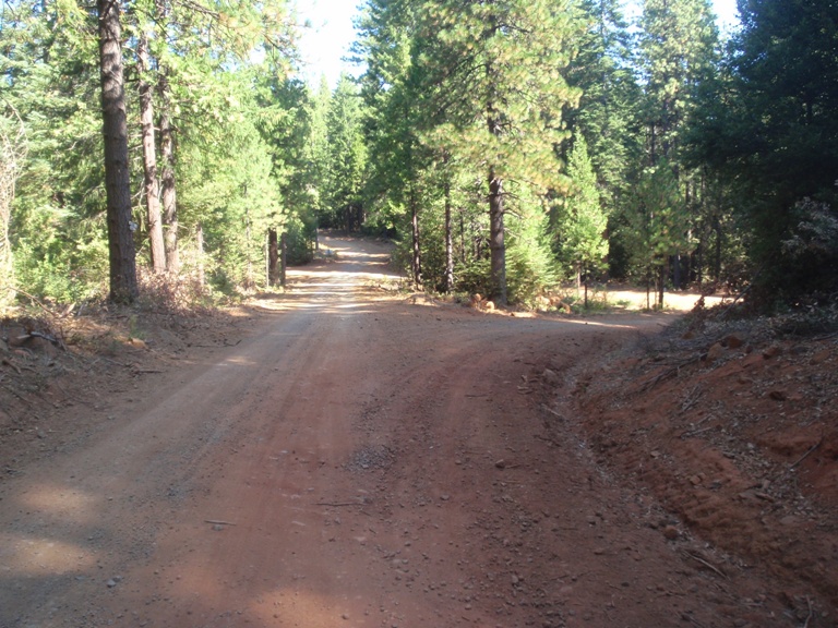
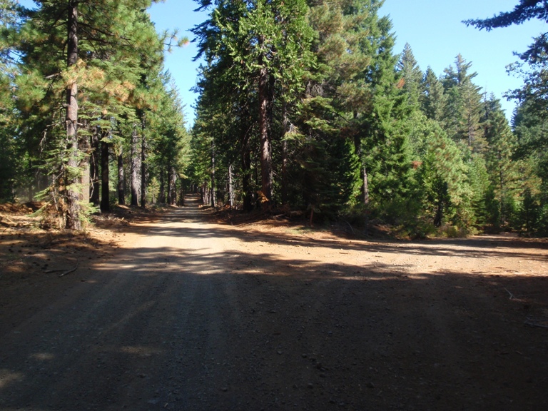
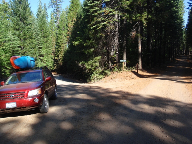
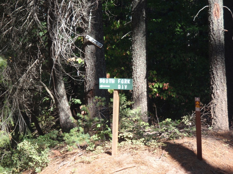
Take out: There is a way in from the South, however that road has a gate which is occasionally locked. I always drive into the take-out from the North. Lots of it is on dirt road, but it is a good dirt road that any car should be able to do. From Oroville, Take 162 East, be aware that in the middle of town (1.6 miles from Highway 70) you need to turn right to stay on 162. In 6.6 miles turn right on Forbestown Rd which is a major paved road. In 6.2 miles, turn left on the major paved road, Lumpkin. In 11.8 miles take the right at the large fork. The It is more of a turn right on the road (Mill Rd) which is not marked, though there is a sign for Cascade right before it. It is also marked by a "Track A" sign. If you end up on a dirt road, you missed this turn. Then go 7 miles until you see a large dirt are at a fork, turn right here, this is La Porte Rd. In 2.4 miles you will see Road 24 drop down to your right, take it, this road is dirt. From this point forward, ignore all small dirt roads, just look for major dirt roads. Follow this road down to the river crossing, cross the river, continue up the other side. Eventually you crest the ridge, stay left at the next major fork, on the far side of the fork you will see a small sign marking it Road 33. Continue going another 1.3 miles or so, stay left again at the major intersection marked with the sign for 21N15Y. Again continue another 1.25 miles to the the left turn at the "South Fork Div" sign. follow this down a mile or so to the diversion dam.
Put in: Go back to Lumpkin road and 24 intersection, turn right onto Lumpkin (27). Follow this road for 10.9 miles, turn right just after the forest Service sign on the smaller one lane paved road. Follow this down to, staying right at the fork to the dam. Hike down near the spillway to get to the water.
HTML Comment Box is loading comments...