
South Fork of the American River (Kyburz)
| Stretch: | Indian Falls to Highway 50 bridge (1:30 hrs from Davis) |
| Difficulty: | Class IV < 800, 800 < Class IV+ < 1,300, 1,300 Class V- < 2000, Class V >2000 |
| Distance: | 7.5 miles, one day |
| Flows: | 500 - 3000 cfs. Current Dreamflows gauge |
| Gradient: | 84 fpm (95 fpm for the first 2.8 miles) |
| Put-in: | roadside turnoff below Indian Fall |
| Take-out: | Highway 50 Bridge / Historical Site |
| Shuttle: | 10 miles (10 minutes) one-way |
| Season: | spring into early summer, from snowmelt |
| Written: | © 2005 & 2014 |
| Featured in Video John Moore's rapid-by-rapid video | |
This is one of my favorite runs that I have ever done. The rapids start off almost immediately. The style at our flow of 725 cfs was technical, forgiving, and droppy. Paul Gamache called me the night before while driving through town, 12 hours later we were boating. We ran it with Brian who had had experience with this run; because of this we did not scout any rapids and therefore the rapids kind of blend together as one in my mind, so it will be a bad description. But here we go...
Note: I have run this again and I just don't think you can figure it all out rapid by rapid, the nature is very continuous. We had 575 the second time down, and I wouldn't do it this low again unless there are no other options. You spend the whole run bouncing off rocks, not in a fun way, but in a constantly avoiding pins or breaches.
Update 2014: OK OK, so I originally wrote this some 9 or 10 years ago. At the time, it was one of the first continuous rivers I have done, perhaps that is why I thought it was so hard as well as so fun. However now that I have a bit more experience I figure it is time for a large overhaul... for the first time essentially deleting my old write-up. The run is great, it is a go to run for Sacramento folks during warm rains and snowmelt... but certainly it is not one of the very best runs around. Good and dependable though, yes. There are various put-ins and take-outs for those wishing to only lap hard sections or two take the teeth out and make it easier. At its easiest, it is class III with a few IVs, at it hardest it is back to back class IV. Also, I now know personally that at flows in the 2000s and 3000s are great fun. Most of it is straight forward with an occasional large hole to avoid. Swimming of course is not an option at those flows.
Update 2017: Note the discussion in the comments about the difficulty of the river. I added some extra info regarding the fact that this run does get much harder as the flow comes up. Though it can also be run pretty dang high.
Mi 0:
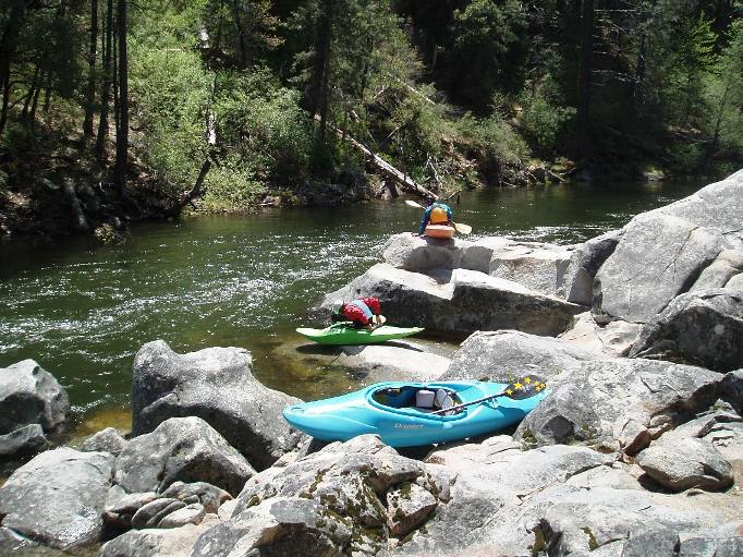
- Indian Falls (V). If you put in at the campground this will be a quarter mile of the run in. Most folks don't run it, it is a mean junky class V... therefore most put in at the turnout at the Indian Falls River Access area just below the rapid.
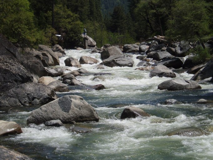
Continuous (IV to IV+). This section comes at you fast immediately below the pool at put in. There is a junky little rapid at the top, then a hard right to left move in front of a fan rock. Then a long read and run section before you finally cross under a bridge and get your first change to catch your breath. Things mellow for the next three quarters of a mile. When you duck a tree (been there for more than 10 years) you know you are about to get back into it.
- Nose Up (IV). Just below the log, enter down the right. A large rock creates a pour over on either side. We run down the right. Get your nose up as the hole will send you deep otherwise. There is then 100 yards of boogie downstream.
S-Turn (III+ to IV-). After some shallow boogie, enter right and do an s-turn back middle. I like to cut back to the right immediately below as the hole can be a bit punchier on the left. But goes. There are two more holes immediately downstream in the run out.
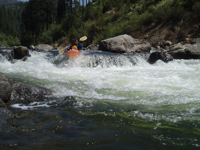
- Steepest Section (IV). This long section of rapids crescendos with one of the large individual rapids. It is continuous leading straight up to it with a few eddies to catch here and there. The top section isn't bad, though a little junky. We enter on the far right before running down the junki8est part down the middle, with a hard left to right across the cross current to keep driving downright to the right. Below is a sticky ledge you can go through or around on the right. A fun wave train leads to an eddy on the right.
Crescendo (IV ). From the eddy on the right, you can either ferry back to the far left to go around a ledge, or boof one of the two rocks in the middle of the ledge. Downstream are two sticky holes in succession that you want to either go far left or far right of.
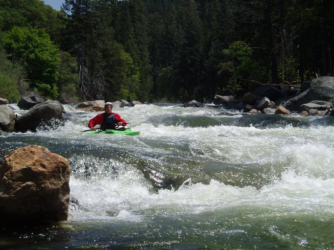
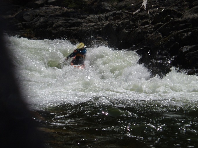
Landslide Rapid (IV to V). This is the hardest rapid of the run. Powerful features and a long length will push a class IV boater through their comfort level. The start has a few holes to punch before the river drops into a large curler. I run down the center through the meat of the curler. Sometimes this kicks you into an eddy on the right, which you can use to roll up if needed. Below are two more ledges that can get sticky as flows come up. I go down the middle of the first one, and the left of the second one to avoid the shallow runout on the right.
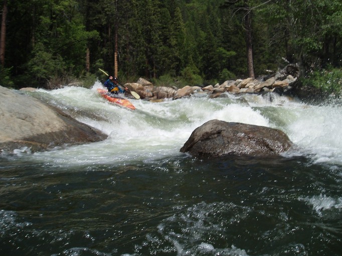
- The Wall (IV to V-). The last rapid of the "hard section" is visible from the road, where the river hits a wall, makes a 90 degree turn before dropping into a large hole on the wall. The idea is to avoid the hole, it is large and has caused many folks to swim. I like to enter far left so I have plenty of time to set a ferry angle to work back right. Others enter right in front of it. At flows above 2,000 you can start to sneak down the middle around the hole.
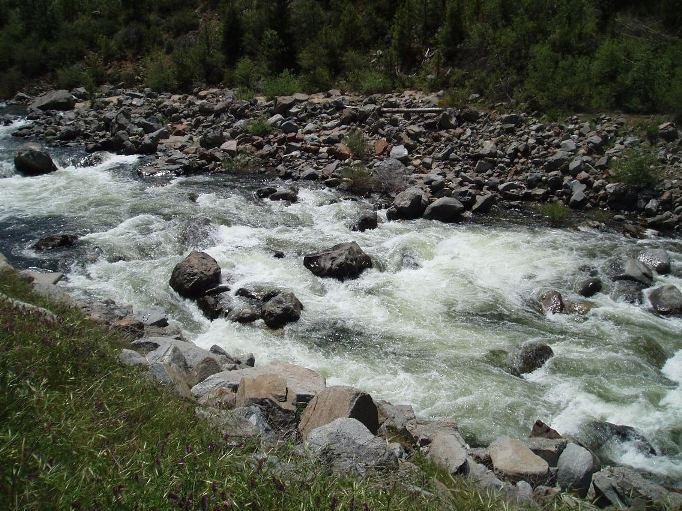
- Bridges Hole (III). OK, so it is easy to avoid... class II in the left channel, or softer if you hit the right edge. But the meat is meaty. At high flows it is wise to avoid. It is just below the first highway bridge on the far right.
- Alder Creek offers an optional put-in to take the bite out. It is just downstream of the two bridges that cross the river. Look for a small road that drops down to a day use area and bridge over the river. Sometimes folks put in here and paddle down through Riverton to Peavine to make the mileage.
- Ledges (IV to V-). This rapid looks a whole lot worse than it is. The first part can be run on the left. Then boof the slab rock in the middle, boof the hole on the left, and then exit on the left. There is a boof at the bottom on the left if you want it that is great fun.
- Sneaky Hole (III). The next rapid leads to a slid hole that packs a huge punch as flow comes up. It is very wise to go around this one. Far left works fine.
Optional take-out is just below on the right at the turnouts. We use this to lap the upper section.
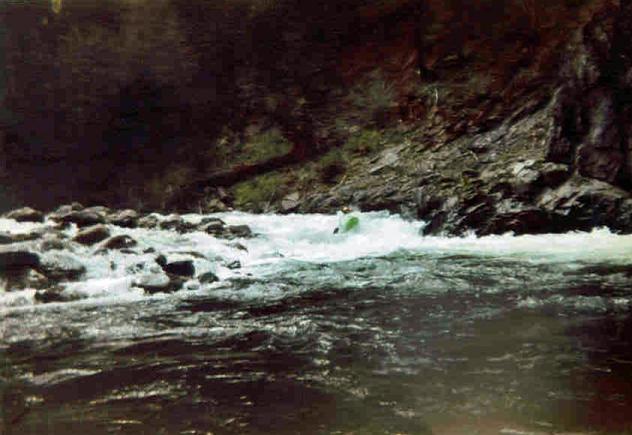
- White House (IV-). The last fun rapid of the run occurs on a left hand bend before a 90 degree right hand turn into bedrock pinch. You can see it briefly from the road driving downriver. The idea is to just go down the middle!
Boogie continuous for the next 2.5 miles. There are a few fun rapid and a few hole to avoid, but nothing super distinct.
Take out: Highway 50, about 9 miles after Pollock Pines there is a highway 50 bridge with parking and river access on the left before the bridge. Riverton is the place. If you pass Ice House Rd you went 100 yards too far.
Put in: For the lower easier put-in, drive 12.9 miles up Highway 50 to the dirt road leading down to the river, just before two highway bridges over the river. Or, continue up the river another 2.4 miles to a turnout and river access area. The turnout is at the beginning of the second passing lane. The turnout has a trail leading down to the river, immediately below the Falls.
HTML Comment Box is loading comments...