
Meadow River (Lower)
| Stretch: | US-19 to Mt. Lookout Rd (or further to the Gauley and Mason Branch Rd) | |
| Difficulty: | Class IV+ to V | |
| Distance: | 3.5 miles (or +1 on Meadow and +2.75 on the Gauley) | |
| Flows: | 450 to 1,500 cfs. The gauge is upstream, so you add ~20-25% for accrual. Visit the American Whitewater flow page | |
| Gradient: | 108 fpm average | |
| Put-in: | Under the US-19 Bridge | |
| Take-out: | Trail up to Mt. Lookout Rd | |
| Shuttle: | 3.5 miles (10 minutes one way) | |
| Season: | Winter and Spring from rain plus occasional thunderstorms in Summer and Fall | |
| Written: | © 2015 | |
| Featured in A Wet State #99 and in A Wet State's contribution to World Kayak's Video Guide | ||
North East Roadtrip 2015 - Day 9
A first heard of this run while we were on a road trip with Darin, Shannamar, and Andrew back in 2011. The first day of our trip we were told it was running, we were tempted to run it, but as we didn't know the lines and only arrived at 5 am after a long stress filled day of traveling standby, we opted just to do the Upper Gauley that day. By the following day it had dropped too low. But, it was put on my radar, especially as we moved to Knoxville, this classic became only 4.5 hours away and resultantly was put high on my list. And as the end of this current roadtrip approached, Fayetteville was a great location to boat our last day, a doable drive the night before and a very reasonable distance from home to finish driving the next morning.
A friend put us in contact with John Moore who was looking to boat Sunday, when he asked if early was ok, I was psyched. On this roadtrip, we were typically getting 9 am starts. On this particular day I was hoping for a similar start to ensure that we were back home and able to unpack and start drying gear prior to it being late in the evening. I was a bit surprised when he suggested a full on dawn patrol of 7:30 am. Seemed like a great idea to me... until 11 pm rolled around and we were still not in Summersville. Surprisingly we both woke feeling rested and motivated so off we went to the river!
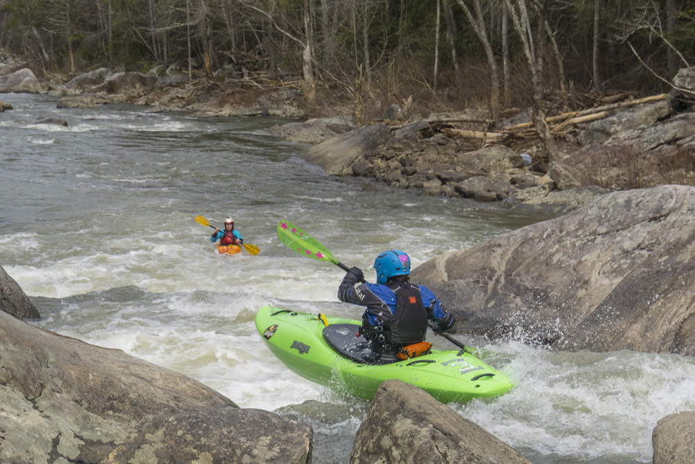
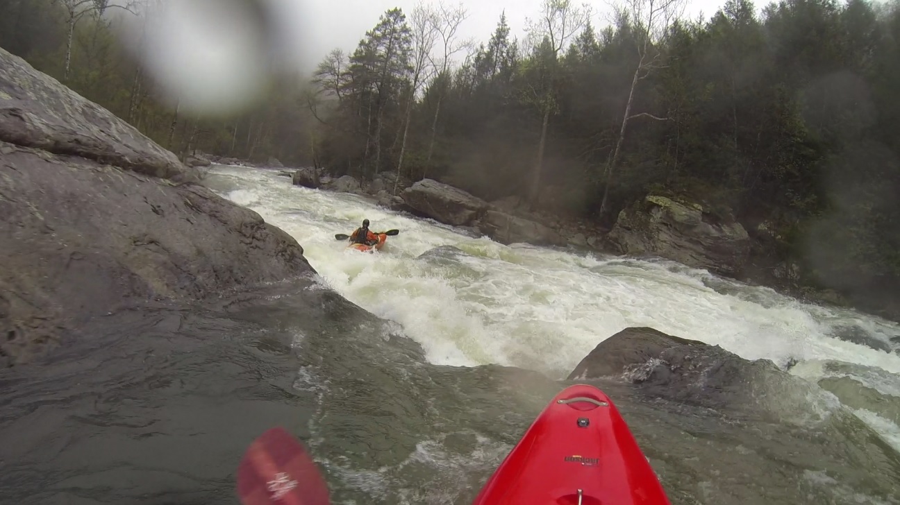
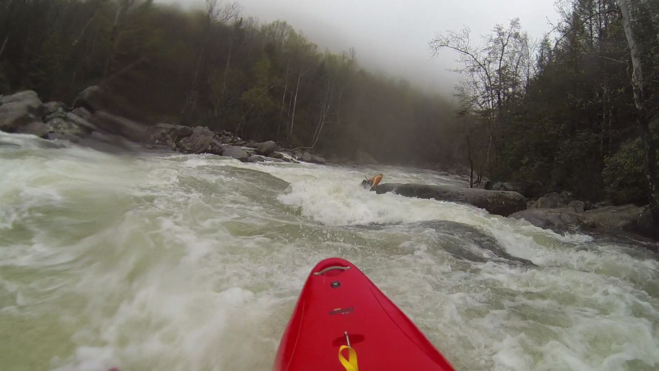
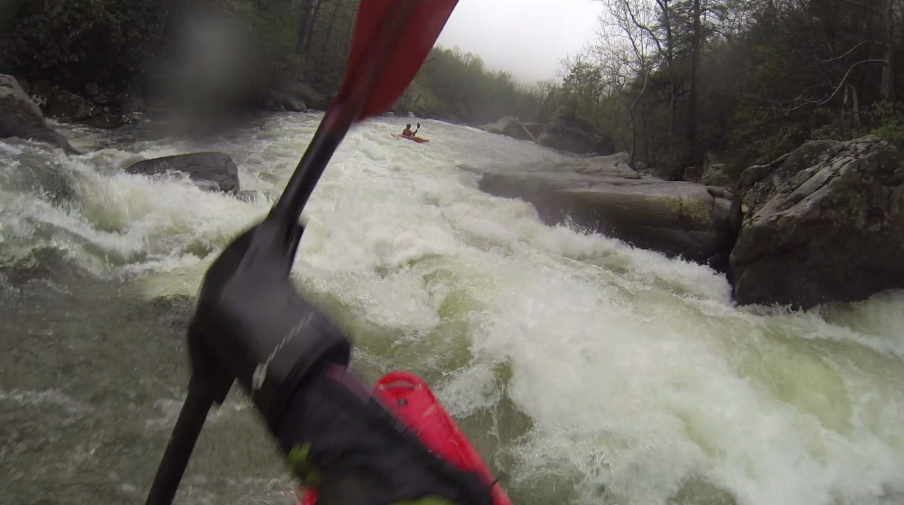
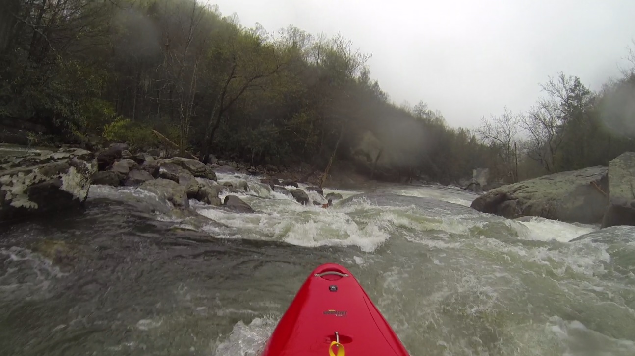
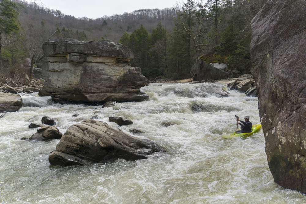
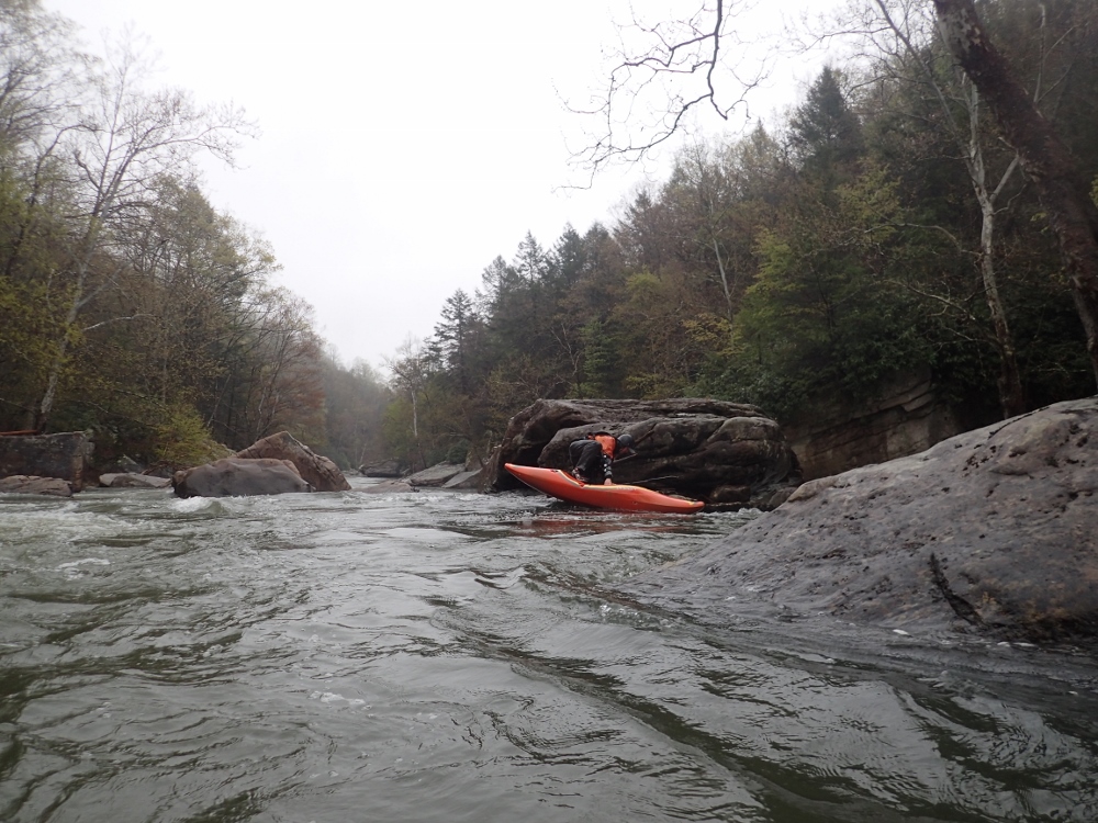
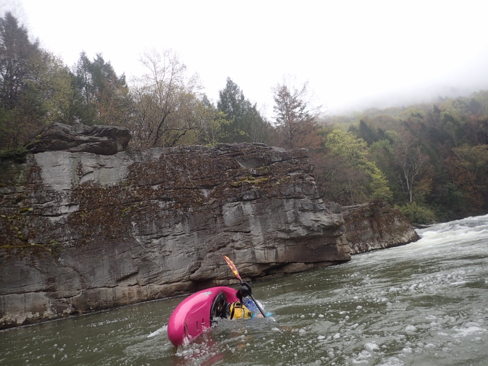
It was really great having someone who knew the lines for this river. Diane and I figured out most of the rivers on the road trip ourselves, but this one would have taken considerably longer. The rapids were long and dangerous, scouting them would take extended periods of times. It is not a creek with the move being clear once you gain a few feet of elevation. This is a full on river, and you would have to walk 100 yards or more to see the whole rapid, all over large boulders and tangled forest. But, following John we were able to boat scout our way to Brink which we quickly hoped out for. At this flow, this rapid was exceedingly straight forward. The only hazard is what lies downstream. John fired up Coming Home while we performed a long scout on the right, I was anticipating it to be a mandatory portage (sometimes guide sources exaggerate, go figure) so I had it in my mind to portage so I did, Diane ran the rapid and followed John's clean line through the sieves and pin spots. Downstream we eddy hoped through each of the big rapids down the Double Undercut which took us out of our boat on a very precarious middle boulder island. After quickly scouting (Diane got nervous for this one... but not Coming Home?!? WTF?!?), we all ran it and quickly made our way down to take-out. After hiking out and running shuttle... we were back on the road by 11 am. Not bad at all! Got us home by 3:30... even earlier than I thought possible!
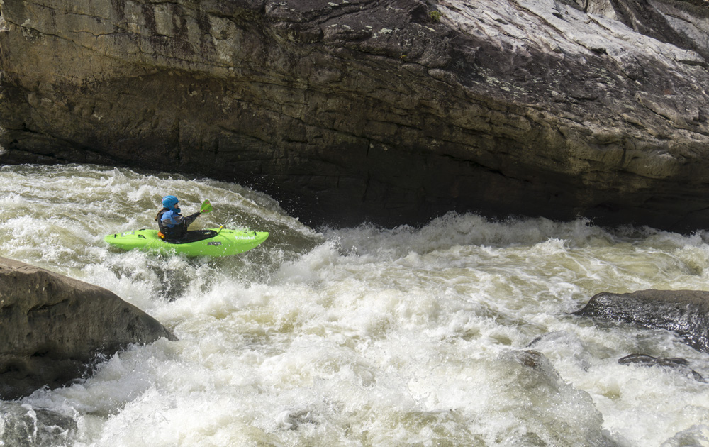
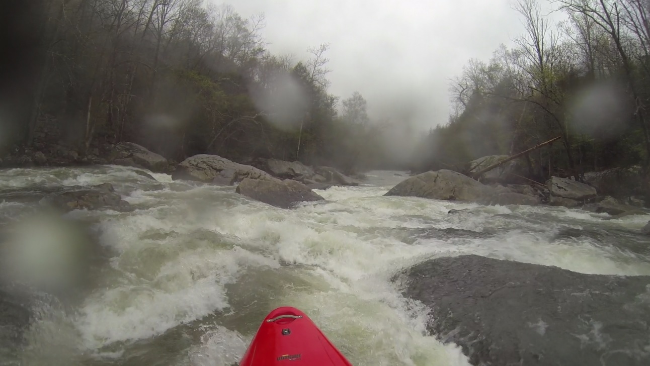
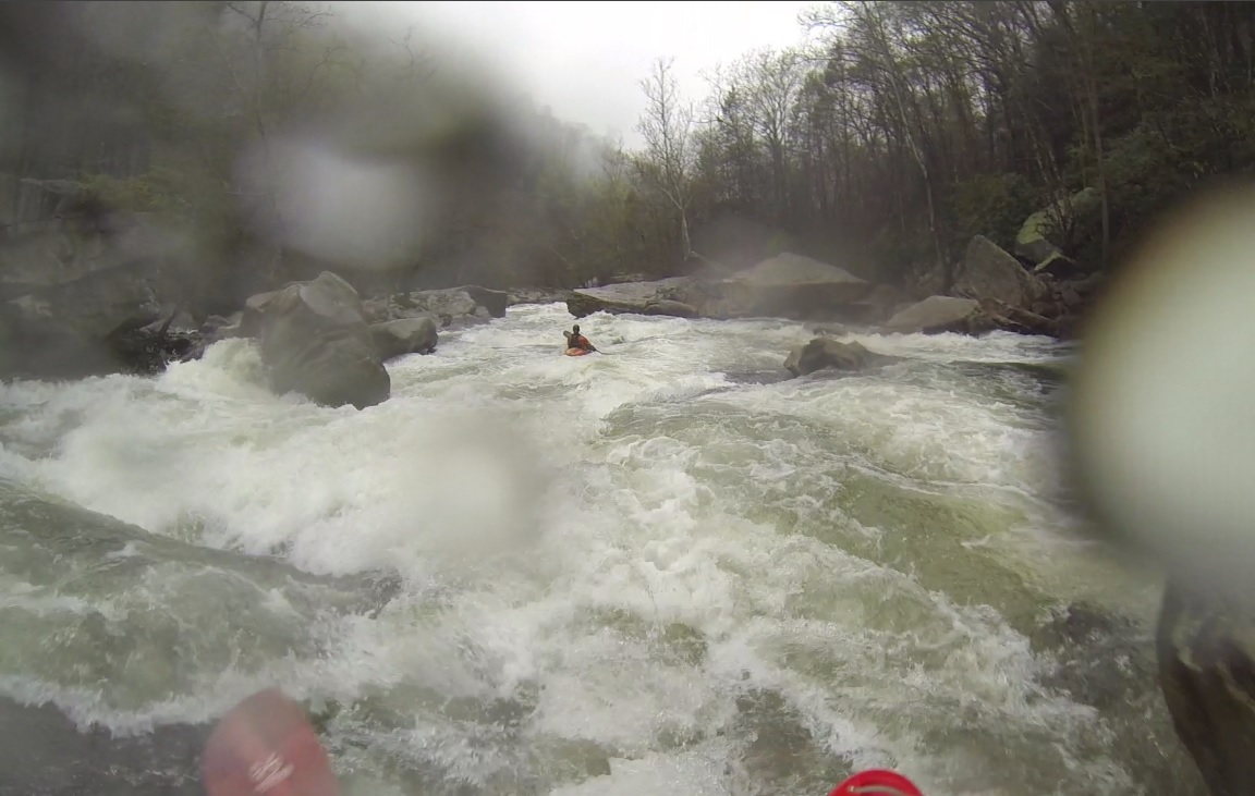
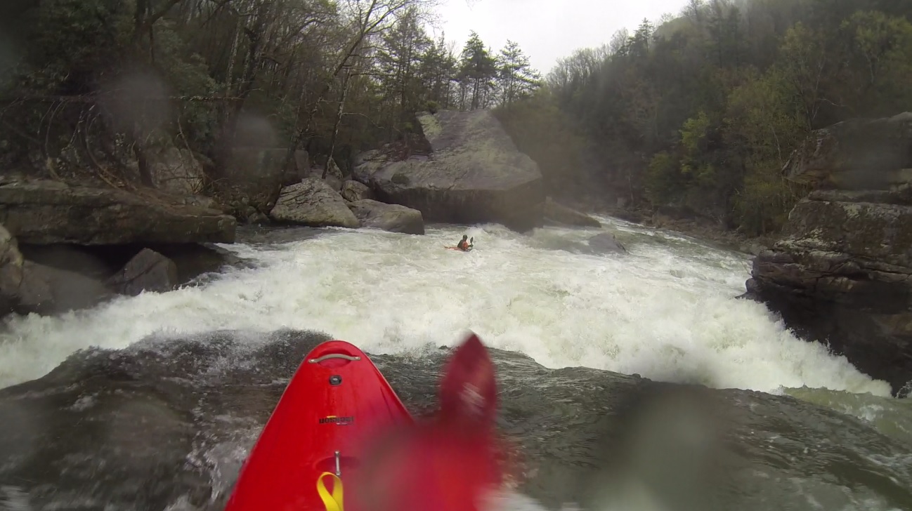
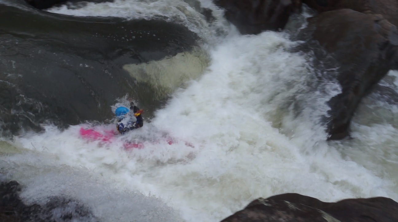
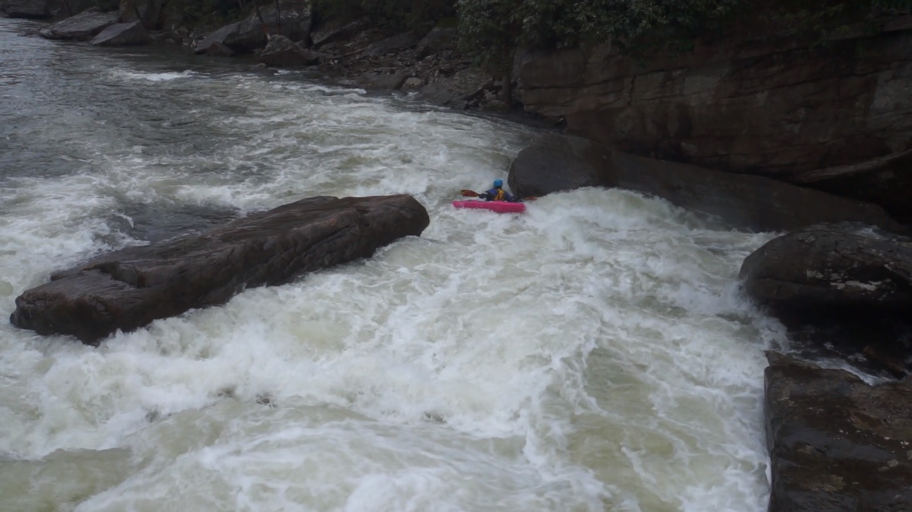
We had ~800 or so on the gauge, it was in the process of going up due to the rain from all evening. This gauge though is well upstream and usually you add 200-250 cfs to get a general estimate of what the flow will be. So we had ~1,000 to 1,100 cfs. Lots of people consider 1,200 cfs their limit, some up to 1,500... though others still are more conservative and call 800. From California, this river at 1,050 (we will call it that), felt like a perfect flow. The sieves were filled in (for the most part), the rapids were full of water and slightly pushy, some holes were big, but the boofs over them were straight forward. I would compare this to Cherry Creek on the Tuolumne at a similar flow I think, though perhaps this is a quarter to a half step easier. Though at the same time, WAY more dangerous! This river has claimed 3 lives that I know of, and I am sure the count won't stop there. Several sections of rapids are linked up, a swim in one rapid could easily spell disaster if your group allows you to swim into the next rapid. So, stay cautious and be ready to rescue!
The final tally for the trip. 9.5 days, 14 rivers in 6 different states, driving through 13 states over the ~3,500 miles we drove which took ~56 hours. We certainly did pack it all in!
Last: North East Roadtrip: Day 8 (Housatonic)
Update 2016: I haven't run it since last year's road trip, but I have seen video of the run after the June 2016 floods ripped through the area. Several rapids have changed significantly. Hells Gate had a big boof and big sieve in it, Sweet Jesus had multiple lines, Double Pothole looked steeper and meaner, and countless inbetween moves looked different. So, approach with caution...
Update 2021: I got laps in 2018 and 2021 since the flood now. I have updated the write-up accordinly.
- Rite of Passage (IV to IV+). The first rapid comes quick. Work from center to the right to avoid a hole that feeds and is partially buried in the left undercut. The exit is fun boofing boogie. Update 2021: The Undercut is hungrier than it used to be. There is a new right slot in the right sneak that takes the teeth away at flows below 800.

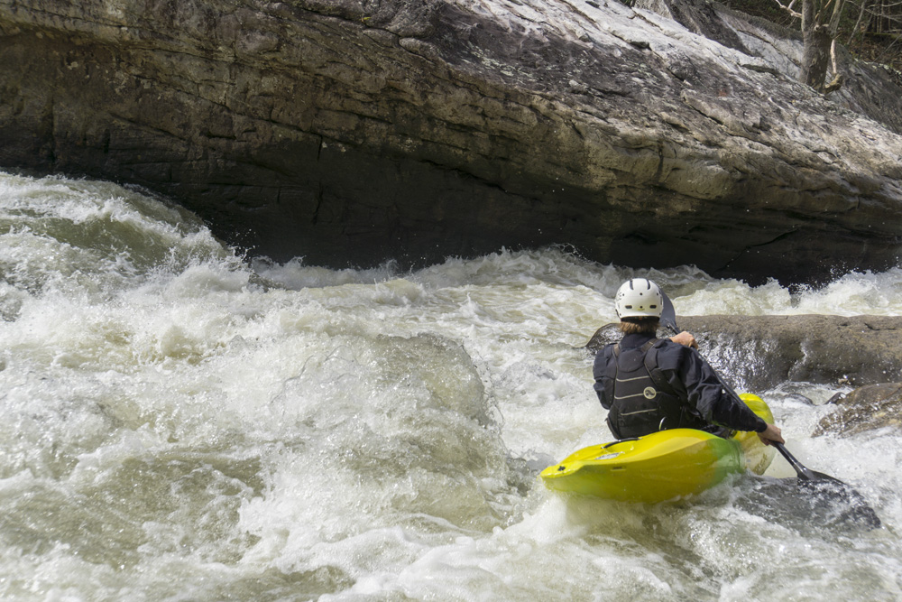
- Hell's Gate (IV+ to V). We entered down a boogie channel on the far right. When the channel moved 90 degrees left before dropping back 90 degrees right into the main drop, we eddied out left to boat scout. The line was to head down the left of the main channel and boof the first hole far left. This then moves you further left around the bottom hole, and also away from the undercuts on the right shore. Update 2021: The line is now a boof on the left of the main channel. The danger of the sieves is much reduced. At flows below 600 you need to start running a smaller left channel staying hard left against the shore.
- Brink of Disaster (IV+). So at 1,000 cfs this rapid wasn't hard. But it was not far above Coming Home. But there was no hole to cause you issues so as long as you can roll it was ok. The cleanest line was right of center, down the left side of the ridge of rock. I know at lower flows people boof the right side of the ridge, essentially dropping through the crack.
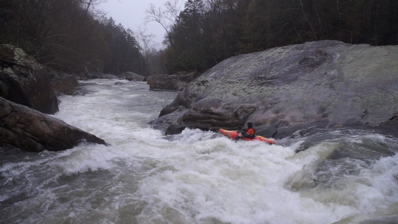
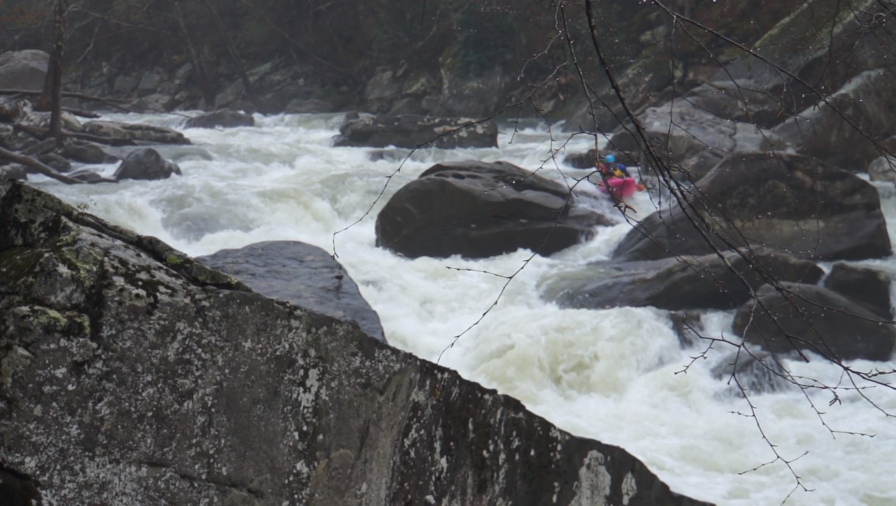
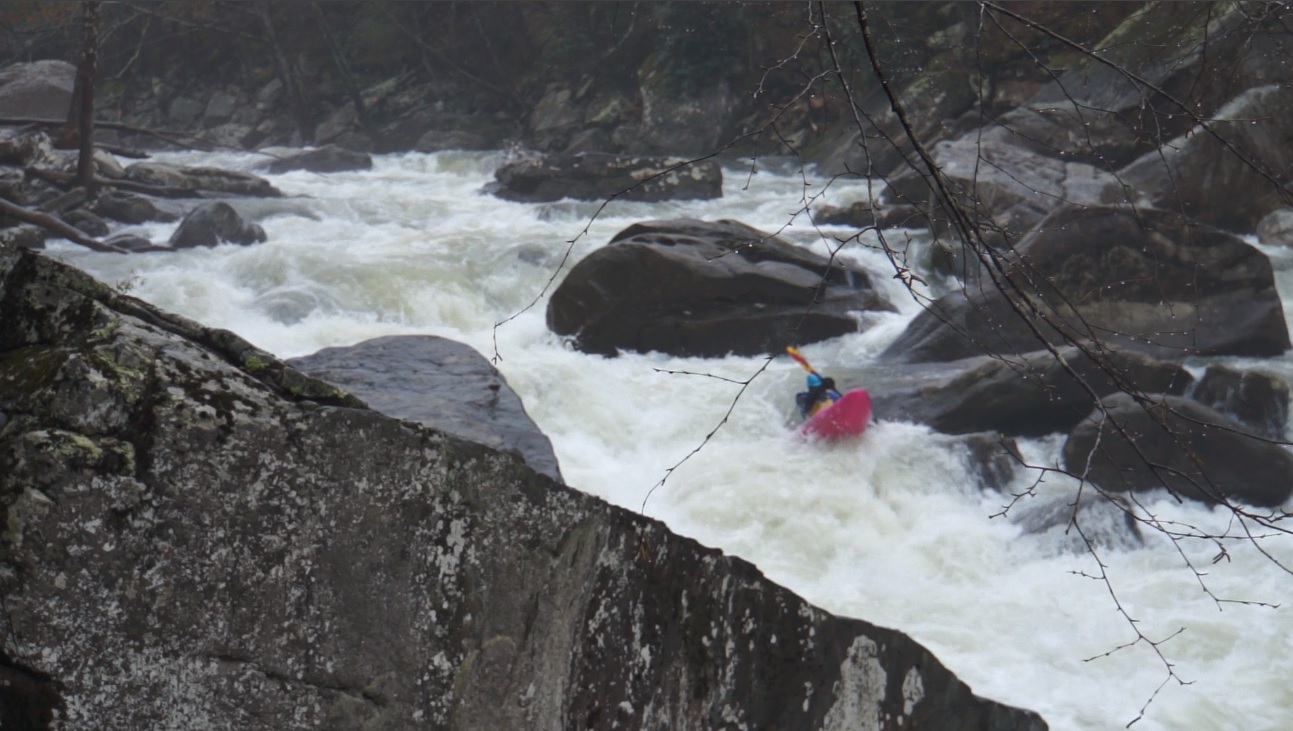
- Coming Home Sweet Jesus (V to V+). This dangerous rapid should be scouted, though the scout hides the danger... but you can see the line. Enter left and boof a small chute just left of the main channel. This lands in a small chute moving 90 degrees back right into the main current. Stay left throughout the runout. The scout and portage are via a old road grade on the right. Update 2021: It was clean for a year, but in 2018 it got bad again and now has the same moves as pre-flood.
- Sieve City (V- to V). Immediately below Coming Home is this fun rapid. We entered in the right of center channel which goes down a slide. Below we worked back left into the main channel and boofed the over a nice ledge hole.
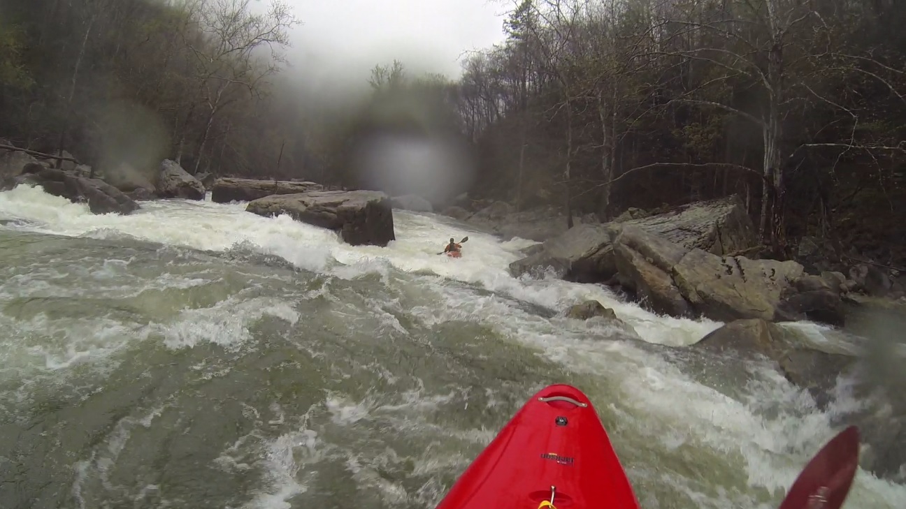
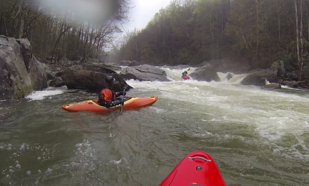
Boogie (IV to IV+). Just downstream is a really great boogie rapid with several nice boofs down the middle. The bottom drop is probably close to a 6 feet tall. This then goes into another boogie rapid with a clean line on the left right in front of an undercut looking rock.
- Heavy Water (IV to IV+). This rapid appears significant and is a little intimidating. Large boulders constrict the rapid and make it ling from the very top. As you boogie in the river narrows into a hallway that has a pillowing rock at the end, go left of it or cut immediately behind it. Just downstream is a really sweet boof off the left shore.
- Let's Make a Deal (IV+ to V). We eddy hoped out way down, so we entered right and then eddied out far right just before it got steep. We then ferried out below the top-middle chute, from there we were back in the main current and had the choice of middle through a pillow and over a ledge hole or right which was a mellow ramp. There was also a chute on the left that would go, but also has a bad rock in the middle of the tight and tall drop. If you get pushed that way, keep it straight! Update 2021: Now the exit is to boof the center slot which is a nice clean ledge.
Boogie (IV to IV+). The boogie just below had a pretty stout hole. We boofed it on the far right.
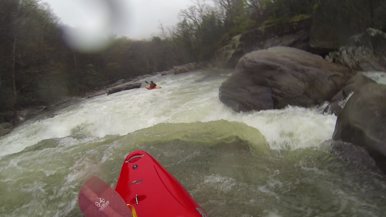
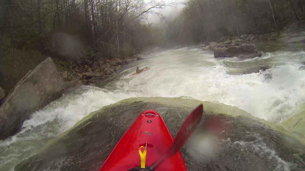
Island #1 (IV to IV+). Another big and blind rapid comes into view. We entered via a small chute on the left side of the main channel, next to a house sized rock. We moved back in this chute into the main channel boofing the left side over a hole. The exit of this rapid is another good size hole that ran far right.
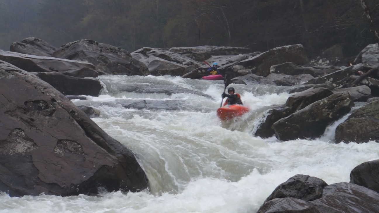
- Second Island Part 1 (III to IV). Straight forward down the middle of a wave train with a few small holes to boof, this rapid leads to an exit drop that is steep but has a clean line down the middle. This then is immediately above the next rapid which has some very dangerous places. If something happens, swim far left!
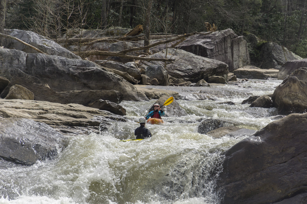
Second Island (III to IV). Really large boulders on the right shore make this one obvious. We essentially snuck it down the far left, along the shore over a simple boof. The middle has a line through a big hole that flirts with disaster, and the right has claimed a life.
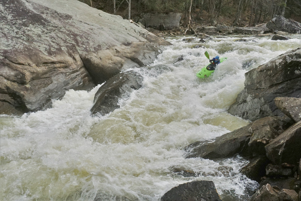
- Sliding Board (IV+ to V-). Not far downstream is this tall drop that is blind from above. You will see the river heading straight downriver over a horizon and into a house size boulder which is undercut. The line is just to the right of the tallest point in the hump, the back side is a slide down through a small hole. Then immediately work right away from the housesized rock. Some fun boogie comprises the runout.
- Boogie (IV to IV+). Next was a fun long boogie rapid that we ran down the right before rejoining the main current. A small moving pool then led to two holes, we boofed the first one off a clam shell on the right and avoided the second one further right. These are known for swimming people. And are just above Double Undercut.
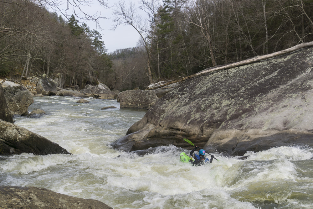
- Double Undercut (V). Down the middle, through the seam... then straighten it up to get through the middle hole before driving left into the exit slot. Some people are pushed right into the eddy. The rock is a little undercut which sometimes when people are just barely making the slot, they get sucked down and flushed into the pool below. The best scout on this one is from the middle rocks... the first person needs to be fast as there really isn't any eddy to use to get out on! Update 2021: The flood made the center boof worse but opened up a smearing boof on the far left. Below 600 you have to run center still but the teeth are gone.
- Stayed Left (IV to IV+). We went down a small micro channel on the far left, essentially on the left of an island of large rocks. It was a boof and small slot exit. I don't remember why we stayed left and didn't run down the main channel.
For more details on the run, see the AW write-up...
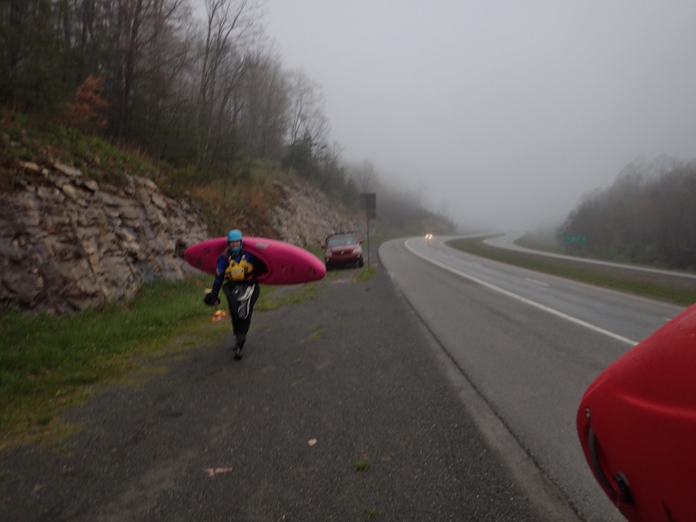
Take-out: From Summersville, WV, head South on US-19. You will pass WV-129 (which goes to the Upper Gauley put-in), look for the first right which comes after 3.6 miles and turn onto Mt Lookout Rd. We stayed left at a fork early on to stay on the road for a total of 2.2 miles. At the end of the road there is a muddy turnout on the left, just across from the last house's drive way. This is where the trail comes up. From the river, after Double Undercut you will go through one rapid, around an island, and then one more small rapid before you will see a house size rock with a small rock balanced on top on the right shore, the trail starts just behind that rock. The trail climbs in 3 segments. The first is up a nice enough trail. You will then head left and climb a washout section. This then hits the old road where the gradient levels off and you head right, up to your car. It takes ~30 minutes to do the hike. It is steep.
Takeout Option 2: If you have time to set a longer shuttle, taking out at the take-out of the Upper Gauley is great fun, dropping you into the river just above Lost Paddle. From Fayyetville, head North on US-19 to WV-129 and turn left. Continue for 7 miles, a mile before you get to highway 39, turn left on Panther Mountain Rd (has a sign marked for river access). Follow this down. At one point there is a big fork, stay right (left takes you back out to Highway 129). When you get to the obvious meadow, look for the dirt rd to the left which leads quickly to the private boater parking (in the meadow) or if it is off-season continue straight and just after the hairpoint turn to the left, look for the left turn on a dirt road which will lead you in a mile down to the river level access.
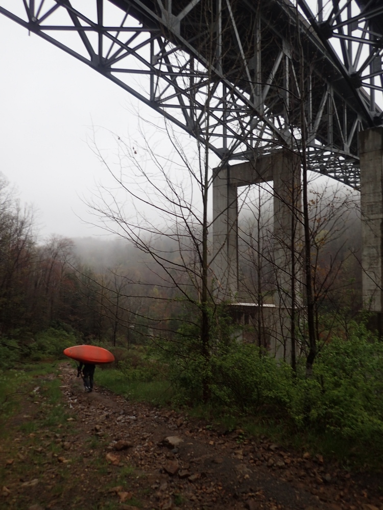
Put-in: From the hiking take-out, head back out to US-19. Turn right and go 1.1 miles. Look for a turn-out on the right just before the bridge. Park just outside the no parking signs. You are on the side of the highway here. But this is put-in. The trail drops under the bridge to the river.
HTML Comment Box is loading comments...