
Middle Fork of the Feather River (Devil's Canyon)
| Stretch: | Nelson Point to Milsap Bar |
| Difficulty: | Class V |
| Distance: | 32.7 miles |
| Flows: | 750-3,000 cfs. Current Dreamflows gauge |
| Gradient: | 69 fpm average |
| Put-in: | Nelson Point |
| Take-out: | Milsap Bar |
| Shuttle: | 85 miles, 3 hours 1 way |
| Season: | Spring and Summer from snowmelt |
| Written: | © 2008 & 2013 |
| Featured in A Wet State #20 | |
Note: In 2013, after 5 years, I finally made it back into the canyon. This time as a much improved boater with much more perspective. We completed the river in two days, taking 6 hours to do the first two days of river from my previous trip. We boat scouted our way down the canyon with only brief scouts at Franklin Falls and a quick portage of the Split Drop which now has wood in it. I found the river to be challenging, but in a fun way this time. So I thought I would share, as in 2008 this river scared me (as you could tell in the write-up). This however was my first hard overnighter, we had boater in our group willing to lead and probe, and I was boating at the limit of my ability at the time thus resulting in write-up that reflected fear. Some folks I know would like a complete re-write of this river to reflect a more accurate and grand picture of the section of river, but personally, I like to look back at these older write-ups and reflect on my growth as a boater and note how my perspective has change. For I am sure, that one day probably not too far off, I will read this and think that I was crazy to have ever enjoyed class IV-V water... but with that said, I am sure it won't be 5 more years until I go back... in fact, maybe I will this weekend...
--------------------------------------------
So where should I start? Should I give the classic quoted line from Stanley/Holbek?
-
"This is it! The Middle Fork of the Feather is the best self-supported wilderness trip in California."
Or how about I quote the Wild and Scenic Act under which the Middle Fork is protected?
-
"It is hereby declared to be the policy of the United States that certain selected rivers of the Nation which, with their immediate environments, possess outstandingly remarkable scenic, recreational, geologic, fish and wildlife, historic, cultural, or other similar values, shall be preserved in free-flowing condition, and that they and their immediate environments shall be protected for the benefit and enjoyment of present and future generations."
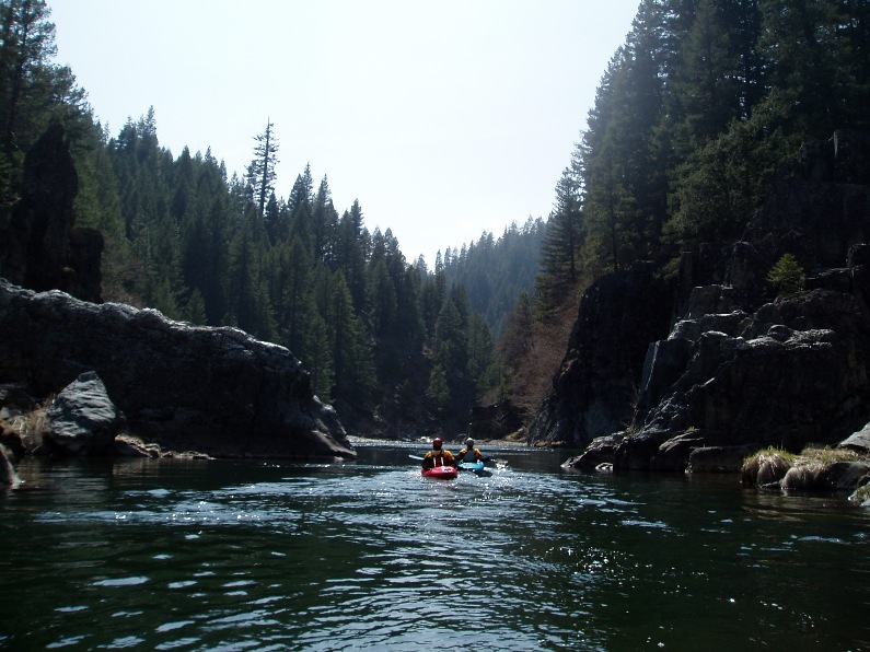
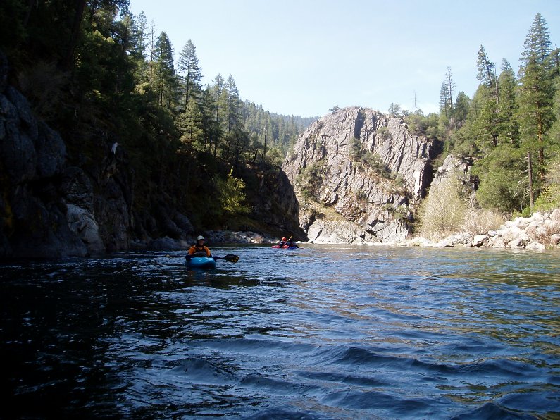
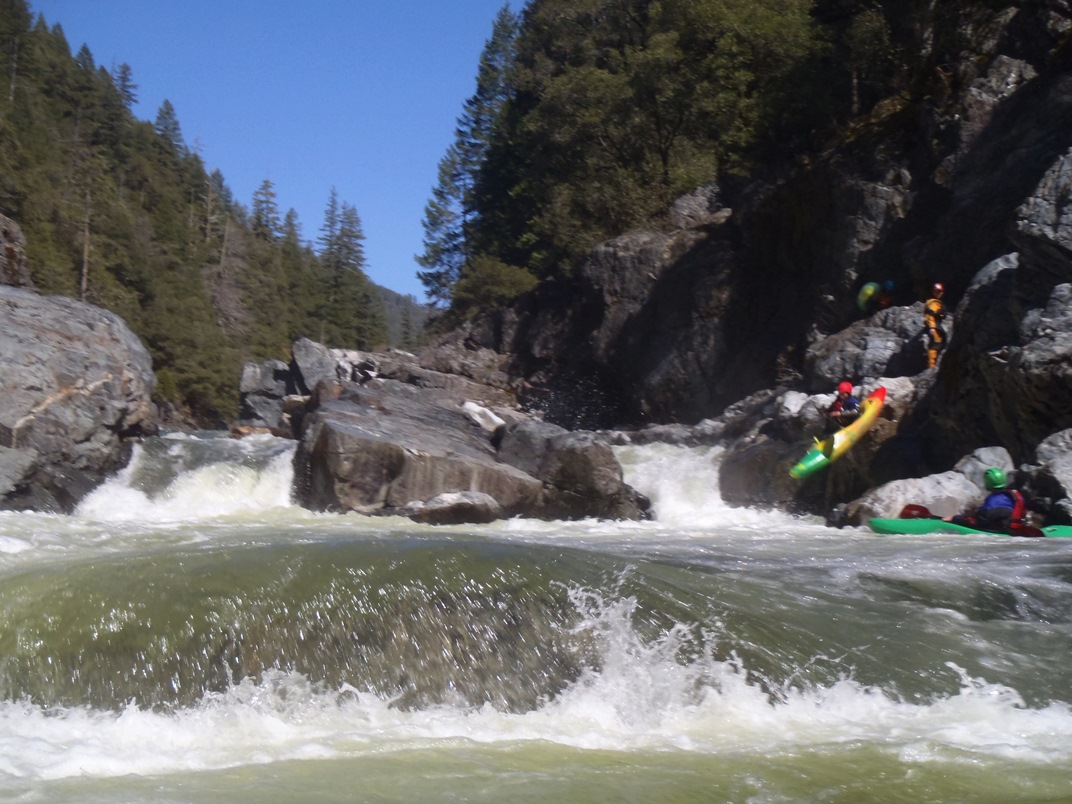
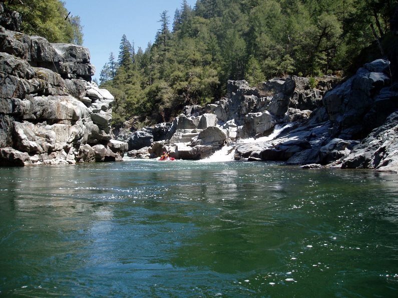
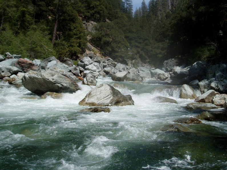
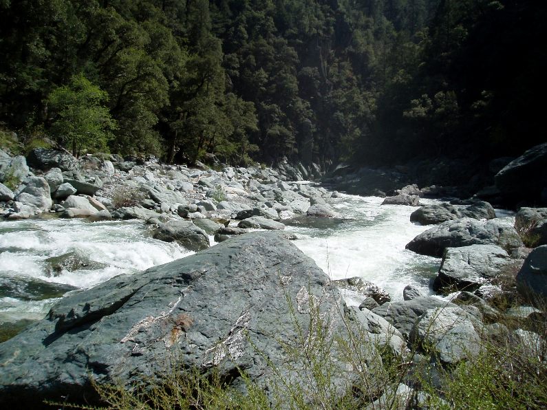
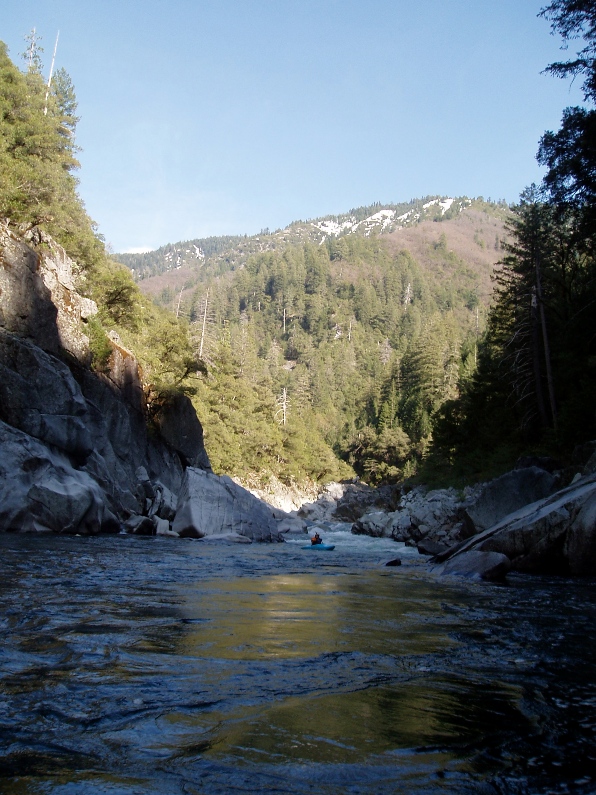
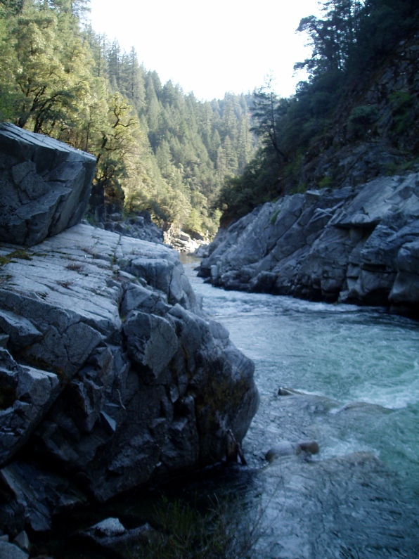
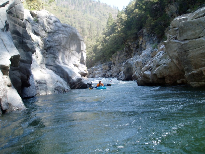
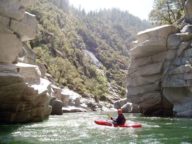
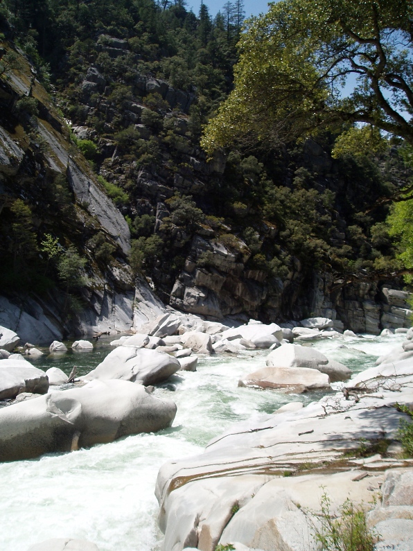
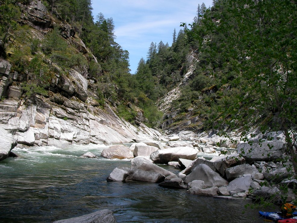
Ok, enough of that. This river was the most beautiful place I have ever been. In all the hikes, rivers, and vistas I have been to I have never felt the beauty the way I did on the Middle Feather. Each of the three gorges had its own feel made up of completely different geology and plant life. Starting at 3,800 feet elevation the first gorge is red rock, followed by Franklin Canyon 1,000 feet lower and formed by a black granite. As each day passes and your mind is blow, the canyon saves the best for last. Within the last five miles of the run are the most spectacular views of towering granite mountains rising 2,000 feet straight up from the river, cliffs of white granite holding the water to its narrow passages.
I honestly hope that I am not so scared that I never return, because it was awe inspiring. With that said, I was scared. Those of you who know me know that I am not the most hard core of boaters... that I scare easily, but still....
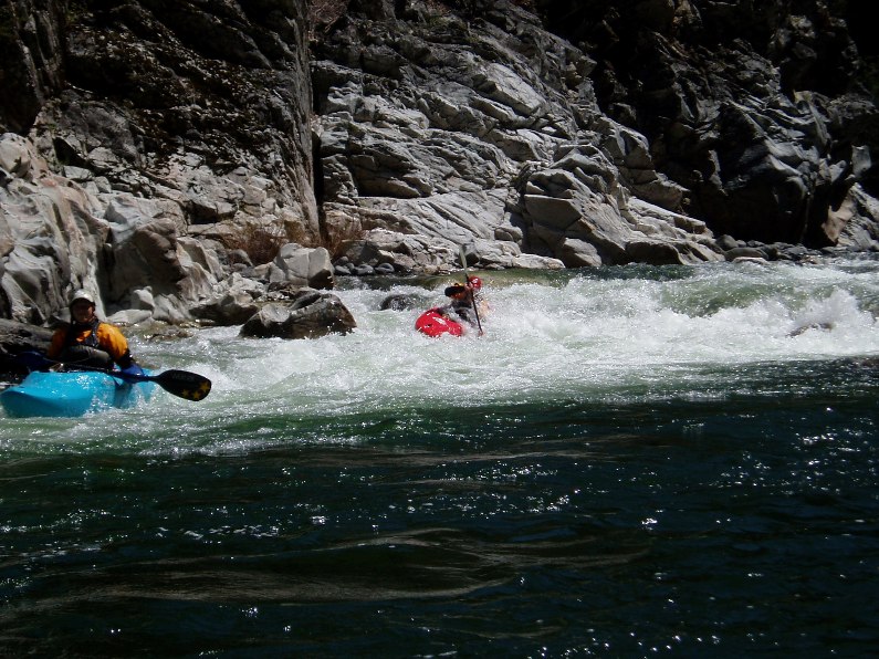
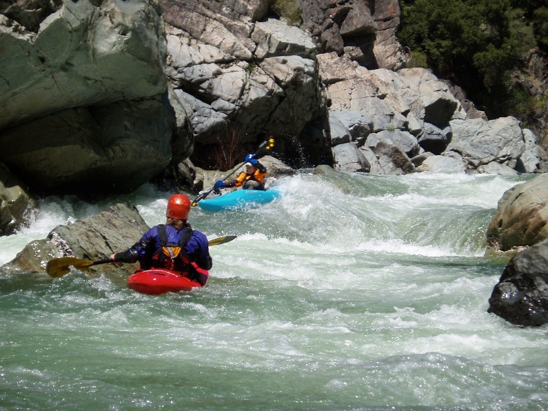
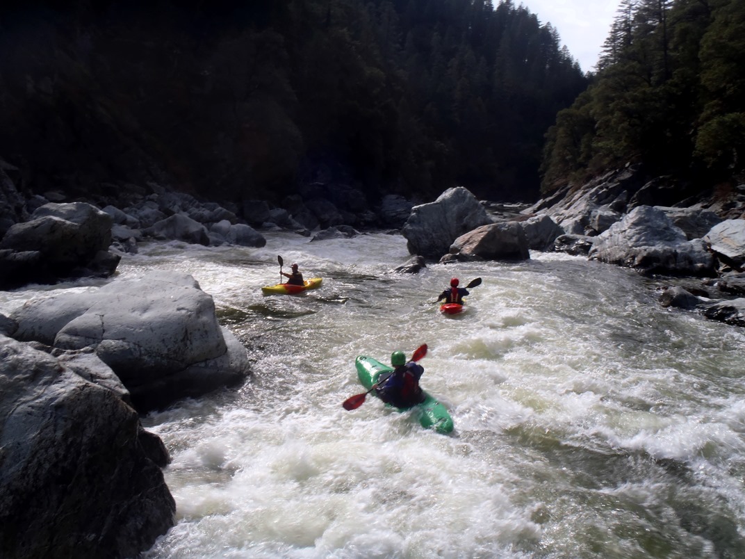
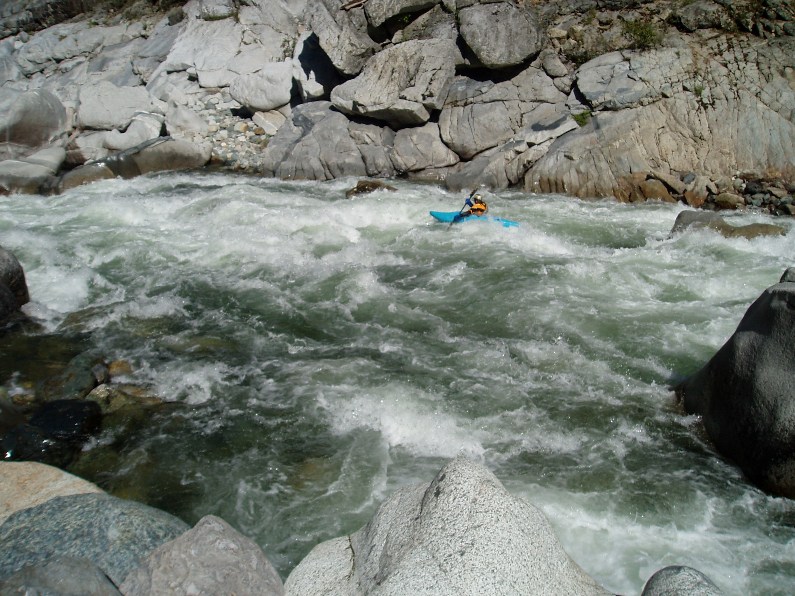
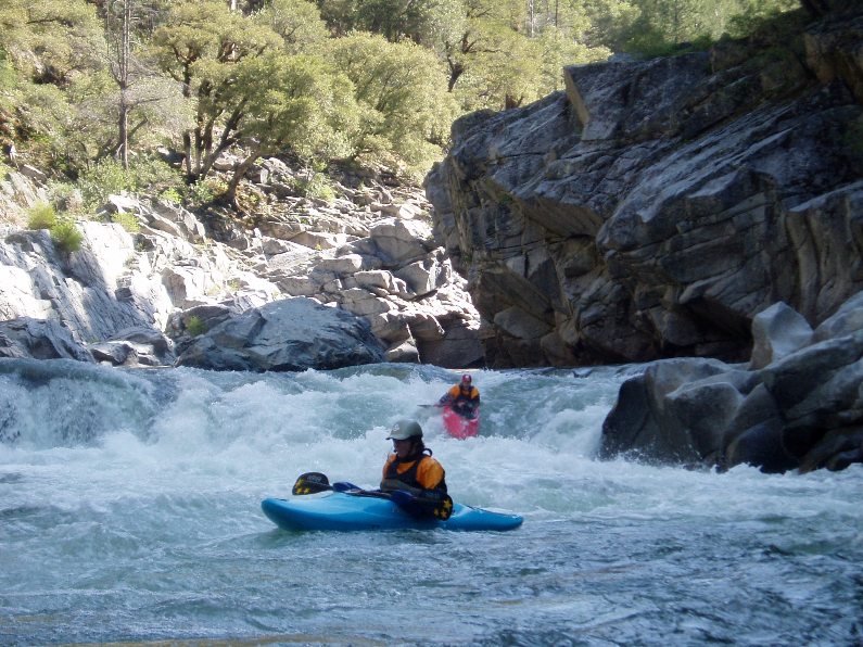
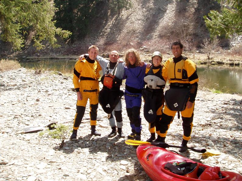
I had been looking forward to this run for a year or two. This spring I bought a new boat (Everest and damn I love it!) in order to boat this run. I read the reviews saying that this run was class V-, easier than Cherry Creek, that it was III-IV with an occasional V to "spice things up." I think most of these things were wrong. I think the run was easily on par with Cherry Creek. Although there were no Lumsdens, there were copious amounts of large rapids, or large lines in the rapids. I would also say that although in between canyons there tended to be class III stretches with an occasional IV, once in the canyons it was much more class IV-V feel. And those canyons lasted for what seemed like eternity, granted it took our group an eternity to paddle each canyon as we didn't have someone with us who knew the lines. This resulted in our group having to scout a lot of drops, even once that turned out to be easy, just because they were so steep that you could not see over the horizon line. The frst day we paddled for 4 hours, followed by two 8 hour days.
To set the record straight, does this river have unportagable drops? Yes. Are several of the "portagable" drops very hard to portage? Yes. If you are alright on Cherry Creek are you going to be alright on this? Yes. Is it worth the trip? Very Yes.
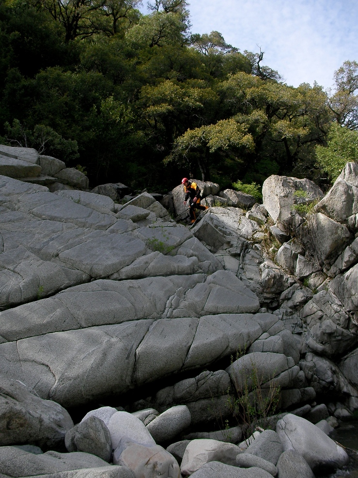
So anyways, there are so many rapids it is impossible to describe them all, I will just describe the ones I took pictures of. I also couldn't find all of them on Google Earth so there are some mileage gaps that I could not fill in. To do this run, don't rely on this guide, you will need either a probe with balls of steel or someone who has done the run before... unless you are so good you will be the probe and then I have to ask myself why you are reading this webpage... maybe for the pretty pictures. Anyways, so here we go.
Oregon Kayaking put up a second write-up in 2009 that has some great photos. And a video here.
For reference we had 900 on the day of putting on, followed by 950, followed by 1,300 cfs in Devils Canyon.
Mi 0-1:
- Several miles of relativly clean III warms you up for the day's work
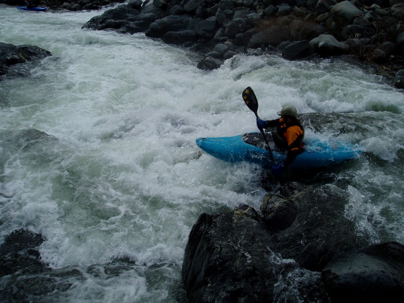
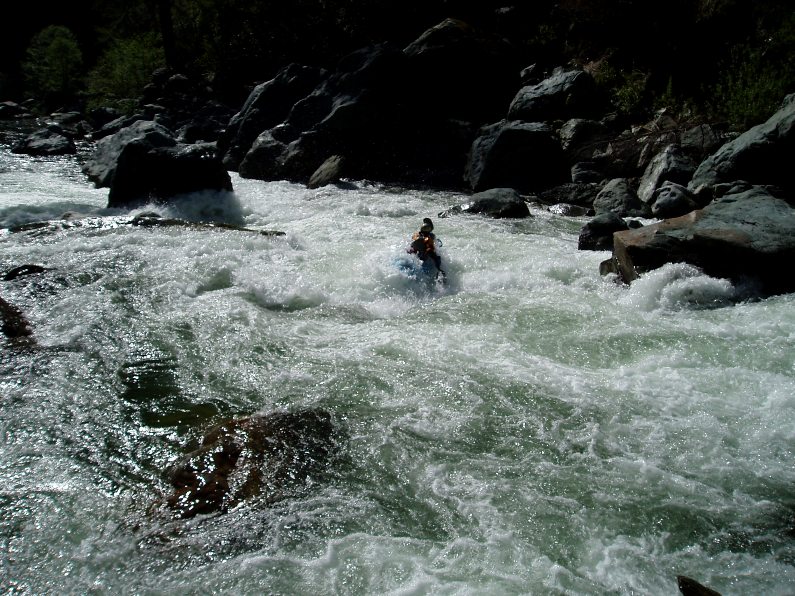
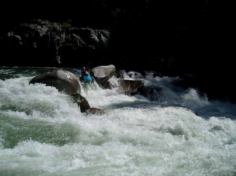
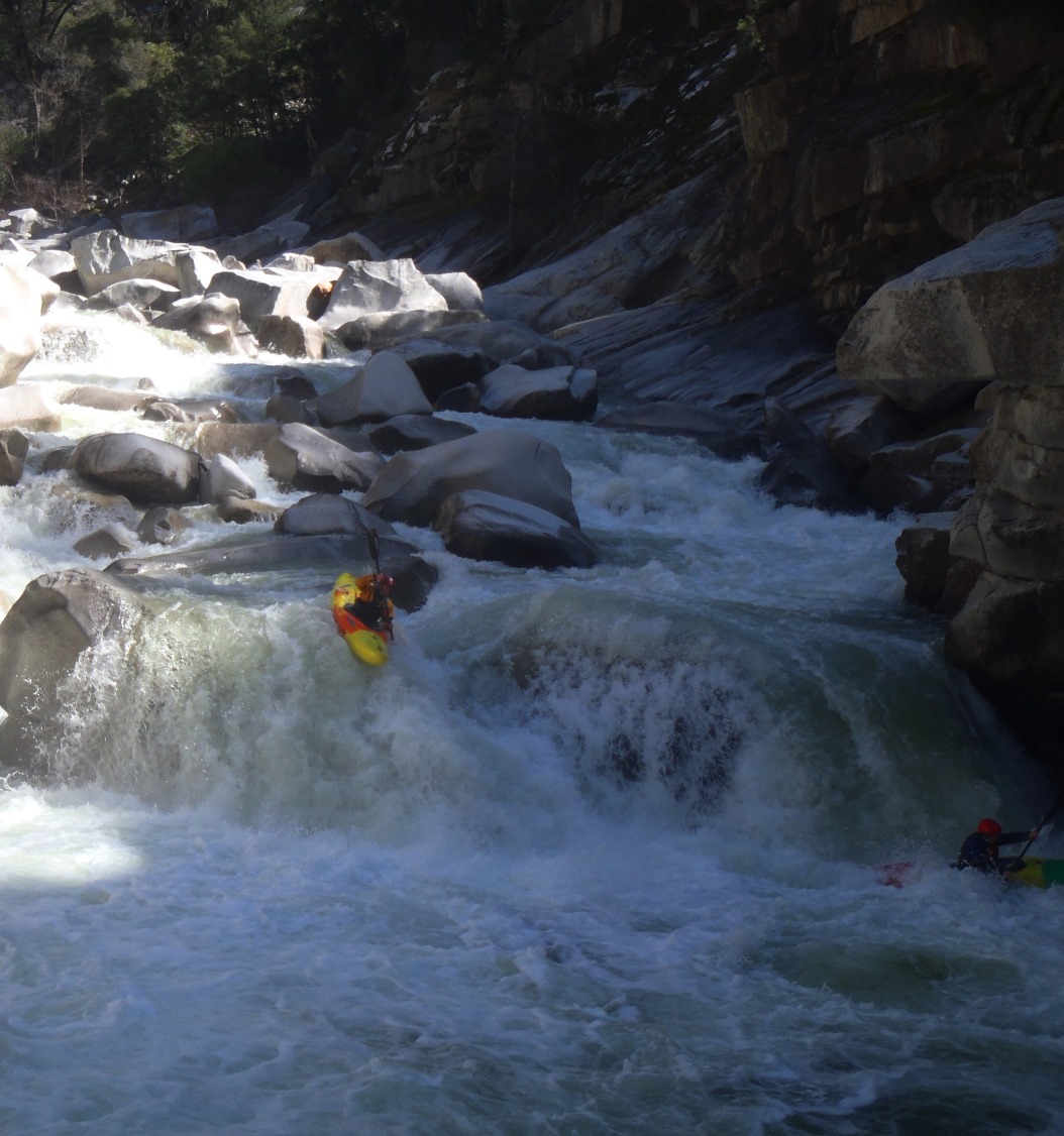
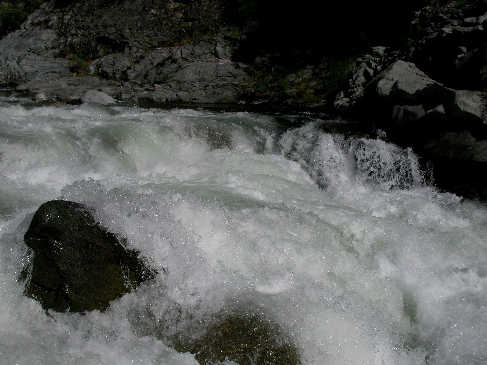
- Sieve (IV+). This rapid isn't all that hard, it is just dangerous, there is a big sieve in play along with a nasty undercut. You drive left in front of the bolder and boof into the large hole below.
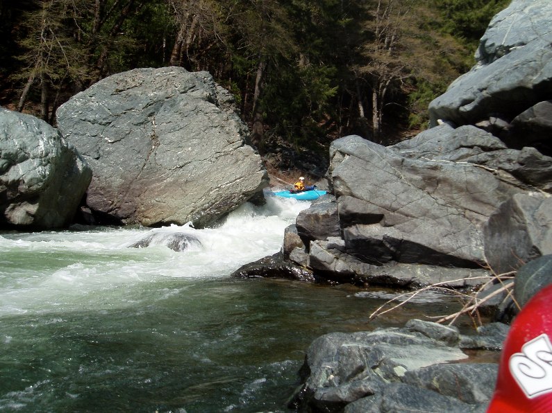
- Big One AKA Chunky Monkey (V-). A easy class IV lead in leads to a rocky tumble down some rocks. At lower flows I know some people run the vertical drop on the left. At our flow we went down the middle, grinding up on the slab of rock on the right, and boof off of it to the left. There is a rock in the landing and a rock behind the slab for the over achievers to land on.
Note: At higher flows, you can huge the far left short and boof around the meaty middle hole.
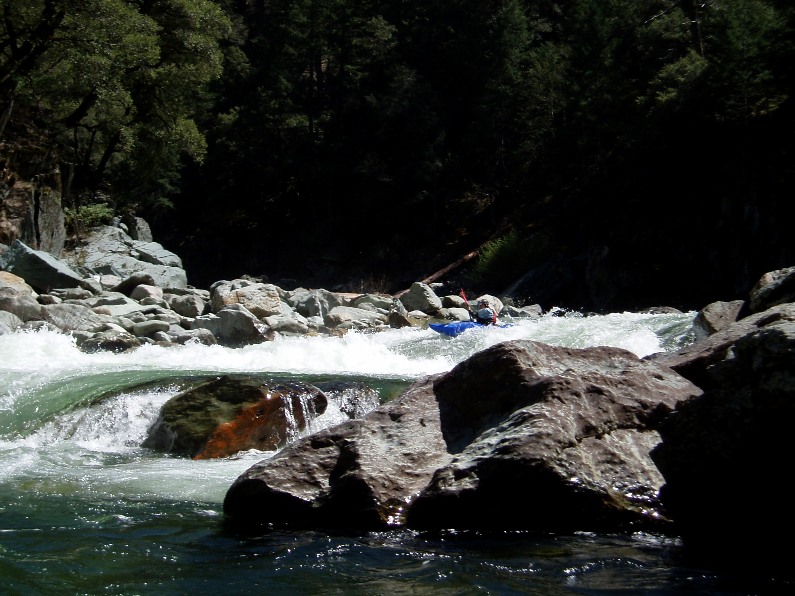
- The rapids begin to get more and more manky, several drops are class IV to IV+ in nature purely because of the boat abuse factor. The rocks are very hard on the boat and seriously impossible to avoid. Despite that, occasionally there is a rapid that sticks out a little more.
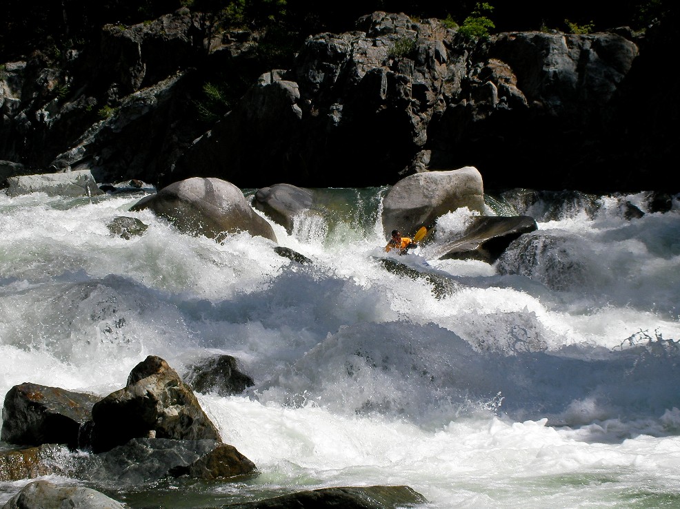
Nose (IV). A sweet 4-5 foot boof off a ledge with a perfect kicker nose of a rock in the middle.
Splat (IV+). Another shear drop, we splatted/boofed the rock in the center then landed and ran down the left side of the river. We though this along with the Big one were the most challenging of the day.
Hard Left (IV). The River piles into some midriver rocks, we went hard left to avoid.
Right Left Hole (IV). Self explanatory name...
- Bad Beta 1 (IV+). Choose between a huge but runnable (at our flow) hole on the right or a manky drop on the left. The left side is doable but beware of rocks lurking all over the place. This rapid is after a river split and at the end of a class III+ boldery lead in on a sharp right turn.
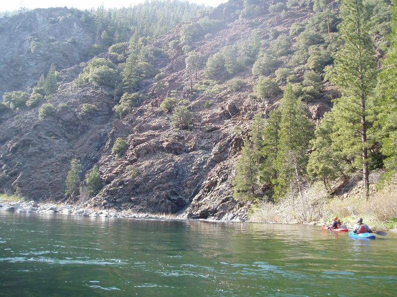
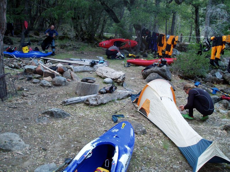
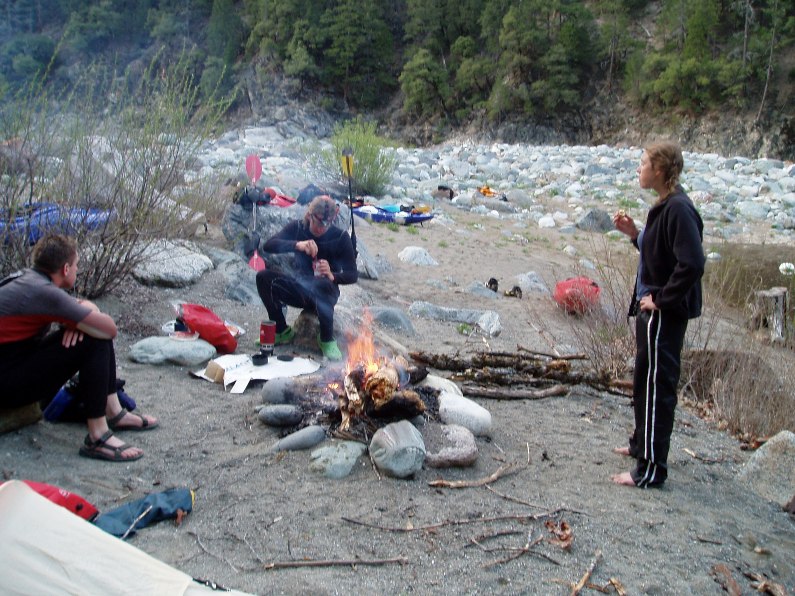
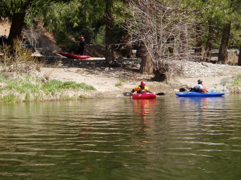
Camp One: We camped just downstream of this rapid on the right. There was a nice platform with a file pit and everything. You could also continue down two more rapids and there is a nice sandy beach camp on the right.
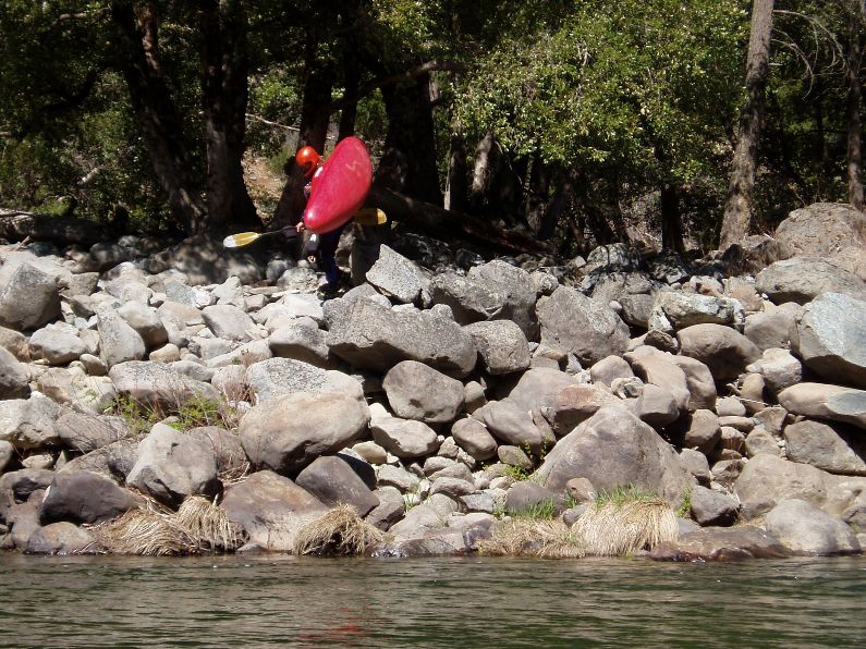
- Two Rapids down is a shallow rapid where all the water goes over a 6 foot tall boulder pile. The correct line is the very small channel on the right shore, trust me, it goes WAY better than any other spot in the river.
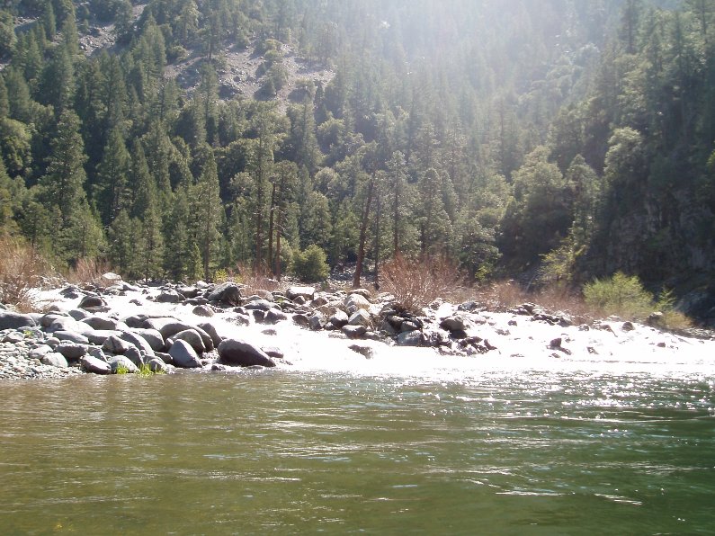
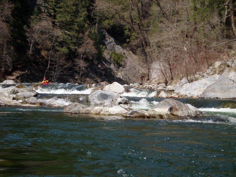
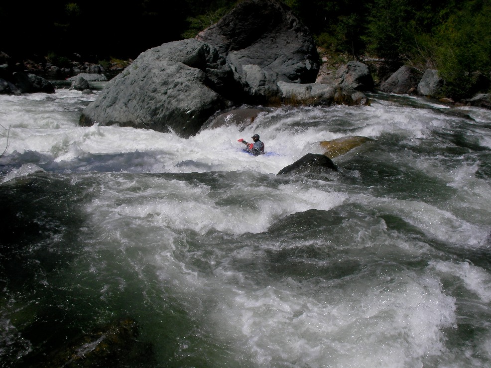
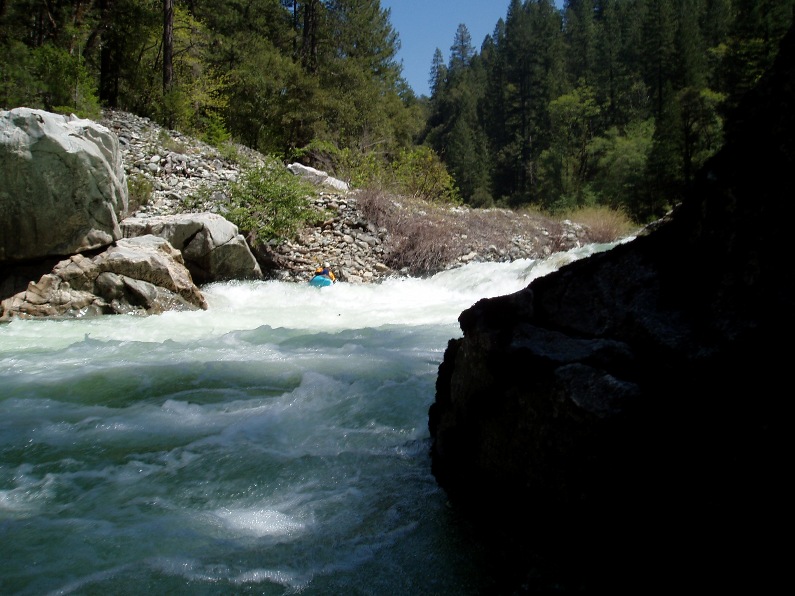
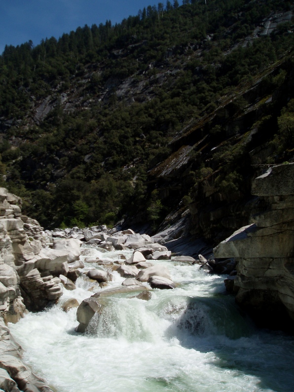
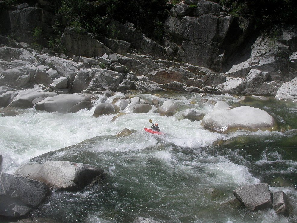
The next 7 miles goes by really fast, a lot of class II-IV- all read and run. The rapids start to clean up finally, and you will soon see the bridge come into view. You will see the river start to drop, the granite cliffs rise faster than you thought possible, and you will get your heart pumping.
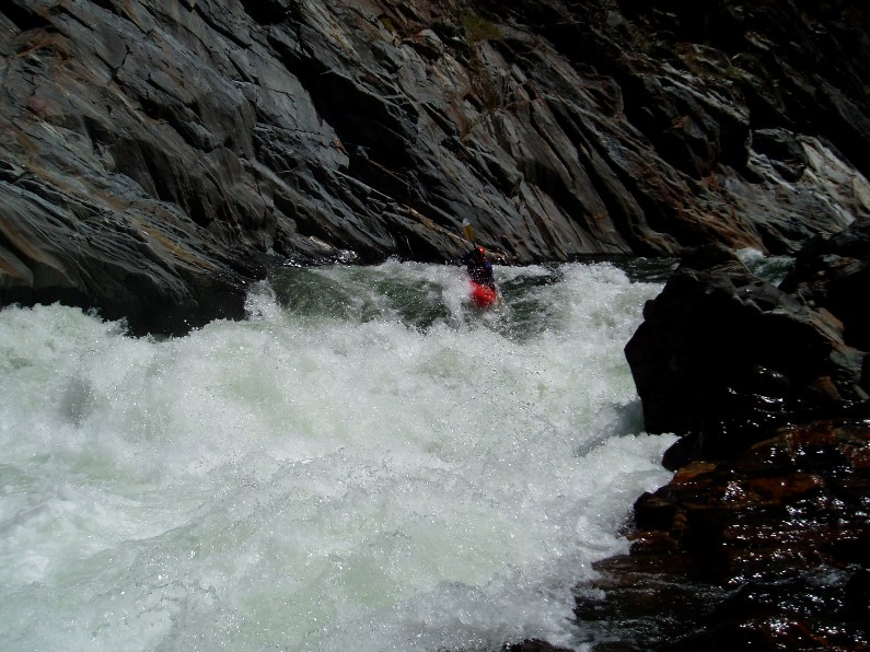
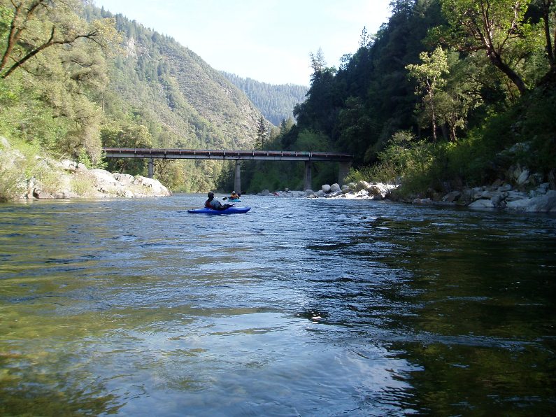
- A foot bridge crosses the river marking the beginning of Franklin Canyon.
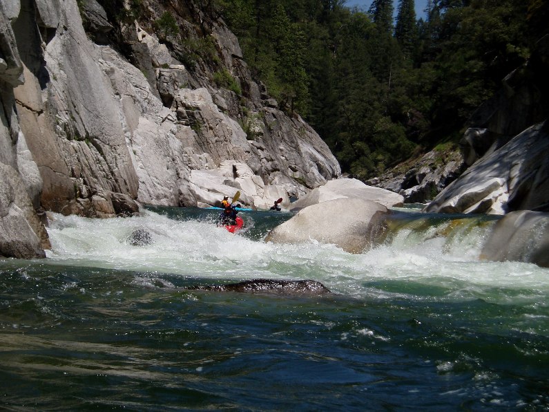
Entry (IV-). There are two rapids at the top of Franklin Canyon, one directly under the bridge and one just down stream, both are easy and a very pleasant change from the bolder bars. It is amazing, one second you are banging rocks, and the next you are in deep channels... wonderful.
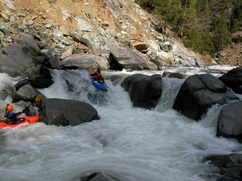
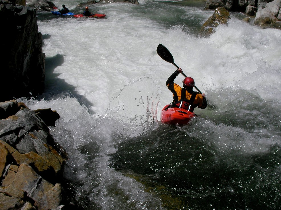
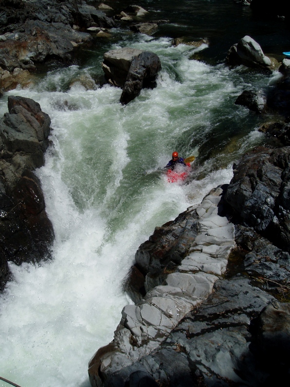
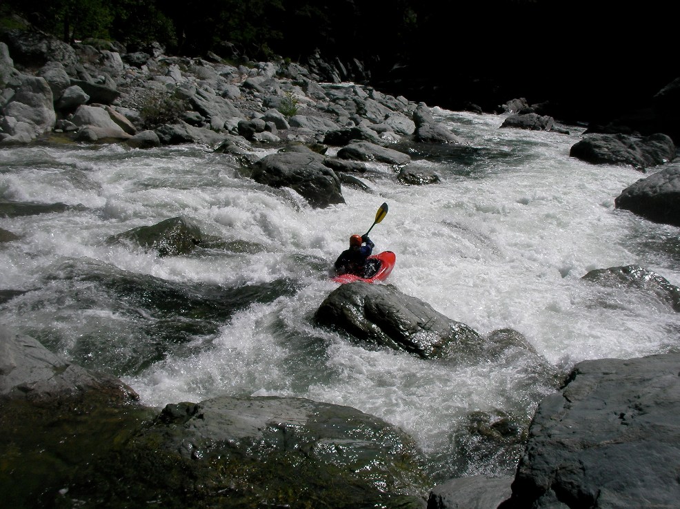
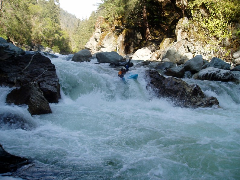
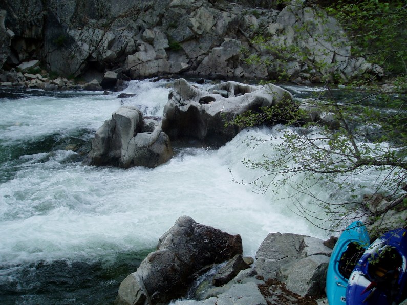
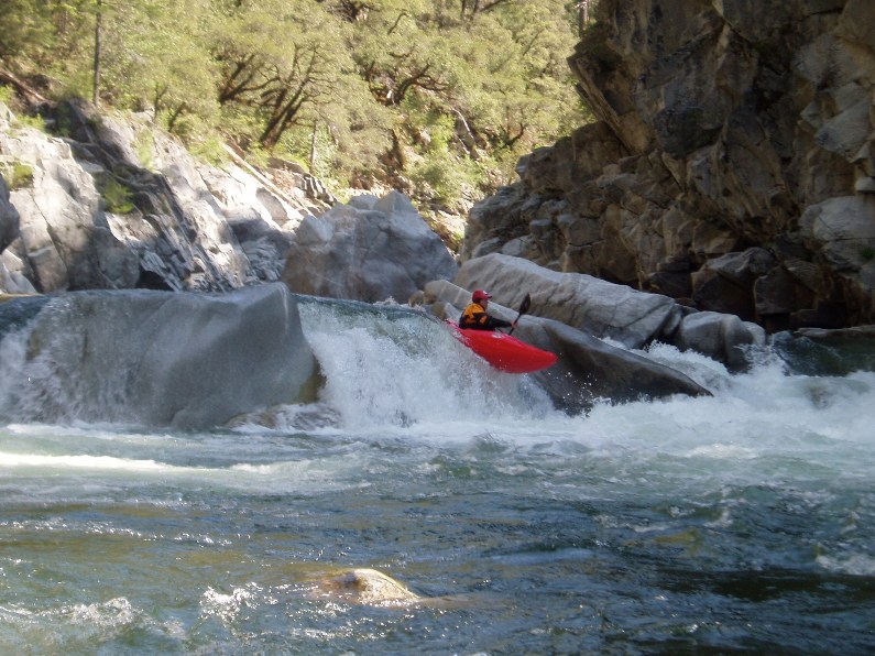
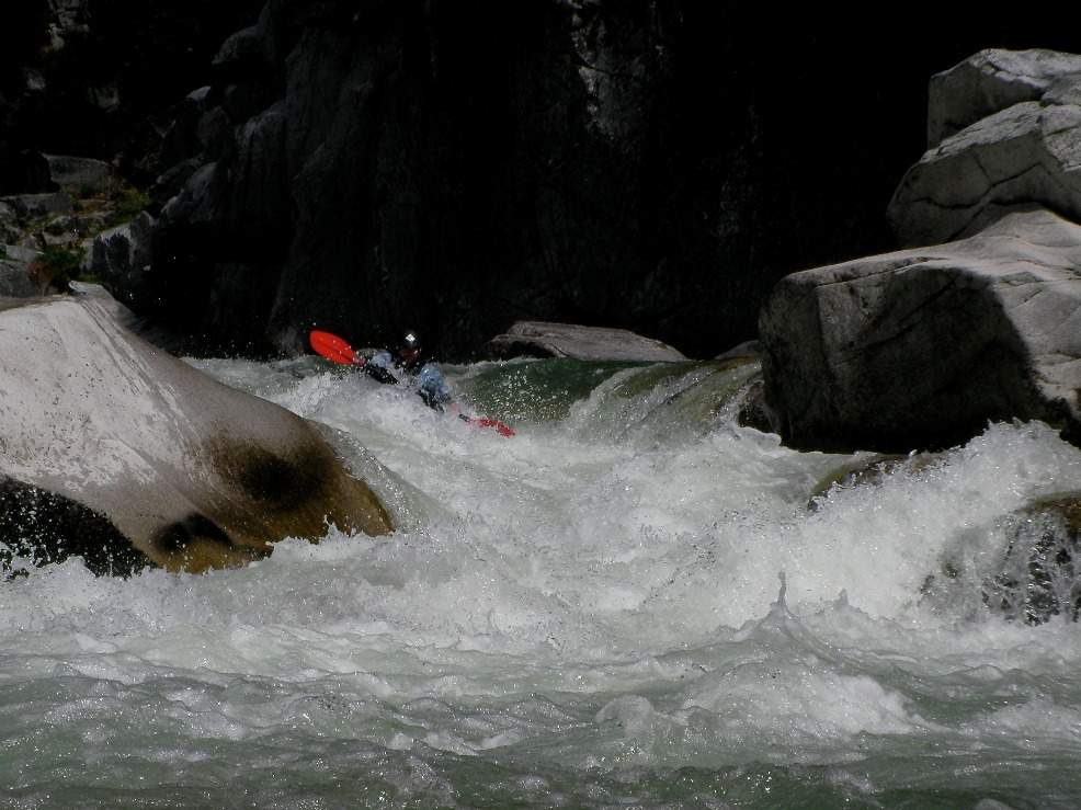
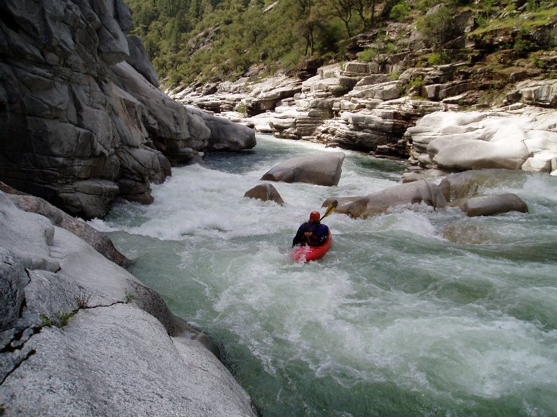
Franklin Falls (V). 0.3 miles after the bridge you come to the falls. There is a class IV lead in which we ran left to right. We then caught an eddy on the right just above the falls and realized the error of our ways. Diane was able to get to a micro eddy on the left shore just above the drop and hop out to scout, giving "beta" to us. Corey went first and thankfully modified the beta so we could all enjoy cleaner lines down the 12' vertical left side. Update: This left line is only advisable at lower flows. At most flows the normal lines is center running down the ramp and coming off just to the left of the midstream rock at the base of the ramp in the middle. The left side gets a nasty hydraulic.
- Split Drop (V or IV). The river splits around an island and tumbles down 8 or so feet. The left side is all at once and very violent. The right side is a little more gradual and lower volume, a nice class IV sneak away from the gnar.
Note: In 2011 a log moved into the right channel making it very dicey, requiring a portage of the rapid. Portage left and seal launch into the exit.
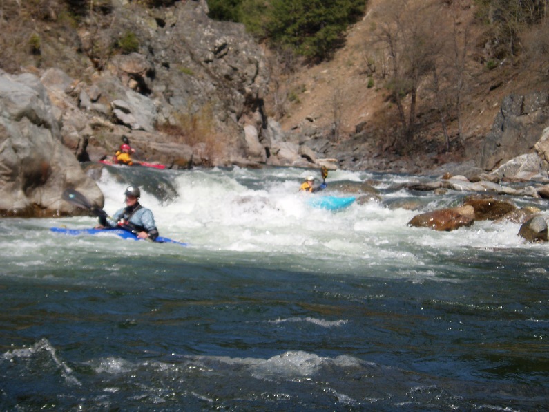
Double Drop (IV+). A double drop with a rowdy first hole. There was a little boof to hit which would clear it though this proved harder than it looked, just downstream was a mean looking hole that was surprisingly soft. There was also a sneak of sorts on the far right that was class IV but avoided the top hole.
- Triple Drop (IV+). This is a long rapid with three sizable holes to punch. The last is the biggest and had a small window on the right to bust through. There was also a large room on the right just below the drop, very fun.
2-part (IV+). A long rapid with 2 distinct parts. The first was a ramping lead in run down the guts. The second was around an turn and then hitting a boof in the middle of the river, such a nice boof.
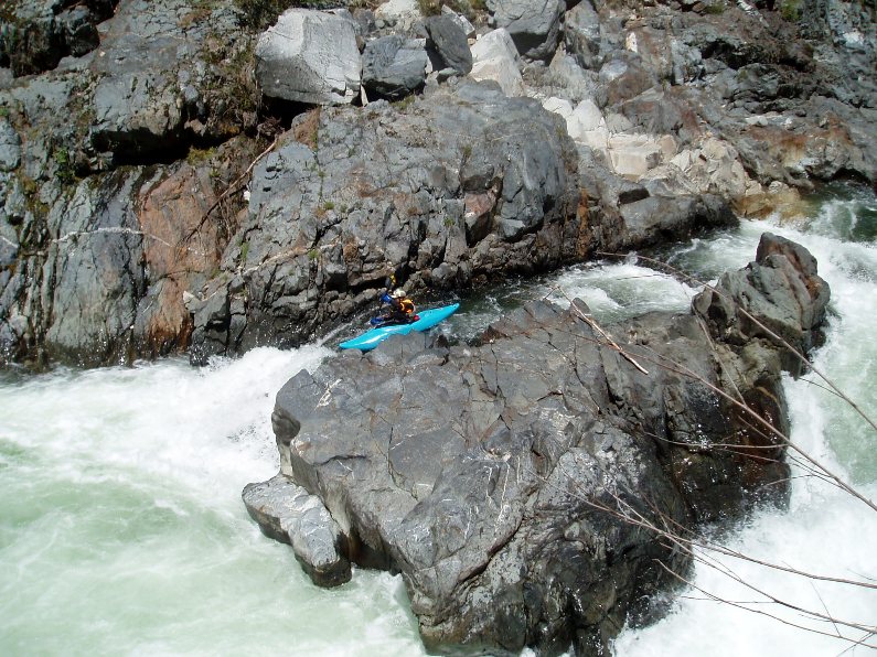
- Boat Pin (IV). A nice boof in the center heading left must be taken with car as to not over achieve and land yourself against the rock wall on the other side of the river, not a hard move, but over achievers beware. The right side is a jumble and had a boat stuck in it on our trip. Easy scout on the right.
Harder Frankling (V). 3 separate moves will small pools between them. The first move is on a sharp left turn, we launched off of a kicker rock in the middle landing in the saucy hole behind it. The second part was a weird s-turn sort of thing heading back to the right and then sharp to the left. It flipped all but one of us I believe. The final part is the hardest and longest. There is a short lead in which leads to a rocky cascade, move hard right, the left is very rocky and I pinned there before being ejected from my boat and bruising a rib. Apparently there was also a far right chute which was also good to go, but we didn't see that until afterwards.
Note: On our return trip, we found you can sneak the top move far right as the middle gets beafy, or run right of center and avoid the hole. The second tier can also be snuck far right. The final tier we boofed far left after entering far right.
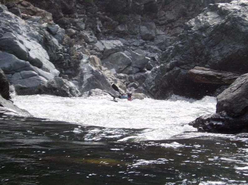
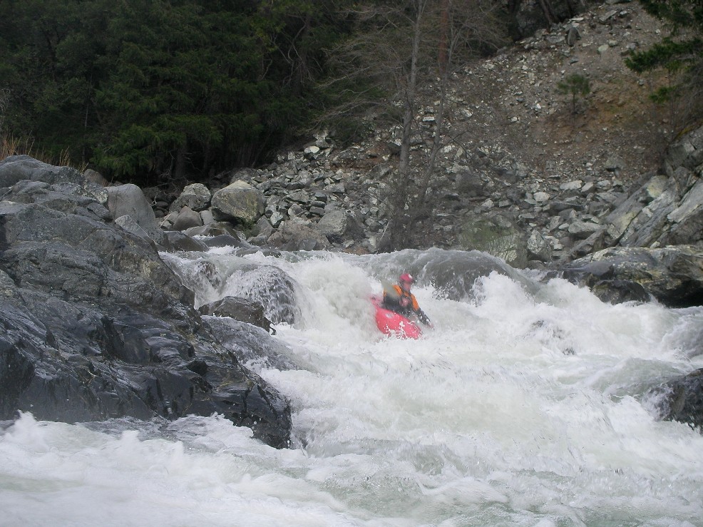
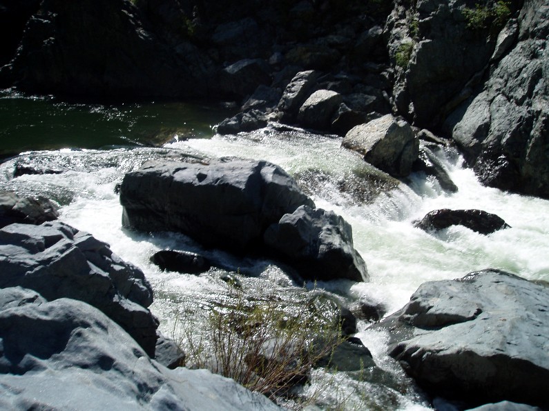
- What Dreams Are Made Of (V). A short gorge yields one long rapid with three distinct moves. You can scout from the right or left for the top two moves, and then from the left for the bottom. The bottom stretch is unportagable. The top has a spicy and rocky hole to clear. The middle was straight forward enough. The bottom required a hard right to left cut through a small channel to avoid rocks and holes, a fairly hard move to make. The run out was read and run with a few nice holes and a sieve on the left.
Junky (IV+). I don't remember if there was a lead in, probably was, the end was over a large hole that had teeth, then flushed into an undercut rock with rocks guarding it to pound all those who were upside down... which was several of us. Scout either side, portage right.
Note: On our return trip, we ran the lead in down the right of center before eddying out far left and exiting via a simple boof far left.
- Hole (IV+ to V-). A small off angle boof leads to a sieve if you muck it up, or down a ramp over a five foot ledge into a very meaty hole.
Note: This rapid went a whole lot easier at the higher flow, we also ended up boofing the far right side of the ledge rather than the far left side like at the lower flow. Also, a sneak opened up in a small far left channel. Portage is easy on the right.
- S-turn (IV+). Just when you think the hard stuff is over, the river drops into another gorge. The entrance is rather blind but Corey probed away. We entered between two large boulders and were blindly greeted by a huge hole backed up by a huge rock, I blasted to the left and down into a few more large holes. Diane went right and had marginal success.
Note: Enter far left, on the shore and just move back center... really not bad.
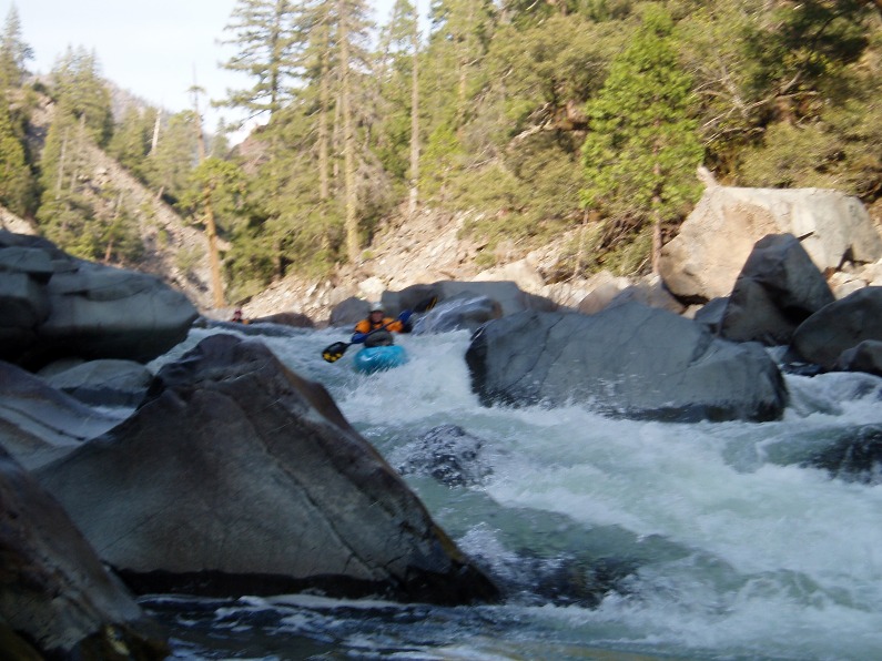
A stretch of easier rapids
- Dam (IV-U). Man made danger. A rebar studded wood dam. The right side is VERY ugly, the left side has a meaty hole with rebar poking through. We walked on the left.
Note: With more water the rebar was hidden and we simply boofed left of center off of the obvious launcher in the left channel.
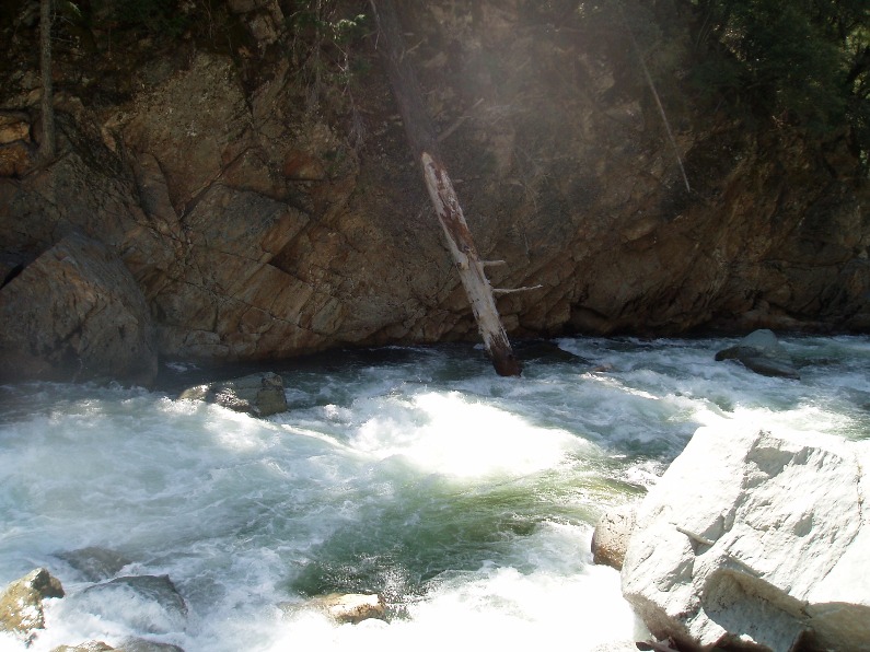
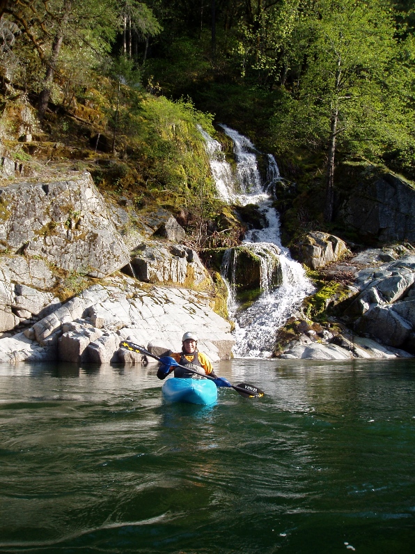
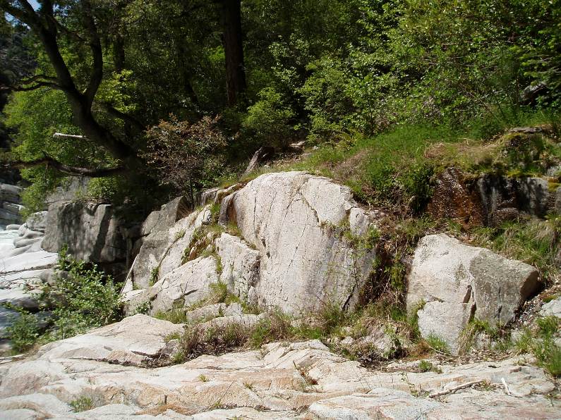
A nice side Waterfall lets you know you are close
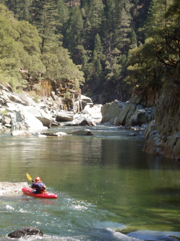
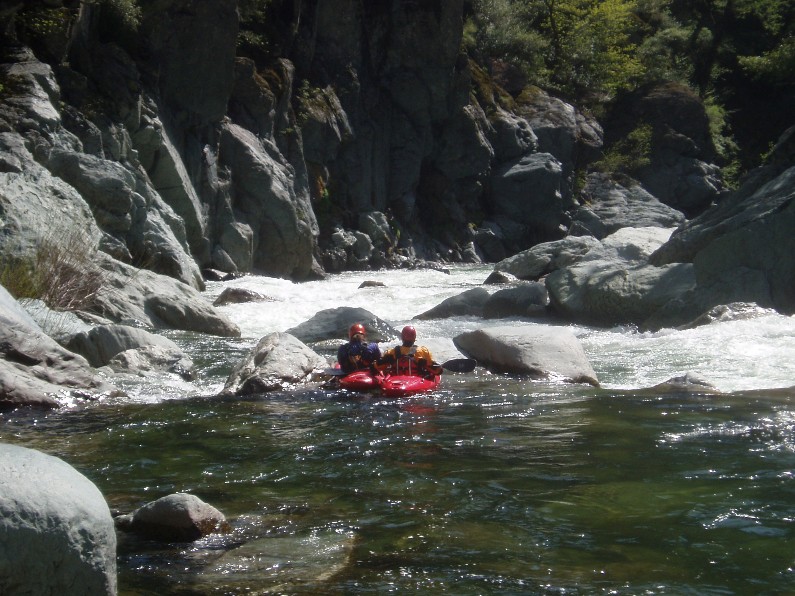
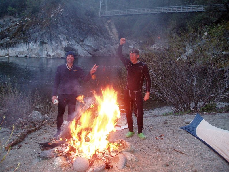
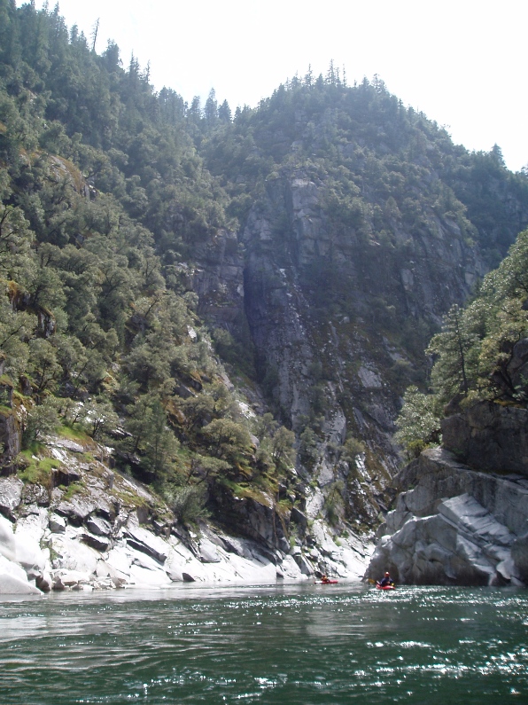
A quarter mile later we were at camp for the night under the Pasic Crest Trail Foot Bridge. Fire pits and litter were there to greet, but thankfully no hikers. The whole trip we saw not another soul out there, very pleasant.
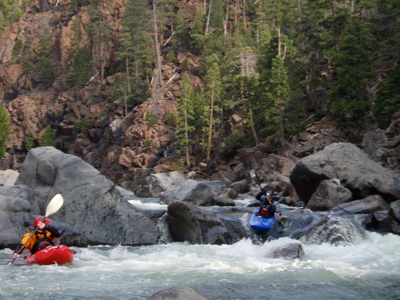
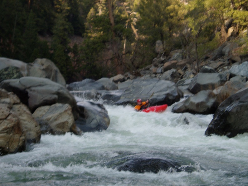
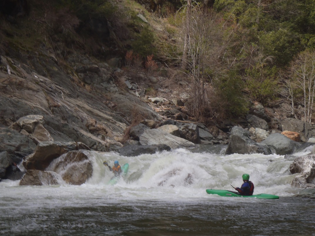
- Many good rapids in this section. A few are:
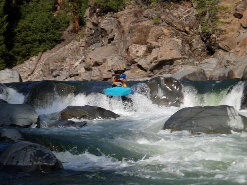
Long One (IV to IV+). A nice long class IV run down the center then moving right to avoid the pillow before dropping into the hole at the bottom.
Steep But Easy (III). This drop had a huge horizon line, looked like it would have a macking hole at the bottom, but instead ramped out to let your stomach drop and your voice sail.
Unscoutable (IV). This drop was pretty much unscoutable, there was a ramping line down the far left which Tupper than relayed word of the center boof line to the rest of the group.
Note: There is actually a cool little boof on the far right micro channel that requires you to duck an overhang but spits you out under a small side waterfall. Really kinda cool.
Sieve (V). There was a line, but off 6 inches left, land in crack between two rocks, off 2 inches right, and you drop into a sieve of death. Walked with marginal effort on the right.
Note: With more water, we were able to run a micro channel on the far right and moved back into the center between large boulders. Scout it, because it is amongst sieves and probably closes out at low flow.
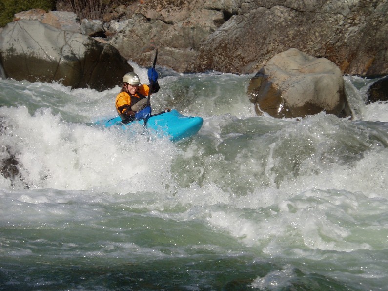
Landslide (V-). A long class IV lead in opens up to an eddy on the right. Scout from there, portaging could be possible, but you would have to bang your way out the bottom. The entry was a 5-6 foot boof, which then immediately flowed left into a hole. There was also the opportunity over cutting left too hard and paddling into a room of doom on the other side of the hole.
- Bad Beta 2 AKA Island Drop AKA Paddle John Paddle (IV+). Some interesting points of what was around the corner was missed when the beta was relayed to us. Enter over a rocky 4-5 foot ledge, round the corner, and look down stream to a field of large rocks and large holes. We all read and run our way down reasonably ok, the scouter found the nice clean and easy line down the right shore... go figure.
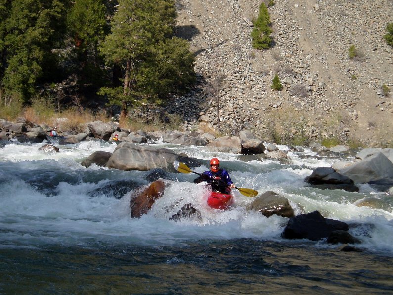
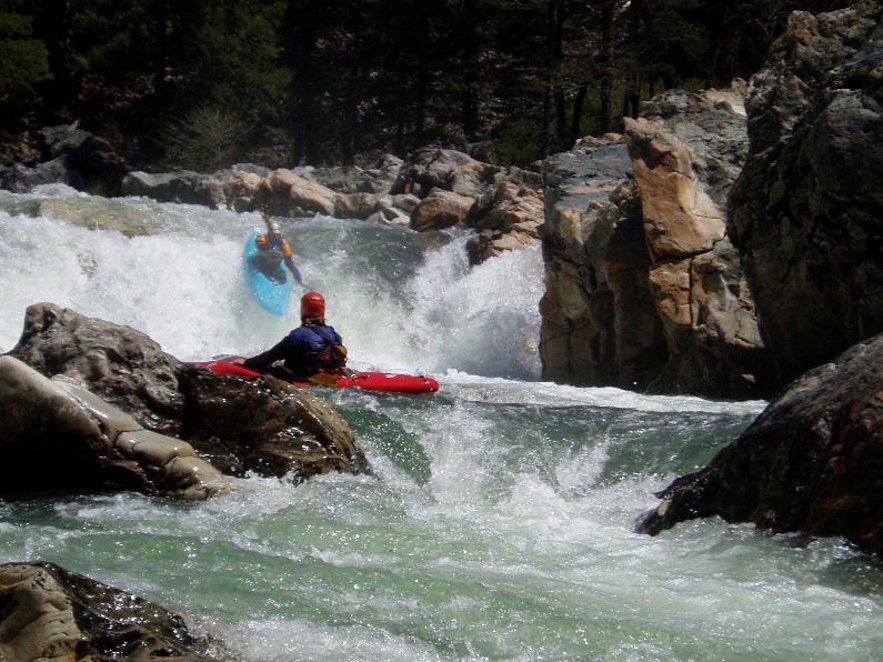
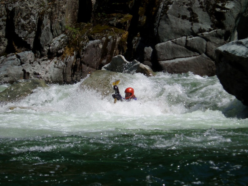
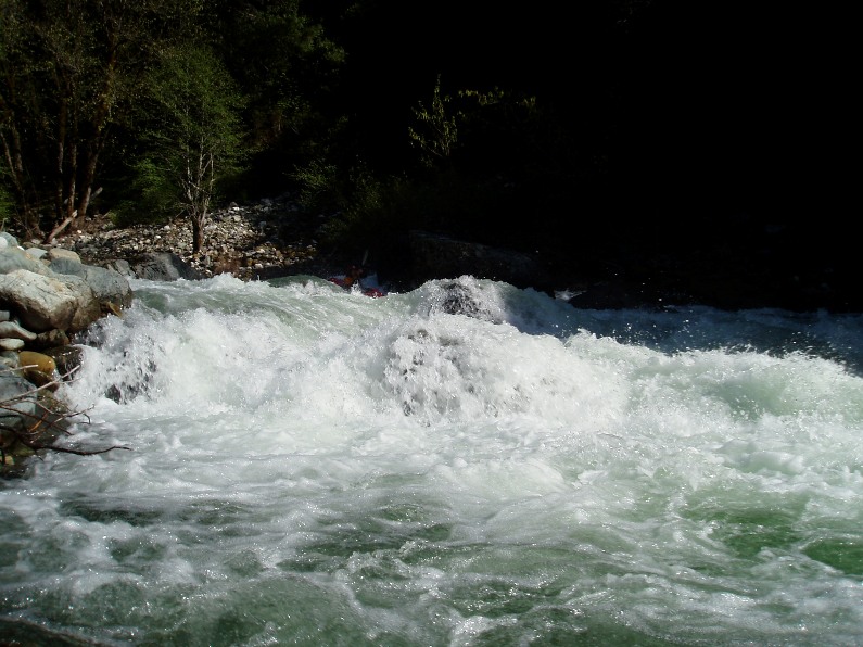
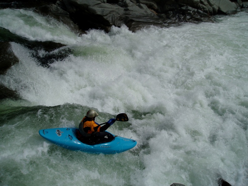
- Eat the Meat (V). A super huge double hole. In the middle is a rocky cluster to beat you before you drop into the bottom HUGE hole.
Note: Everyone in our group ran through it blind and flushed straight through the hole... half keeping their head dry. I walked, but regretted it... they made it look easy... and even fun.
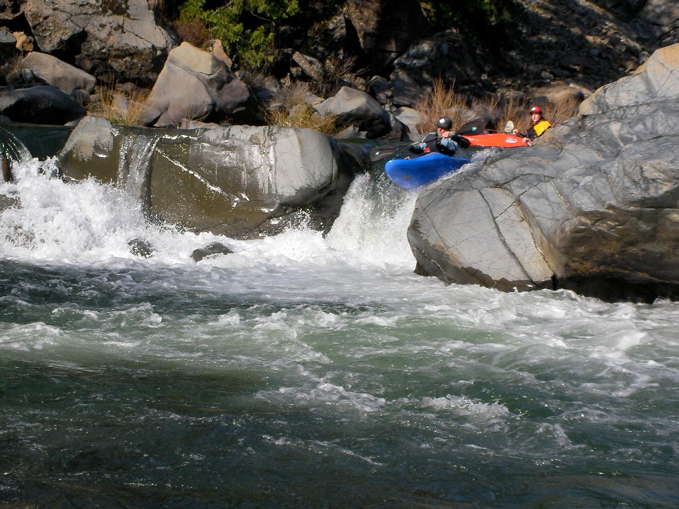
Right or Hole (IV). The river drops off of a large shelf. The line is to drive right onto the cushion forming off the wall, and ride it around the hole. If you don't get enough umph then you will end up in the very large hole in the middle. There also looked to be a boof line on the left 2 feet of the river. This is the top of Devil's Canyon proper.
Note: With more water we were able to boof far far left over the hole. The far right looked like a bad place.
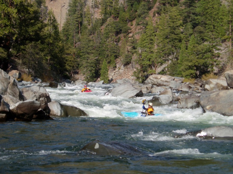
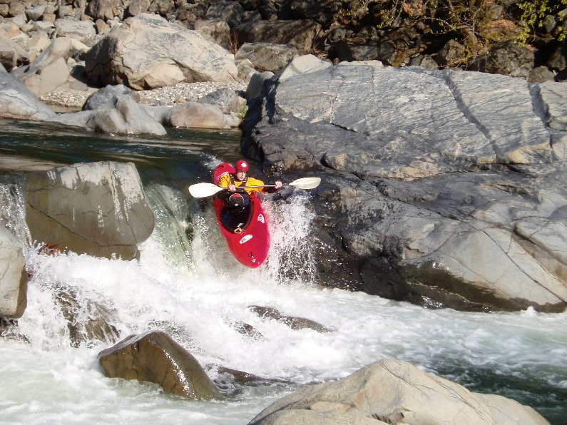
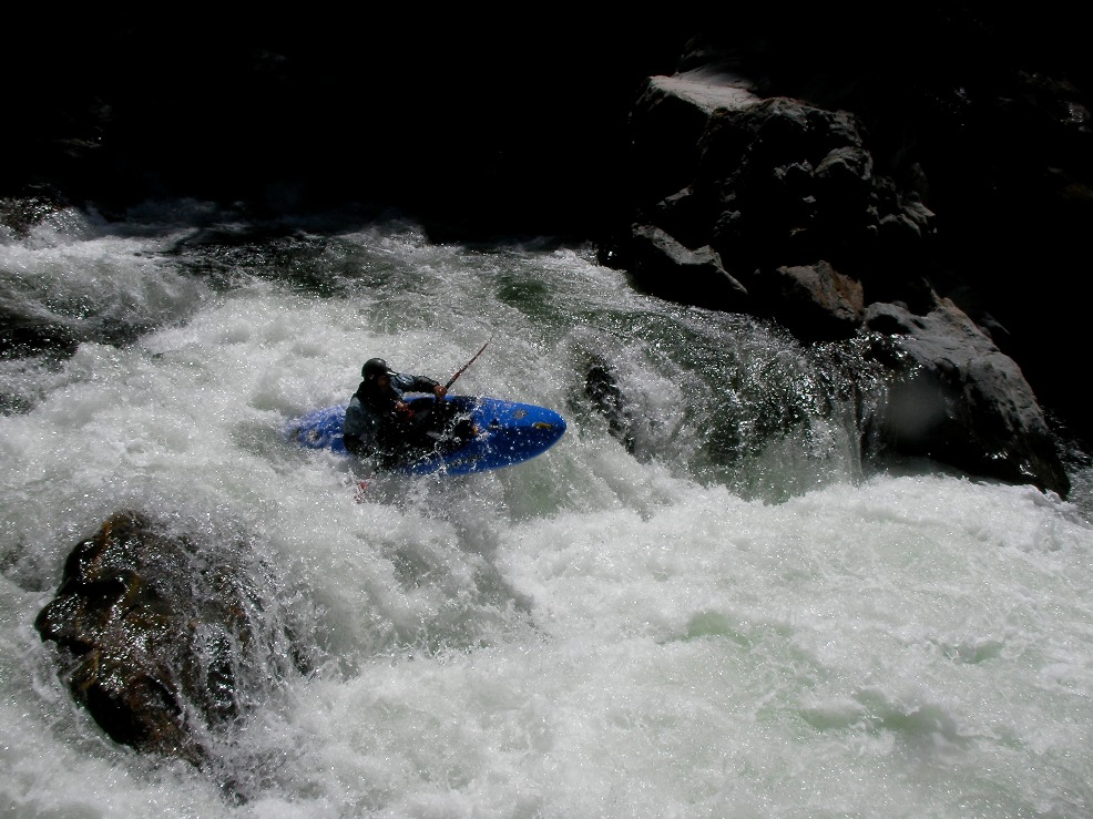
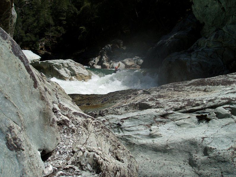
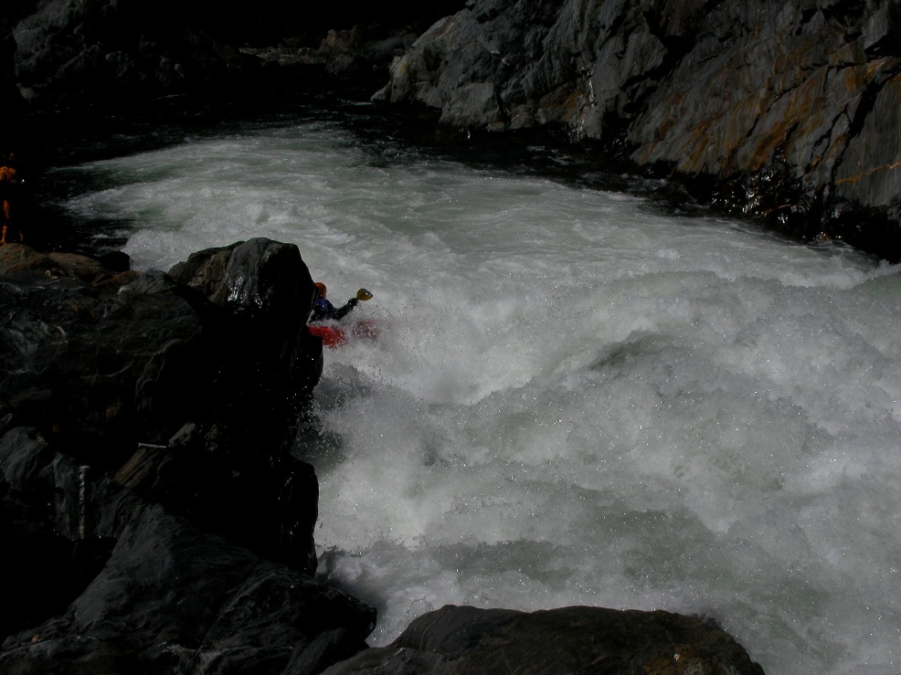
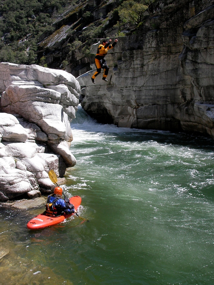
Devils #1 and #2. I don't remember #1... or #2. I do remember running down the left wall in one before moving hard back to the right... I think that is #2. The exit is then a small ramping hole that is picture here and in Oregonkayakin.
- Before the Portage (V). A huge rapid with 2 large holes at the top before the river splits. The final drop on the right of the split is easy, the left side has a large hole that is also a bit sieved out. Scout or portage on the left. To do a complete portage requires team work up and around the house sized boulders at the bottom.
Note: In 2013, it still looked bad, we all walked... but with more water the exit hole was nothing so we all put in at the bottom eddy and ran out of the exit hole... thus making the portage much much easier.
Portage (VI+). Enough said.
Note: Two in our group ran this beast... I still can't believe how well then made it look. Impressive to watch... and I still think this is a portage for 99.9% of the folks who run the river.
Double Drop (IV+). Just downstream is a double drop that if done right isn't a big deal. Boof hard right into the small eddy, over/around the very large hole. Run the rest down the right bank.
Note: Perspective is everything... just run right of center moving right and it is fine... totally fine.
- Left to Right 1 (IV). A large drop needed to be powered left to right to avoid a very large hole at the bottom.
Left to Right 2 (IV). A intimidating rapid had a pretty straight forward line on the right side that our boat scouting got us committed to not running. So we scouted from the left shore the line that we had to run. Power left to right to avoid the rocks at the bottom, blast through the hole and stay on line heading left.
Heaert of the Gorge
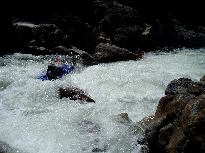
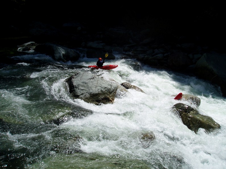
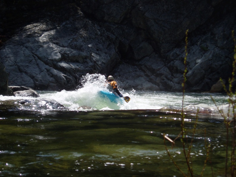
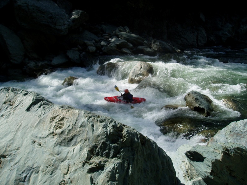
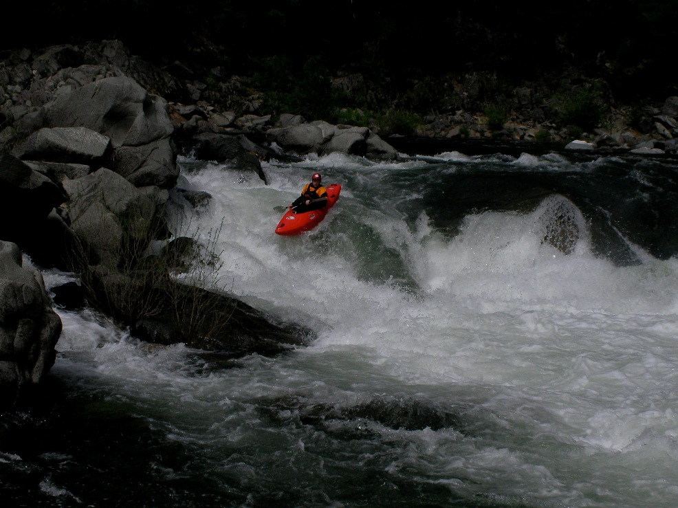
Helicopter (V). The part of this rapid you see in videos and on photos is only the final move. There is a long and fairly challenging class IV lead in which brings you to a eddy on the left. Scout from there. Drop through three boisterous holes, the first is the largest. The bottom one is bad on the right, but if you right the cushion on the left wall it is really easy, enough so to do it upside down, trust me.
Note: You can sneak the lead in rapid down the far left if you want... makes it totaly easy to get to the eddy at the top of the main rapid.
Large Hole (IV). An interesting looking kicker on the left led to a very large hole that none of us had the guts to probe. The center line dropped into a hole, the left of center might clear the hole but also kinda landed on a rock, so we chose to drive right across the top of the drop and drop it near the shore to face smaller holes.
Grand Finale (V). I was hoping that this would be like people calling Pin Ball on Giant Gap class IV+ just because it is at the end of the day... but no, this was class V. A large lead in had to be negotiated correctly to allow you to enter the left eddy. Then drop over a large drop and negotiated the hole driving right to avoid being slammed into the wall and a room of doom in the wall. Scout early, before the lead in from the left side, and portage from there if so desired. Once you have entered the lead in, you are committed to running the drop.
Sweet Plug (IV). This is a cool rapid which you obviously want to drive right in front of a large rock that all the water is funneling down into and pillowing off of... though it rejects half the ffolks and they plug super deep before flushing out.
John's Rapid (IV). On the next left turn, there is a small ramp into a ledge... stay far left on the ramp and go around the ledge. In 2012 a paddler boofed the ledge and found a hidden pin hazard and if it were not for his friends quick actions, he would have drowned as he and his boat were pinned under water... just avoid it.
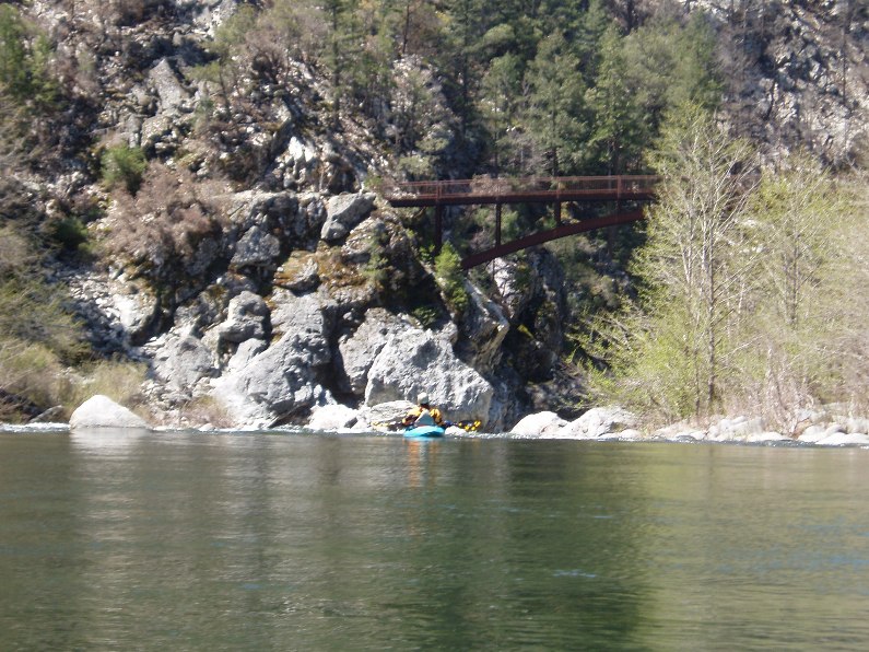
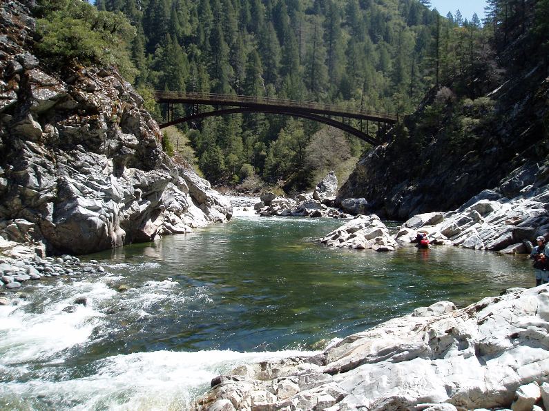
Look up and you can see the bridge
Take out: Take 162 out of Oroville until you see the Brush Creek Forrest Service sign. Take this road 9 miles or so down to the river, most of it is dirt but in pretty good condition.
Put in: Drive back to Oroville and take 70 up the North Fork of the Feather. Continue to Quincy. A few miles out of town turn right on La Porte Rd (I want to say I also saw a sign saying "120" right there). Continue 7 paved miles down to the river.
View Middle Feather, Devil's Canyon in a larger map
HTML Comment Box is loading comments...