
Island Creek (Lower)
| Stretch: | Catoosa Bridge to the Emory |
| Difficulty: | Class III+ to IV (IV+) |
| Distance: | 2.4 miles |
| Flows: | ~0.8' to +2' (1.1' felt on the low side of optimal) Gauge is located on the put-in bridge, downstream side of the center pillar. Look for at least 1" of rain over the previous day. But no guarantees. |
| Gradient: | 109 fpm average |
| Put-in: | Catoosa Bridge |
| Take-out: | Downstream of Nemo Bridge on the Emory |
| Shuttle: | 2.3 miles (10 minutes one-way) |
| Season: | Winter/Spring from rain... |
| Written: | © 2015 |
| Featured in A Wet State #103, A Wet State #136, and A Wet State #150 | |
Norway 2015 - Day 15 Morning
You might be asking why I have Island Creek in Tennessee listed as part of my Norway vacation. Well, when I travel internationally I liked to return on Saturday, that way I have one day to relax, unpack, and try to get right on sleep. Returning from Norway and getting home at 11:30 pm on Saturday night, we already knew that the rivers and creeks on the plateau had water and had made tentative plans to boat the following day. After sleeping in, we packed up the car with broken "back-up" boats which we have held on to for just this sort of case. Diane sold her boat in Norway and hadn't picked up a new one yet, and mine was left with Harry for next year when I intend to go to Austria.
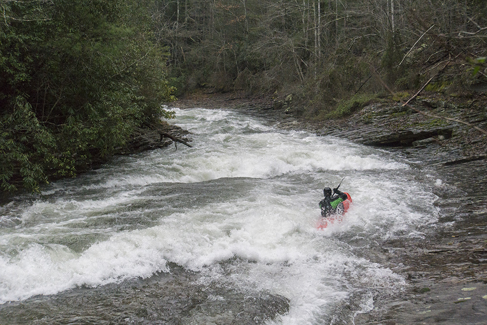
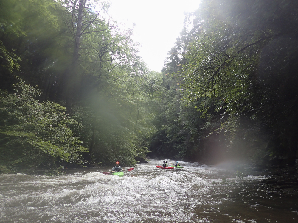
We ended up doing two laps on Island Creek before heading over that evening for a quick lap on Little Clear Creek. Island Creek lived up to the hype that I had heard. One of the best creeks for its difficulty. For the most part the river is low stress slides with only one somewhat more dangerous rapid. However, some of the classicness of it has been affected by the wood situation as expected all over the plateau after the ice and wind storms we experienced this past winter. Still, despite a few sketchy wood avoidance maneuvers, the low angle slides were still classic. The river after a brief paddle in opens up and you are welcomed with numerous slides, none harder than class III to IV. A great intro into slides, as they are a different style of boating that certainly takes some practice to understand how to control on. And this is the perfect place to get that practice!
We had 1.1' and 1.0' on our two laps this time. 1.1' certainly felt a little better than 1.0'. I thought this was a great first time flow. There were pools between the slides, and with the wood situation it was nice to be able to stop yourself on the shore while still in the current. For ideal flow on a clean river I bet a little more water would be welcome. Maybe like 1.5' or so.
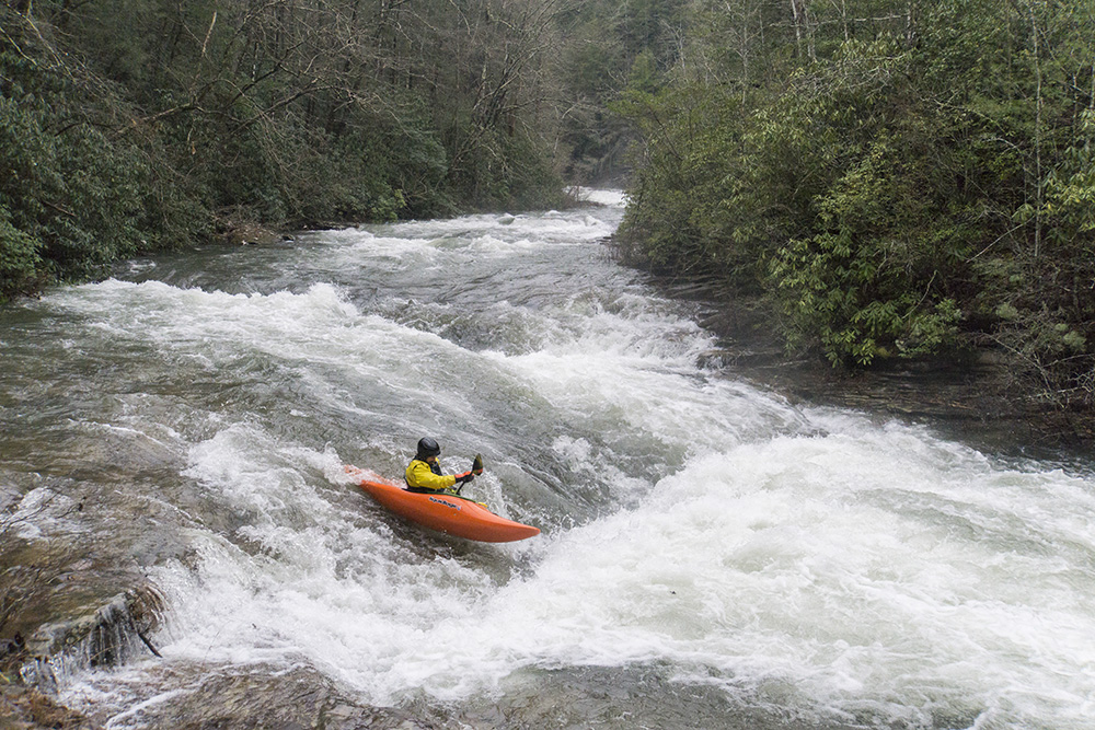
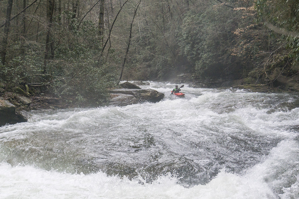
Update 2017: OK, so yesterday (April 22) I got four laps ranging from 1.2 to 1.4. This year, the wood situation is much better... and this run is an absolute world class run. Classic from top to bottom. With the higher flow you don't touch rock on the slides, there are a few meaty holes but as long as you are straight they are no problem. But really, the actions is just non-stop from top to bottom. And with the higher flow, laps only take like 25 minutes or so from top to bottom... so bring a lot of cars or a shuttle driver, because you will want some laps!
Last: Norway 2015: Day 13 Morning - Lågen (Hunderfoss)
Next: Norway 2015: Day 15 Afternoon - Little Clear Creek (TN)
Mi 0.0:
- The first has some brush to avoid (if it is spring/summer). Do note, the very first drop the river splits into two. You do not want to go with the bulk of the water to the right, instead you want to go into the brushy left channel (it actually often doesnt even look like a channel when you need to head left, just looks micro and bushy) which quickly opens up into a clean channel. The no go bigger, more obvious, right channel ends in a boulder pile that usually contains wood and has been the site of several close calls. After that one rapid, it all is more obvious downsteam as to where to go.
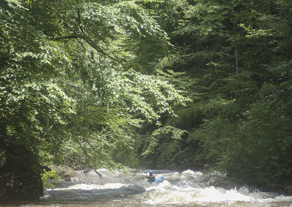
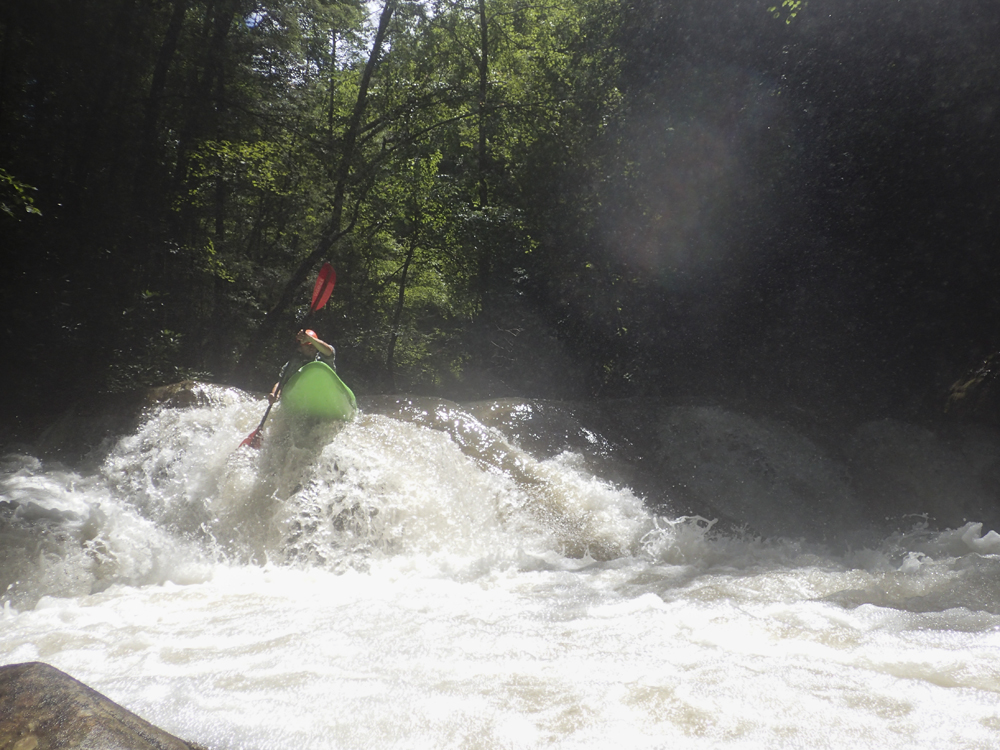
- Slides Start (III to IV). After some boogie the river bends right and drops straight into one of the most fun section of slides. This stuff is all read and run, just keep it straight. As the river turns back left be on your toes for some more powerful slide holes, you can avoid the meat on the right. Things then mellow a little bit.
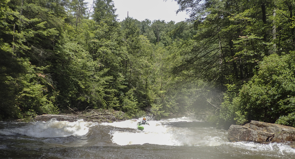
- Next Slides (III to IV). After a bit of fast mooving boogie you get to another set of slides. The middle slide has a blind lip and slides down into a good size, but flushing hole. Go down the middle as the window is dead center. Careful for a fin on the right that can drip up people who enter too far right. Below is another small hole that is off angle, just "T" it up and it is all good.
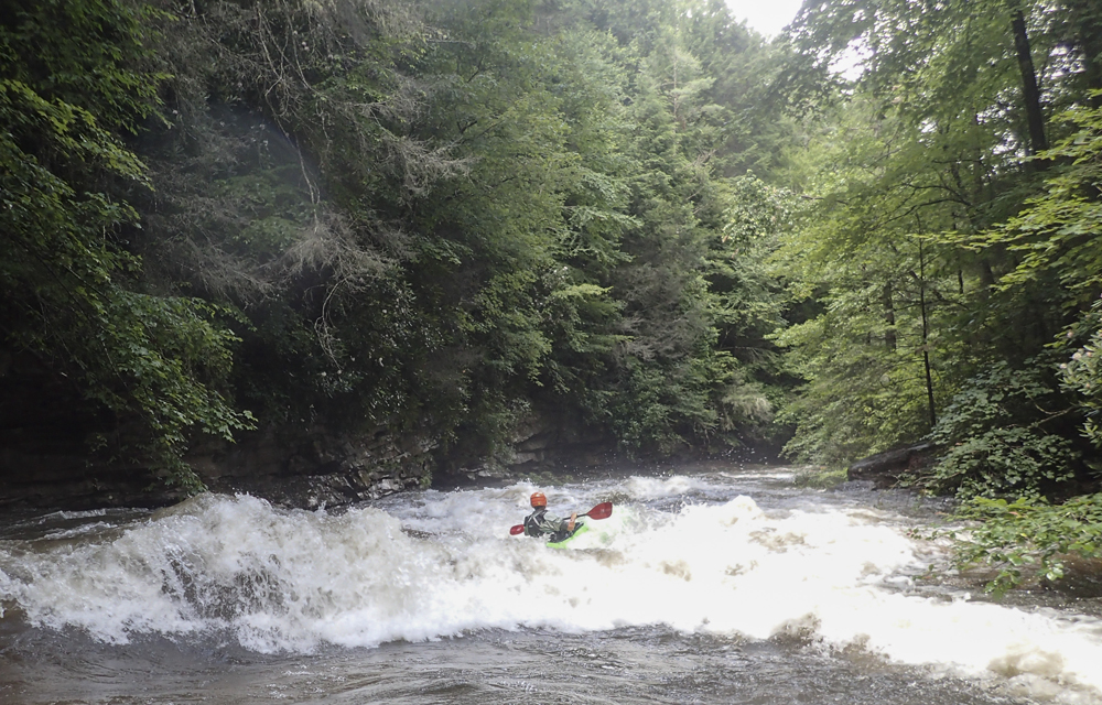
- The Best (IV). This slide had a ledge at the bottom, in my mind it is the most difficult because this ledge could pack a punch. And you aren't far above Compound Fracture. Just keep it straight and go where the water takes you.
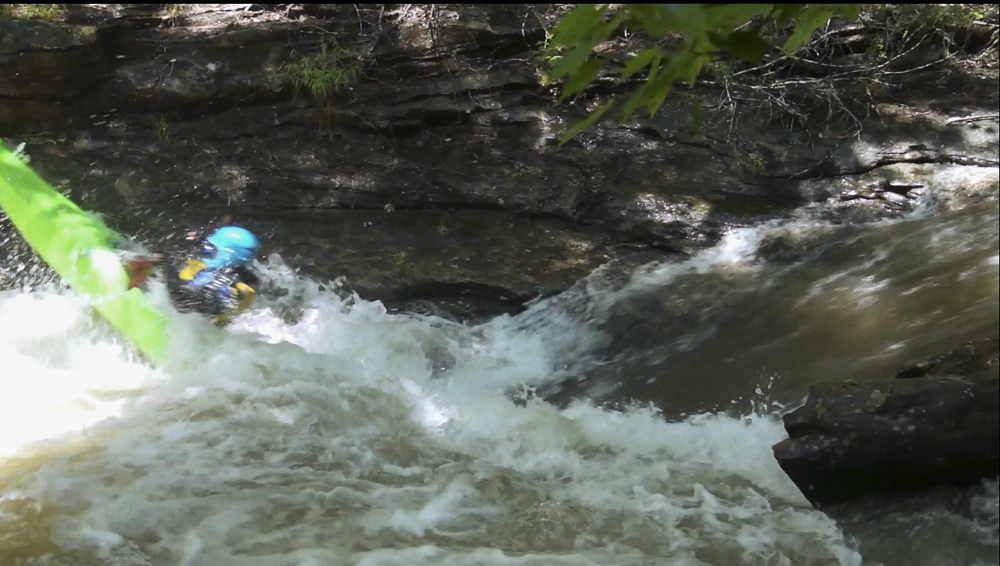
- Compound Fracture (IV+). This rapid is a tricky one and has some consequence. The entry is a small ramp into a hole, get your nose up to keep from back endering. Below the river goes over a junky pile that pushes you left towards the wall, go ahead and go with it but then paddle away from the wall immediately below as a sieve is just downstream on the far left. Alternatively if you come through the top in control you can sometimes move hard right across the top of the junky pile and avoid the sieve altogether.
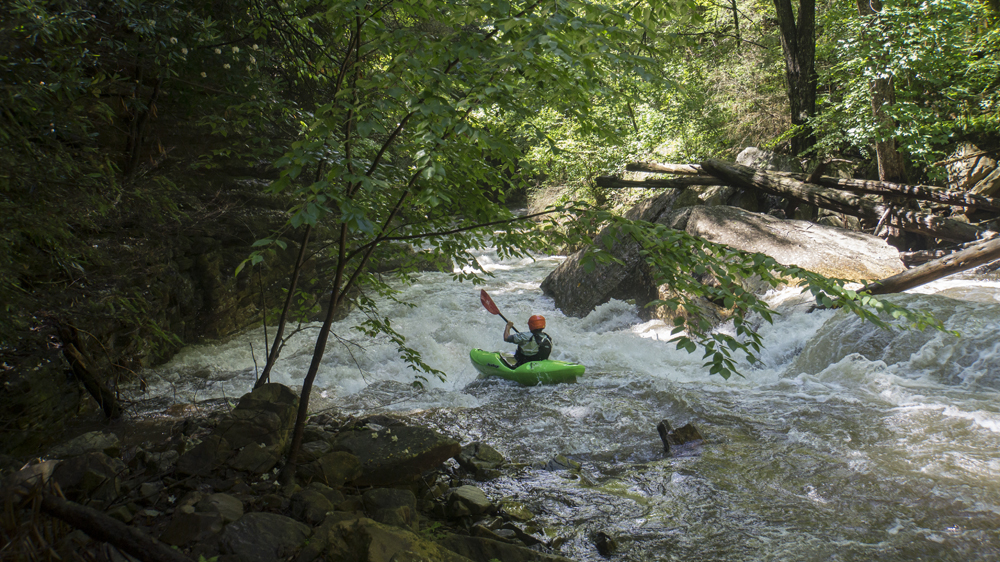
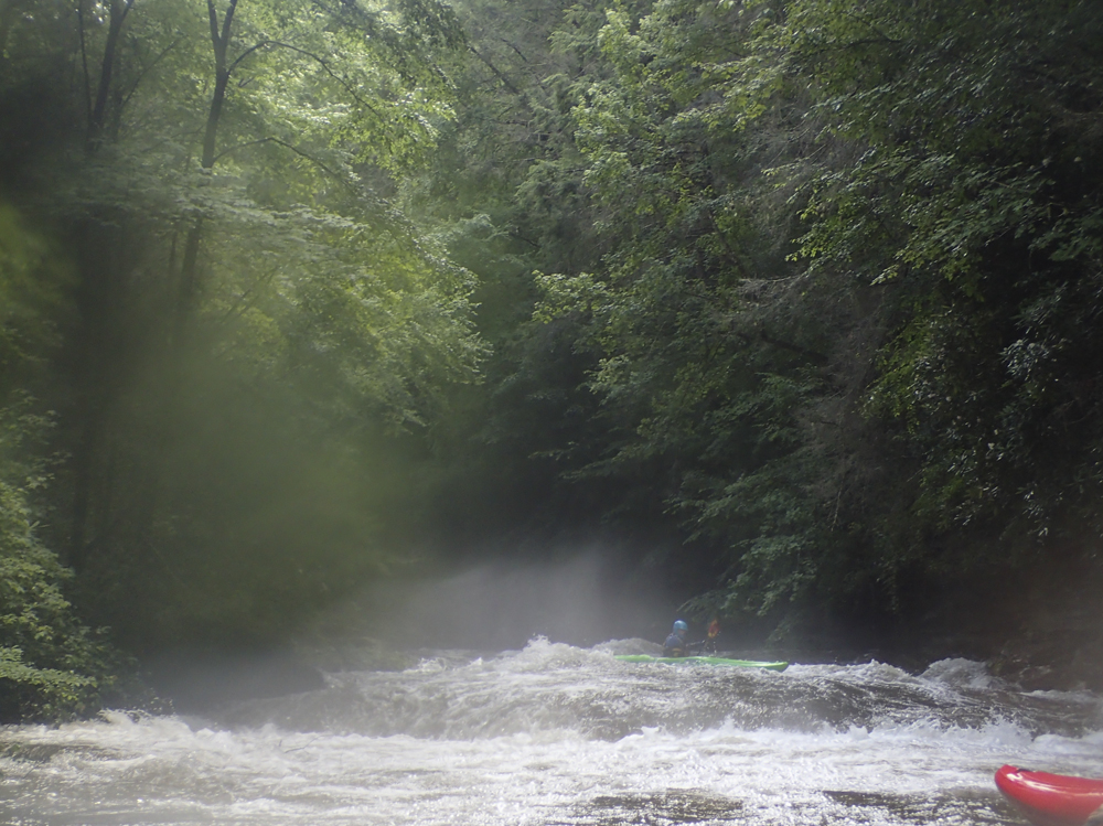
- Rock House Slide (III+). This is pretty much just the entrance to the Cave Rapid. But depending on the flow there are different lines. At low flows you can slide down the center. As flows get higher it is wise to boof far right.
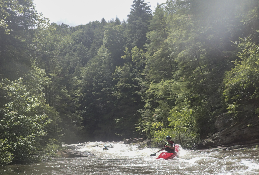
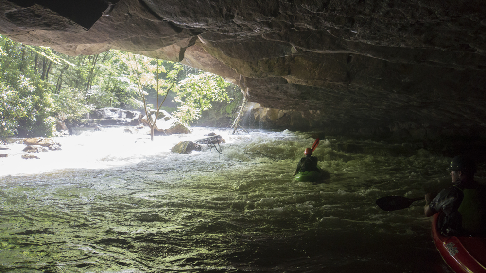
Cave Rapid (IV- to IV). A small boogie rapid leads to a cave that you can eddy out behind and surf in. Just downstream, the fun continues as the rapid runs along the wall for a few hundred feet, just follow the water staying down the middle and then exiting down the right side as the river splits around a large boulder.
- Show Me Your Tatas (IV). As Cave Rapid ends, you enter a pool with two small channels exiting it. Careful as these collect wood regularly. In 2015 the right had wood, in 2017 the left had wood. The right is a sweet line that involves either a boof onto a fast green tongue or if you can get far right a nice grind down a rock slab.
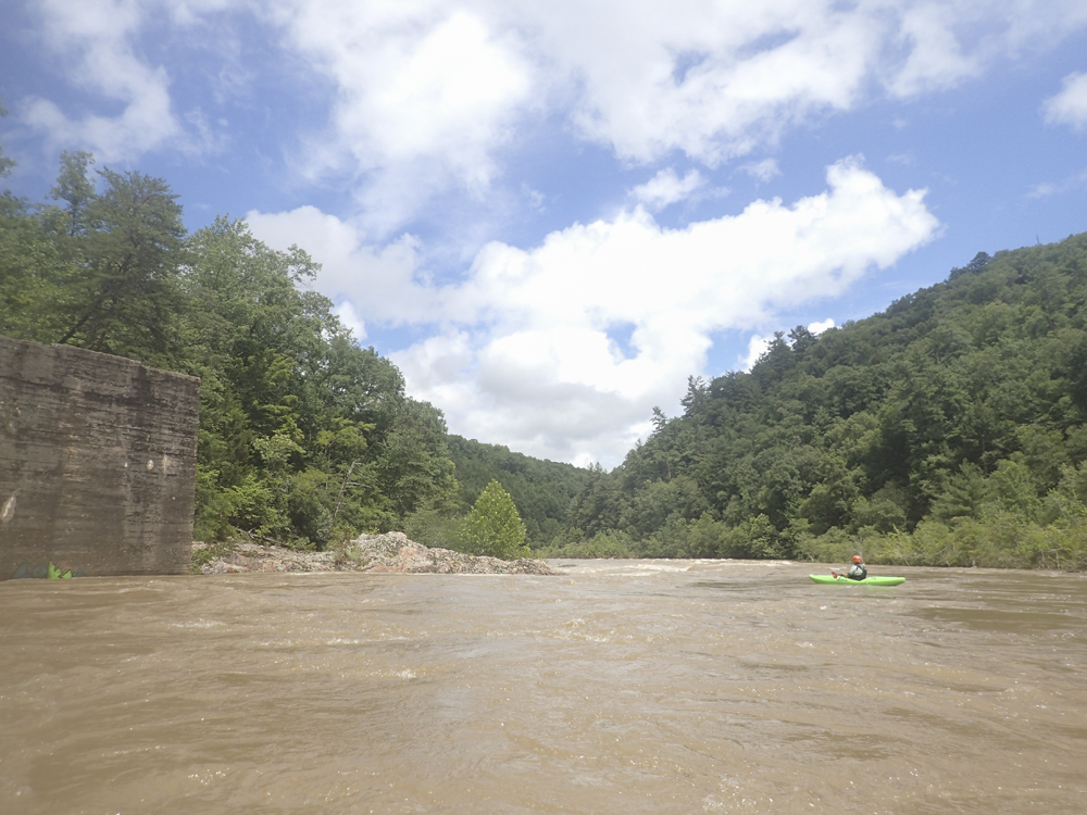
- The Emory confluence marks the end of the day. Ferry over to the left and hope out in the big eddy just downstream.
Take-out: Take highway 27 to Wartburg. Upon entering Wartburg turn left on Main St. Follow signs to Nemo access which will jog you south one block before turning right onto Catoosa. Follow this for 5.5 miles down to Nemo Bridge. The best access is to drive down the dirt road on the left 100 feet before the bridge . follow this down and part just as you start to climb a small hill. Look for the trail which comes up near the bottom of that small dip before the hill.
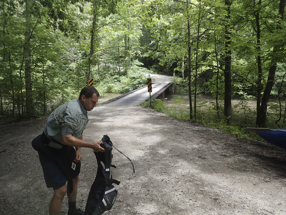
Put-in: Continue over the bridge over the Emory on Catoosa Rd. After you climb you will enter an open field, turn left to stay on Catoosa and then follow this to the Catoosa Wilderness sign where you will turn left at the fork. This follows the river down to the bridge over Island Creek. This is put-in. The gauge is on the downstream side of the bridge.
HTML Comment Box is loading comments...