
Emory River (Canyon)
| Stretch: | Montgomery Rd to Nemo |
| Difficulty: | Class II to III |
| Distance: | 6.7 miles |
| Flows: | >700 cfs. Minus the Obed at Lancing gauge from the Emory at Oakdale gauge for an approximation. Only accurate after the creeks have dropped out as Island, Crooked Fork, and Crab Orchard all come in downstream of the Obed. |
| Gradient: | 64 fpm average from mile 4.0 to mile 5.85, 8 fpm before and 12 fpm after |
| Put-in: | Bridge on Montgomery Rd |
| Take-out: | Nemo Bridge access on Catoosa Rd. |
| Shuttle: | 7.3 miles (15 minutes one way) |
| Season: | Winter and Spring, Rain. |
| Written: | © 2019 |
I heard that this section is worthwhile a year or two ago when some friends went in. So, this weekend, when Jim Janney mentioned that he was going to take his dad there, I jumped at the chance.
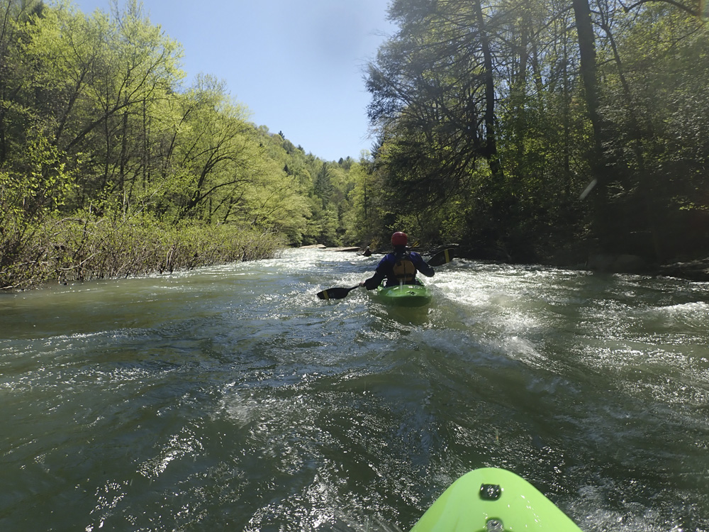
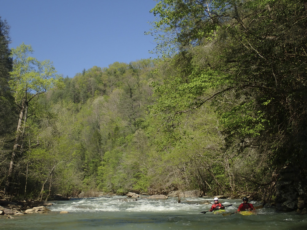
The run starts off with an hour of flat water, there is current... but it is flat, almost completely flat. With just a few riffles to break up the pools. But, after the 4 miles of paddling in are done, you get to run some very nice class II to III rapids. To boot, the scenery is quite nice too, with a few spots lined by walls, a few spots lined by steep banks shrouded in huge boulders, and some remnants of railroad industry. In all, it was worthwhile for sure. But, on the downside is the dang paddle in! 1 hour is a long way! So for that reason, I would say it is worthwhile, but not working doing regularly.
For reference, we had Emory at 4,300 cfs downriver in Oakdale, and 2,930 on the Obed at Lancing. This would lead me to believe we had at most 1,300 cfs (the difference), but likely lower and perhaps 900 cfs. I thought this was a low stress flow, a little more would have been welcome.
Mi 0.0:
- Flats (0). The paddle in is flat... with light current, with only like 2 exceptions. It is pretty, but the paddle in took us 1 hr.

- First Class I (I). A mellow enough affair, we ran down the left.
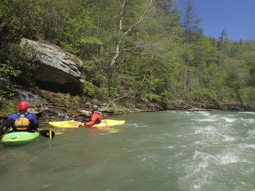
- Second Class I (I). A pool formed and the river split around an island. The left looked more fun so we floated down that side along the nice wall.

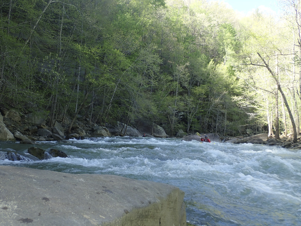
- Undercut Rapid (III). After one or two class II rapids in the prior quarter mile, the river bends left and enters a class II lead in, which then hits the left wall, which is a little undercut. It is easy enough to avoid the undercut by not being far left. Below, there is a small double drop that is mellowest on the right. This rapid marks the start of the good stuff.


- Right Wall (II+). A small set of rapids along the right wall. Near the bottom was a decently size hole in the middle, easy enough if you go around it, but also big enough to stop you if you go for gold and don't clear it.


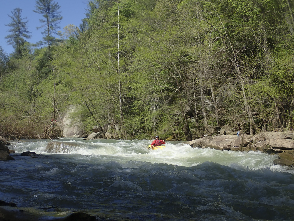
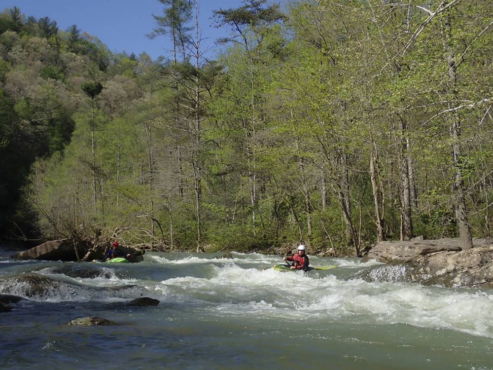
- Left Wall (III- to III). I bet at higher flow, this rapid gets some meat to it. This rapid forms along a nice left wall. The top has a few small ledges, while the bottom has a few small slides. There are some nice surf waves at the bottom depending on the flow.

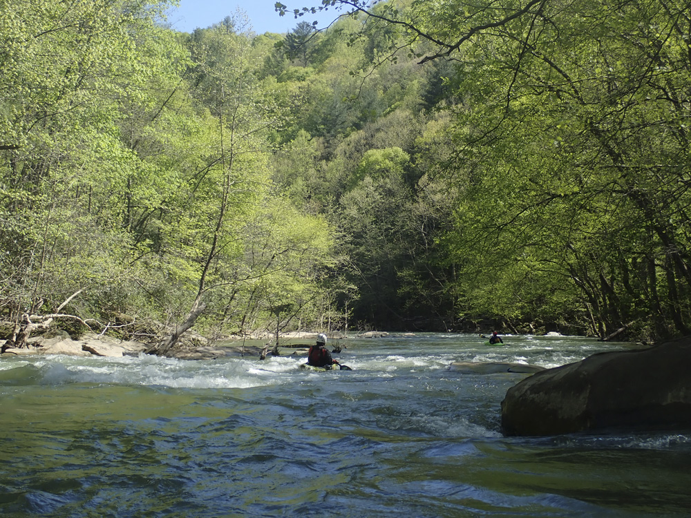
- Long and Busy (II+ to III-). This rapid is a long boulder garden with no sticky features at normal flows. Cleanest entrance is center and exiting down the left along the wall.

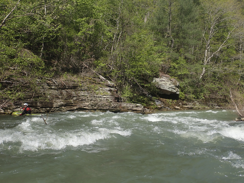
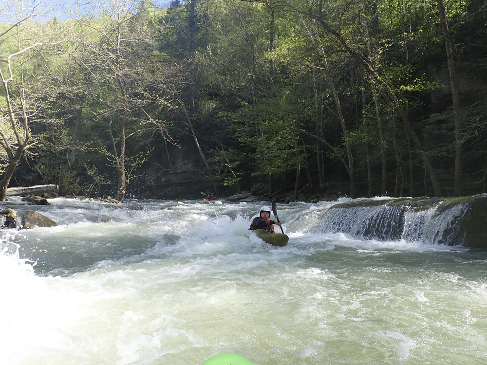
- Ledge (II+ to III-). A scenic bend in the river ushers in this drop, you can stay right and make the rapid easier, or you can boof the ledge that is formed on the left shore by a large slab rock.
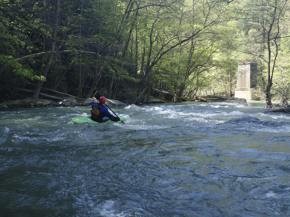
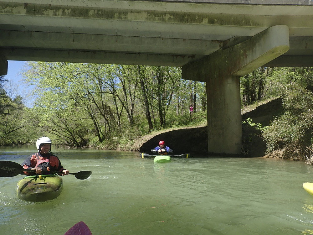
Bridge Pylon (II). Immediately below you get to old railroad bridge pylons. The rapid here is a wave train.
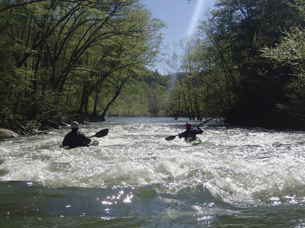
- Long and Busy #2 (II+ to III-). As the river bends left, you enter another long rapid. We entered left of center. It keeps going through a few more tiers. The final one was best run on the left.

- Railroad Bridge (II+ to III-). So, I would have called this class II+ but I pitoned the shit out of a rock and came to full stop and briefly pinned. So, avoid the middle wave train as there is something in the small hole. Instead, just go far right around the feature. Downstream, boogie lets up but continues down to the confluence.

- Obed Confluence, the Obed River enters on the right and will be much higher water. Like several thousand higher... though the river retains the Emory title.
- Surf Wave (III). There is a great surf wave sorta hidden on the left side of the channel of the first rapid. It is a catch on the fly wave.
Take-out: From Knoxville, head up 162 then 62 to the town of Wartburg. On the far side of town, turn left on N Kingston St and follow it for 0.2 miles before turning left on Main St. In 0.1 miles when Main St bends right, go left on Bonifacius St and follow for just 0.2 miles before turning left on Catoosa Rd (I think actually Bonifacius turns left and at the 90 degree bend and then the road name changes to Catoosa). Either way, then follow it for 5.5 miles down to the river.

Put-in: Take Catoosa Rd back towards Wartburg for 5.5 miles, as you get into town turn right on Bonifacius St and quickly turn left on Main St (Old Highway 27). In less than a mile, turn left on Montgomery Rd and follow it for 0.7 miles. Park on the right just before the bridge. Access is under the bridge.
HTML Comment Box is loading comments...