
Diamond Creek (North Smith Tributary)
| Stretch: | North Fork Diamond Creek to Gasquet |
| Difficulty: | Class IV to IV+ |
| Distance: | 4.15 miles (then 10.6 miles on the N. Smith) |
| Flows: | 3,000-10,000+ cfs (on the N. Smith). Current Dreamflows est |
| Gradient: | 94 fpm for 2 miles, then 122 fpm for 2 miles. Then 41 fpm on the N. Smith |
| Put-in: | North Fork Diamond Creek |
| Take-out: | Gasquet / Confluence with the M. Smith |
| Shuttle: | 30 Miles (2.5 hours one-way, very rough road for 6 miles) |
| Season: | Winter and Spring from Rain |
| Written: | © 2012 |
| Featured in Video A Wet State #56 | |
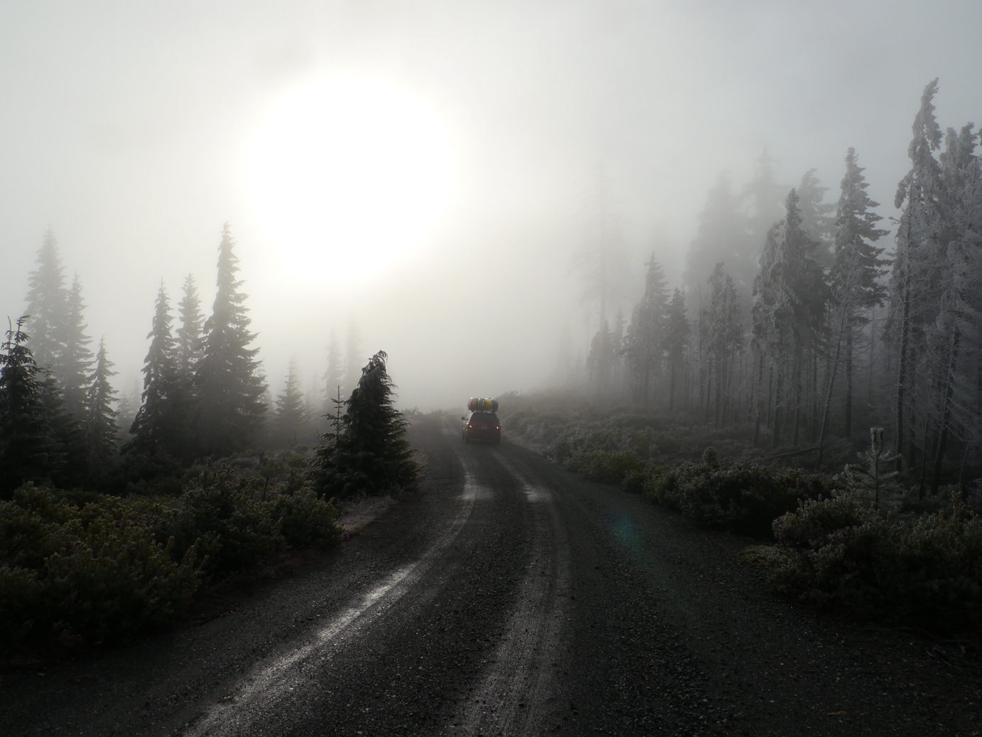
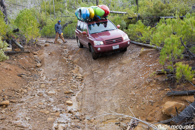
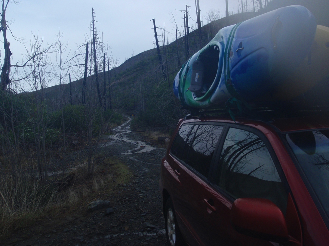
Diamond Creek has been on my mind since the first time I boated by the confluence of the creek with the North Smith some 6 years ago. Since then, I have made several trips to the Smith River area hoping to get on this creek, but due to weather either not showing up or showing up too much, I was never able to make it. The challenge is that you need some rain to come in to bring the creek in. However, the dirt road that takes you to put-in goes near 3,000 feet and is as such under snow most of the times that the creek has water. Furthermore, it is run so rarely that the road may have significant trees across the road in addition to being plane and simply a very crappy dirt road. Although my Highlander made it, I would not subject my car to that road ever again... I am sure I reduced my car's value that day. Next time, I will recruit someone with a pickup with proper clearance... or a 4Runner or something.
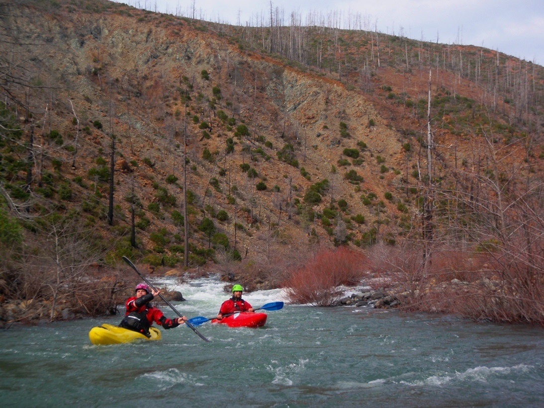
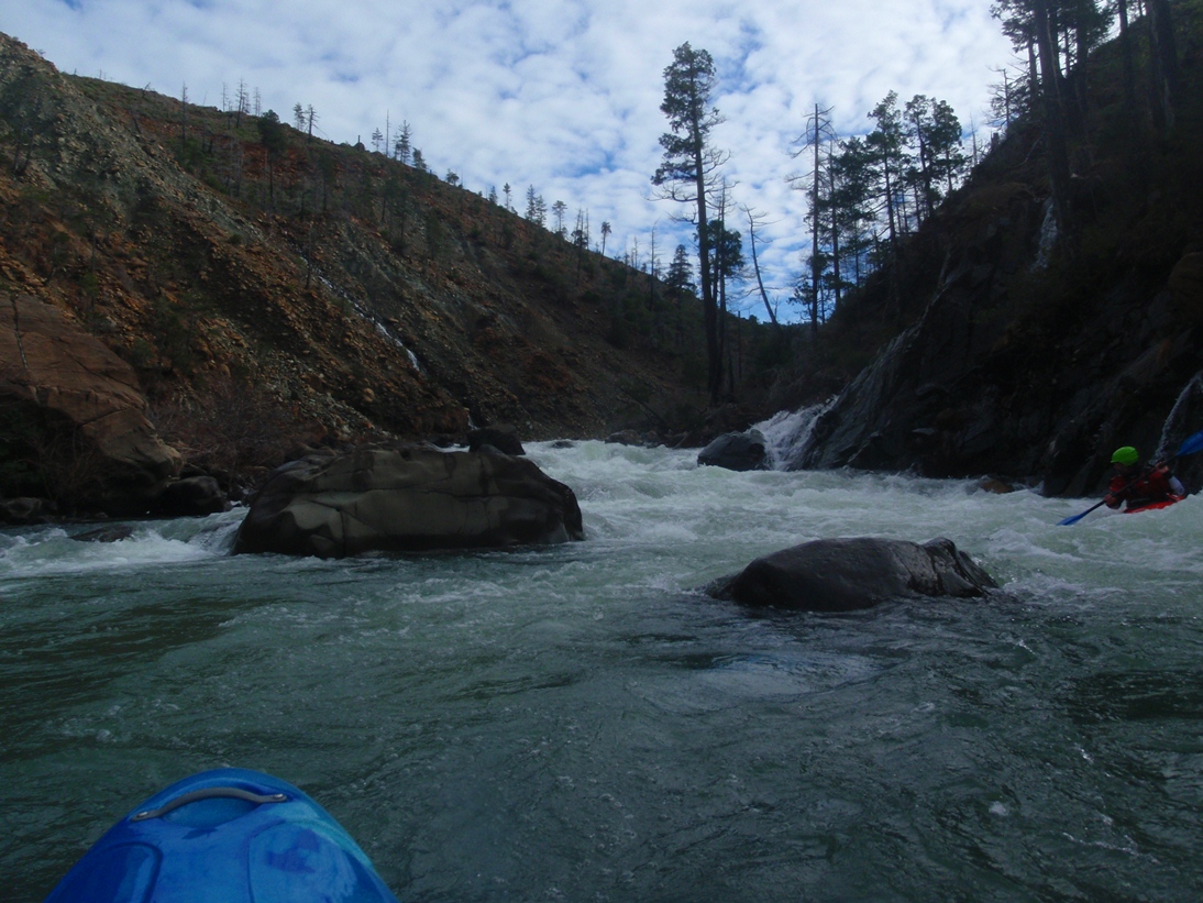
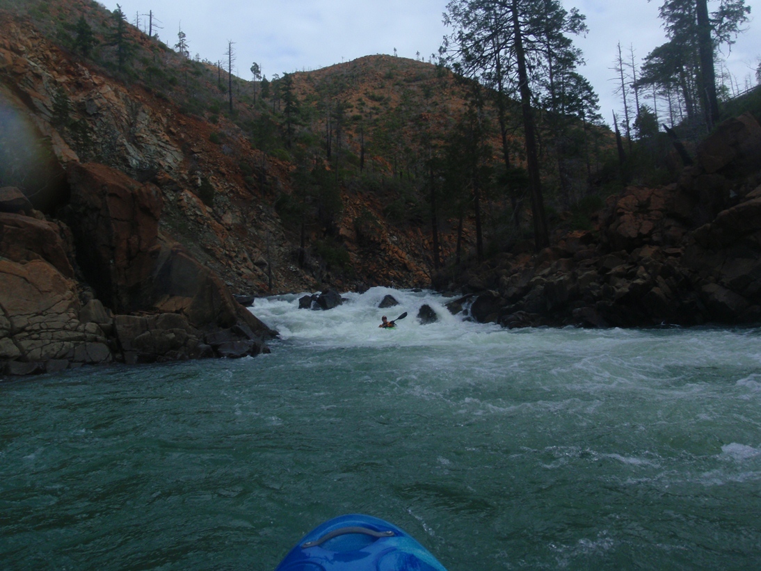
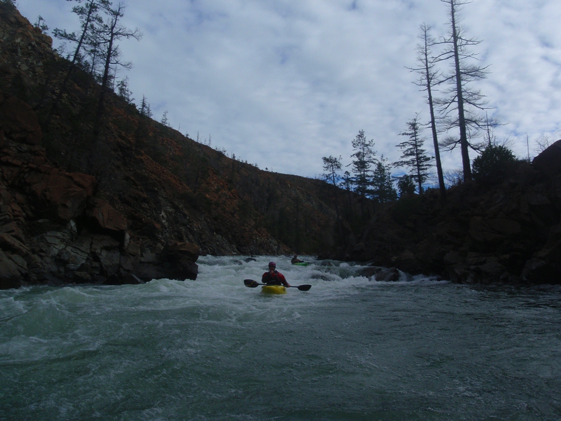
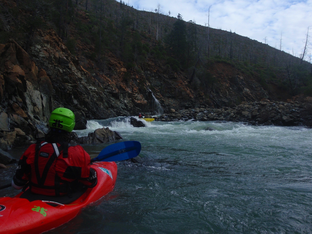
The creek itself is fun. The first 2.5 miles are mellow class II through burned out country. Although the river was absolutely clear of trees (2011), be wary of blind corners. Once the river tightens its belt, you are greeted with several fun class IV rapids and one or two that approach class IV+. Portaging would not be hard in here if you were so inclined. We estimated that we had about 450 cfs at the confluence of the North Fork and main stem of Diamond Creek and approaching 800-900 by the confluence with the North Fork of the Smith (running 3,700 cfs). I would say this is minimum for a fun time. It was plenty for the rapids to feel padded, but many rocks were just below the surface. Furthermore, no holes felt all that sticky. Lower would make the paddle into the fun section a pain in the butt.
So, the run was worth doing. I was surprised at how short the section of good rapids were though. I was also surprised at how long the drive took. We spent some 3 hours getting to put-in from Brad's house. That was with 30 minutes or so of getting lost... still a long shuttle. And as I said, the road was crap. If the shuttle was the same difficulty as the North Fork Smith, I would do Diamond Creek every time... however, it just adds more hassle that we wanted and as such I likely not be in too big of a hurry to return. If you do motivate, I think you will enjoy it but feel the same way about it afterwards.
Look for flows at Jedediah to be between 10-12,000 cfs. Though groups have certainly run it higher. I know of one group who ran it when the North Fork of the Smith alone had 10,000 cfs. I can imagine that it is perfectly runnable at those flows, but probably won't be that appealing to the class IV boaters who want to do this run. We had planned to do this run the day before but overnight rain sent the North Smith over 25k cfs (20+ feet) and we chickened out. The following day though with no rain, the river dropped in perfectly to have ~3,700 cfs (12-13 feet) on the gauge. In all, not a bad way to spend New Year's Eve 2011, with friends, on a river... in the middle of the wilderness. And that night we rewarded ourselves with a hotel room in Crescent City and the first proper shelter and shower of the road trip.
Mi 0.0:
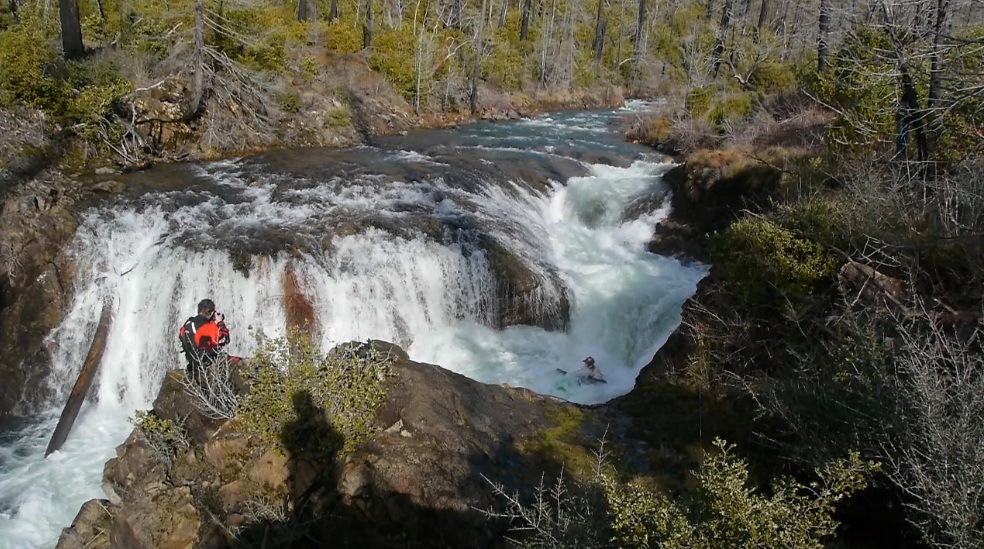
- North Fork Falls (V- to V). Some people will choose for their first strokes to be in this interesting falls. If the water is higher, you could boof the right side. At our flows only the left line went. Three holes and a bunch of scrappy unfriendly rock were looked uninviting enough for me and I walked 100 yards down river and put on Diamond Creek proper just above the confluence with the North Fork of Diamond Creek.
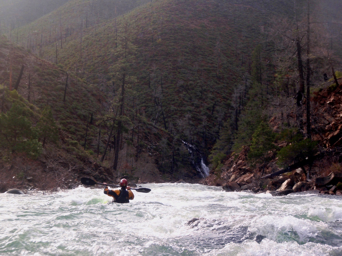
- Mellow class II-III rapids begin immediately and continue until a straight away with a waterfall coming in on the left with an obvious tightening of the river bed. This is also where the road departs to the left.
- Rapids begin, though only two or three really stick out in my mind. All were read and run.
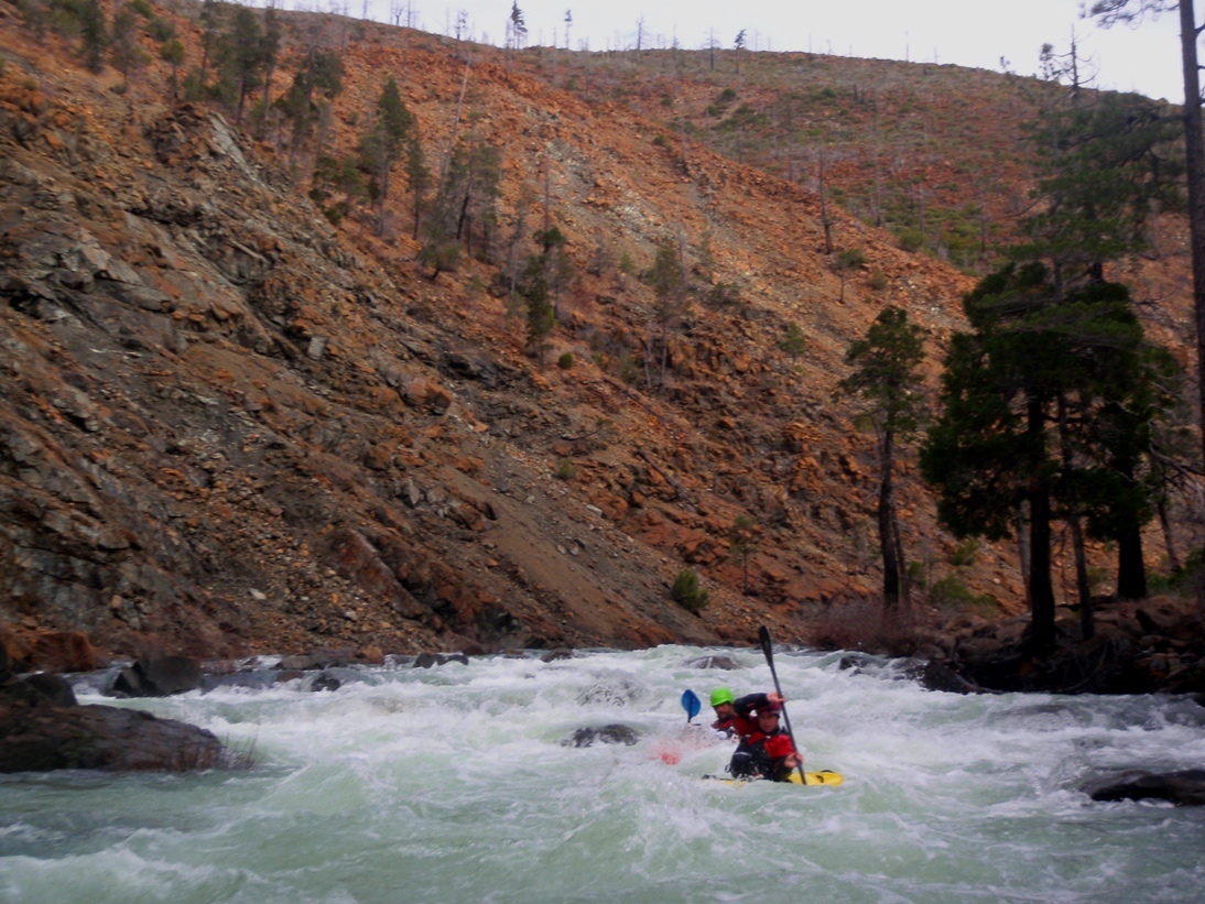
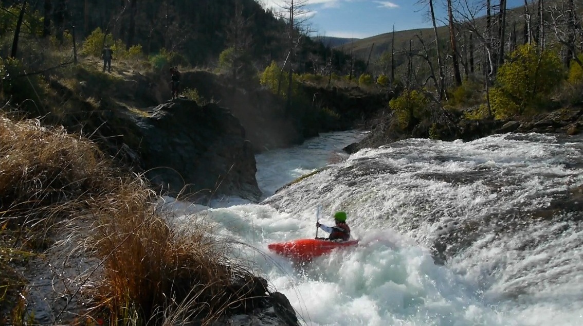
Two Falls (IV to IV+). After a few class III+ rapids you will come to a spot where small falls come down on both sides of the river. We ran down the right, there are a few good sized holes near the bottom that we boofed through.
Grove Tube Rapid (IV+). After about a mile (I think), there was a the biggest rapid on the run. It is tight and blind from above. We entered left and swung around into the current going through a grove tube in the middle of the river, to the right of the big boulder spraying a sheet of water across the channel. This was scary going into not knowing how clean it was, but Kyle had just made it through so I followed in suit. One in our group didn't have faith and had time to react so he went to the left around the tube.
A short distance of boogie leads to the confluence with the North Fork and 10 miles of fun class IV big water!
Take-out: In Gasquet, a quarter mile east She She's Café, turn left on Middle Fork Gasquet Rd. Cross the Middle Fork, and park on the left near the gate.
Put-in: First off, call Brad to drive your shuttle... 707-457-3365, he drives the North Fork Shuttles as well for a very reasonable price. This shuttle is long, and driving in again at the end of the day would suck. Here is the gist of it though, drive up Highway 199 to Patrick's Creek. Go up Patrick's Creek Rd (dirt). In 3.1 miles turn right to stay on Rd 316. In another 5.8 miles you will come to a large 3 way intersection of dirt roads, stay center on 316. In 2.6 miles turn left on a dirt road which climbs steeply for a mile up to a well maintained gravel road, turn left, this is rd 4402 (unmarked). Follow this for 2.6 miles around several hairpin turns up and over a small ridge. Near the bottom, turn left on a very small and shitty looking road. I don't recall having to make any turns, but the map shows that after 3.7 miles we turned left to stay on the road for another 2.7 miles. I think it was all one road. When in doubt, head down river! The last roads (3.7+2.7) are really crappy and I would recommend something better than a Highlander or Subaru for this one.
View Diamond Creek in a larger map
HTML Comment Box is loading comments...