
The Falls Segment
| Section | Sub-section | Miles | Elevation Gain East to West (ft) |
Elevation Gain West to East (ft) |
GPX File (Right click, save as) | AllTrails Link |
| Stinging Fork | Full Section | 6.7 | 1,650 | 740 | Link | Page |
| Piney River to Base of Stinging Fork Falls | 5.5 | 1275 | 774 | Link | Page | |
| Stinging Fork Falls | 1.2 | 385 | 35 | Link | Page | |
| Hinch Mountain | Full Section | 17.8 | 4,000 | 4,330 | Link | Page |
| Hinch Mountain (Stinging Fork Falls to Pond Cove Creek) | 11.1 | 2,750 | 2,160 | Link | Page | |
| Hinch Mountain (Pond Cove Creek Campsite to Head of Sequatchie) | 6.7 | 1,250 | 2,170 | Link | Page | |
| Hinch Mountain (Connector to Brady Mountain) | 0.9 | 260 | 180 | Link | Page |
Stinging Fork Falls: Piney River to Stinging Fork Falls Trailhead
- Stars: ★ ★ ☆
Piney River to Base of Stinging Fork Falls
- Stars: ★ ★ ☆
- Access: The parking along the Piney River is plentiful as there is a dayuse area there, plus the Cumberland Trail going off the opposite direction for the Piney River segment. When you park, walk 100 yards on the road, crossing the bridge over Piney River and look to your right for the gated dirt road. This is private property for 1.5 miles to where the trail obviously forks to the left. (Location: 35.71423, -84.88028).
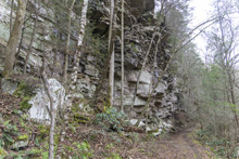
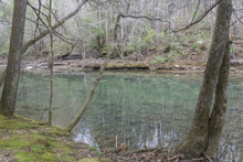
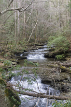
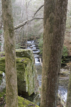
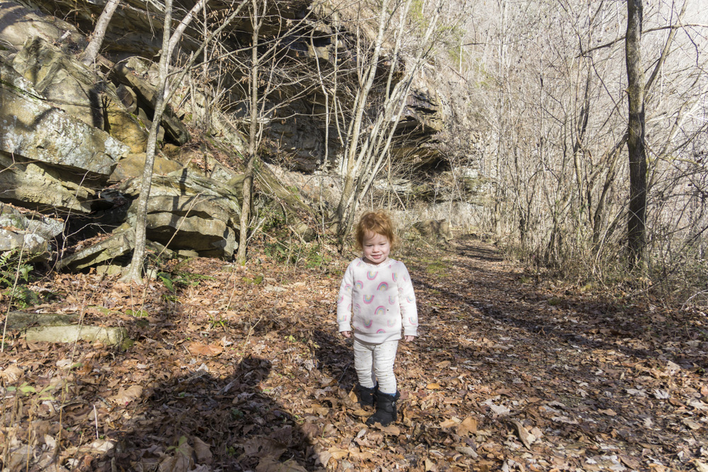
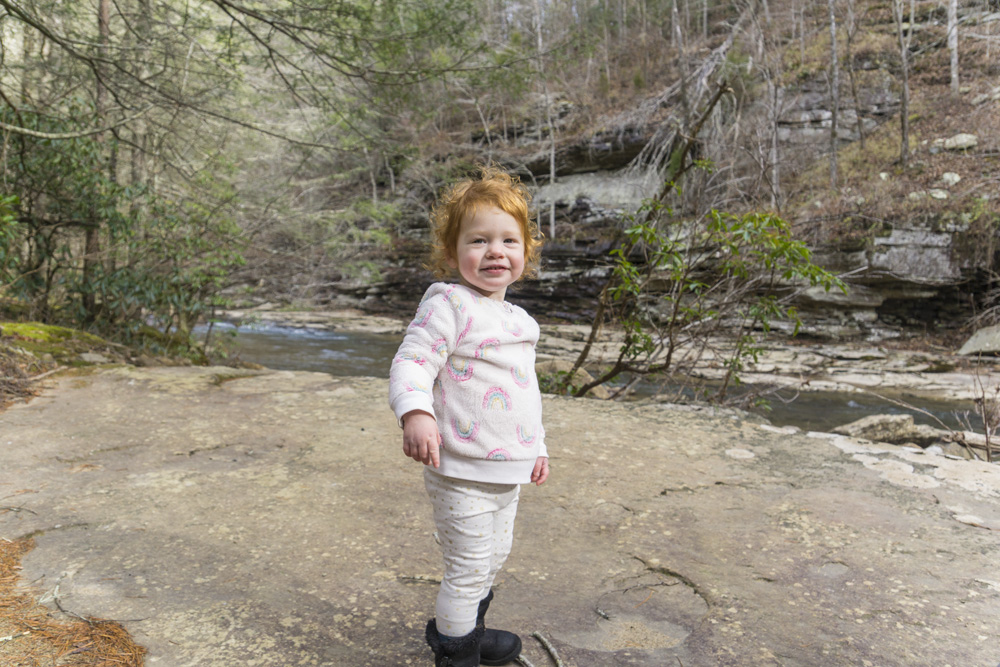
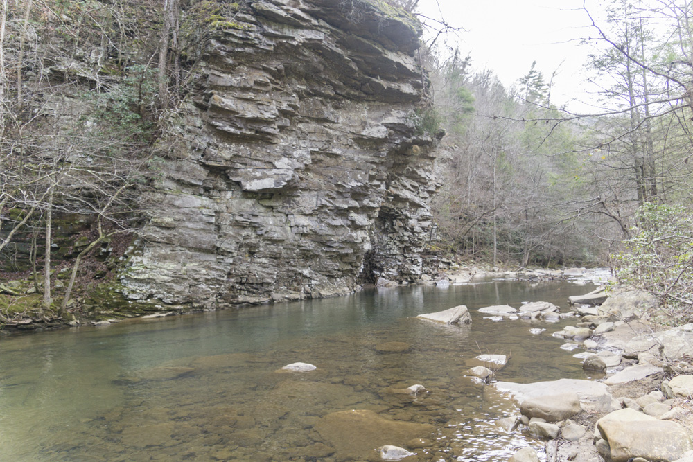
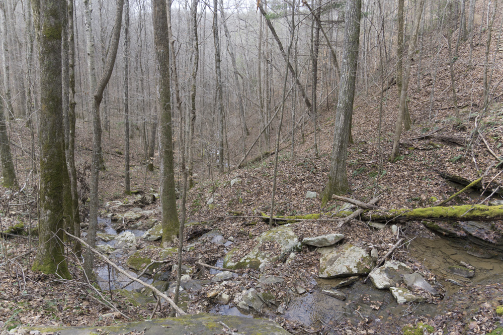
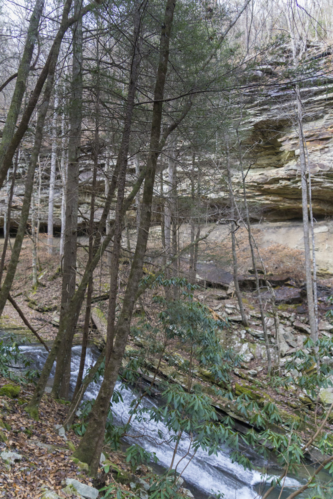
- Description: The first 1.5 miles is on a dirt road that is private property that has been granted an easement for hikers. Hiking along Soak Creek, there are many nice swim spots after the first mile. After a nice big wall, the trail departs the dirt road, obviously climbing up to the left. This first climb seems a bit undeeded as you work to crest the ridge above you but no view is afforded before you drop right back down to the creek. More swim holes welcome you as you work upriver before joining an old road bed which is well marked. Eventually, you bend sharply left and begin climbing again, and again it is a lot of work for not a lot of reward. You cross a major stream and drop back down to river level crossing another major stream. Now you are hiking up Little Soak Creek also known as Stinging Fork. You stay at river level from here on, enjoying nice views of the creeks rapids and falls. At mile 5.5 you will get to the spur that goes to the actual base of the falls. Go right to the base, left to the Stinging Fork trailhead (see the next description), or back the 5.5 miles back to your car. For me, the nicest part of the hike would be doing just 1 mile up Soak and swimming, and the very end as you approached the falls, which would be much easier from the other trailhead. So I just can't rate this section high.


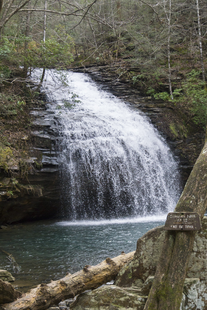
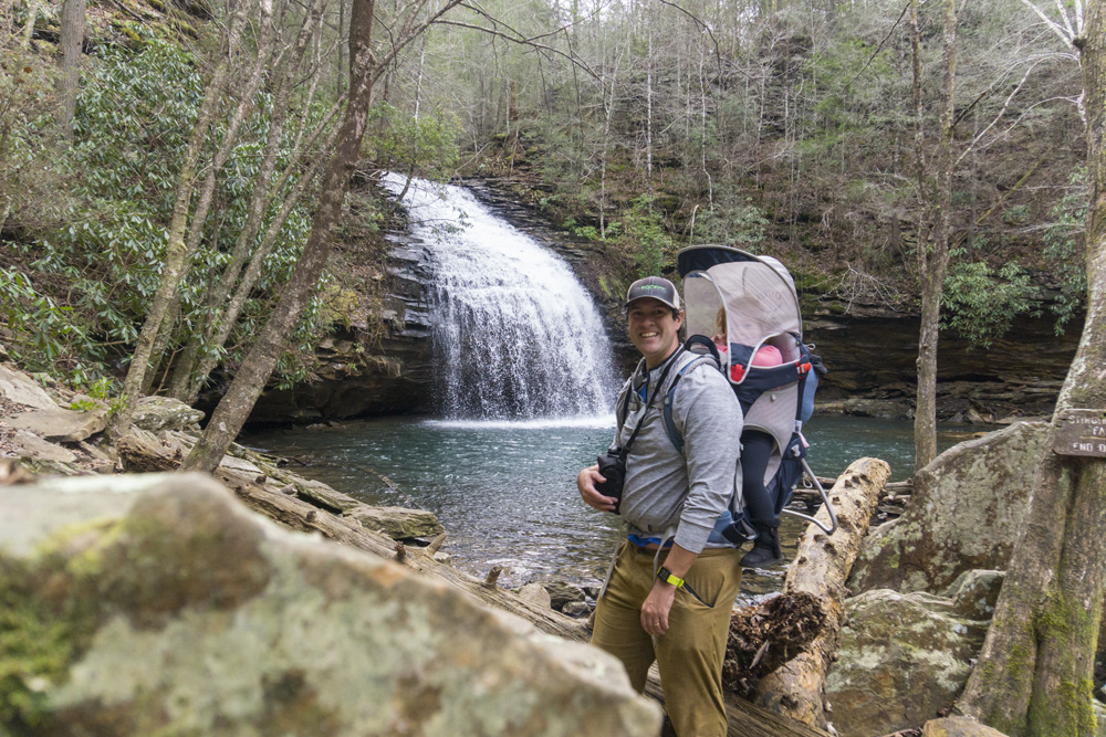
Stinging Fork Falls
- Stars: ★ ★ ★
- Access: On top of Waldens Ridge there is ample parking at the trailhead which as of 2020 is sadly directly next to a well marked "State Natural Area" which has been clear cut. But alas, that is where the easy to find trailhead is. (Location: 35.71262, -84.92856).
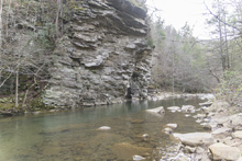
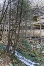
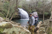
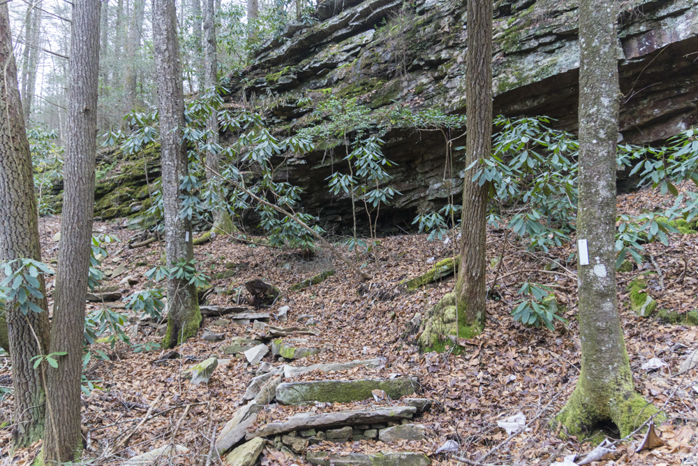
- Description: It is most common that this section is done as an out and back to see the falls as it is a short, though demanding hike, that is more accesible than hiking the entire Piney River to Stinging Fork full section. From the trailhead, after crossing the edge of the clearcut to the edge of the canyon, you begin to descend steeply, sometimes using wood stair steps. The hike is short at just 1.2 miles one-way, but in the last 0.6 miles you drop nearly 400' of elevation. Which isn't a problem going down, but gets the heart going coming back up. The Falls is the main thing on this trail. When you get to the river level, turn left to do the short spur to the base of the falls. The trail there is really rocky so take care. Turning right instead, leads you downriver towards Piney River. Even if you don't intend to hike all the way to the Piney River, hiking the first 0.5 miles downriver will present you with several pleasant river canyon views.

- Stars: ★ ★ ☆


Hinch Mountain: Stinging Fork Falls Trailhead to Head of Sequatchie Trailhead
- Stars: ★ ★ ☆
Stinging Fork Falls Trailhead to Pond Cove Creek Campsite
- Stars: ★ ★ ☆
- Access: On top of Waldens Ridge there is ample parking at the trailhead which as of 2020 is sadly directly next to a well marked "State Natural Area" which has been clear cut. But alas, that is where the easy to find trailhead is. In 2026 the clear cut had doubled in size. Sigh. (Location: 35.71262, -84.92856). On the other side, the Head of Sequatchie is the access (unless you are using the connector described below). It is just off of Old State Highway 28. There is difficulty in this access though in that it is gated except 8am-4pm central time. And overnight parking is not allowed. We parked just outside of the park, along Old Highway 28 and I am told by others that the rangers were not pleased, quite annoyed, and were considering calling the sheriff to tow or ticket our car, despite it being completely off the road, a public road, outside of the state park boundary, and in no way marked as "no parking." So, I guess the park wants you to HAVE to get a shuttle drive for you to hike Hinch Mountain since that is not possible to do in 7.5 hrs for the average hiker. (Location: 35.7932159, -85.0081989).
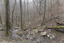
- Description: Note, the alltrails mileage is longer than my watch's mileage for the trip. I used the alltrails mileage so I could aligned waypoints. From the Stinging Fork Falls Trailhead, head down the dirt road 0.2 miles to the well marked junction where the right goes to Stinging Fork Falls and the Piney River trailhead and the left takes you towards Head of Sequatchie. The path opens up to a road again, follow the sides for Cumberland Trail. At 0.4 miles, look for the smaller sign marking where you steeply drop down off the road onto the trail. At 0.5 miles you cross Stinging Fork (mislabled on google maps as of this writing, as Little Soak Creek). You then gently climb to the ridge and follow the ridge line through new growth pine forest. At mile 2.2 you begin to descend steeply to Little Soak Creek and start the few miles that is my favorite of this section of trail. There are several creek crossings without bridges where waterproof shoes and hiking poles will be beneficial if it has rained at all recently. At mile 3.9 you ascend steeply back up to the ridge. Once up top there was an old creek wash that had a trail leading out of it, that can be used to loop back to the car as it pops out just down the road from the trailhead according to maps. Instead, continue following the white blazes. The trail is gradually up hill as you now hike along the upper stretches of Stinging Fork Branch with wonderful creek views and many cascading waterfalls to be viewed. There are a few dirt road crossings that are easy to navigate, following the white blazes. You eventually climb and top out and quickly begin descending to Soak Creek, first you will come to Keaton Falls which is a pretty wet weather falls next to the trail. Quickly after, you cross Soak Creek (mi. 10.2) on a nice alumunum bridge, though watch your step as the deck is wood and quite slick. After crossing you once again have a climb, about 500', and begin a pretty non-descript section of trail before dropping down to Pond Cove Creek (mi. 12.5). This wood bridge is also quite slick if wet. On the otherside, the trail goes through a cool rock formation and then you will see yellow blazes heading up to the right to the campsite that can fit 3 small tents easily and has acccess to a seasonal creek. Due to the campsite's location and early morning rain, we hiked the trail in the opposite direction, so my pictures will be approaching each milestone from the opposite side, but I will order them to align with this description.


Stinging Fork Falls Trailhead to Pond Cove Creek
- Stars: ★ ★ ☆
- Access: The Head of Sequatchie is the access (unless you are using the connector described below). It is just off of Old State Highway 28. There is difficulty in this access though in that it is gated except 8am-4pm central time. And overnight parking is not allowed. We parked just outside of the park, along Old Highway 28 and I am told by others that the rangers were not pleased, quite annoyed, and were considering calling the sheriff to tow or ticket our car, despite it being completely off the road, a public road, outside of the state park boundary, and in no way marked as "no parking." So, I guess the park wants you to HAVE to get a shuttle drive for you to hike Hinch Mountain since that is not possible to do in 7.5 hrs for the average hiker. (Location: 35.7932159, -85.0081989).
- Description: Note, the alltrails mileage is longer than my watch's mileage for the trip. I used the alltrails mileage so I could aligned waypoints. On the upstream side of a cool rock formation, you will see yellow blazes heading up to the right to the campsite that can fit 3 small tents easily and has acccess to a seasonal creek. From the campsite, the trail is mostly flatish to a road crossing (mi. 14.2), then descends steeply to below a cliff line which you follow. At mile 17.2 there is a very well marked junction where the connector to the Brady Mountain section (part of the Grassy Cove Segment) connects. Just after, the trail begins to descend steeply down toward Head of Sequatchie, descending some 1,200'. At mile 19.0 you get to a junction for the Head of Sequatchie's Shelby Loop. Straight across is the Cumberland trail's connection to the valley. Due to the campsite's location and early morning rain, we hiked the trail in the opposite direction, so my pictures will be approaching each milestone from the opposite side, but I will order them to align with this description.


Hinch Mountain to Brady Mountain Connector
- Stars: ★ ☆ ☆
- Access: Access is a shoulder along the rough dirt Happy Top Rd (Location: 35.79244, -84.97612). We were able to make it from TN-68 in our minivan, but it was border line and I think anyone who is not accustomed to driving rough dirt roads may not feel comfortable in non-4-wheel drive cars. The Highlander had no problem whatsoever with the road when we undid out shuttle. The road looked to get worse as it continued up the hill towards Hinch Rd, so be aware if you come in from that side it may be worse. This trailhead isnt even really a planned trailhead, and now that the trail connects to the Head of Sequatchie, its just another spot where the trail crosses a dirt road. From the Trailhead you hike toward the Head of Sequatchie.
- Description: There really isn't a whole lot of reason to do this trail unless you plan to do section concurrently, connecting Brady Mountain with the bulk of Hinch Mountain. I say "bulk" because it prevents the need to climb (or descend) 1,200' of elevation from/to Head of Sequatchie. The trail basically follows, then crosses, to continue following the Hinch Mountain Rd to connect the two trails. From the Brady Mountain side, hike the short distance until you cross the road, continue to the 3 way, well marked intersection, of trails. Right to Head of Sequatchie, left to go to Stinging Fork Falls.
HTML Comment Box is loading comments... - Stars: ★ ★ ☆
Cumberland Trail - Home Page
A Wet State - Home Page - Stars: ★ ★ ☆


