
Conasauga River (Upper Upper)
| Stretch: | Hickory Creek Trailhead to Chicken Coop Gap |
| Difficulty: | Class IV (IV+) |
| Distance: | 3.15 miles (+7.4 miles on the "Upper") |
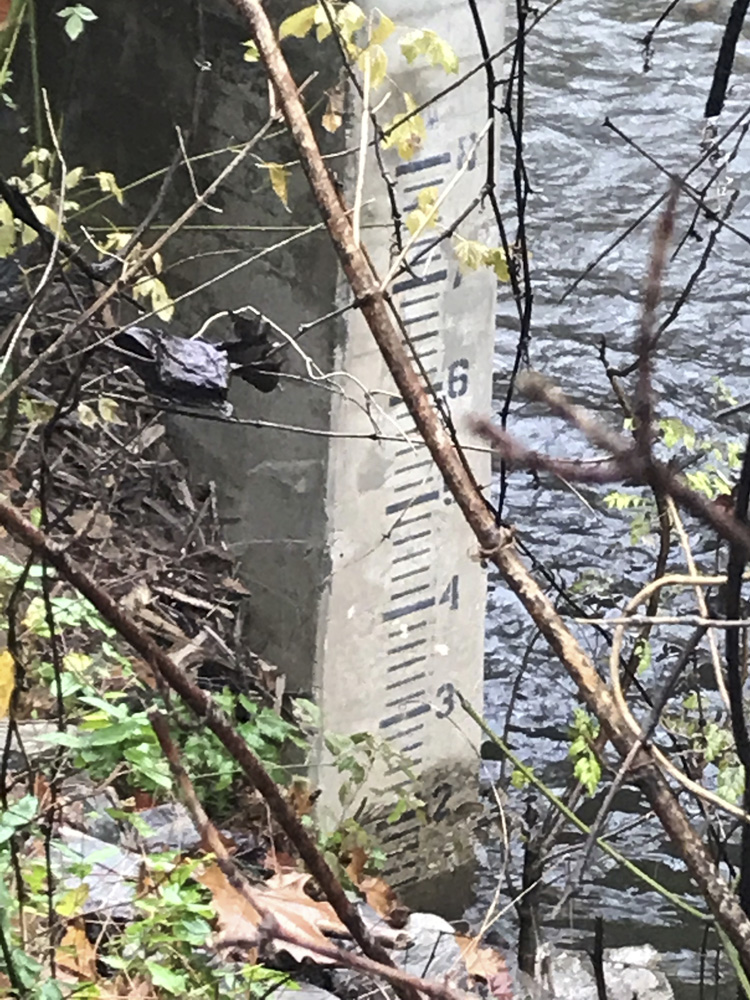
| Flows: | 10"+ to 24" on the bridge (we had 1,600 cfs and steady on the Holly Creek Gauge) . Check out American Whitewater's current Holly Creek flow gauge |
| Gradient: | 156 fpm average for 1.5 miles then 75 fpm to Chicken Coop Gap |
| Put-in: | Hickory Creek Trailhead (confluence of the Conasauga and Rough Creek) |
| Take-out: | Chicken Coop Gap (realistically, you will continue to Old Highway 2 through the Upper) |
| Shuttle: | 11.5 miles (30 minutes one way) or alternatively, 22.3 miles and 1 hour one way |
| Season: | Fall, Winter, and Spring from rain. |
| Written: | © 2018 |
| Featured in Video A Wet State #145 | |
Morning came, Diane and I didn't have to work that day, and the rivers were running. Well, some were anyways. It seemed to me that the tributaries of the Tellico may be at a good flow, and I hadn't done any of them. We tentatively started planning for that when Jim sent me a text about the Conasauga. I hadn't really looked that far south, but after doing some research agreed with his assessment and deemed it more likely than my original plan. So, we headed out!
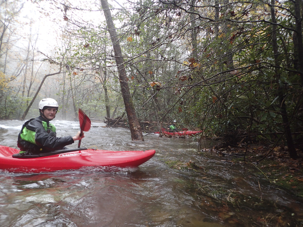
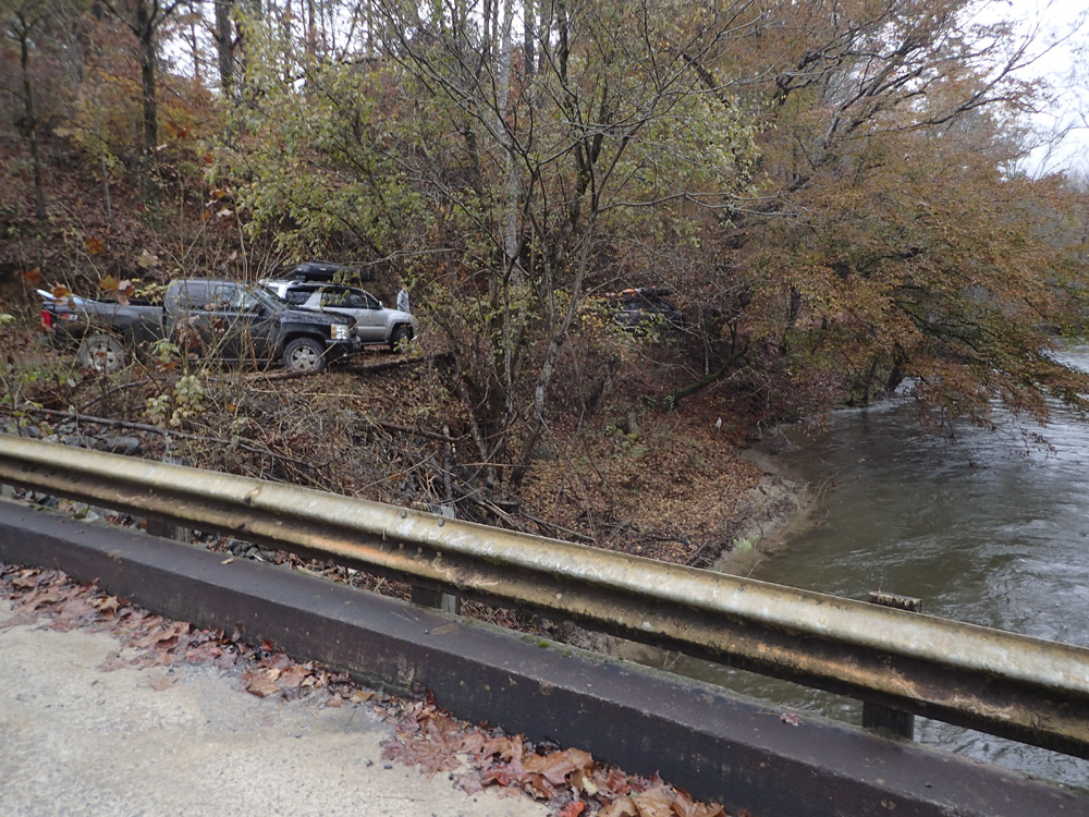
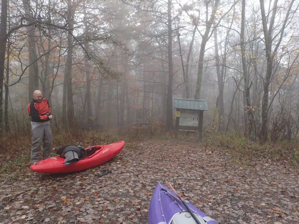
Joining me was Diane, newly returned Tennessee son , David Lew, Erik "Spacesuit" Hancock, and Lisa Ivester. Arriving at take-out, Diane and I were a few minutes ahead of everyone else, so we headed the extra 2 miles down to the bridge to check the gauge. Arriving there, we found great flow. We also ran into some local boaters who gave us the update that the upstream access should not be used any more as the landowners had expressed a disinterest in the kayakers being near their land. In an effort to keep the local boating community in the good graces of their constituents, we abided. So we headed back upriver to wait for David and the Erik/Lisa car to have them come down to the bridge. After changing and loading into one car, we headed back up towards put-in and quickly got to a new roadblock where a forest ranger informed us that the road was wet and therefore closed. We asked if there was another way to the top and they told us "no." A bit frustrated we cede that our 2 hour drive south was for not, and I begin to look up info for the nearby Holly Creek. While driving back to take-out to fetch our car we pass another group of local boaters who inform us that there is another way to the top, via the other side, via a roundabout path, and for us to follow them. Thank you guys for saving our day!
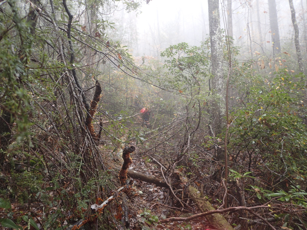
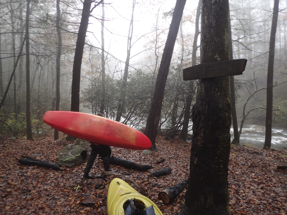
The day starts with a walk downhill about 1.5 miles. Our new friends informed of us a shortcut that is a straight downhill bushwhack to cut a big corner on the trail (decommissioned road). It was steep and slippery... in the future, I would just stay on the road honestly. The road eventually crosses Rough Creek. Almost immediately after you hit the confluence with the Conasauga. We put in here. Note, there is an Upper Upper Upper section that puts in one trail higher up and adds an additional few miles of class IV.
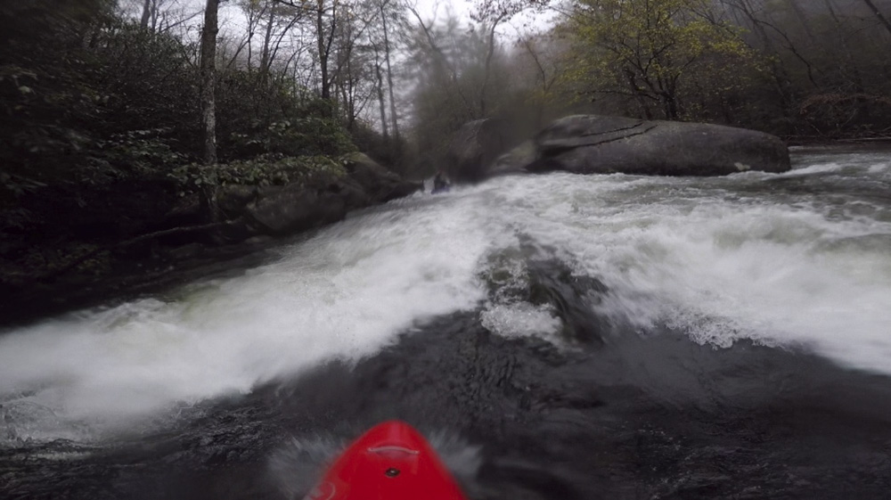
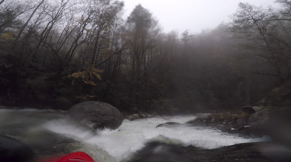
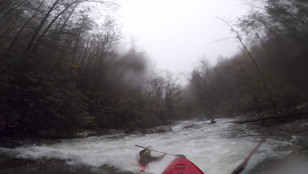
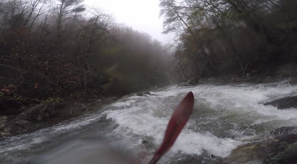
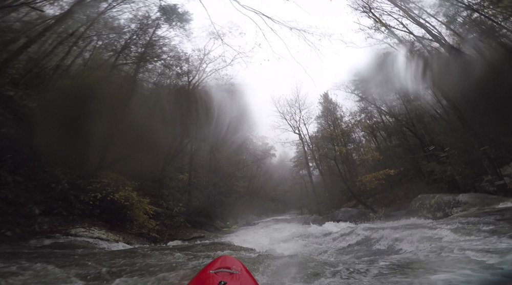
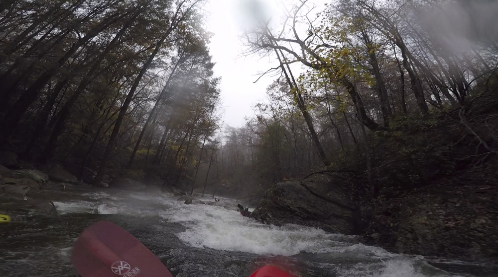
Once on the water, the rapids start immediately with the hardest section up first. Chernobyl is the first rapid which appears on the first bend. Below, the river keeps coming for the first mile before it takes a step back and becomes more straightforward. Keep an eye out for Mixing Bowl which is a sloping ledge with a powerful hole. A delayed boof is key there for a clean line down the left. Fun rapids continue down to where the river begins to mellow and the Chicken Coop Gap put-in is located. This access is a scramble down from the road, so it is really not a great option for take-out and should only be used as such in the case of emergency. So, plan on paddling all the way down through the Lower section of the Upper.
I thought that putting in at the top was super worthwhile as the section doubled the length of the run and packed some great rapids. It does double the length of the mellow section at the start of the regular Upper though, so don't plan on all of the miles being packed full of action. But still, you likely drove a long ways to get there, so you might as well make it a full days worth of kayaking and hiking. For the record, we had 1.2' on the take-out bridge gauge. I thought that this was a great flow and not low, maybe in the medium/low range.
Mi 0.05:
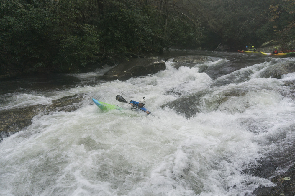
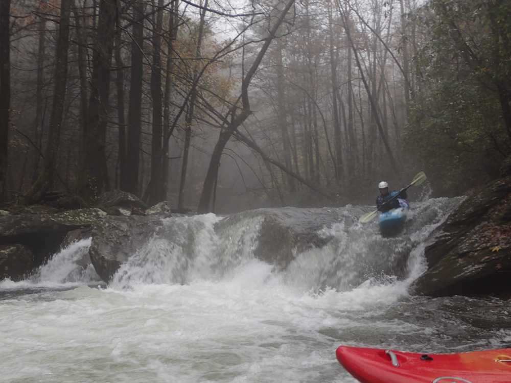
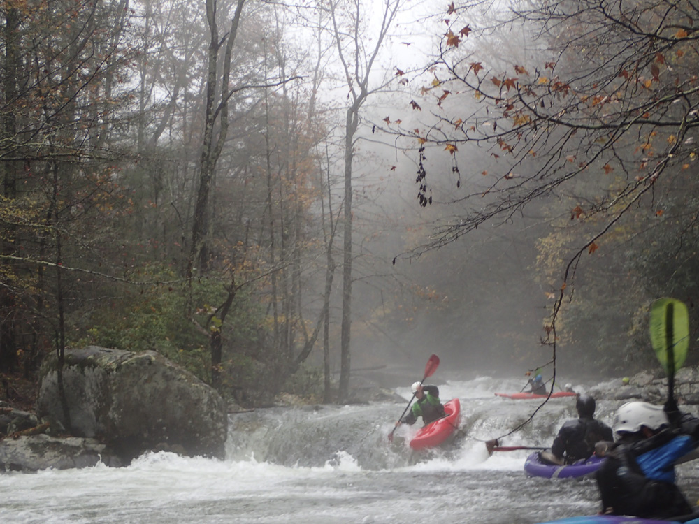
- Chernobyl (IV to IV+). The first rapid on the run is the biggest. Scout left or right, if you just want a glimpse the left is certainly easiest. To see the bottom in detail, the right is best. The rapid starts with a slide, you want to be right of center, but avoid a kicker rock on the right. This will slide down and through a decent hole. The river then bends right and goes over a ledge which is backed up by another ledge. Right of center or the harder to achieve far right are the preferred options for the top ledge, the bottom is where ever you end up.
Ledges (IV). 100 yards downstream is a rapid that sorta of sneaks up on you. There is an eddy at the top on the right. Or you can just run down through the punchy ledges generally left of center. Mind the left wall half way down which is sorta undercut.
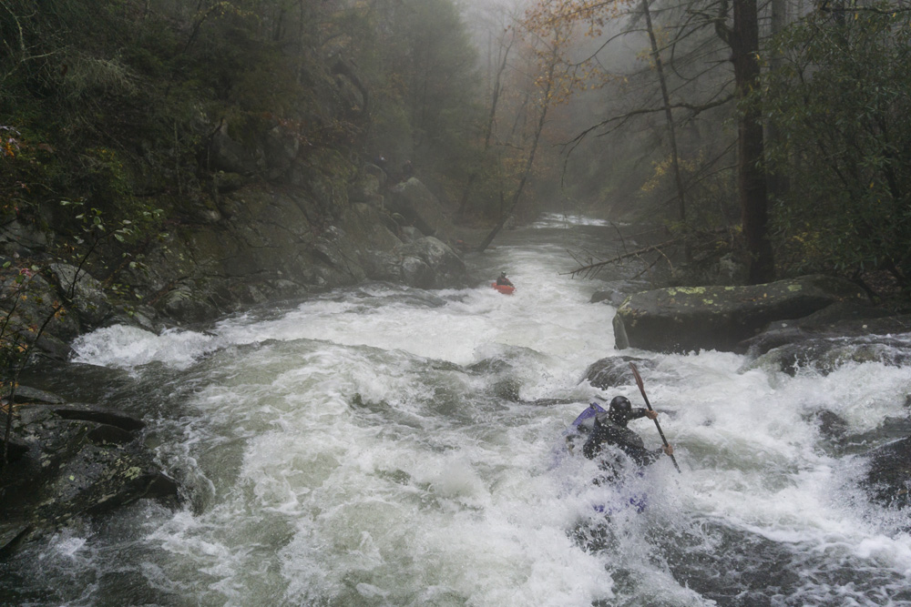
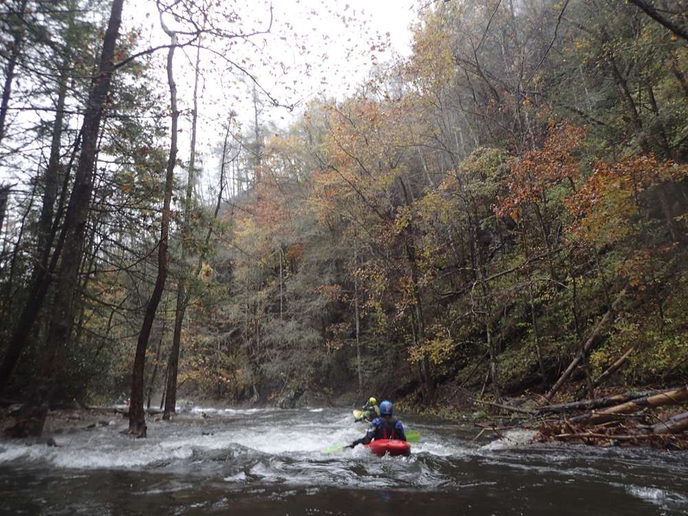
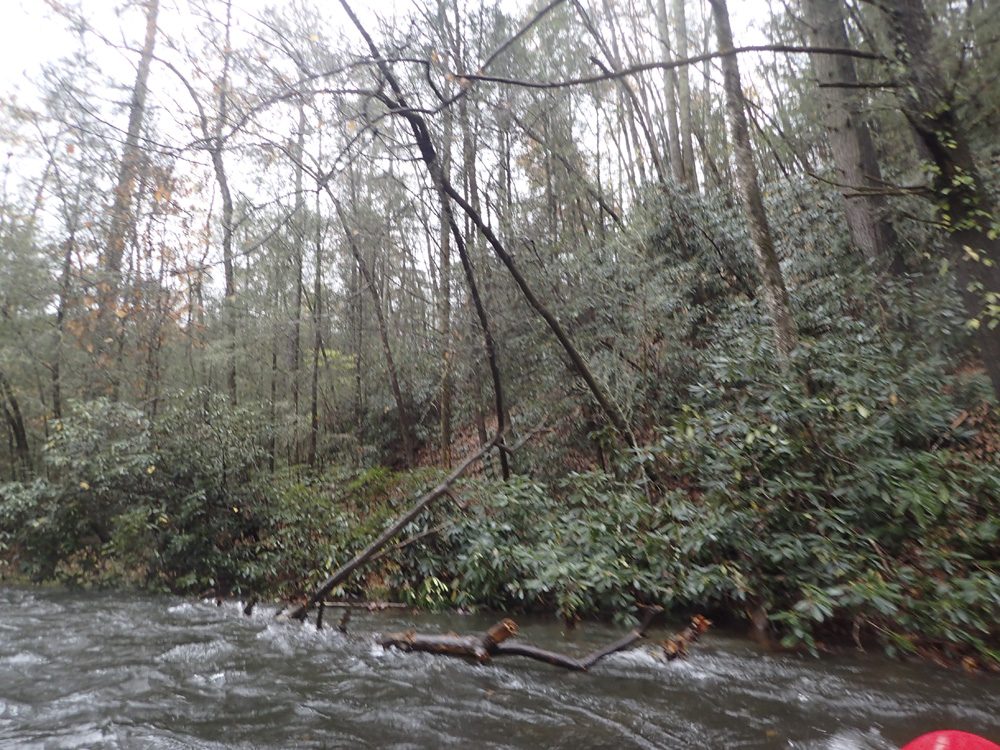
Boogie (III). Things ease up for a bit... Stay on your toes for wood, we did sneak into a small offshoot channel in one spot to avoid some wood.
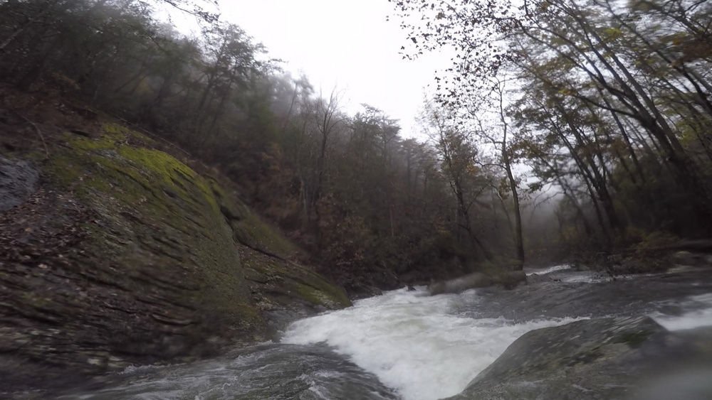
- Double Drop (IV to IV+). Locals had a different name for this, but it has slipped my mind at this time. You can see the move from the eddy at the lip on the right. The river splits around large midstream boulders, the line is down the right, cutting back left behind the boulders. This rapid then continues as slides for the next 100 yards. I imagine at higher flows this one can pack more of a punch, but at normal flows I would say it was just a big class IV.
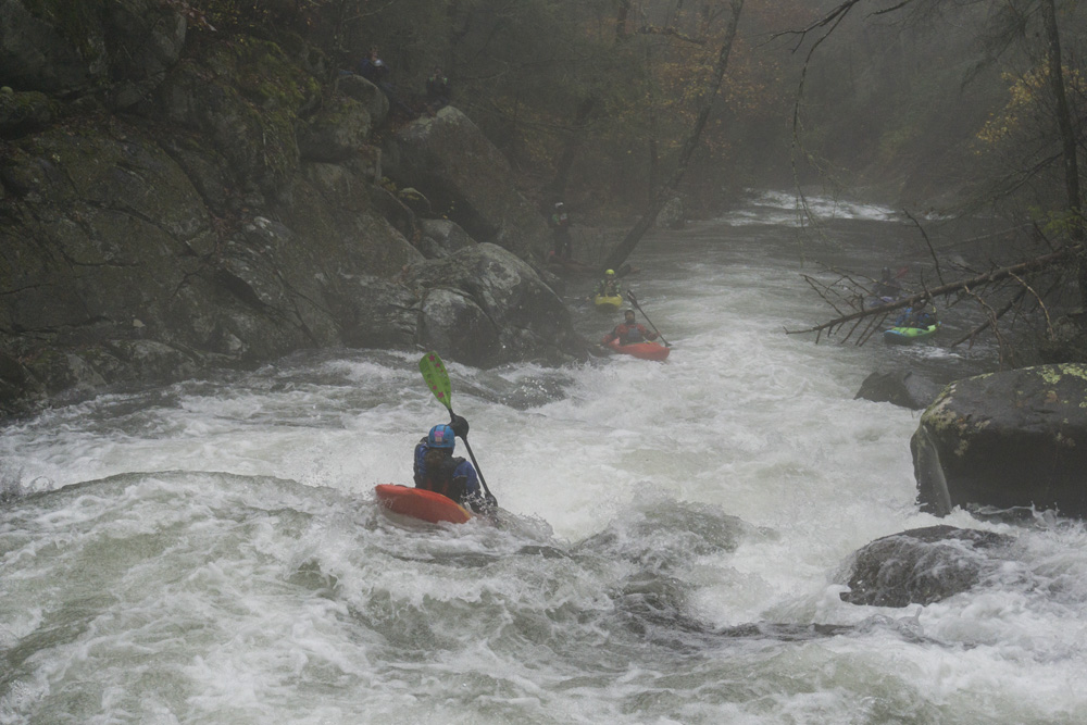
- Blind Hole (III+ to IV). This one probably has a real name. We had to wheel chair around a tree at the lip. Then the river drops down sliding drops into holes a few tiers tall. As you near the bottom, the river bends right into a blind small slide. Far left was mellow, middle packed a good size hole, though a few hit it and powered through.
Boogie (III). Boogie leads directly to the lip of Mixing Bowl.
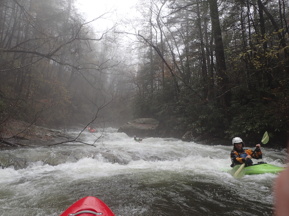
- Mixing Bowl (IV). A horizon line that should be run down the left. It is a slopping drop that necessitates a delayed boof. I imagine people get worked here, but I still can't agree with AW's rating of it as a IV+. I say it is just IV. And will feel like a class III if you know how to delay boof.
- Slide Section (III to IV-). You will hit a nice section of slides and small ledge holes. They are read and run.
Shoulder Boof (IV-). In the middle of the Slide Section is a steeper move, you will see a bulge in the middle of the river, you want to shoulder boof the right side of the hump. Going further right lands on some rocks. Immediately below is a bit of a sticky ledge that you boof down the center.
- Pinch (III to III+). A boogie rapid suddenly comes to some large boulders with a tight constriction along the right wall. That is the cleanest line, just point straight and carry speed into it to avoid broaching.
Boogie (II). Things ease out for the remainder of the run down to the Chicken Coop Gap "access."
- Chicken Coop Gap river access point is a super non-descript slope that looks like it would be a nightmare to go down... let alone up. So, most likely, you will continue through the Upper
Take-out: From the town of Cisco, GA, on highway 411, take Old Highway 2 east. It quickly turns to dirt, stay on the main road. Follow it for 7.1 miles to the bridge over the river. The gauge is on the upstream, river left side. This is the take-out for the "Upper" section, as getting out at Chicken Coop Gap is highly unlikely.
Put-in: Go back towards Cisco, going 4.0 miles. Turn left onto W Cow Pen Rd. Climb for 7.5 miles. The trail is obvious from the parking area, it is an old road grade that then drops down to the river over about 1.5 miles. There is a cut off that cuts the corner on one spot, but I honestly am not sure it is worth the effort. It is where the river cuts back up Rough Creek and goes straight down the hillside to where the road cuts back. Near the end, cross Rough Creek and then 100 yards later you get to the confluence.
Alternate Route to Put-in: Our day, the road was closed due to mud. So we took a longer route, following locals. We went back out to Cisco and Highway 411. We then went south for 6 miles. Turn left onto Grassy Street and then after the train tracks, turn right onto Crandall Ellijay. After just 500 feet, turn left onto Mill Creek Rd. Follow this up Mill Creek (runnable), for 8.6 miles. You will come up to where Cow Pen Road comes in, go right and get to the trailhead in 100 yards or so. This route takes much longer, but the road is in better shape apparently and doesn't get closed as often.
HTML Comment Box is loading comments...