
Cispus River (Upper Upper)
| Stretch: | Adams Fork Campground to Road 23 |
| Difficulty: | Class IV+ to V... with a mandatory class V with a big lead-in |
| Distance: | 5.2 miles |
| Flows: | 400 cfs to 800 cfs (season dependent, summer flows ~550 is medium, in winter rain it can be higher flow for medium). Current AWA gauge |
| Gradient: | 125 fpm average (153 fpm for the first 3.2 miles) |
| Put-in: | Adams Fork Campground on FS 56 off of FS 21. |
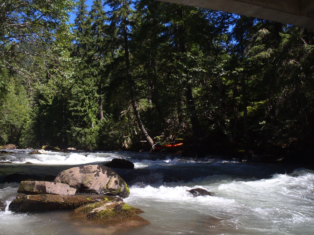
| Take-out: | FS 23 bridge/ |
| Shuttle: | 5.7 miles (15 minutes, paved or good dirt road) |
| Season: | Winter from rain or late summer |
| Written: | © 2013 |
| Featured in Videos A Wet State #78, Todd Wells' High Water and in A Wet State's contribution to World Kayak's Video Guide | |
Washington and BC 2013 Day 2:
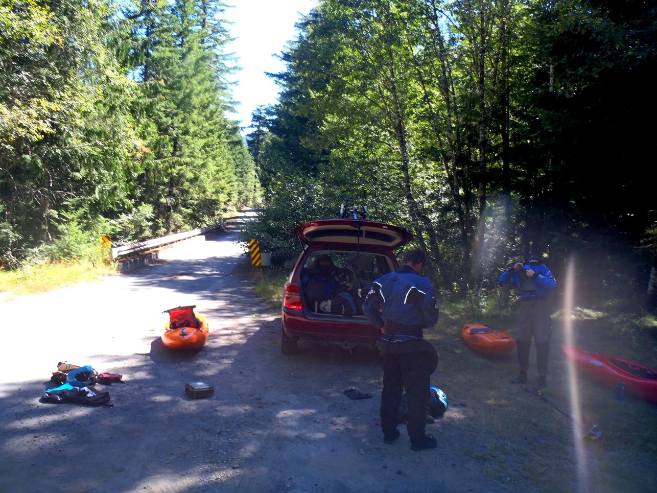
After a nice night at a friends in White Salmon, we made the 2 hour drive to the Upper Upper Cispus. This is a river that I have wanted to do for several years, since a friend of mine first mentioned it as one of his goals for a Washington road trip.
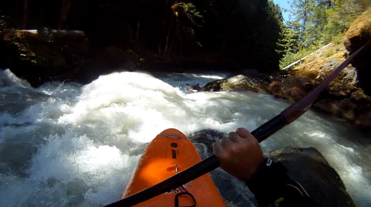
The river itself is interesting. Some guides call it class V+, others class V. As is the theme on this road trip, we had low water... 480 cfs of so in August. We found the river to be mostly class IV+ at this flow. With the exception perhaps of the rapid immediately above Behemoth, Behemoth, and the rapid immediately below. The one above I would give a V- rating, with an added step due to the fact that if you were to swim, your boat would certainly run Behemoth without you. The rapid below is also maybe V- just due to multiple moves and dangerous rocks. The main reason though why I would not take anyone other than class V boaters in here is Behemoth itself. You need to have control entering and boofing the drop. Boof to far left and you run the risk of getting recirculated behind the falls. Plug and run the risk of a skirt implosion. Additionally, the hole below can become very mean at high flows... requiring you to boof left in order to exit left. In total, someone who is not used to running tall drops may be more prone to making a mistake here and requiring a very long drawn out rescue. As it was though, for our group I thought Behemoth was great. Nothing like standing at the top of a must run falls to get your heart going. Especially as one in your team knocks your boat of its precarious perch at the lip of the falls only to be saved by the third member sprawling out on the rock slab to dive after it and almost sliding into the river (and the drop) themselves. Man did I appreciate that. Being without a boat would have sucked!
Other than that, I thought the run was fun. I think the low flow we had was good for figuring it out ourselves, plenty of eddies and time to make moves. However in the future I would want more water to pad out the boulder gardens. Many of the rapids were boulder piles with clean lines though to get to the clean line, you occasionally had to push through some shallow mank. Wood was also an every present danger, something those of us from California are not accustomed to. Luckily, most of it was not in play, though I imagine that can change year to year.
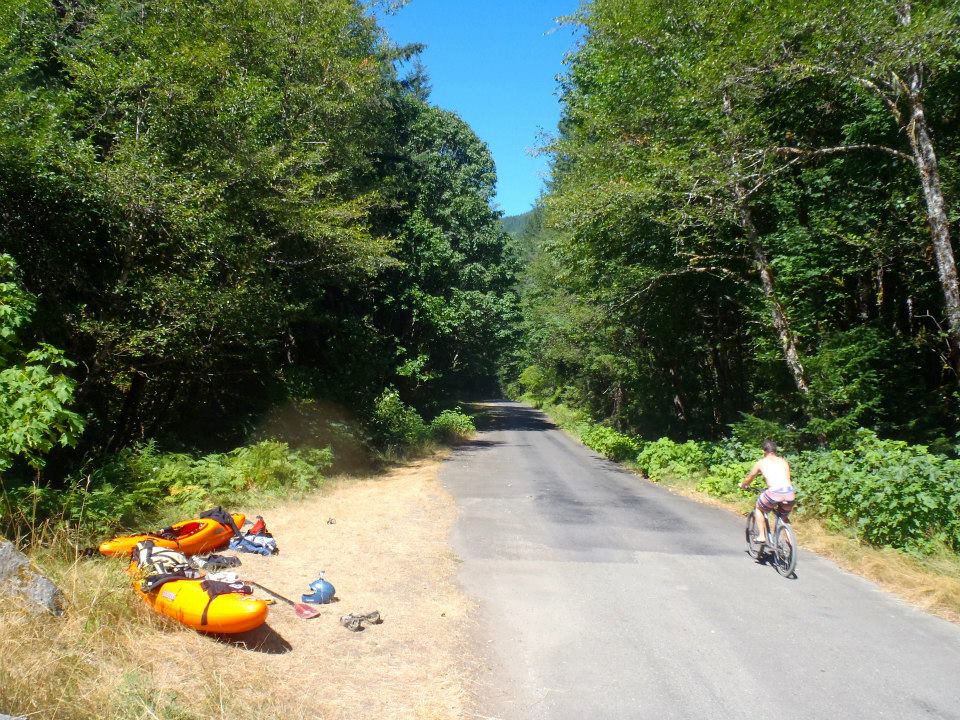
After a great day on the water, Darin biked the shuttle for us and we set off to crash at a friend's in Seattle to further break up the drive north. And as that day ended, we slept eagerly awaiting for our BC leg of the trip to begin.
Also check out OregonKayaking.net for the final word on all Oregon and Washington boating...
Mi 0.0:
- First Falls (IV+). Around the first corner, hop out on the left to scout the first falls. We ran down the far right of the falls. It was more of a non-vertical falls then a free fall and stood about 10 feet tall. Immediately below is a junky run out that we ran down the far left.
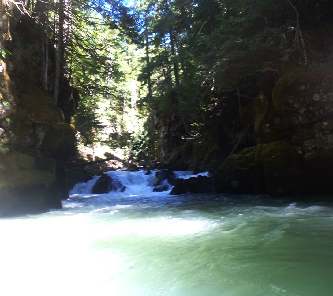
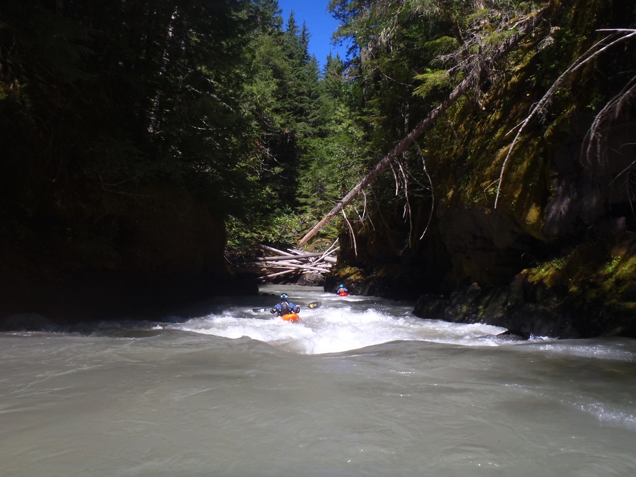
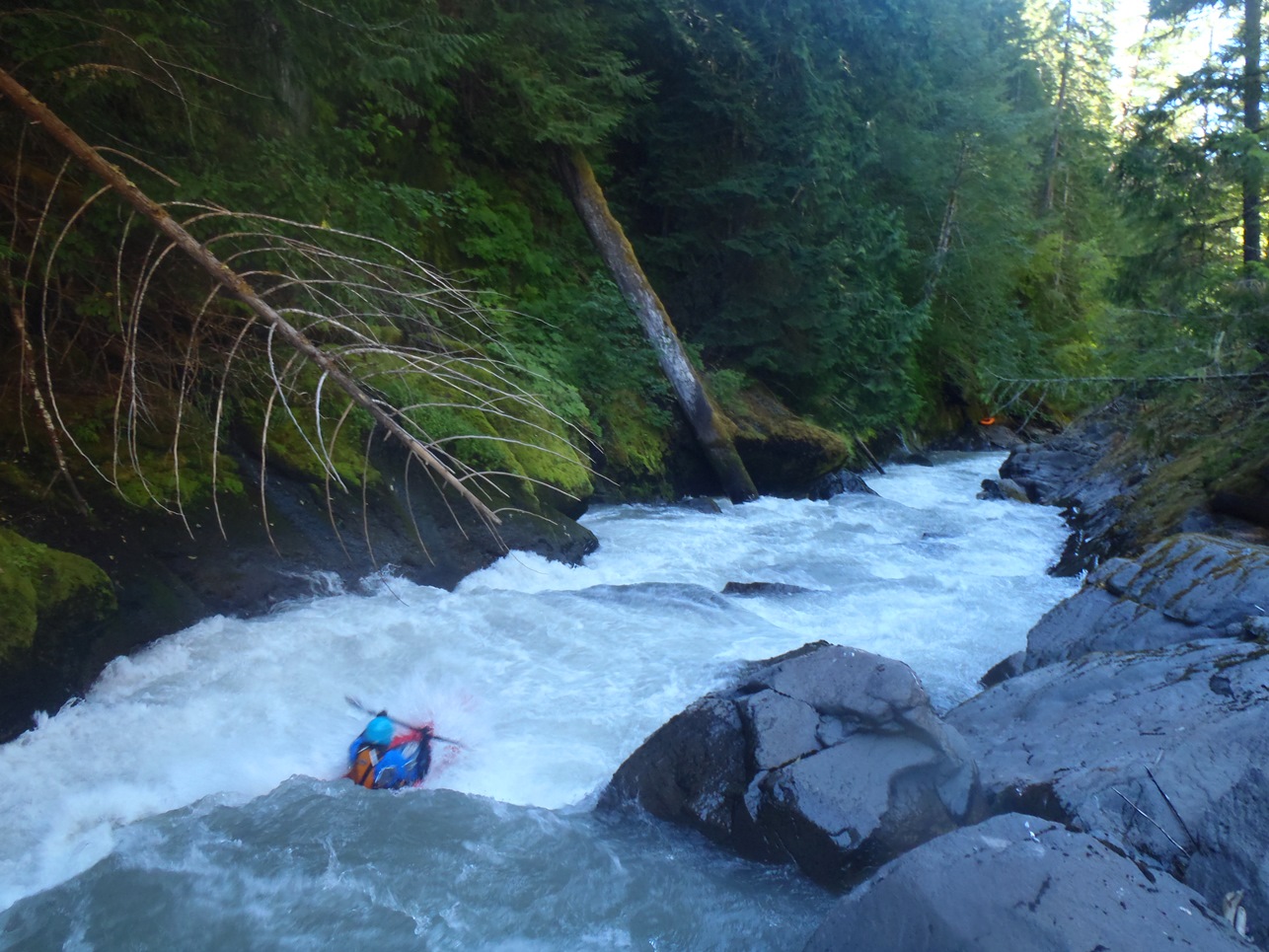
Boogie (IV to IV+). The first mile and a half is boogie with a few stand-out moves. We found the greatest challenge was finding a clean line at the low water, that with the plethora of wood in the river we found ourselves on our toes, but able to boat scout our way down river.
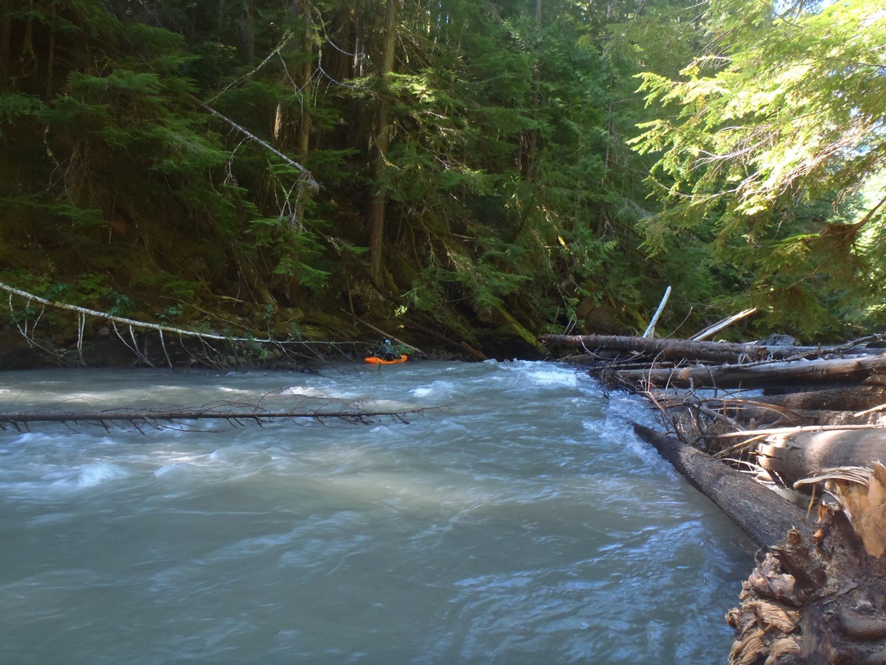
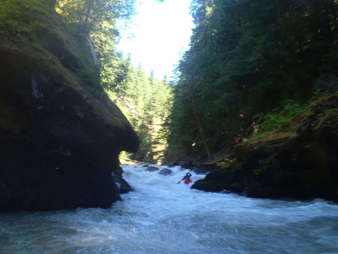
- Sweet Boof (IV+). The first rapid that signaled getting to the good section was on a right bend. The top was a boulder choke. I recognized it from above, but a log blocked the boat scout eddy. We ended up bashing our way down the far left before exiting over the sweet boof on the left. There was also apparently a clean line in the middle at the top.
Blind Boof (III). A little ways downstream there is a blind boof that we went far left on, small piton potential if you drive right off of that boof.
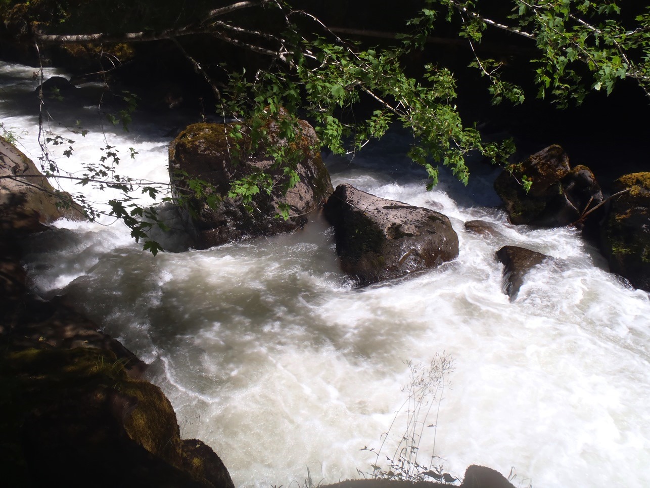
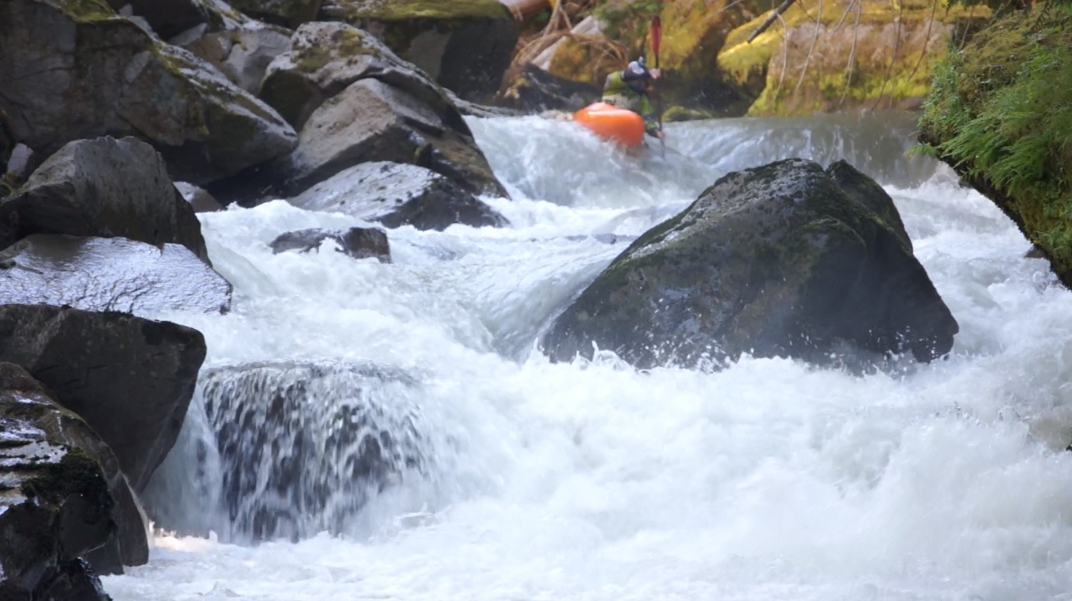
Not the Island (IV to V). Scout left when the river gets ominous looking. The river left side goes but drops into a mean hole. Most people go down the far right avoiding the hole.
- Island (V). Somewhere in the middle between Not the Island and Behemoth is the island drop. It is obvious... scout from the center island or the far left, though once you are on the far left I do not know how you would get back to the right. The left line is a 10 foot tall slide to the hole forming at the bottom of the right side. The right side has a plugger hole at the top in a walled out caldron before dropping over the exit hole which is also sticky. We decided to seal launch in below the top hole on the right and exited.
- Right to Left (IV). Not too far below Island is a cool walled out section with one drop of note in it. The pinch moves left to right, you want to move right to left across it. At low flow there was no hole below.
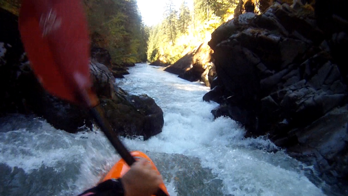
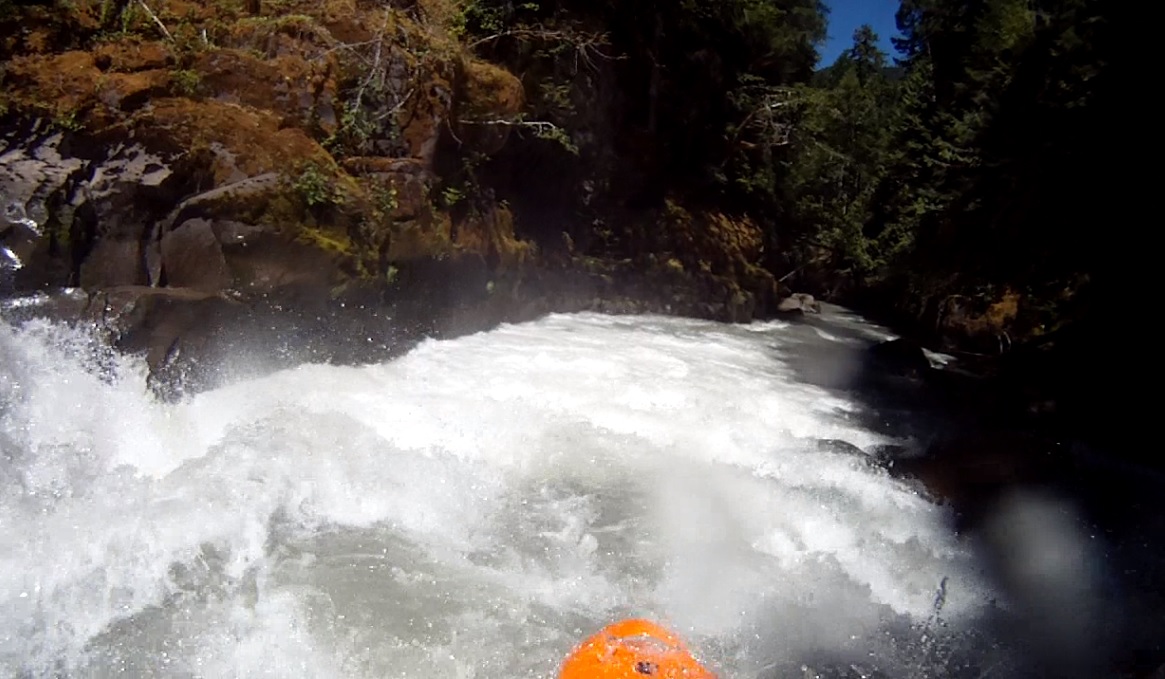
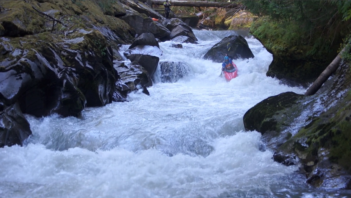
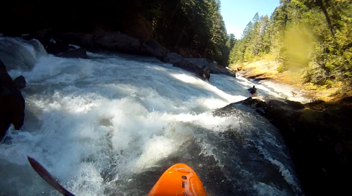
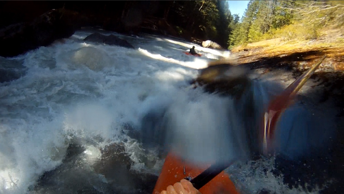
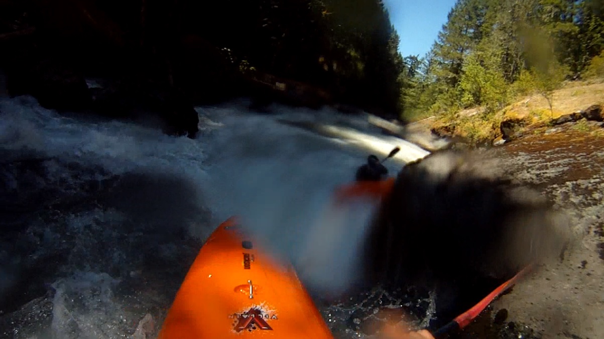
- Pre-Behemoth (V). A few read and run boulder gardens leads to an obvious walled out section just after a landslide on the right. That is your cue to hop out to take a look on the right. There is also an eddy directly at the lip. Boof the top hole right. Then work down the right cutting back to the middle, driving through the curler and through the powerful hole at the bottom. At high flows I have also seen people bang down the far right the hole way. 100 feet of boogie lead to the eddy at the lip of Behemoth. Eddy out left. I do not feel like this rapid is actually class V... if it weren't for Behemoth just downstream. It is more of a class IV+ in terms of move and overall difficulty. If you swim though, your boat is likely running Behemoth without you. Hopefully you make the eddy... then you are sorta hosed again at that point.
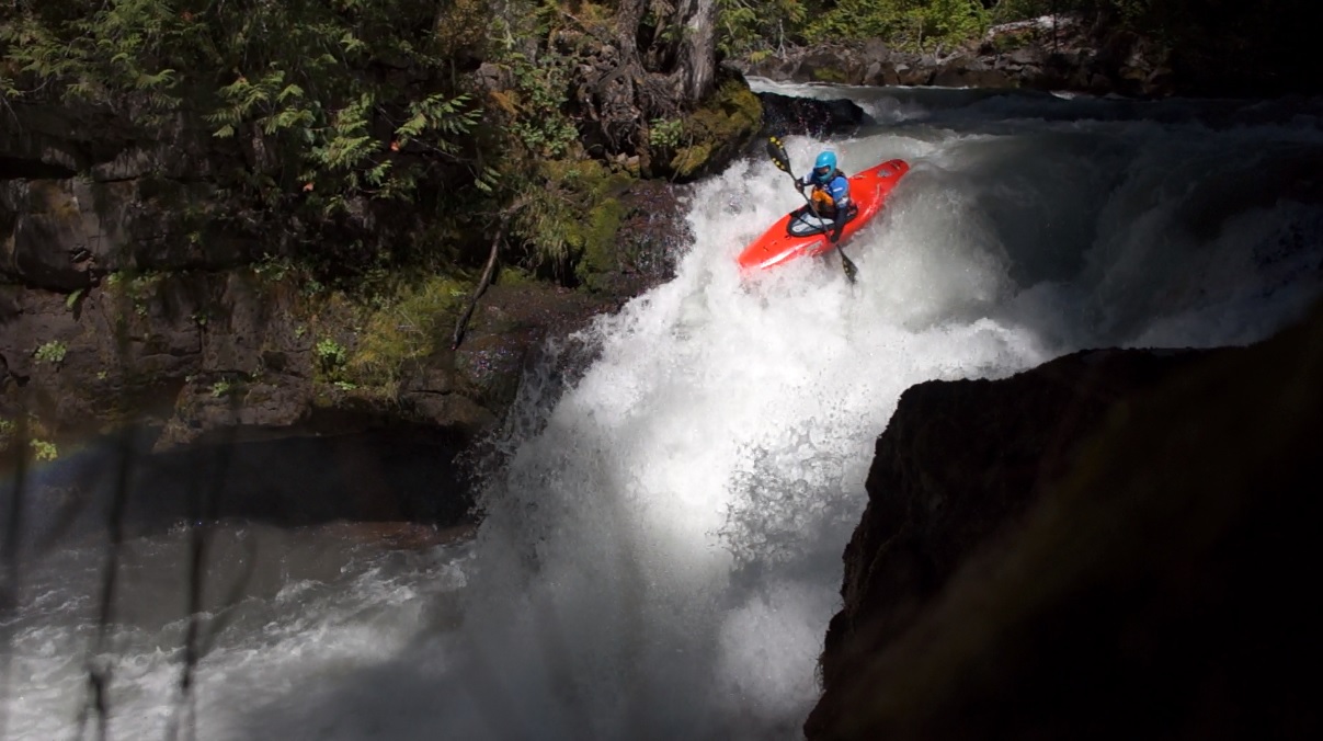
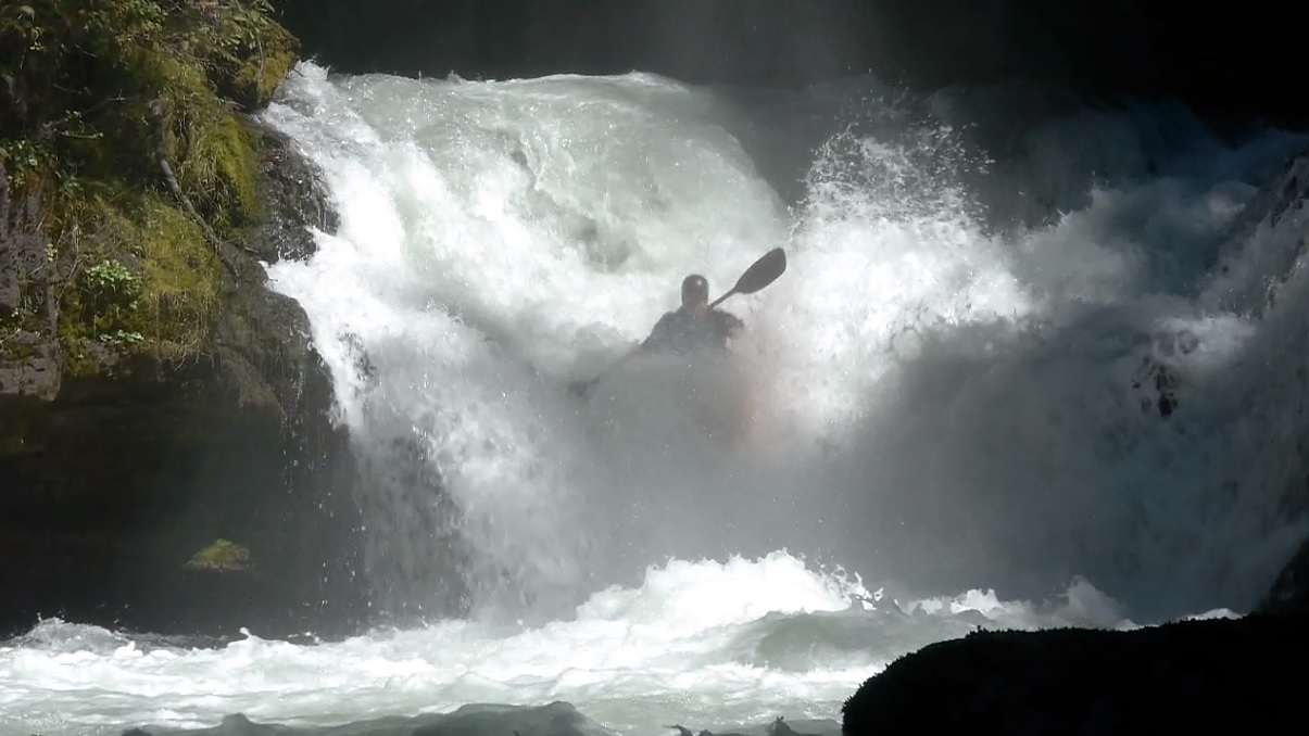
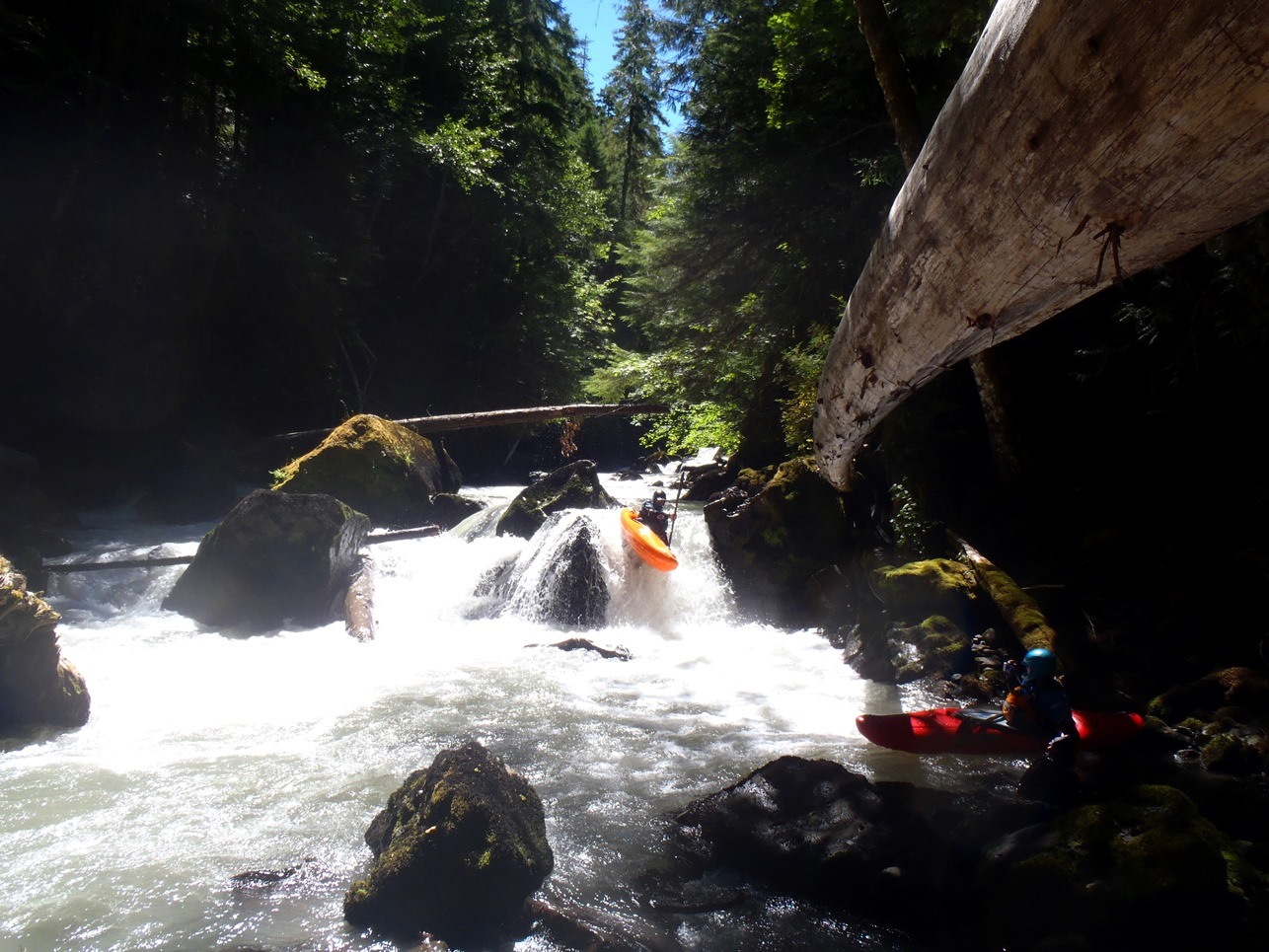
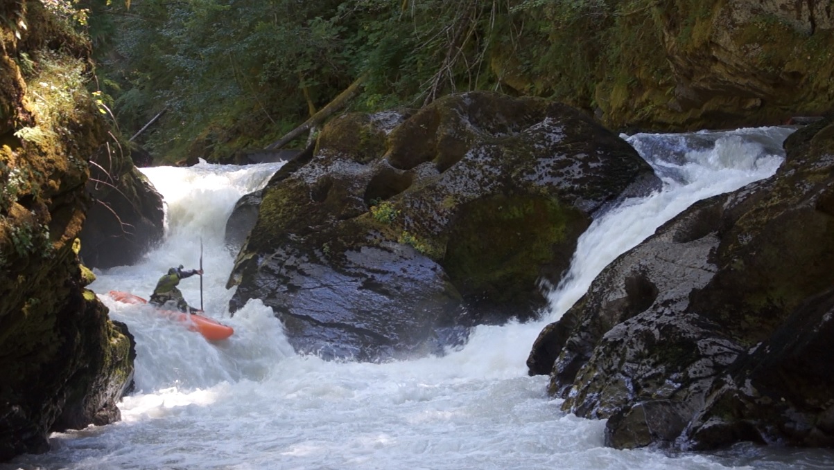
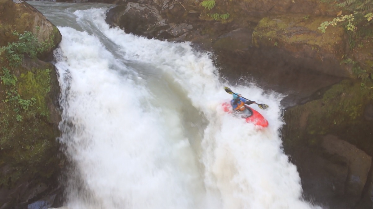
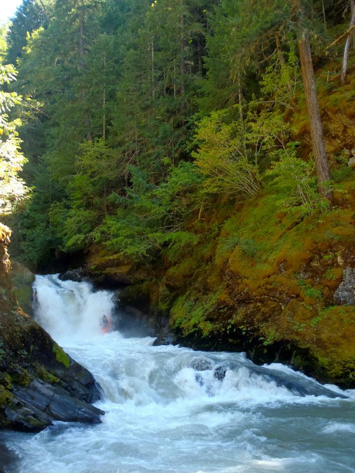
Behemoth (V). Plenty of photo and video of this one. The move is to drive center to left down the top slidey part before boofing the ledge. The drop is about 30 feet tall in total but only have is free fall, if even. The danger of this drop is that if you over drive and boof left you can eddy out and be pulled behind the falls. This has happened plenty of times and causes epics but to date folks have been ok. The second hazard is that the hole just below is rather large, especially on the right. Ideally you want to exit on the far left. However, folks worry about the bottom hole and drive harder left and end up behind the falls. So, be careful, scout your line... and hedge your bet for the bottom hole... safety is easier to set down there and a rescue is less scary.
Post-Behemoth (V-). Other than Behemoth, this is the best rapid of the run. 3 or 4 distinct moves, all down the right keep you paddling and enjoying getting some clean, linked, and inconsequential moves in.
It immediately mellows out below and turns into class II to III.
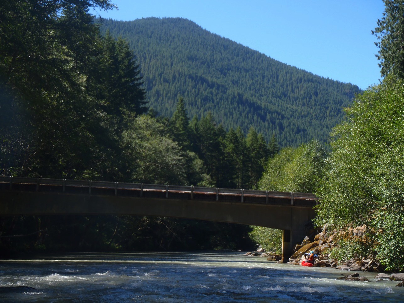
Take-out: We came up highway 141 from White Salmon to Trout Lake where we got on road 23 and stayed on it all the way until it crossed the river. Super pleasant drive, though some 20 of it was on dirt road that got wash boarded at times. Most folks will approach from Randle on highway 12. In Randle, take Highway 131 south for 1 mile before turning on road 23. Follow 18 miles to the bridge over the river.
Put-in. A few hundred yards towards Randle (north) on road 23 is a right turn on road 21. Follow road 21 for 4.6 miles to road 56, turn right towards Adams Fork Campground. Park at the bridge. Good access on the far side, upstream side.
View Cispus, Upper Upper in a larger map
HTML Comment Box is loading comments...