
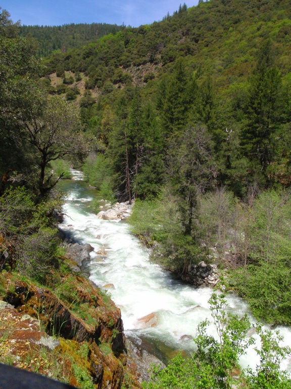
Canyon Creek (South Yuba Tributary), Artic Mine
| Stretch: | Arctic Mine Road to South Yuba |
| Difficulty: | Class IV+ to V |
| Distance: | 1.8 miles |
| Flows: | 250-400?. Current Dreamflows gauge |
| Gradient: | 231 fpm |
| Put-in: | Arctic Mine Road Old Bridge Site |
| Take-out: | South Yuba Confluence |
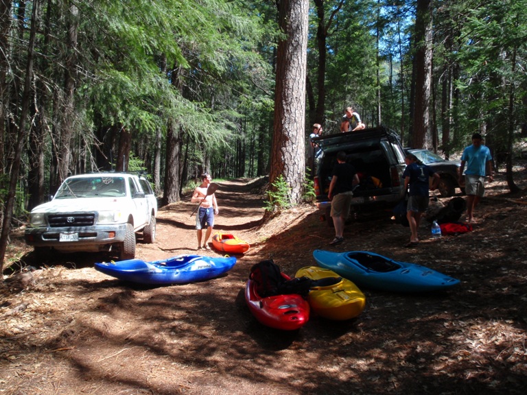
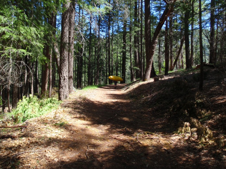
| Shuttle: | ~2 miles 4 wheel drive, high clearance required, plus half a mile of hiking |
| Season: | Dam release rarely, Winter/spring from rain or snow |
| Written: | © 2009 |
| Featured in Video Twenty-Six. | |
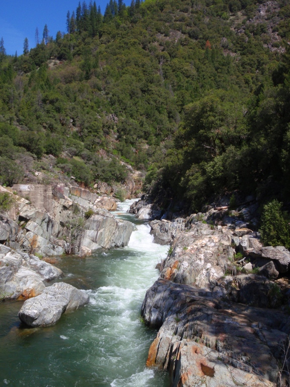
What is there to say? This is a great run. In only 1.8 miles this river plummets over steep drops, full of rocks and holes to nail you if you waver. What a ride. Your first time down you can expect to scout 5-6 times and spend about 2-3 hours on the river. There are many steep in between drops that would probably justify a scout if no one knows the lines. The time would also vary depending on if you have probe units to try the rapids out for everyone else.
My day almost didn't even get started. The night before my family went to San Francisco for a concert on the bay and I didn't get back to Concord until midnight. As I drifted off the 9 am in Grass Valley meeting time seemed impossible, not to mention enough energy to boat some Class V. As morning came (6 am) I began my drive. As I arrived at Grass Valley and took a nap, I realized I had no energy and wasn't going to boat. At put-in, others in the group were feeling marginal on their desire to boat. We hiked to put-in to talk ourselves into it, I still say I am not boating and then head back to the car. A few feet into the walk back to the car something in my mind changed and I decided to put on. What a great call. Sure enough, after one rapid and the accompanying mix of adrenaline and cold water to the face, I was wide awake.
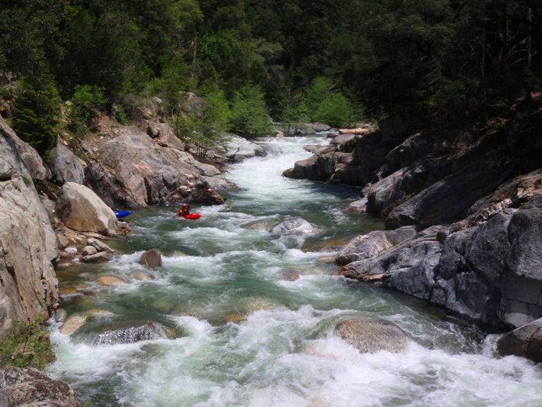
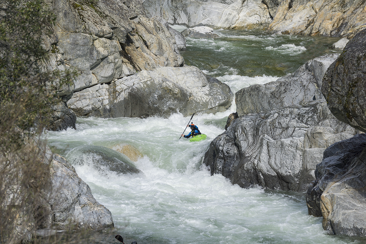
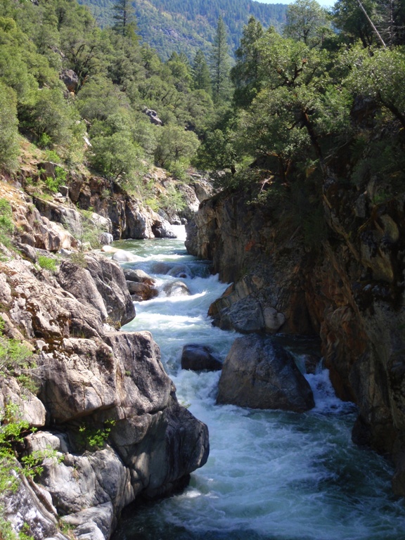
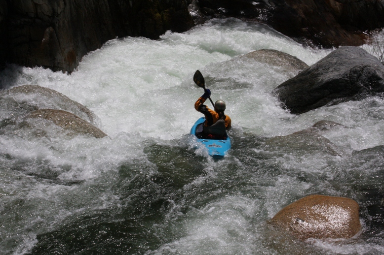
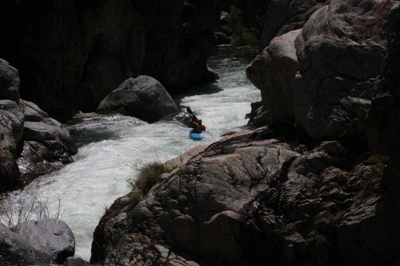
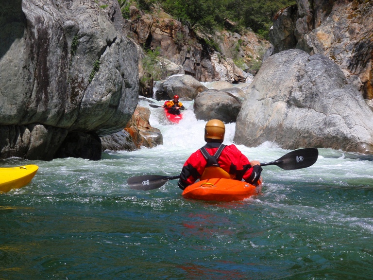
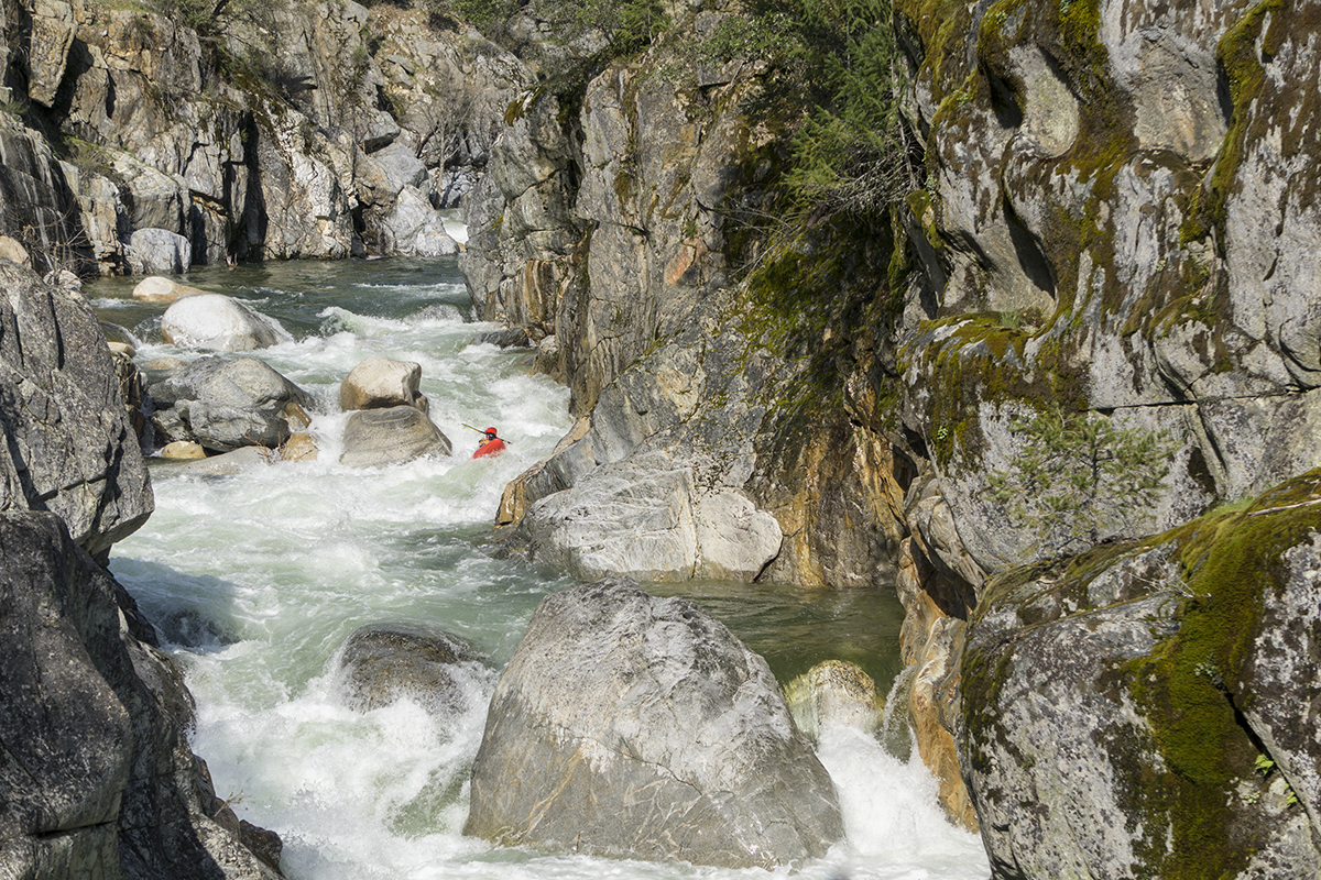
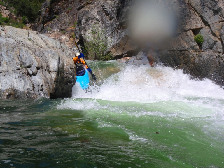
Although this run is short, there are many rapids. And you can walk most of them. However, even the in between stuff can be big and is certainly sieved out. Furthermore the rapids are fairly continuous so swims are not desired (as if they ever are). On that note, when I say something is class IV+, it is only that rapid I am talking about, there may be another class IV+ just downstream of it, or upstream, thus making the section more of a class V experience top to bottom. It is probably a good idea if you are all having doubts, hike up from take out on river right until you can see the last gorge, these are typical rapids that you will be expected to run. For reference we had 300 cfs in middle of May from a dam release brought to us by American Whitewater... Thanks guys!
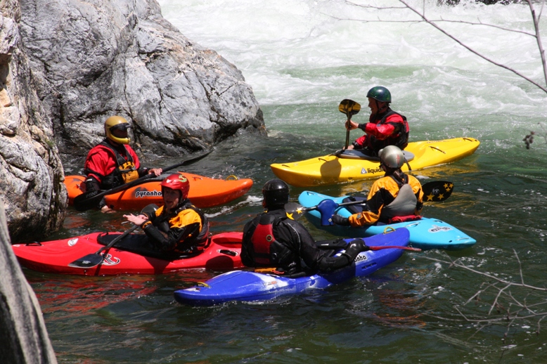
Also, a big thanks to Steve Schimtt for contributing photos and Chezo Van Lith, Diane Gaydos, Josh Bruckner, and Brad Brewer for contributing video.
Update 2017: I got back out to this river while visiting on a business trip. The flow was 250 at Bowman Dam but with recent rain we felt it was more like 350 cfs. This flow made the run much more continuous and in my opinion difficult. Some in the group felt it was still just IV+ to V-... but I would never take a IV+ boater in there at this flow. The continuousness of the rapids alone means people need to be bomber. And there are some large holes as well!
Mi 0:
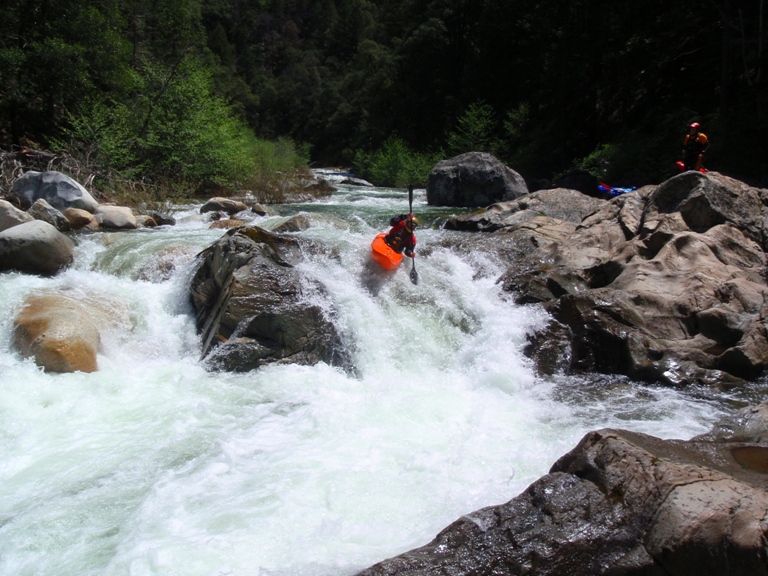
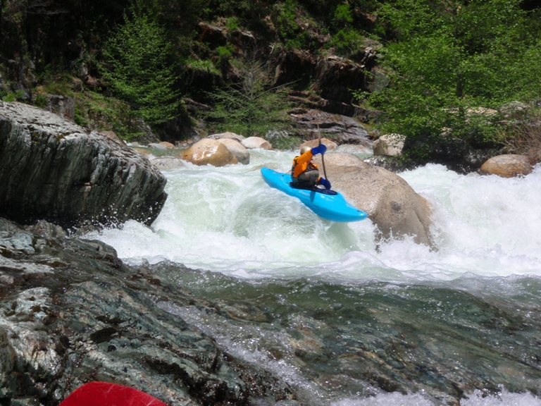
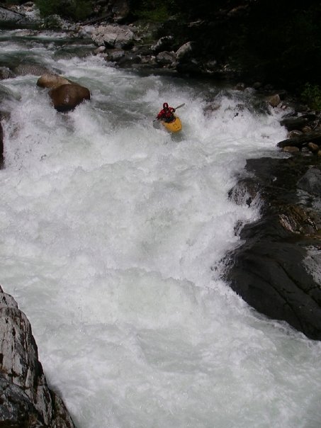
- Start (IV+). Around the first corner there is long boulder rapid. This rapid is easily scouted from the road/trail in though it looks MUCH smaller from the trail. Work down the left of center, through the holes, before driving hard right in front of a rock fence and boof the exit on the right. Downstream are more junky rapids, at an island go right and stay far right and find a clean route.
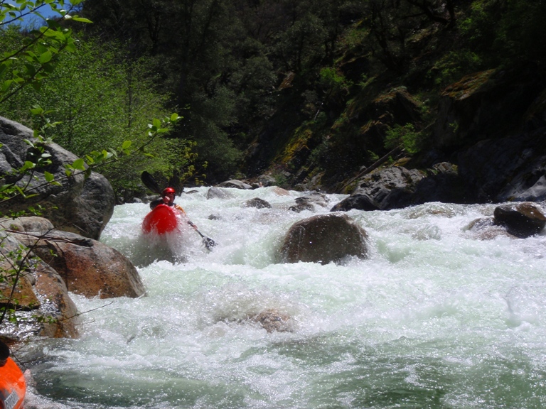
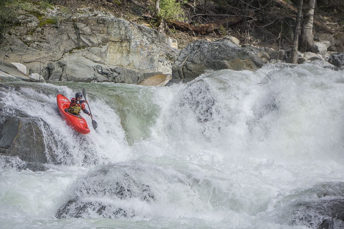
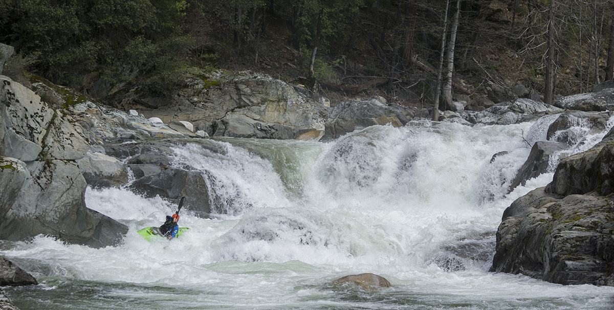
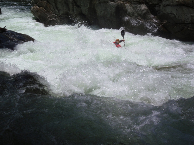
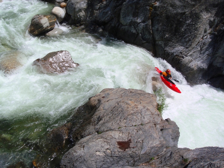
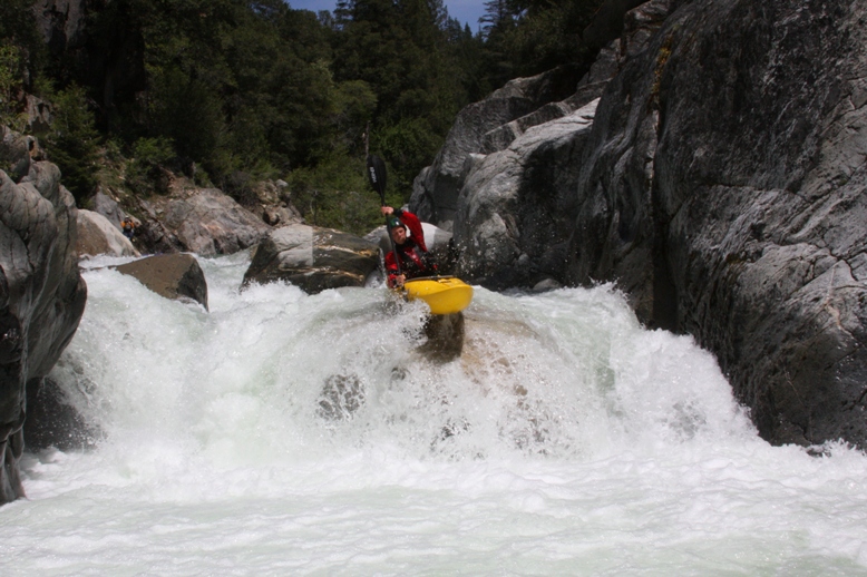
- Triple Drop (V). What a great three tiered drop. The first is boofed on the right, the center is boofed on the left or center. Be aware of a pocket on the left wall and a cave on the right. The bottom is boofed over the center. It would probably be good to set safety and scout on the left. Also an easy portage on the left.
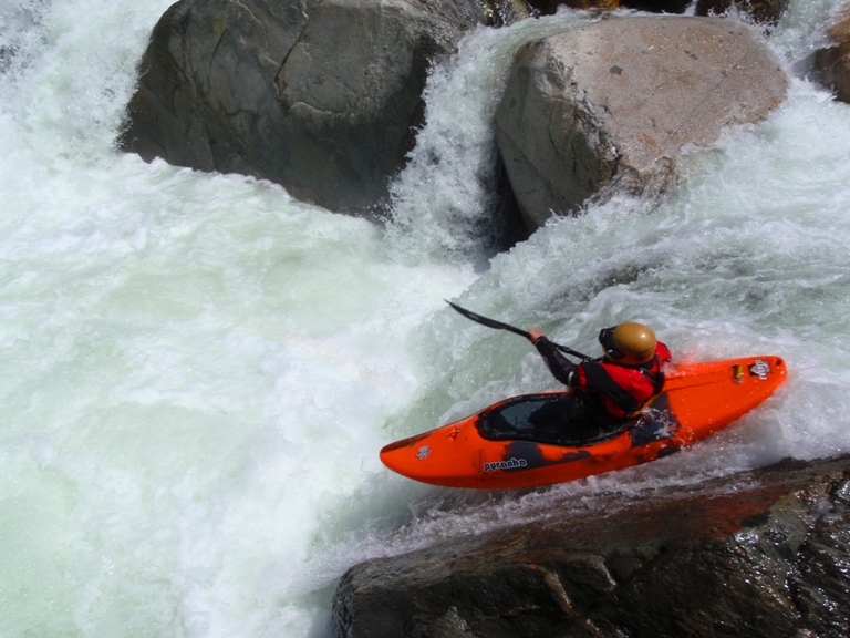
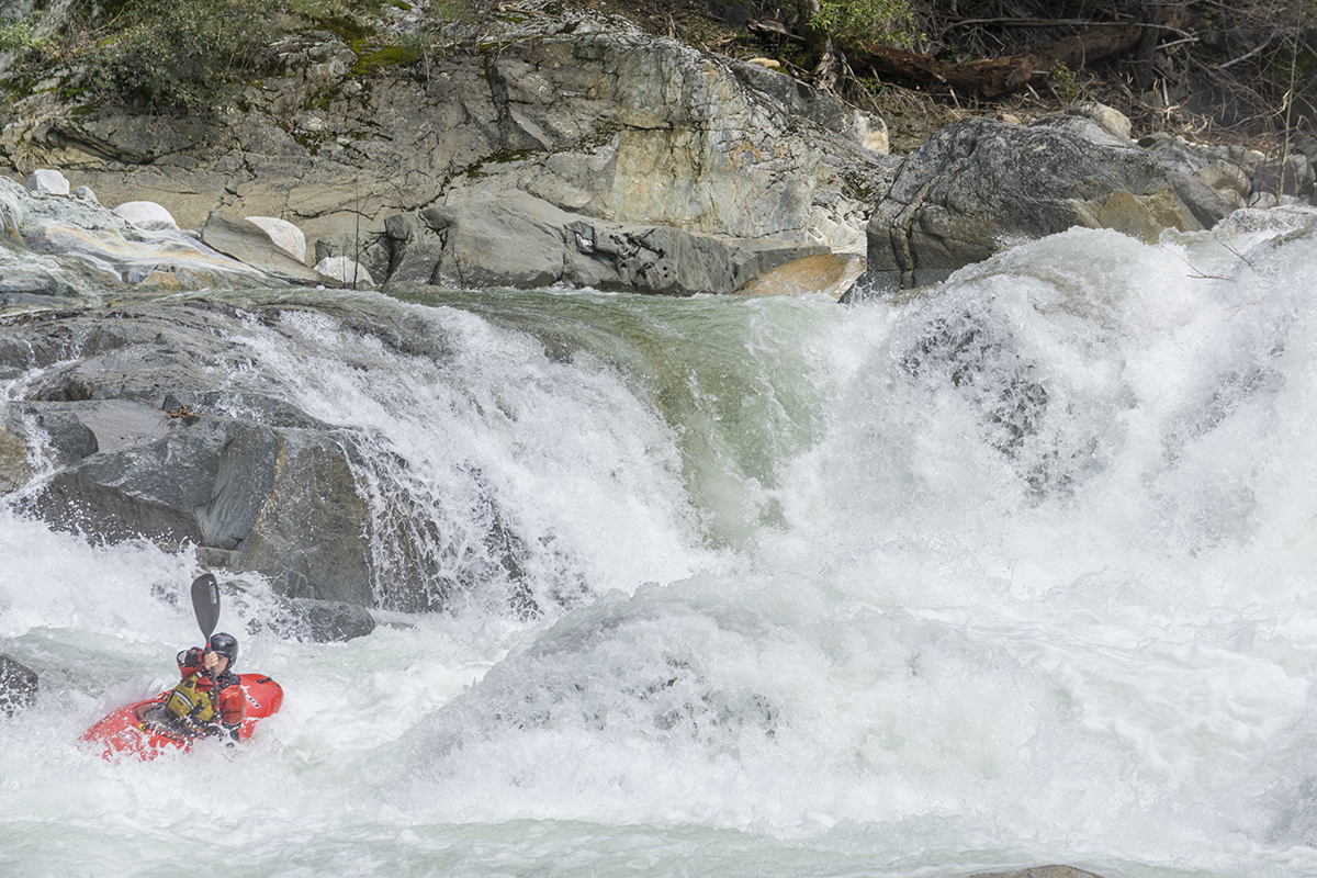
Cascade (IV+). Ok, so it is really only a one move rapid. However, it is big, steep, and very rocky. If you flip in the entrance curler to you almost certainly be in bad shape. Also note, there is a rock after the first drop so keep you nose up.
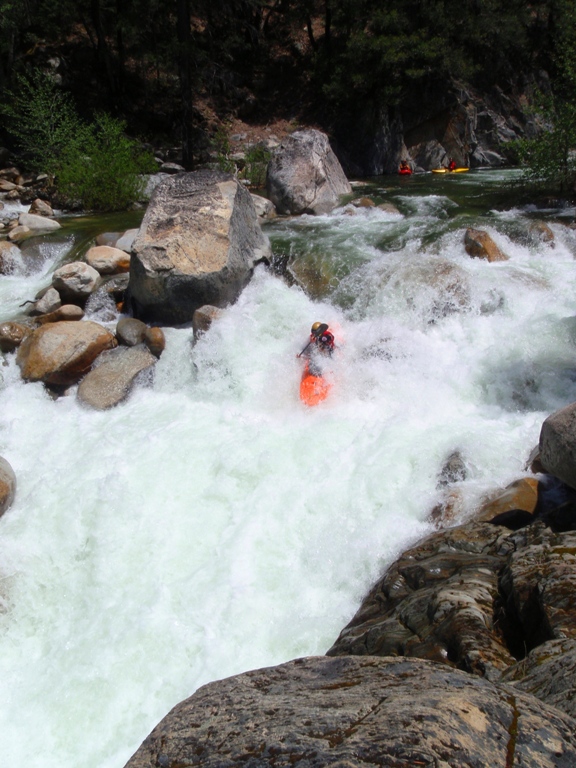
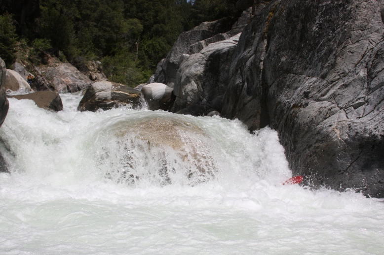
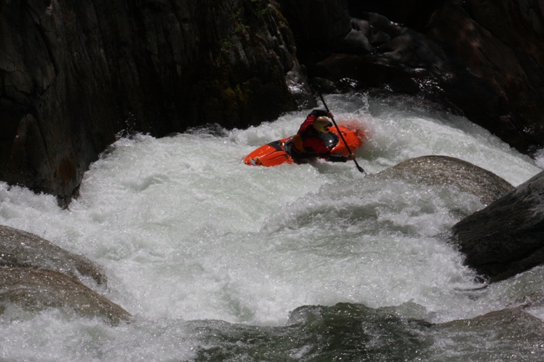
Slide (V). A shitty little lead in lead to this 10-12 footer. The cleanest line appears to be high on the right side. The landing is shallow and then 50 feet downriver the water slams into a rock, causing a reactionary hole, and then melts off either side into pocket holes.
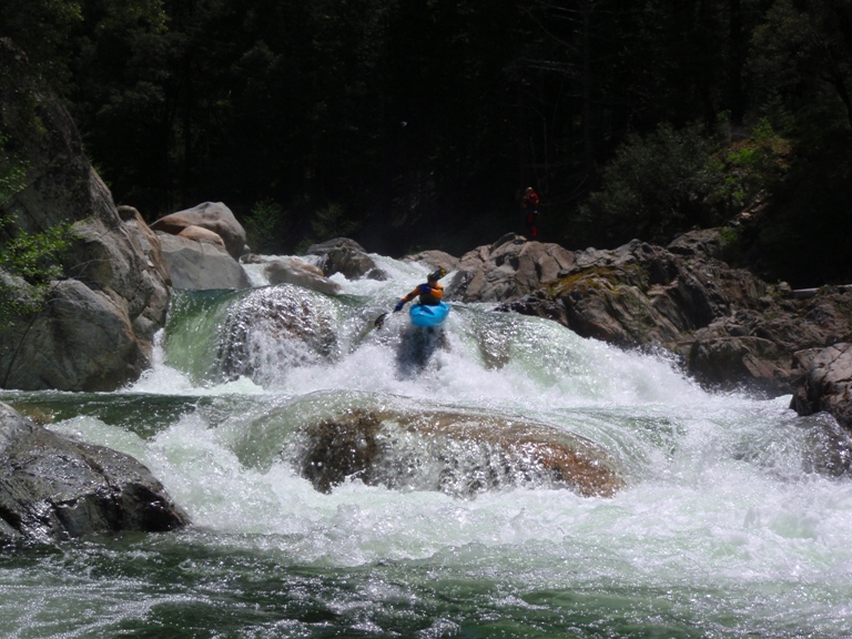
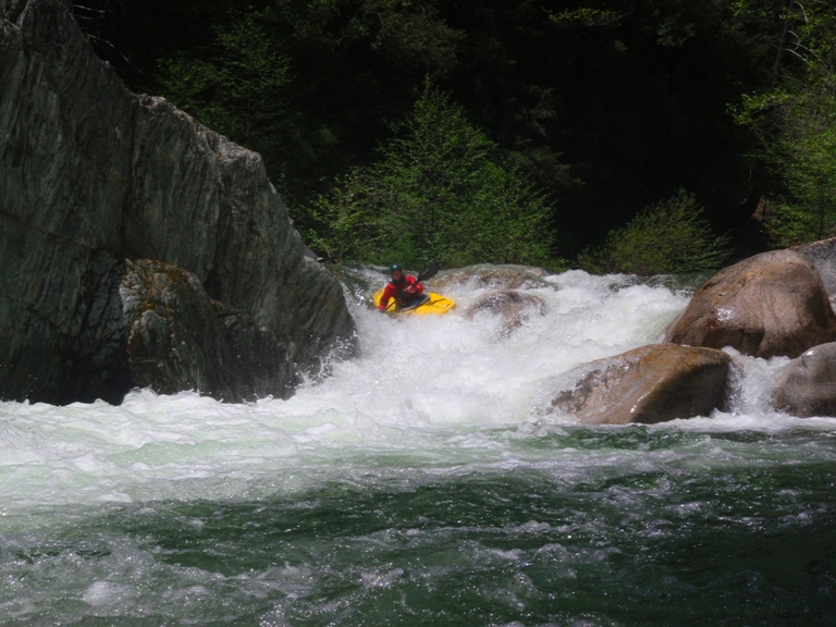
Pothole (IV+). This rapid isn't that hard but is consequential. The entrance is on the right shore and involves boofing into a little pot hole. You then want to drive left to boof center left below. Apparently, the day before someone went off the left and pinned briefly underwater.
Zigzag (IV+). Boof the first big hole into the cross current and drop into the less than destructive as expected hole below. Updaste 2017: When we ran it, we scouted it... which actually surprised me, as I was totally ready to route in. Upon inspection it did look like the bottom hole was stickier than before. But we all ended up going straight through it with no problem. The following weekend though, some in the group went back and resulted in two rather severe beat downs and subsequent swims. So, I guess make sure you get to the right of the bottom home or at least line it up straight!
Off the Wall (IV). This rapid totally reminded me of the Waterfall Rapid below Lumsden, but maybe that is just me. You just want to drive into the middle and stay off the wall.
Big Hole (IV). Somewhere in here there was a ramp into a large hole. I think it was here. Run it down the gut.
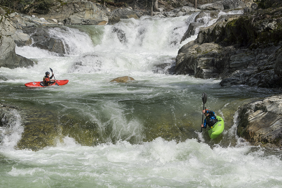
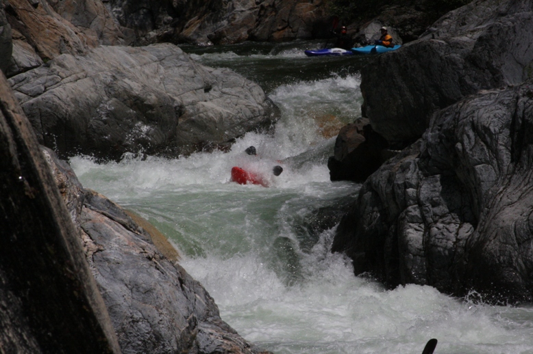
Lead In to Final Gorge (IV to IV+). The rapid dog legs around a blind corner and then straight forward down the right then catch the eddy on the right. Updaste 2017: At higher flow this one actually was quite difficult and beat us up really hard. Two in the group went for the meat of the hole. One flipped and had his helmet snag a rock causing a scary few moments. He then was ferrying behind the larger than normal exit hole that is backed up by a wall on the right, just as I drop in. I run into him and knock myself into the hole where I swim. I barely make the eddy before swimming into Button. If I had been any further into the middle of the hole I probably wouldnt have made it to the eddy. I get out just in time to see another person run and flip in the large hole above my hole, and roll up with a big shiner on his eye. It turns out at higher flow, this one may be worth scouting on the right...
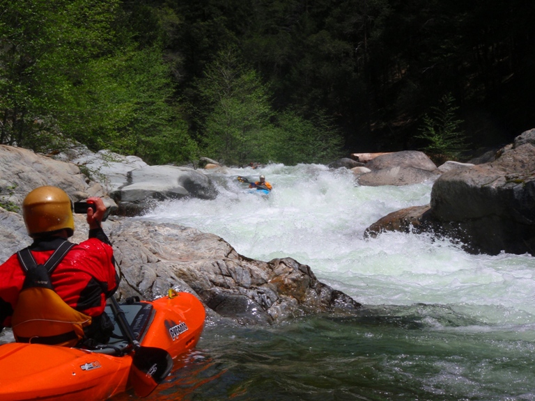
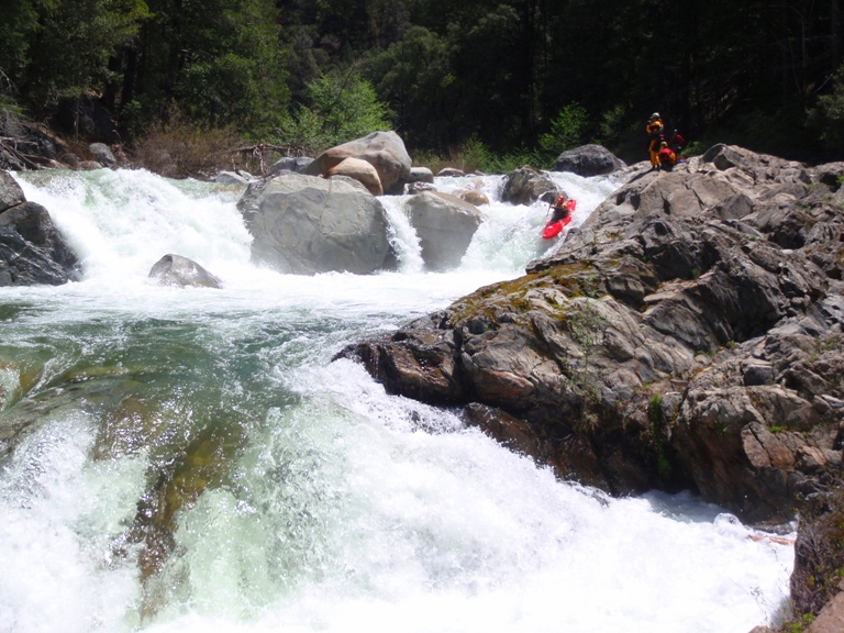
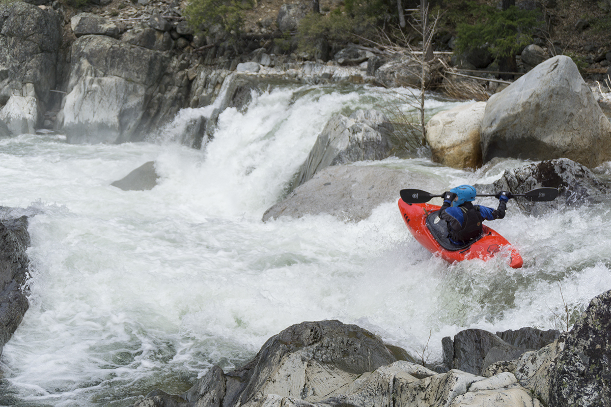
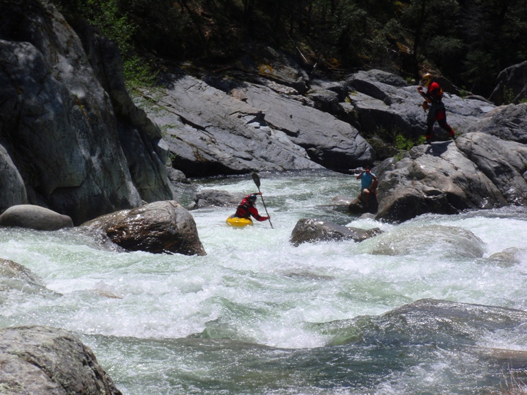
The Button Rapid (V-). As hard as one move can be to get right. Catch the eddy at the lip on the right, ferry out, hit the curling hole, don't melt right into the bad pocket, don't melt left into the wall pocket, and boof the center. Easier said then done. Scout or portage on the right. Below is the last chance to scout or portage drops. So if you didn't before hand, scout at this point using the trail on river right.
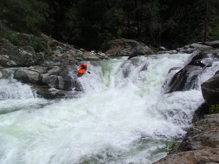
Gorge Entrance (IV+). The river bends sharp right and drops sharply over two consecutive drops. Boof the first far left into the pocket, make sure you boof, and then run down the tongue into the hole at the bottom of the second drop. Avoid the eddy on the right below.
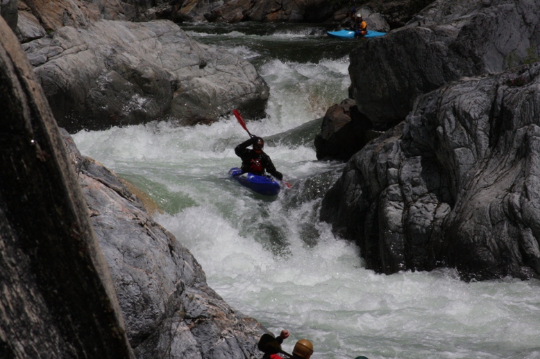
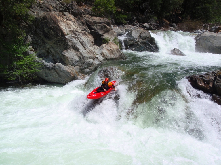
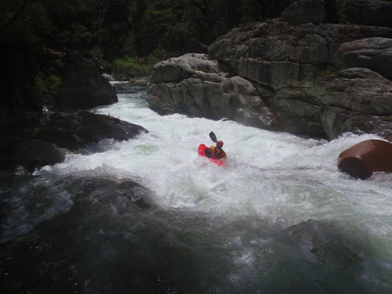
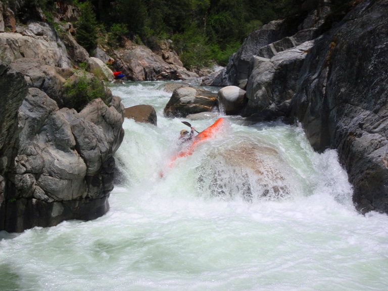
Gorge Middle (V). This is one of the more consequential rapids of the run. This rapid is consequential due to an abundance of sieves in the top and bottom half of the drops plus the fact that the rapid above it leads pretty directly into it. Furthermore, a rescue or reentry into the water would be very difficult between the drops. We started right and drove left over the boof. Hit the curler coming off the wall and followed it right. We then followed this current to the second tier into a chute and hole on the right shore. Point your nose left to avoid the eddy against the wall.
Gorge Exit (IV-). A easy ledge at 300 cfs, run right and then some busy runout
Bridge in Sight (IV+). This rapid was a lot bigger than I remembered from the trail. A few steep drops and a wall keep you on your toes until the very end.
Take-out: From Highway 49 in Grass Valley, take Highway 20 towards Truckee. After 16 miles, turn left on Washington Road and follow 6 miles to the town of Washington. Cross the river and continue right on Maybert Road. Follow 4 miles to Canyon Creek. Just on the far side, 100 feet past the bridge on the right there is a turnout that fits a few cars.
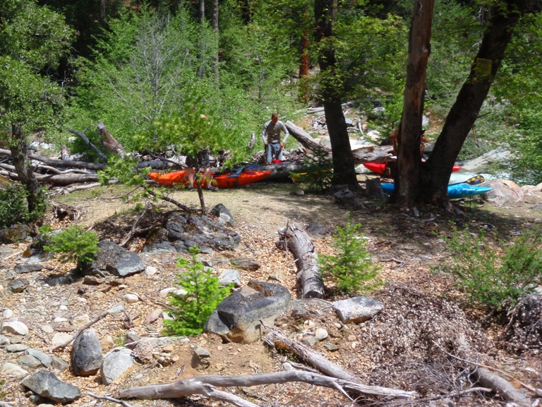
Put-in: Continue up Maybert 3 miles to Golden Quartz Picnic Area. Drive past the picnic area and drift left at the no trespassing signs. Go up the steep hill that continues getting steeper. Soon you will get to a gate, if it is locked, drop your boats and park 200 yards back down the road at the wider turnout. If it is unlocked...after another 0.5 miles driving, park at the top of the grade. There is a hill clearing on the right that you can pull up onto. Hike the remaining half mile to the river. The road is washed out, thus necessitating the walk. The full hike takes about 30 minutes. The half hike takes maybe 15.
View Canyon Creek, Arctic Mine (South Yuba) in a larger map
HTML Comment Box is loading comments...