
Callaghan Creek
| Stretch: | Above the 99 Highway |
| Difficulty: | Class IV to V |
| Distance: | 2.45 miles |
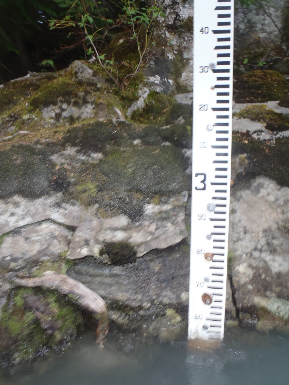
| Flows: | 2.45 m to 3+ (visual gauge at Cal-Cheak Recreational Site - Campground / take-out). Current Water Office gauge |
| Gradient: | 172 fpm average |
| Put-in: | Turnoff with trail leading down 4.2 km up Callaghan Valley Rd from Highway 99. |
| Take-out: | Cal-Cheak Recreational Site - Campground, just below the Highway 99 bridge |
| Shuttle: | 6.1 km (5 minutes, paved) |
| Season: | End of Summer (July/August) from snowmelt/rain |
| Written: | © 2013 |
| Featured in Video A Wet State #79 and in A Wet State's contribution to World Kayak's Video Guide | |
Washington and BC 2013 Day 3, 4, 5 and 8:
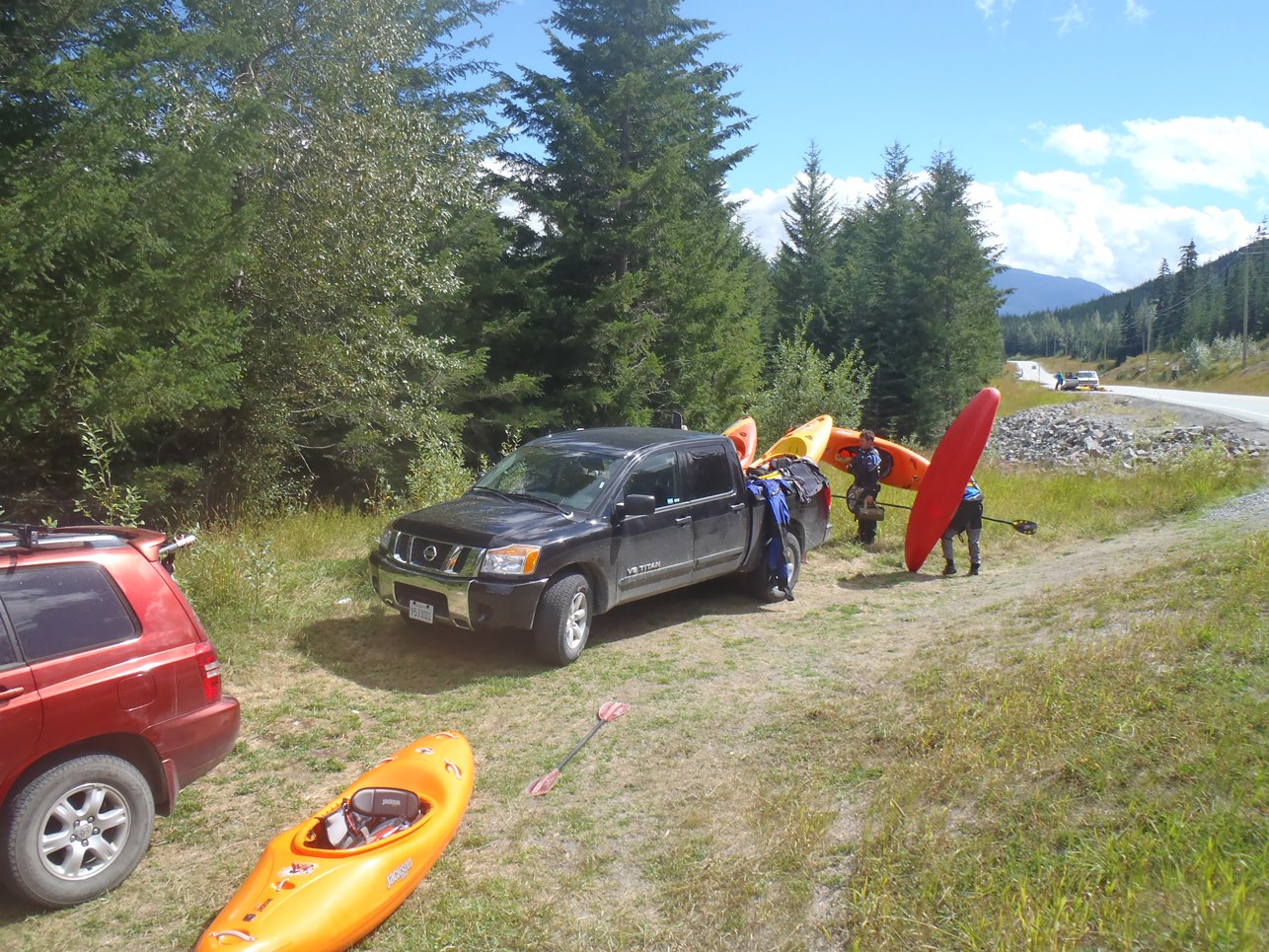
Finally, we got into Canada! Our third day of the trip started in Seattle at our friends place. We left around 7 am and got to the border just before noon. Due to traffic in Vancouver, progress was slower than anticipated and we were not able to make it to Whistler until close to 2:30 in the afternoon. Driving straight to take-out we ran into another boater who was waiting for a group that was running late, and who was interested in joining us. And so we quickly loaded gear and headed 10 minutes up the road to put-in.
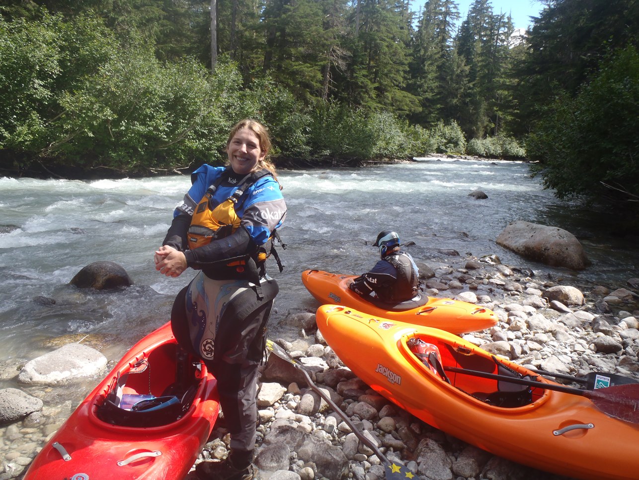
A week before we started our trip, some friends of mine had come back from BC saying that Callaghan was low and probably would not hold. A pity really, because this along with Rogers were two of my major draws for wanting to go to BC. When we arrived at put-in we found that indeed the flows were low, but still at least runnable at 2.55 m. We found this flow to still be plenty of fun while on the water. Over the next few days we often found ourselves getting a dawn or dusk patrol lap on this run, and ended up running it down to 2.45 m and still found it enjoyable, but the lower flows did take some fun out of the run without a doubt.
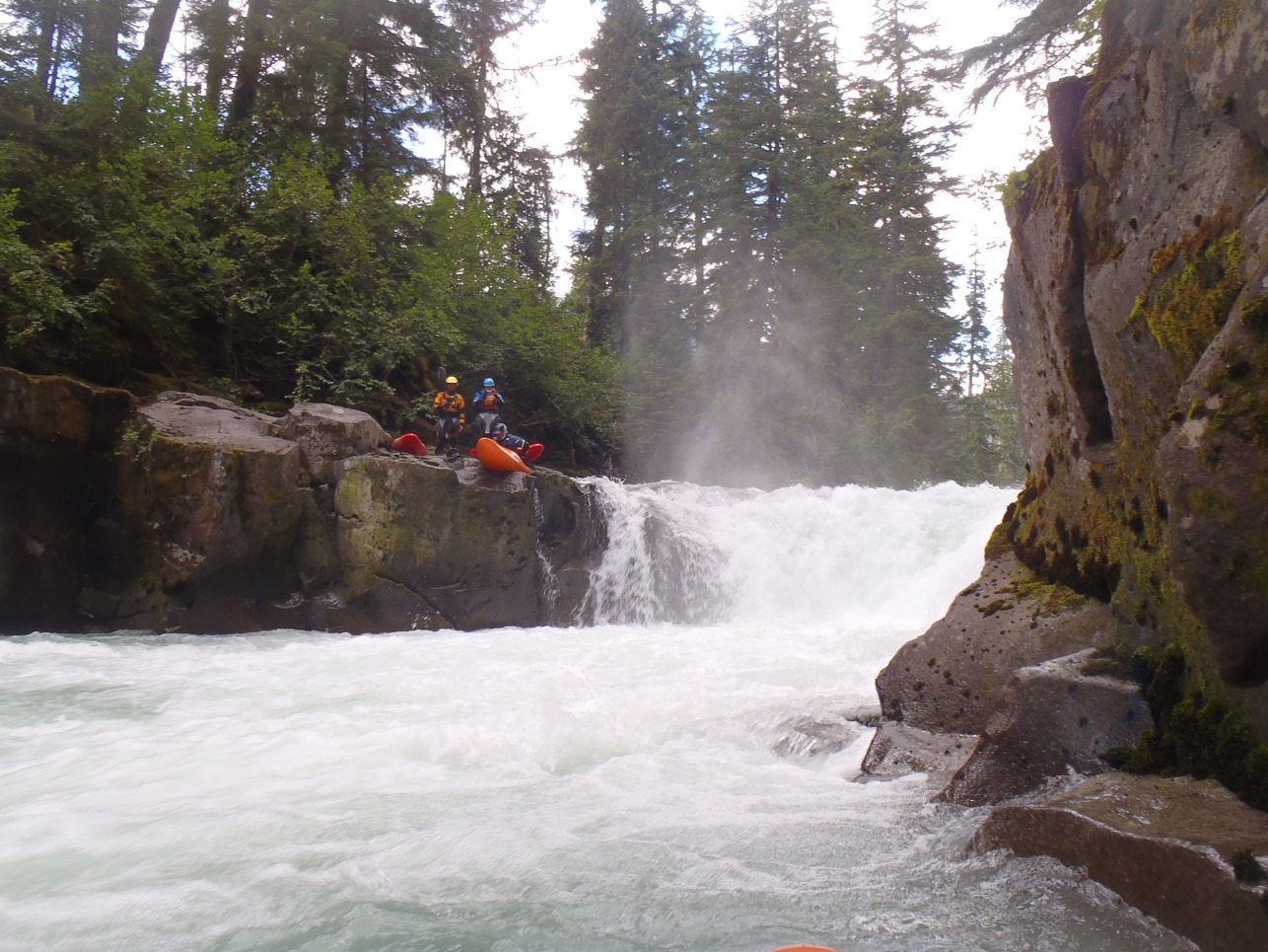
The run starts with a potential portage just a few hundred yards downriver. There is an eddy at the lip, but it is not great. Many will choose to get out 100 feet above the rapid, before the lead-in and portage on the right. The danger is that the hole can pull you back around the left and into a deep cave. A few folks have had close calls, and a few boats have been lost in the cave. Below, the action starts and you quickly get to the first 10 footer. Below, one rapid leads to the lip of the 20 footer. Downstream, boogie begins one after the other with limited flat water and flow depending another potential portage, before ending in two more bedrock drops with holes before the bridge comes into sight.
The run really is that short. 2.45 miles and less than 30 minutes once you have it figured out. You really do take longer shuttling and hiking (10 minute) to put-in than you do on the water. But that only leaves more motivation for laps. Our first day we did only one lap (Diane ran two). Our second day we ran one lap (Darin did 2), before heading to Cheakamus for two laps, our third day we ran Cheakamus at a dusk patrol after running the Soo and the Cheakamus. Finally, we also decided to run a quick lap on the way out of town on our last day.
If this is your first time in Whistler, this run is very much a classic... and should be at the top of your list. A great introduction into some nice busy boulder gardens and some nice waterfalls. Not to mention the forested, walled out canyons and the classic chalky blue water that is synonymous with Whistler! Just amazing!
Also check out LiquidLore.com for the final word on BC boating...
Also, check out Darin McQuoid's photos on his website, www.darinmcquoid.com
The rapids are literally one after the next. So below are just the few highlights with unique moves to make.
Mi 0.25:
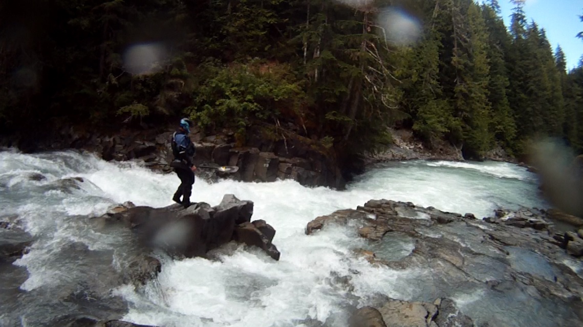
- Portage Ledge (IV+). So how do you rate a rapid that looks easy... but is just consequential as f'? The water was just a little to low for us to run right, and would have forced a left side run which also looked very boofable but we just weren't game for rolling the dice. Who wants to ruin a vacation with an epic rescue or worse? A small micro eddy exists at the lip on the right, or you can hop out 100 yards up river prior to the lead in rapid and portage on the right.
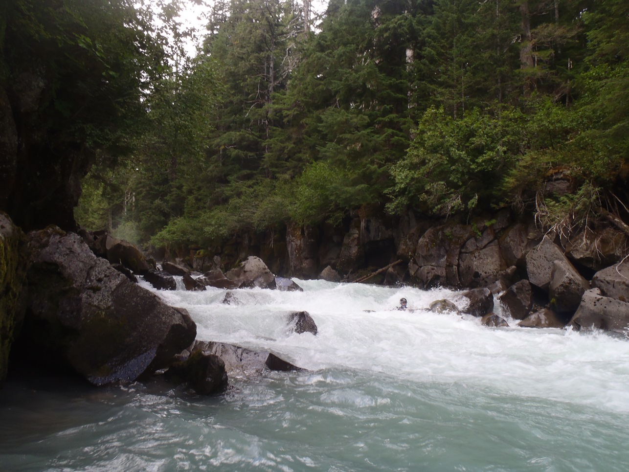
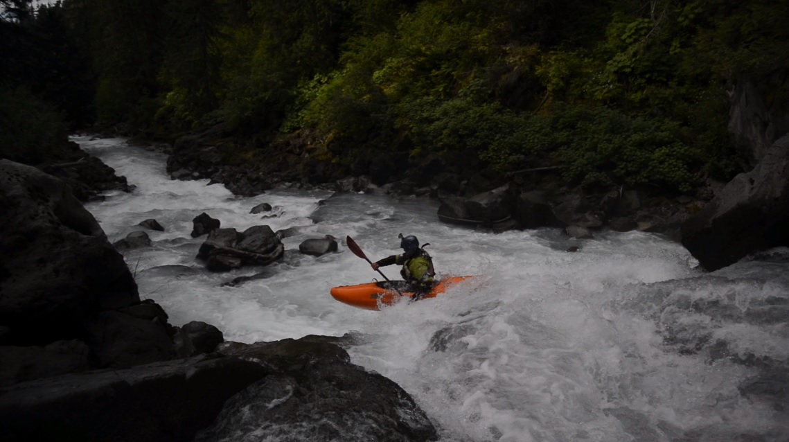
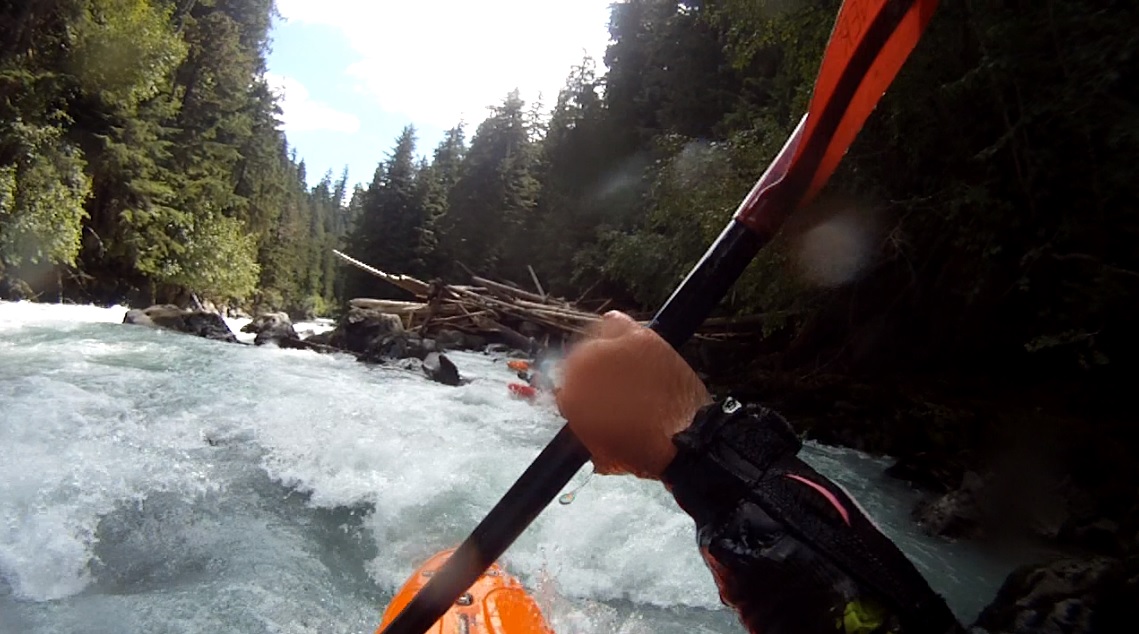
Boogie (III to IV). Some good fun boogie starts immediately downstream. As the river bends left stay left down one of the mankier (at low flow) rapids which leads to the lip of the first falls.
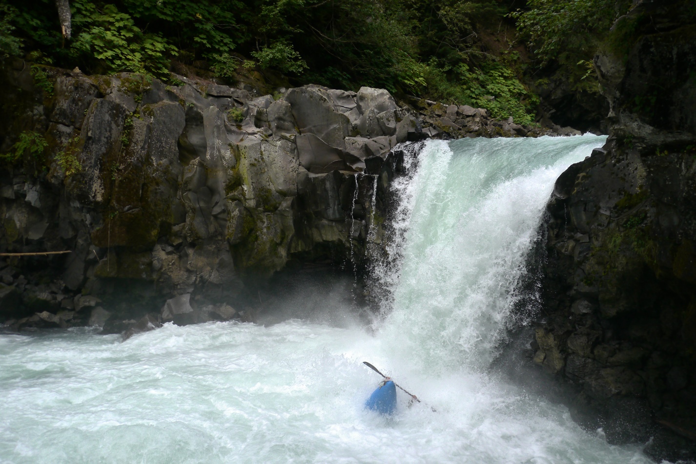
10 Footer (IV to IV+). At low flows, we were able to just go anywhere on the left and it would autoboof you. Not bad at all!
In-Between (IV). Immediately downstream is a fun rapid, just stay right throughout. It is a ramp around a few holes and through a few laterals. The runout of it has a good size hole that drops you into the pool above the 20 footer. We all ran this hole on the left.
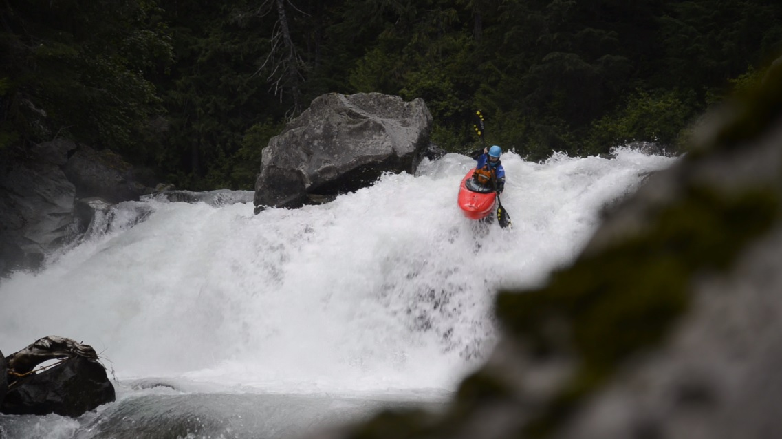
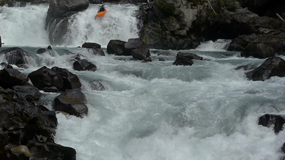
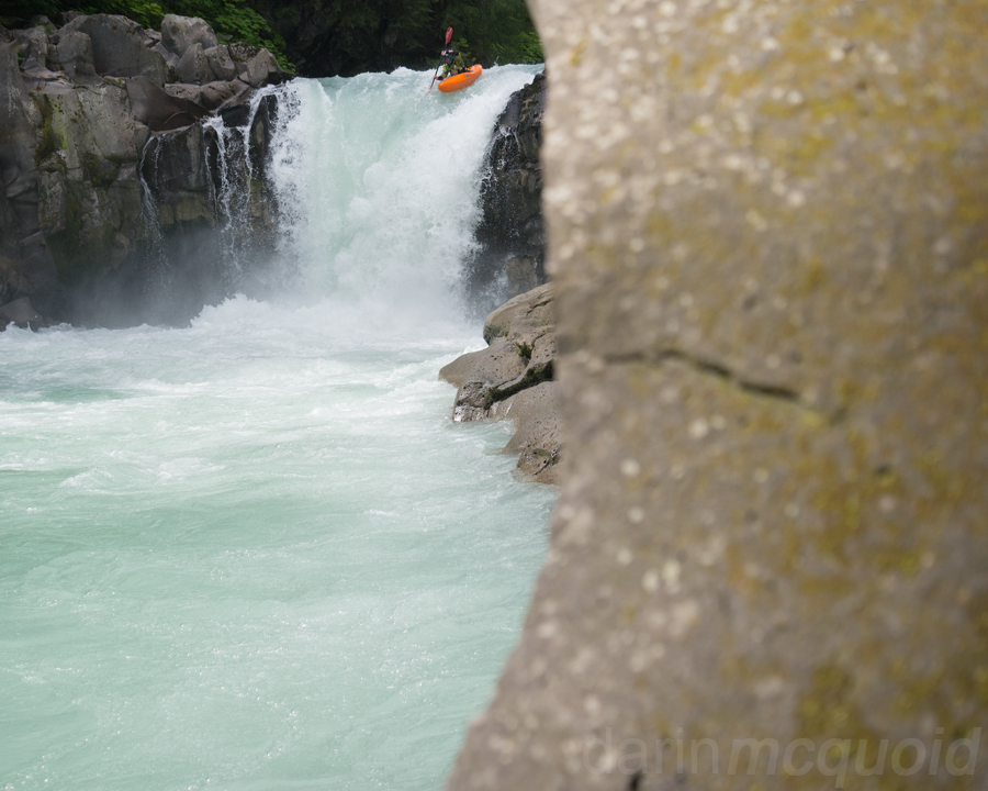
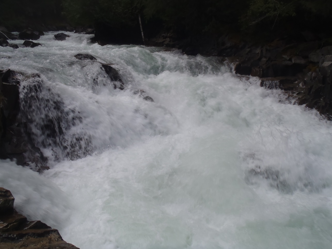
- 20 Footer (IV+ to V). At low flows the hole was not bad at all... we were able to run down the center with a delay boof. As the water comes up you go farther left using the flake to help with the boof. The right side has a shallow landing. Scout the 20'er on either side... portage on... mmm, left I guess, but that would not be easy.
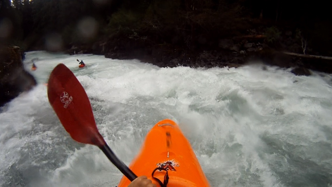
Boogie (III to IV+). The run is pretty continuous pool drop that at low flows we were able to boat scout down. I have heard though as flows come up that it becomes much more legit and pushy. There are really no stand-out rapids that are any harder than any others in this stretch. Lots of fun holes and boofs to keep you busy.
- Old Dirty Bastard "ODB" (V). At low flows this is a portage. A ramp leads into a dead center rock. The line is normally to the left, but at low water the window closes out and impact is just about guaranteed. The portage is easy on the right though. In 2013 there was a huge log jam that we used as the signal for when you get out as it was the only log jam. Eddy out on the right shore immediately behind the log jam.
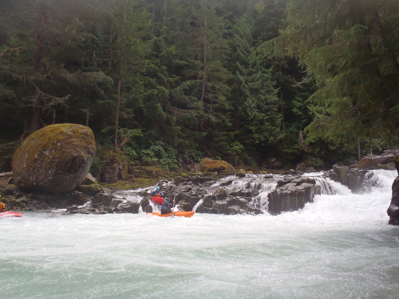
- Island Drop (IV+). I quickly hoped out to take a look at this one using the island in the middle. I passed along the information to the rest of the group, run the left side of the island down the center boofing the hole at the bottom. Really one of the better drops.
Last Bedrock (IV). Just downstream is one more bedrock drop. At these flows it went anywhere, left right or middle. I could imagine at higher flows you would want to not be center due to the concavity of the bedrock ramp.
Take-out: 6.2 km North of Daisy Lake on Highway 99 (or 13 km south of Whistler), look for the Cal-Cheak Recreation Area and campground. Take the turn "Cal-Cheak" just north of the highway 99 bridge over the Callaghan and take the first right down to the parking area just outside of the campground. This is take-out, walk through the first site to the river to find the gauge. We also camped here for most of our trip... we found that there was no camp host to collect money Monday-Thursday night. So... now you know what my morality is worth, $12 a night.
Put-in: Head north on highway 99 and use the first left turn to u-turn and head south on 99. Then take the first right on Callaghan Valley Road and head up the hill. In 4.1 km you will see a cement pull out with a nice dirt pull out off the road 10 feet on the right. Use the dirt pull out. The trail to the river starts in the pull out. The trail is obvious and tagged and takes about 10 minutes of gradually downhill.
View Callaghan River in a larger map
HTML Comment Box is loading comments...