
Caney Fork of the Cumberland River (Rock Island)
| Stretch: | Rock Island Dam to State Park |
| Difficulty: | Class II to IV+ (V at high water) (II at normal flows if you skip the falls and Sieve City) |
| Distance: | 1.7 miles |
| Flows: | Needs >3,600 cfs and a gate at least half open for the falls, >2,000 below the powerhouse for the section below Sieve City.. Check out American Whitewater's current flow gauge. |
| Gradient: | ? fpm (google earth seems to be broken here, the falls and Sieve City are probably ~40 total, after that probably ~40 fpm) |
| Put-in: | Either at the dam, just upstream of the falls or at the powerhouse downstream of Sieve City |
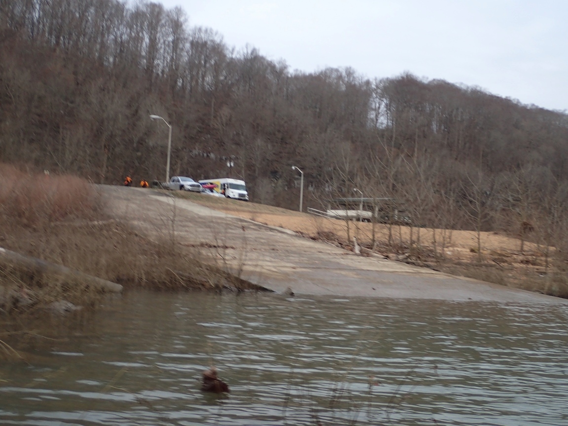
| Take-out: | Blue Hole Picnic Area |
| Shuttle: | 2 miles, 5 minutes one-way. |
| Season: | Year round for below Sieve City (dam release), Winter/Spring due to dam release for the falls. |
| Featured in Video A Wet State #97 | |
| Written: | © 2015 |
| Featured in Stephen Wrights video Sieve City High Water | |
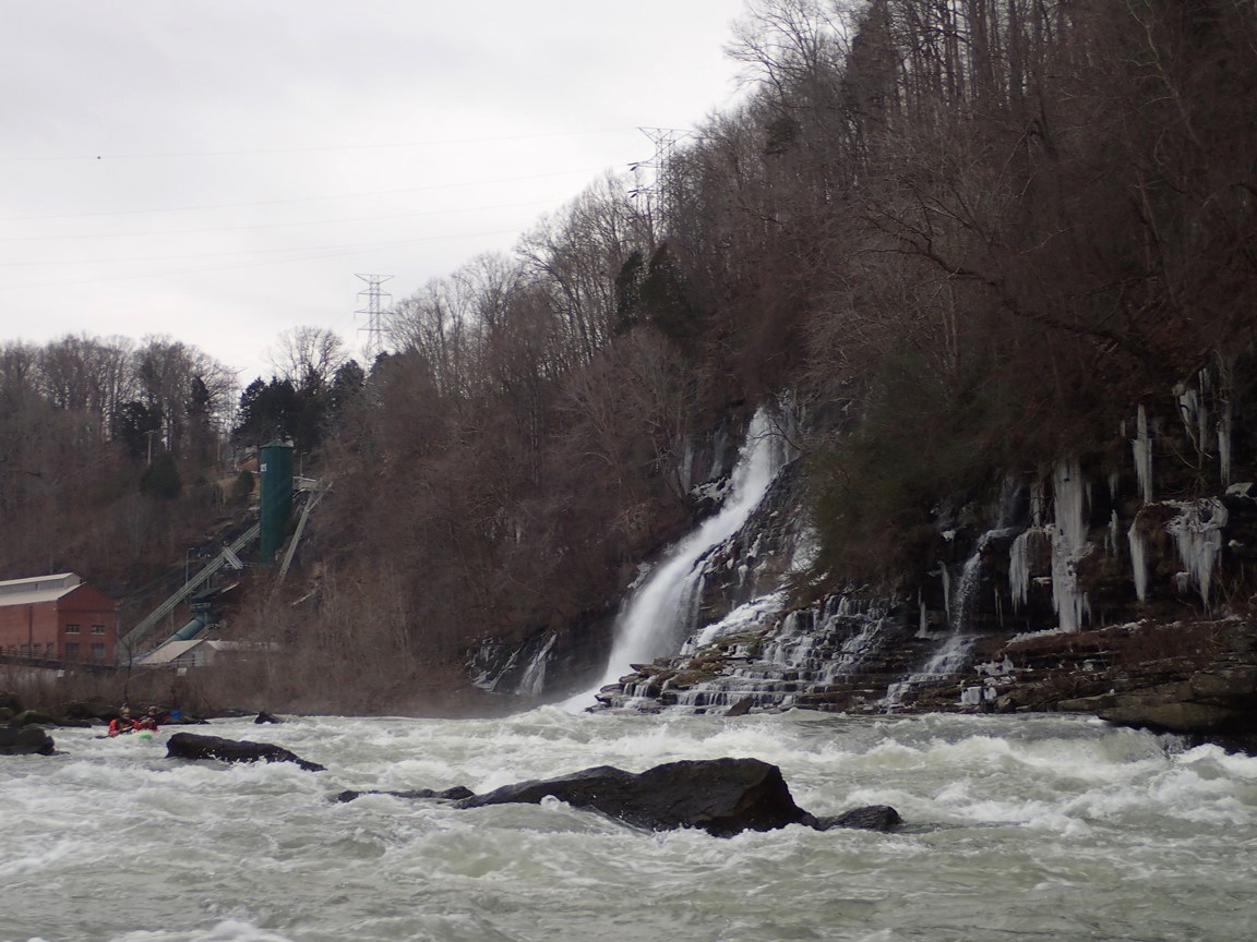
After years of seeing this nice collection of waterfalls in Jackson team posts, I finally had the opportunity to visit for myself while picking up a boat at the Jackson Factory. All I can say is, how nice would it have been to of had a park and huck 18 to 22 foot waterfall to practice on when I was getting into boating? In California of course the waterfalls are either on rather tough runs or limited to runs like Pauley Creek and Brush Creek. But dependable flowing waterfalls with the ability to lap time after time are nill. Sure there are rain fed drops like Traverse Creek, but how many days a year does that run, sometimes none! While as Rock Island has run every day for the past month!
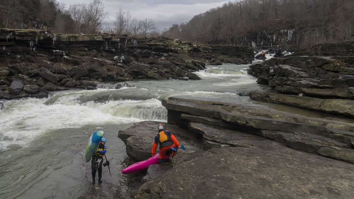
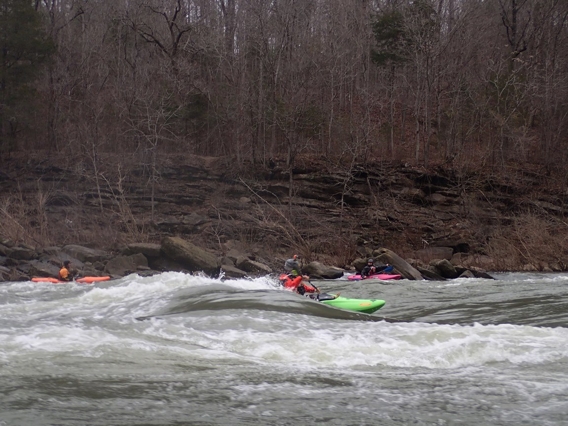
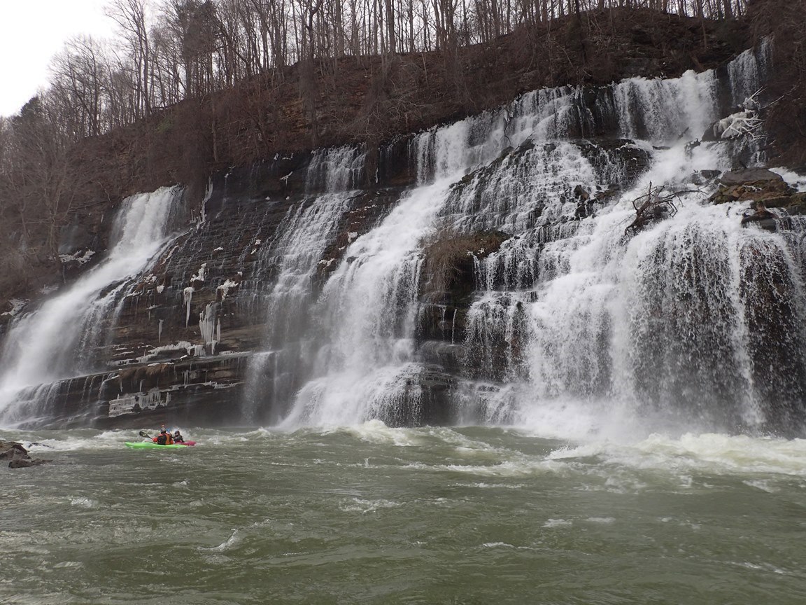
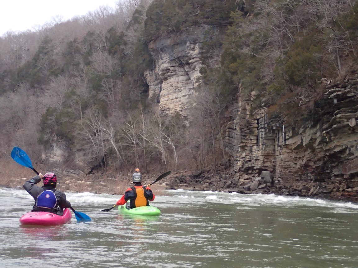
In addition to the low water Spout line, there are several others that come in as the water gets higher... leaving you wanting more and with more of a reason to return. Below the falls, the river plummets through a band of the rock that has collapsed under the power of the water leaving a sieved out mess of a rapid named Sieved City. While some run it (and it goes fine depending on the flows), many others choose rather to walk around easily on the left. Below here, the river takes a huge step down, as the water from the powerhouse brings the flow up, you are greeted by the site of the springs pouring water in from high above, additionally, at the base is a world class play spot that has featured the world championships as well as national championships. Below the play spots exists a few more smaller rapids leading to the take out and Blue Hole. All in all, this day was much more fun than I was expecting, and even at the low flow at the falls, it was great practice. I am sure I will find myself back here sometime soon!
Mi 0.0:
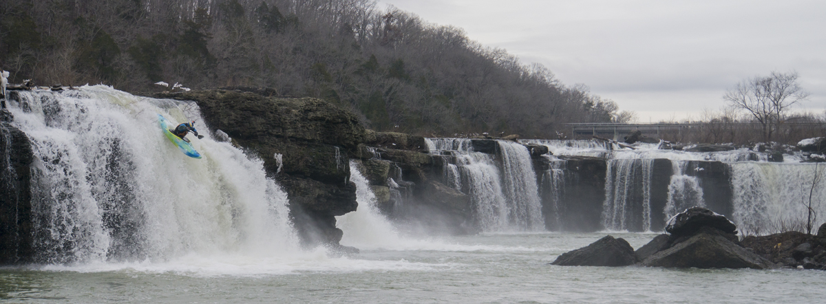
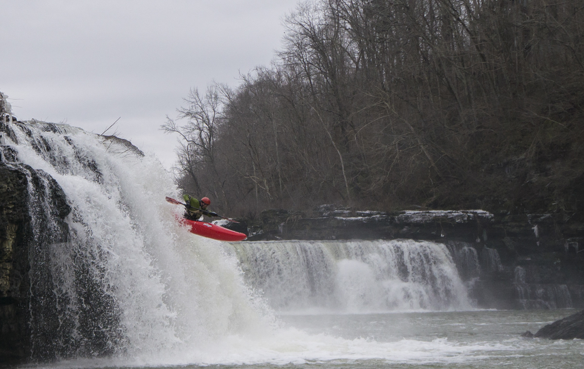
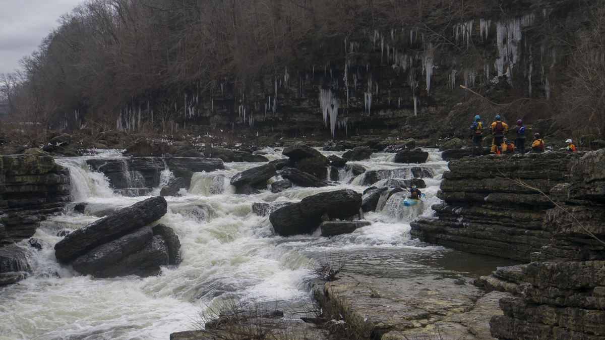
- Great Falls (IV to V). The falls start immediately below put-in. If the water is higher and you can run the Mill Side or the High Line, the falls are immediate. For those going to the Step Down or Spout, you are graced with a tenth of a mile of warm up as you shed a little gradient in class II. The only line that runs at low water is the spout line... so it is all I know. It is the far right line, drop over the center and try not to just straight plug into it as although it is not shallow, it also is not super deep.
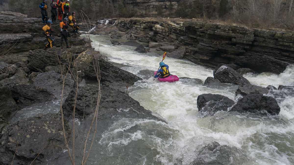
- Sieve City (IV+ to V). Aptly named, this rapid is dangerous top to bottom. And as flows bump up it gets harder. At our flow we entered far left and stayed left. At even lower flows there is a line moving out to the middle near the large sieve on the right. At high water folks boof a ledge on the far right around most of the rapid. At those higher flows the two ledges below form large holes that you want to be right of.
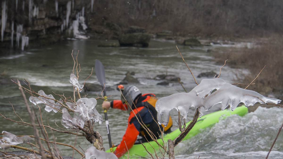
- Powerhouse (III). A squirt spot at the outflow plus a world class surfing spot just below, at the base of a large spring gushing 1,000 cfs of water into the river... what else could you want? If you are not super confident, try to make sure you are right at the bottom of the rapid as the holes at the bottom will flip you. Of if you are confident... surf those. There are also great surfing waves above.
- Just Below (III). The next rapid has a few sticky holes on the left, some will opt to sneak down the right the whole way, others will enter right and work through the "island" to finish left. There was also a thin line on the left, just to the right of the holes.
- Blue Hole (III-). The last rapid was straight forward wave train, just be aware that the flow moves you right towards the wall and there are exposed rocks over there. Error to the left.
For more details on the run, see the AW write-up
Put-in: From Rock Island, TN, take TN-287 out of town to the North West. You quickly cross the Collins River and will see the dam on your right. Just a few hundred yards downriver is river access parking lot on the right. Park here. To reach the river, walk back up the road 100 yards to a spot which the bank gently drops down to the water above the falls. Alternatively there are stairs that lead down below the falls if you aren't so inclined on running the falls.
Take-out: Continue on TN-287 for 0.9 miles. Turn right on Beach Rd to enter the park. After a few hundred feet turn right to drop down to the water and the parking area at its bank.
HTML Comment Box is loading comments...