
Abrams Creek (Upper)
| Stretch: | Abrams Falls Trailhead (Cade's Cove) to Abrams Creek Campground |
| Difficulty: | Class II+ to III (IV/V) |
| Distance: | 10.1 miles |
| Flows: | No Gauge. Look for Tremont to be runnable. We had 2" of rain in the previous 24 hrs. |
| Gradient: | 60 fpm average (142 fpm from Mi 3.8 to 5.0) |
| Put-in: | Abrams Falls Trailhead in Cades Cove (tri-confluence of Abrams Creek, Mill Creek, and Victory Branch) |
| Take-out: | Downstream of Abrams Creek Campground, across from the Ranger Station |
| Shuttle: | 6.6 miles, 10 minutes one way |
| Season: | Fall, Winter, Spring from rain |
| Written: | © 2019 |
| Featured in A Wet State #150 | |
Well there we have it, my 100th SE run. Though, I still have a long way to get near the 192 California runs I have, or the 206 international runs I have. But hey, there is time!
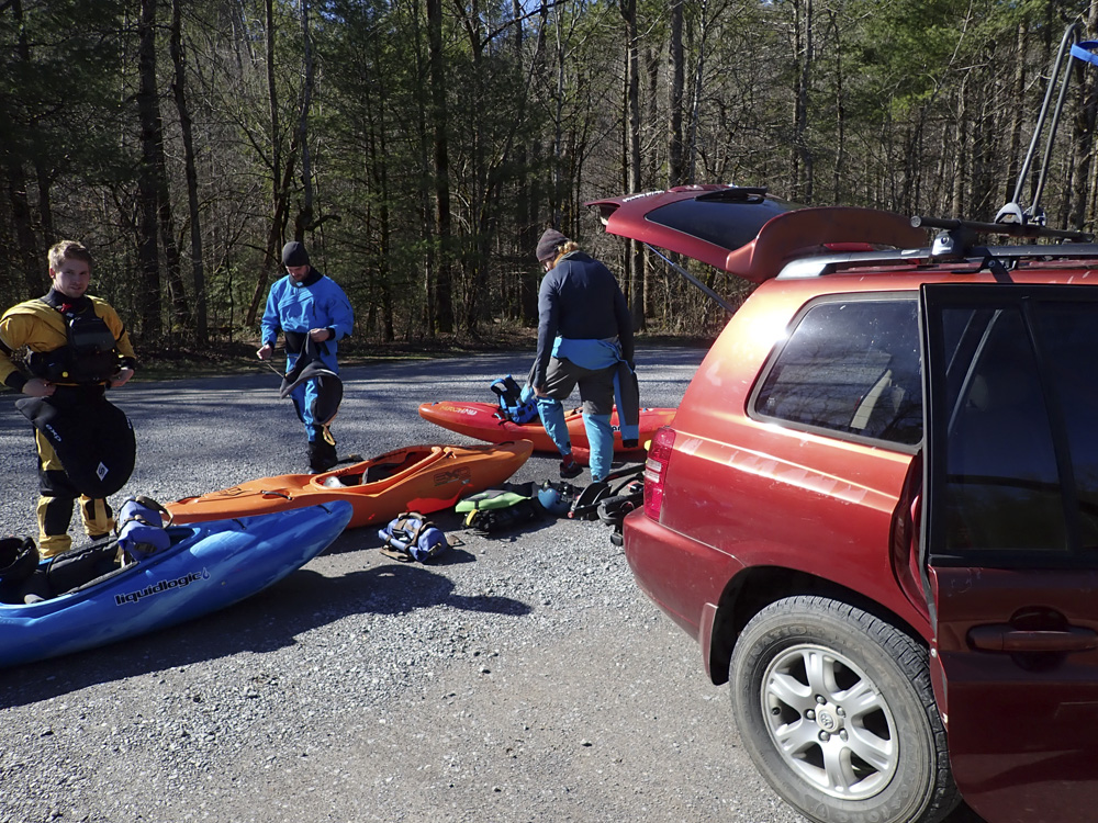
I had heard of this run early on in our time here in Knoxville. Mainly because of the falls, which I was told was super pretty and good to go. I never made it a huge priority to kayak however because it has water when a lot of other runs have water that I wanted to do more, and the shuttle is notoriously heinous, as far as SE shuttles are concerned. The mileage of the shuttle is significant, but more, it is the fact that the put-in in at the tourist trap of Cades Cove, which has a one way scenic loop, that you must drive to reach the river. The shuttle takes at a minimum 1 hr and 20 minutes, but depending on slow cars driving the scenic loop, this can easily be pushed to close to 2 hrs. A shuttle driver is therefore a valuable asset on this one.
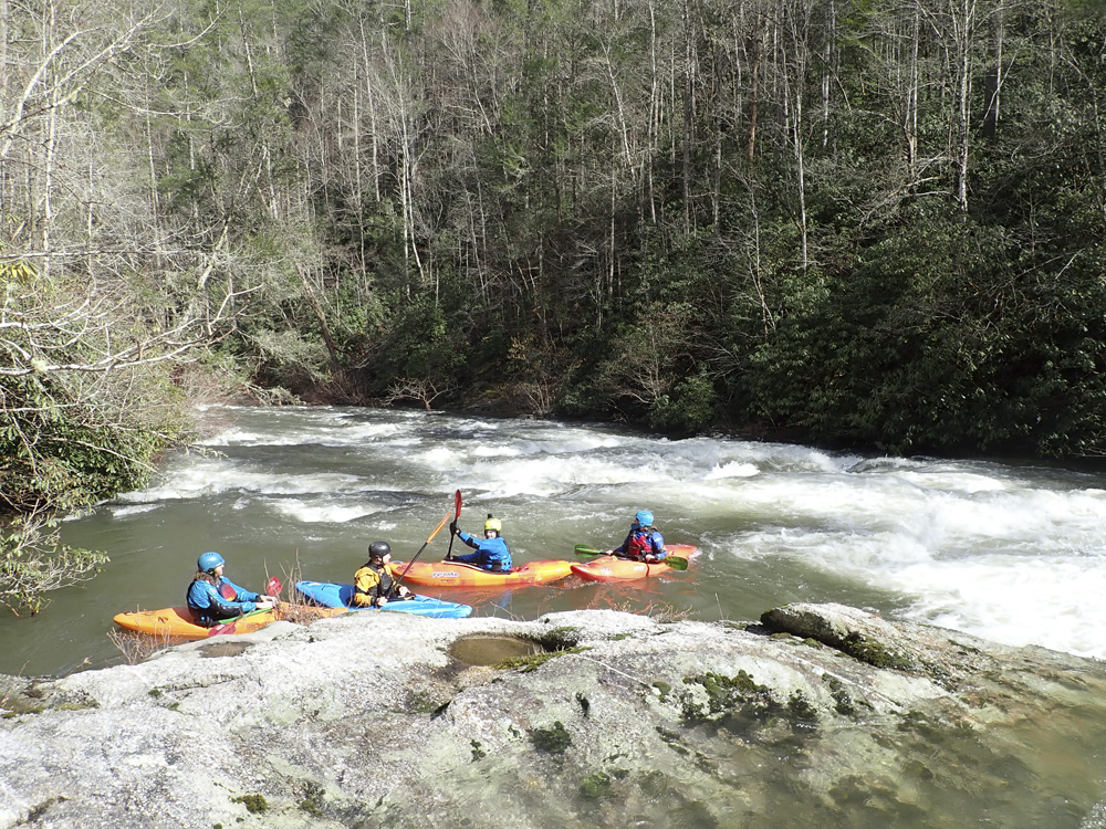
This trip came around thanks to interest shown online by Sam, Matt, and Jack. It was midweek, and going to be relatively cold... so I figured it was the perfect time to go to ensure light traffic on the loop.
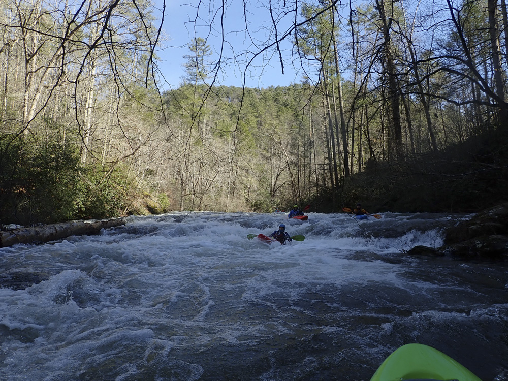
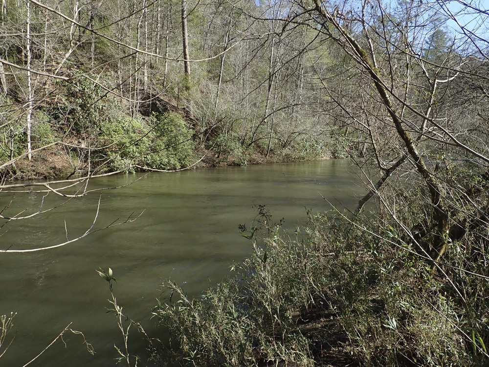
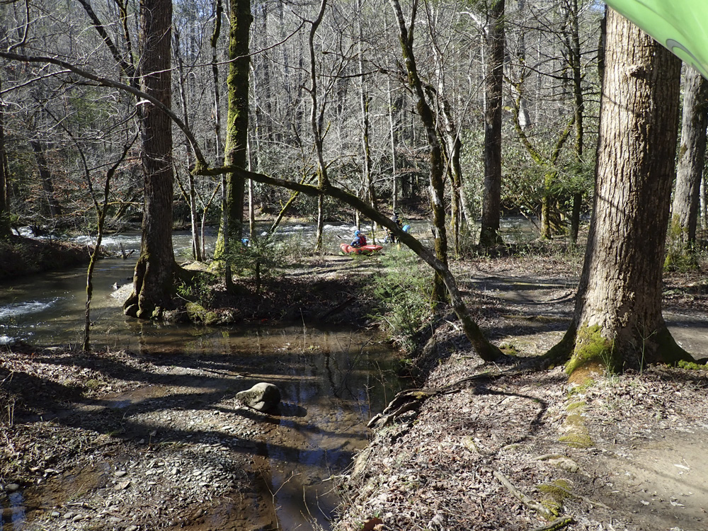
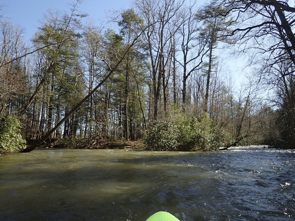
The run is a crap shoot to guess flows on. At take out the river is flowing but flat, so gauging is tough... it should look plentiful. At put in, enough to float is good enough. Below put in, you quickly double the flow at a confluence. Downstream, class II and II+ rapids begin and keep a nice pace. They change into a few small slides and small II ledges before you get to the 1.2 miles around the falls, which are III to IV. You will know you are getting close when you get to a 10 foot tall slide. Around the next corner is the falls, run the rapid above it carefully. The falls are best run at medium flows, at high flows the hole is terminal and at low flows the right and left have exposed shelfs. Downstrea, fun rapids climax at Sidewinder, a three tiered slide. A few more rapids are below before things taper off to class II- for the remainder of the run. Down here the scenery is quite nice, though the paddle out is enough with the shuttle, to prevent me from rushing back over and over. Though, I do anticipate returning, because the run is good none-the-less.
The night before we went, Tremont flashed to an unrunnable flow and was a medium at 8 in the morning. I think we had a medium flow on Abrams... I think it was medium low for most of the run, but for the falls it was medium high, and for the rest of the rapids I felt it was a nice enough medium. There is no gauge, so it is a bit of a guess as to flows otherwise. Some look for Little to recently be spiked to 3.5', but I think Tremont on widespread rain is likely a better indicator.
Mi 0.0:
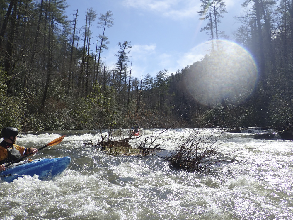
- Warm-up (I). The first short bit is just warm up.
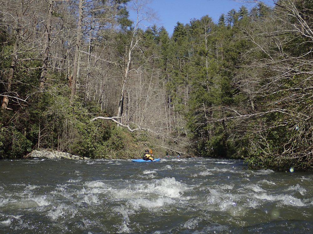
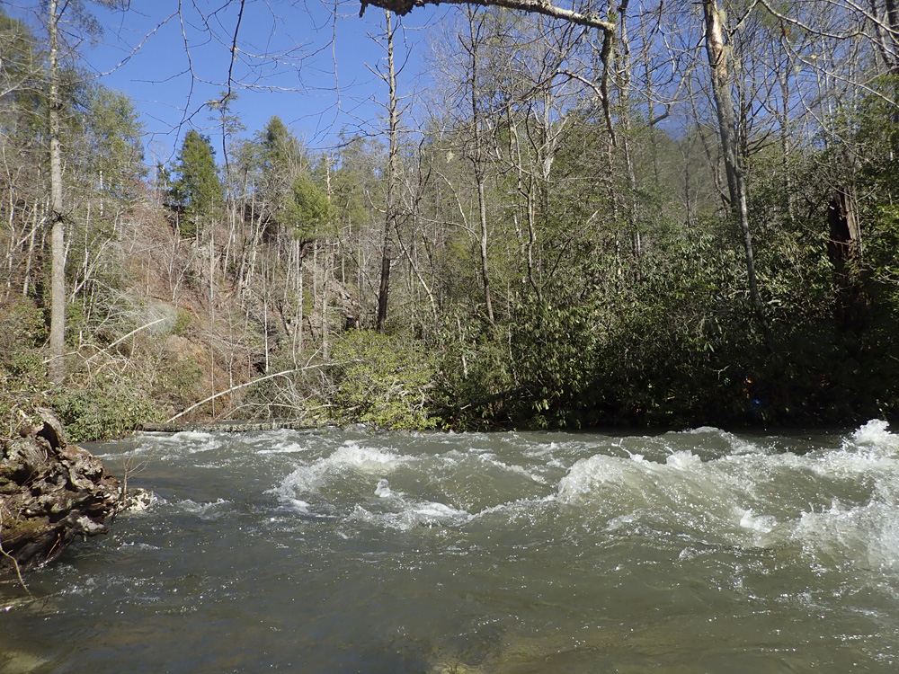
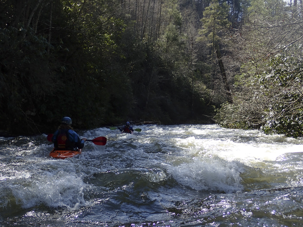
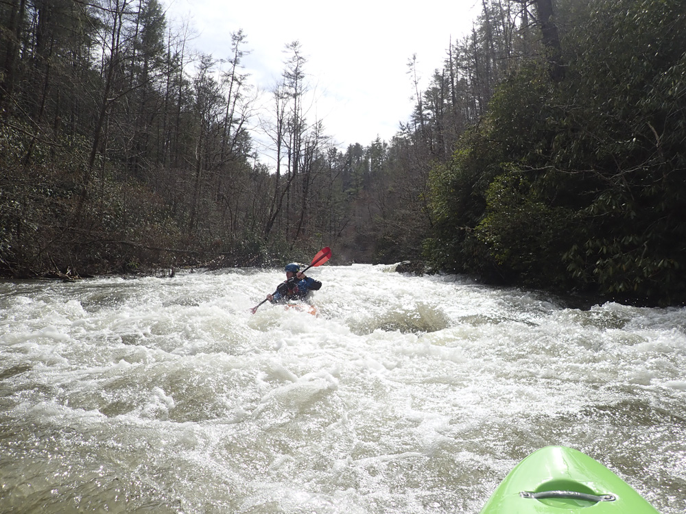
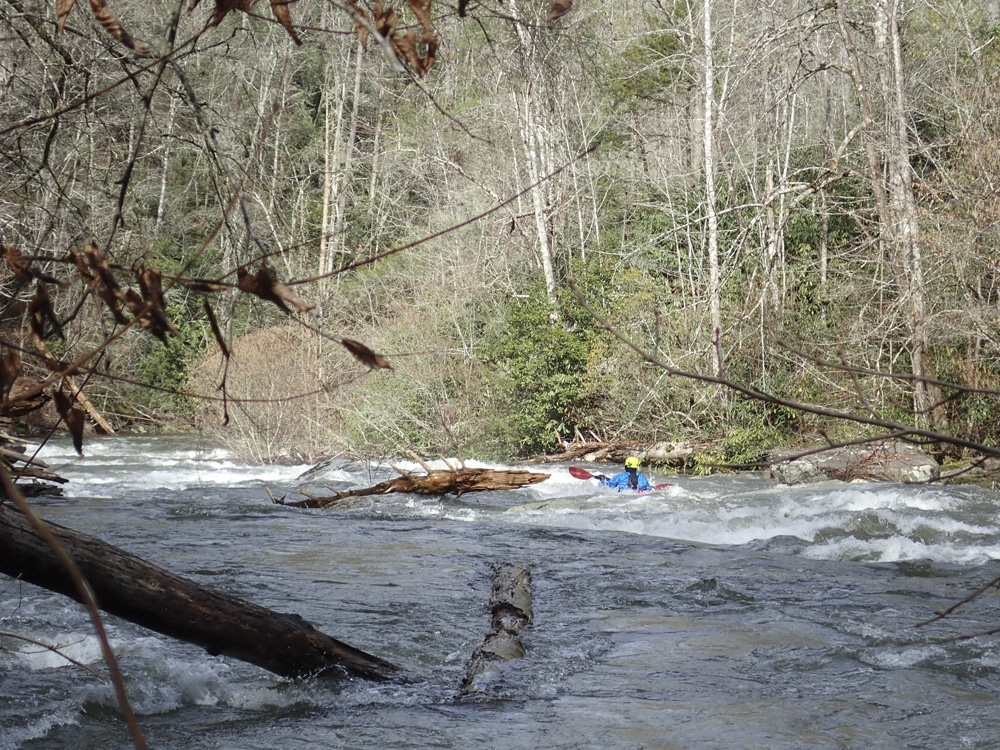
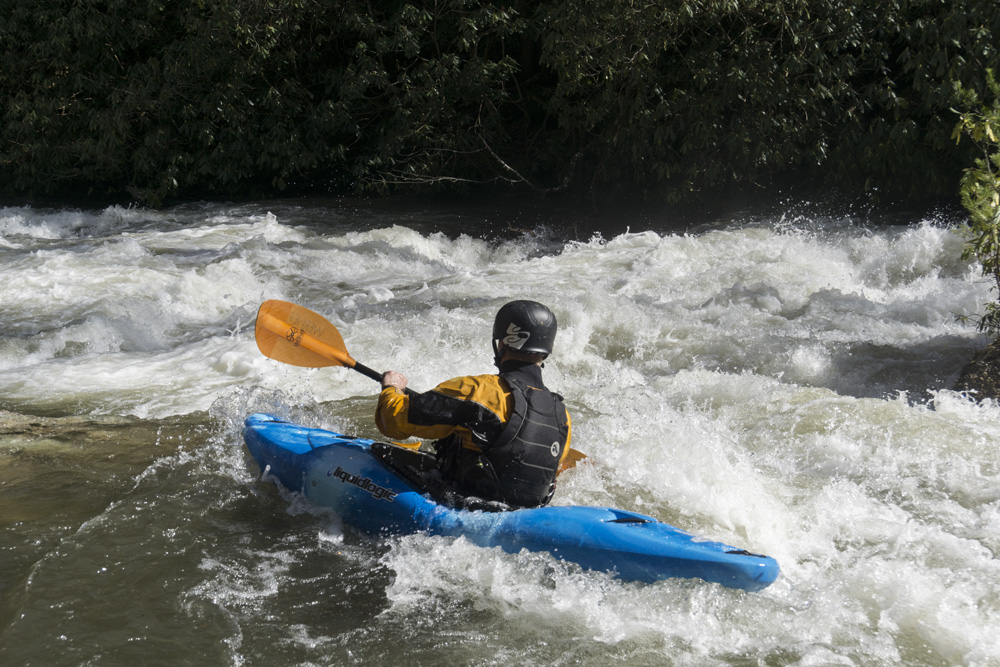
- Boogie (II to II+). The small slides and ledges begin. None are harder than II+, but the run is full of horizons that may stress a novice class III boater out. Also, stay on your toes for wood, there is a lot of it along the shore just waiting to wash into the current. We had one portage our day.
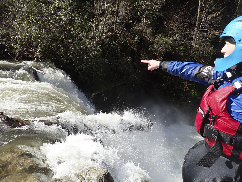
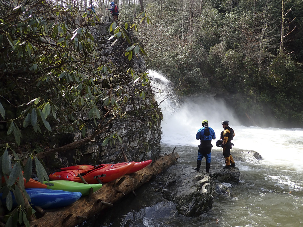
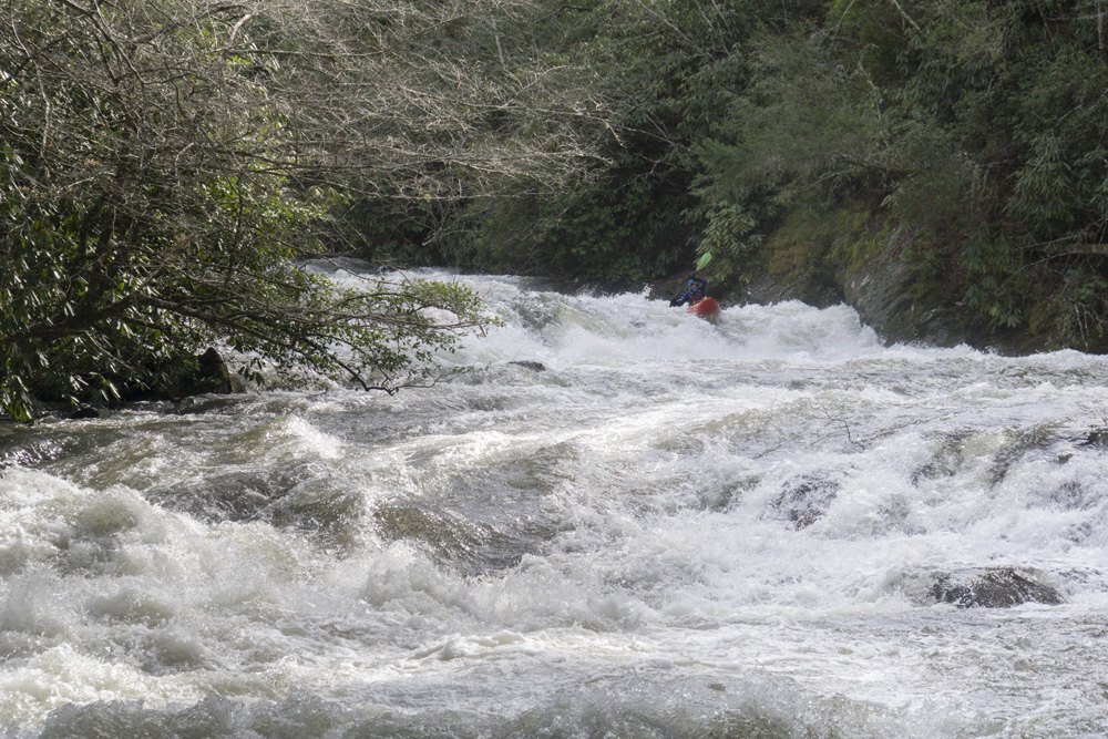
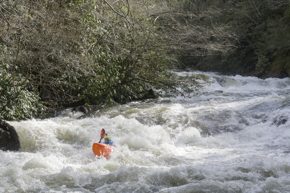
- Premonition (III to III+). One a left bend you will get to a horizon. Eddy out right. The line is off the right shore. It is a 10 foot tall slide with some fluffy, but not sticky holes down the ramp on the right. Just be aware, a swim here is bad as around the next corner is the falls.
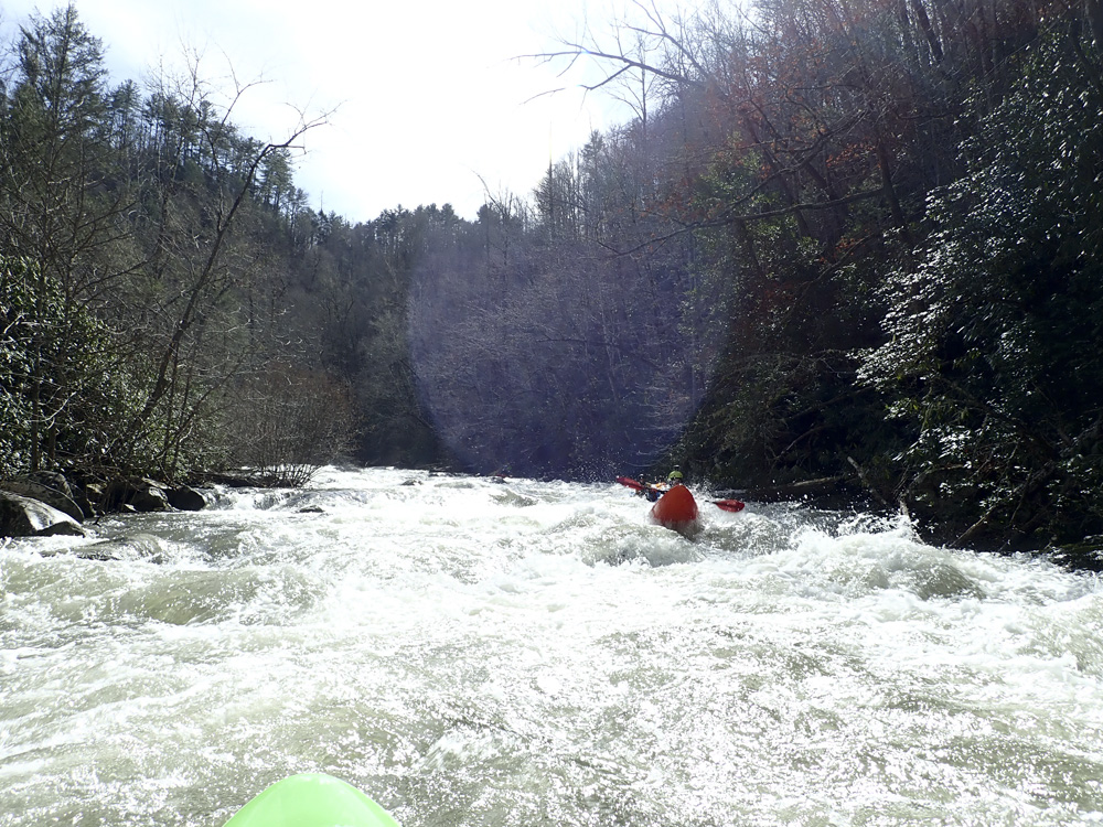
Prelude (III-). This rapid isn't hard, it has three tiers. The middle one, note the horseshoe hole on the right, it is best to run the shallower part of the ledge in the center. The final tier is run center driving to the right into the eddy above the falls. This is essentially the entry move to the falls, so don't mess it up. At higher flows, you may want to have someone catch folks as they enter.
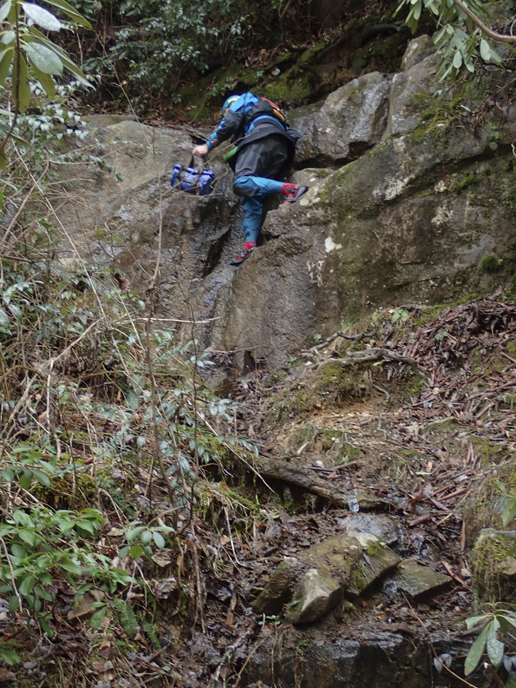
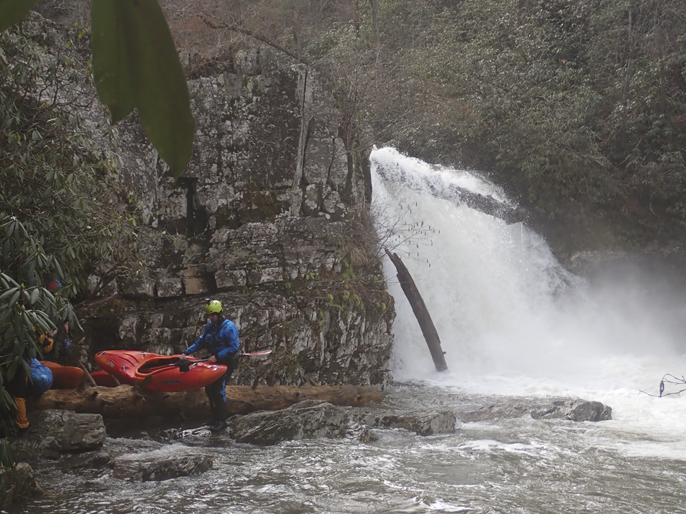
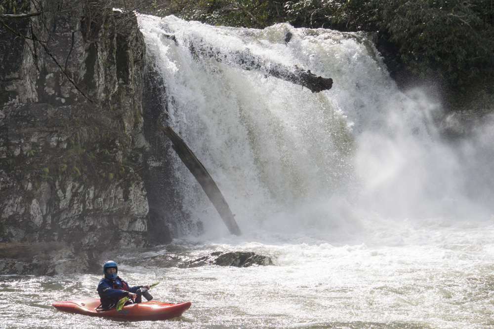
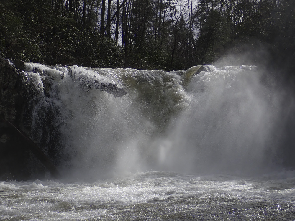
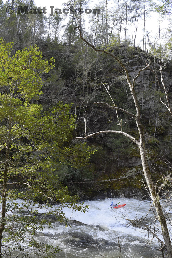
- Abrams Creek Falls (V). The line is down the center. Left has a ledge and a big hole. The right has a ledge. If you care for your ankles, run the center. At high flows it is commonly walked. The scout is on the right, so is the portage. We roped boats down and then walked the trail to the base. The trail has a small section of easy rock climb/scramble down... hence lowering boats. This rapid does collect wood so don't run it blind. Our day was a portage due to wood that was very in your face in the line... though technically it was still runnable.
Runout (III-). The run out was choked full of woods, we went down a small right channel that also had some wood, though not immediately in play.
Boogie (III-). A few small but nice boogie rapids fill the next bend...
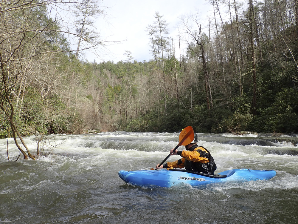
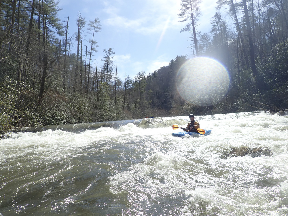
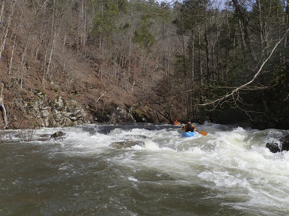
- Small Long Slide (III). On a right bend is a long slide. We ran down the right. At higher flow I think some interesting holes could form in the middle. At this flow, it was fine to just read and run. It is shallow though, so keeping it upright is important. There was a small boulder run out to the rapid immediately below it.
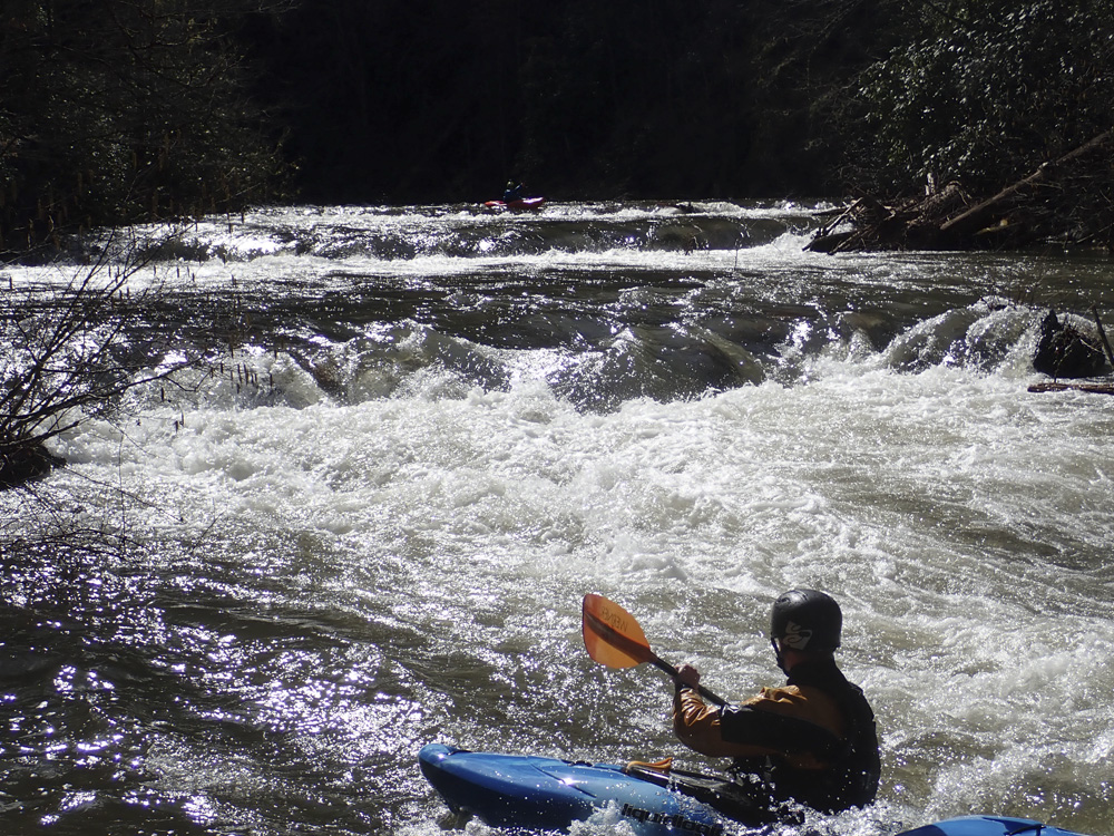
- Boulder Sluice (III). The next horizon has a few lines, an s-turn left side that we ran, a straight shot down the center (left of the midstream boulder), and then the right side which is a cascading ramp. You can scout from the left if you eddy out 20 feet upstream.
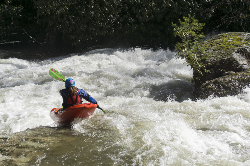
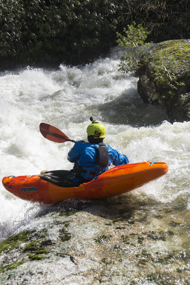
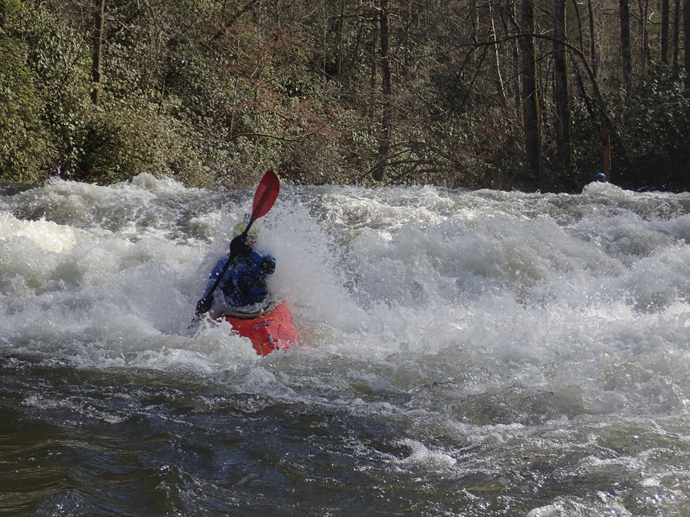
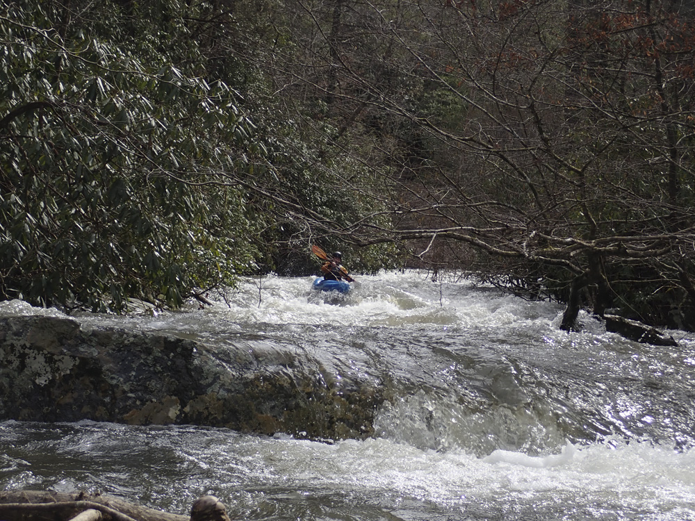
- Sidewinder (IV). The river then splits into two smaller channels. We entered down the right due to wood. This then led us to small eddies at the lip of this rapid. Scout from the right. There was a boof right of center on the top of the three tiers. The left side of the second tier then had a few fluffy holes/boofs to hit straight. Finally, the third tier was runnable anywhere, but fluffiest far right. Overall, it was a great rapid! The highlight of the run (since we had to portage the falls)
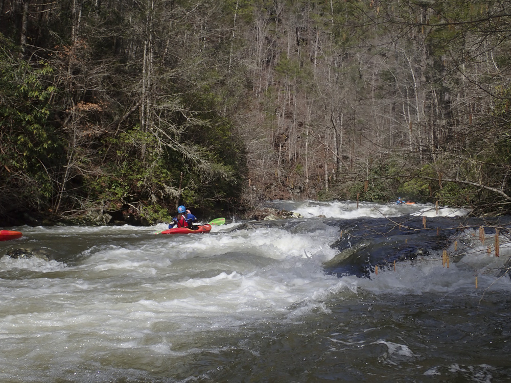
- Two Step (III-). The next rapid had a nice looking line on the right that stepped down two small ledges, but it was blocked by wood. Instead we went a slightly mankier line down a regular old rapid down the left.
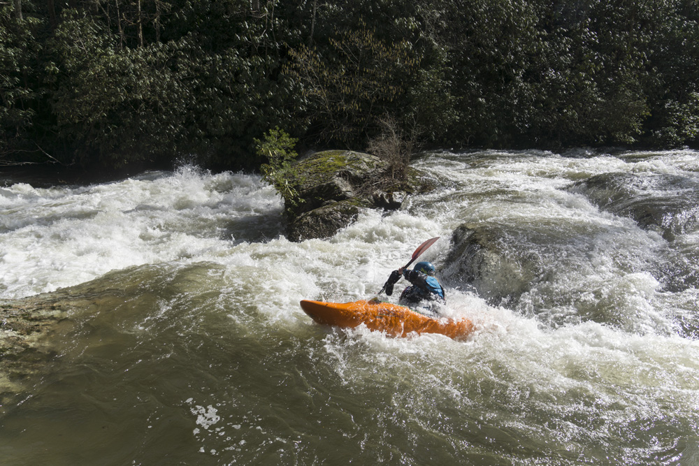
- Last Step (III). A nice section of boogie leads to one last ledge. There was a nice line left of center, directly to the right of a flake. It is non-vertical with just a tiny hole at the bottom. Super nice rapids.
- Horizon (III-). After some mellow bit, there is one last horizon line rapid that we ran down the far left. Not far below was another small ledge that was runnable anywhere. Downstream is just class II- to take-out.
- Abrams Creek Campground is on your right. It was gated our day so we continued paddling down. I bet the parking is always downriver at the Ranger Station.
Take-out: From Maryville, get onto TN-336 (Montvale Rd) heading south. Follow this for 6.9 miles, in the small town of Sixmile, break off of 336 to the left to stay on Montvale Rd. This begins to climb up the ridge and changes names to Happy Valley Rd. You will pass under the Foothills Parkway as you crest over. Drop down to the valley on the other side. After 6.0 miles since you broke off of 336, take a left onto Abrams Creek Campground Rd. Follow this for 0.7 miles. Park in the parking area next to the river, directly across from the Ranger Station.
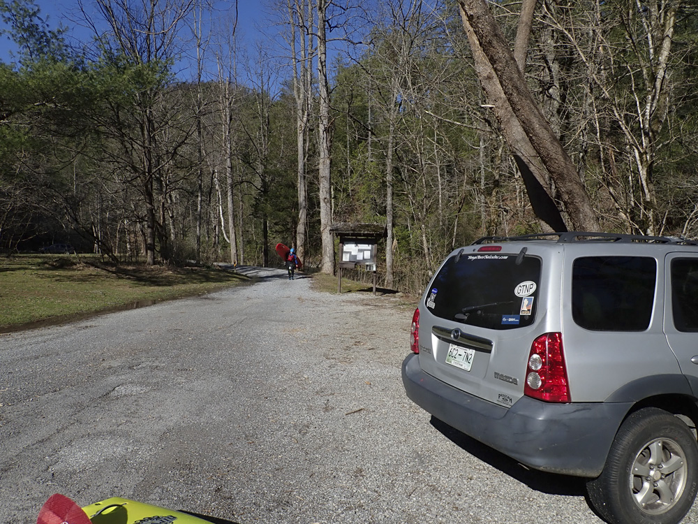
Put-in: Go back out the 0.7 miles to Happy Valley Rd, turn right. In 2.3 miles, turn sharp right onto Flats Rd. Follow this for 0.6 miles to a sharp left turn onto Butterfly Gap Rd. Follow this 0.2 miles, turn left away from the Look Rock Campground and towards Foothills Parkway. In 500 ft you will hit the Parkway, turn right. Follow this for 9.0 miles to US 321, turn right towards Townsend. Follow this for the 7.5 miles, stay straight onto Lamar Alexander Parkway and continue the 1.5 miles more to the park. At the Wye, turn right and follow this for the 5.1 miles to the Cades Cove entrance. Get on the scenic loop, and follow it for 5.1 miles to the opposite side of the loop, look for a right turn that is well marked for Abrams Falls Trailhead. Turn right and drive the 0.4 miles to the parking. The creek is directly next to the parking area.
HTML Comment Box is loading comments...